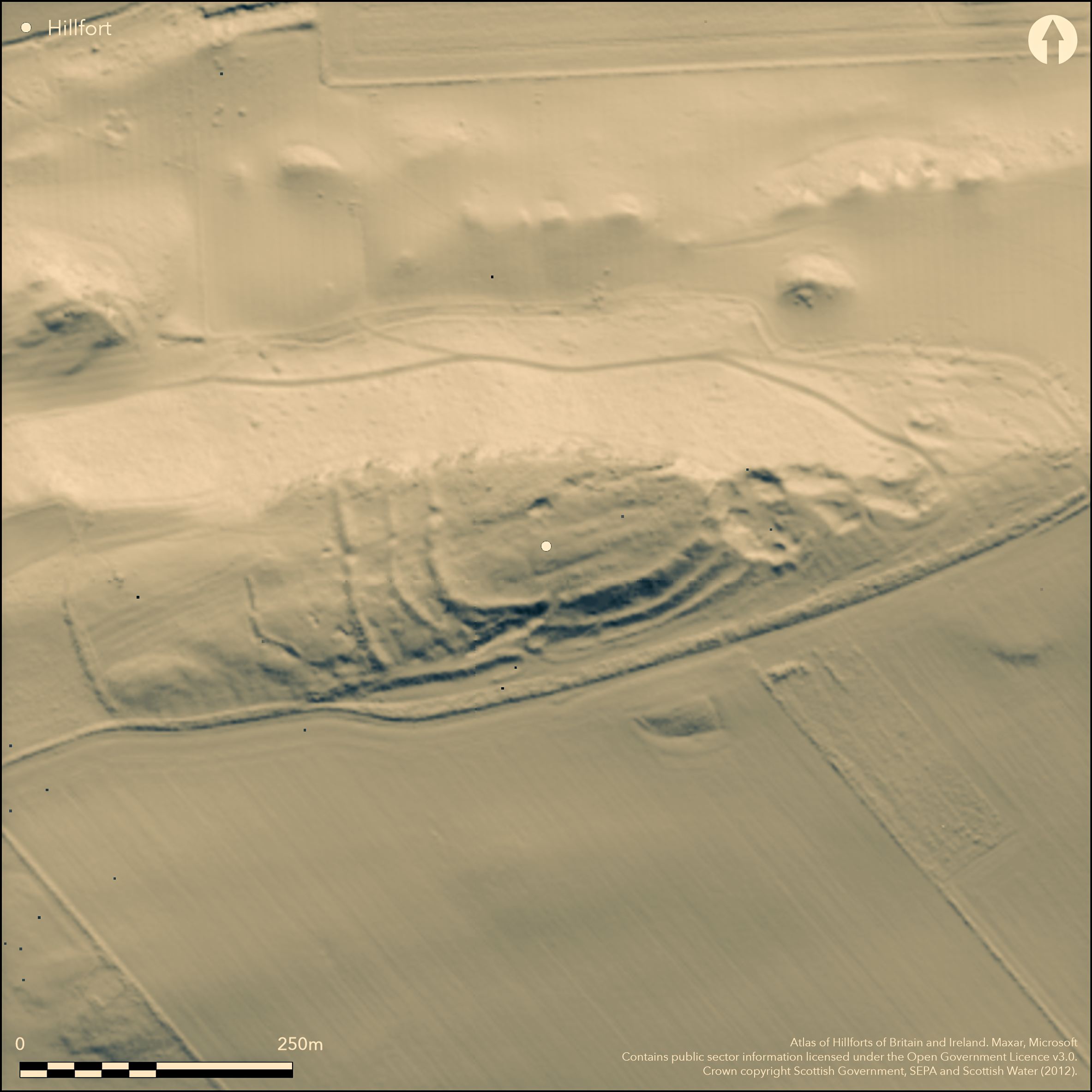
LiDAR 1m DTM Hillshade
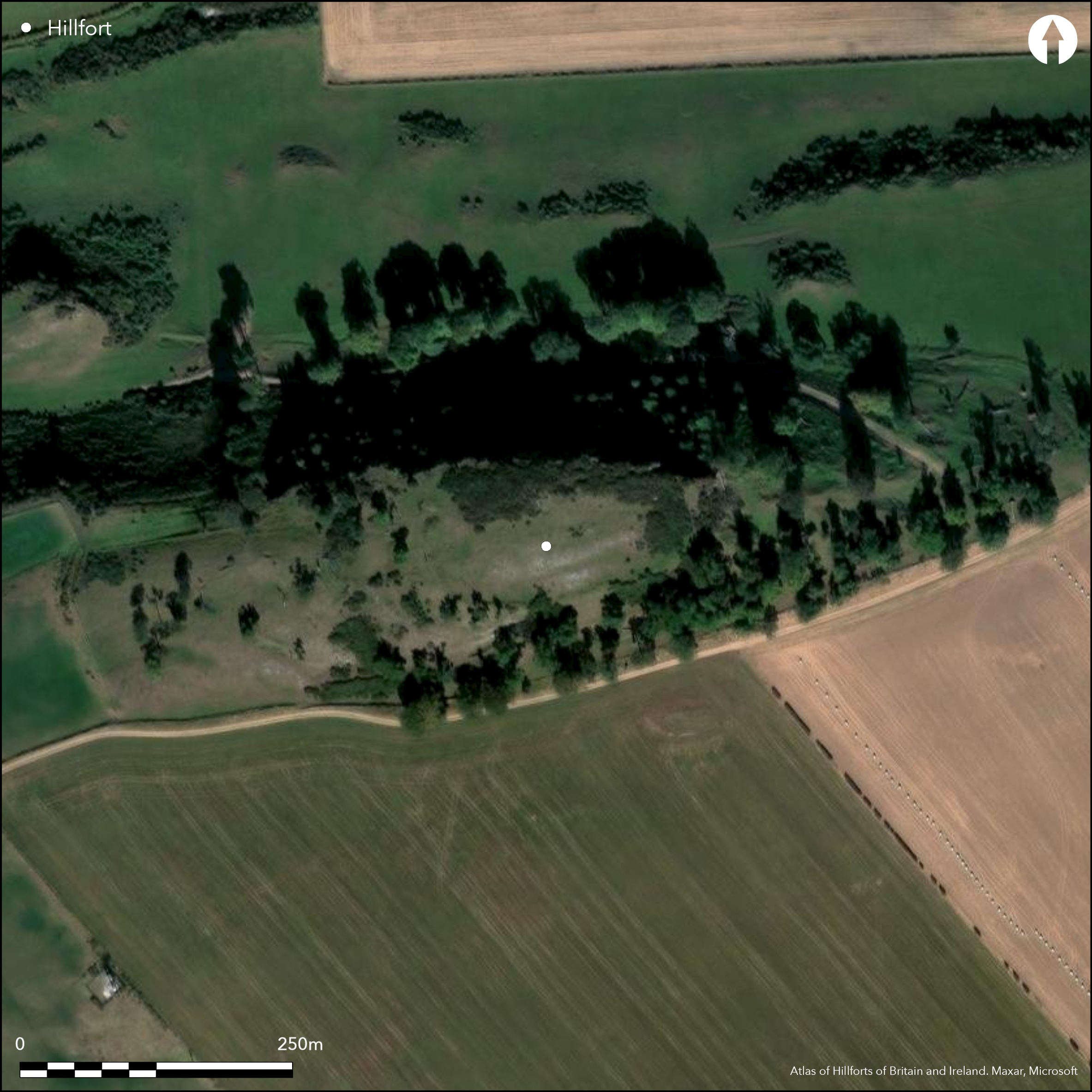
Satellite Imagery
LiDAR 1m DTM Hillshade
Satellite Imagery
Scroll left/right to view further images.
HER: East Lothian Council MEL896 (None)
NMR: NT 57 NW 23 (56295)
SM: 752
NGR: NT 5183 7627
X: 351830 Y: 676270 (OSGB36)
This fort is situated on the tip of the E spur of Barney Hill, exploiting the crag known as the Kae Heughs dropping away along the N flank. Between the crag on the N and quarries that have eaten into the E end, and at least two ramparts and possibly three or four on the W and S respectively, the interior is roughly pear-shaped on plan, measuring about 140m from E to W and contracting from 72m on the W to no more than 30m on the lip of the quarry on the E (0.84ha). The inner and middle ramparts traverse the spine of the spur from the crags on the N some 18m apart, but on the SW they close up to swing round the S flank, where, with the addition of a third rampart and possibly a fourth, they form a more impressive belt of defences in excess of 35m deep. The third rampart, however, takes a rather different line on the W, cutting straight across the spur and on the S resting on what is probably a largely natural scarp which has been incorporated into the rampart along the foot of the slope on the S. Now grass-grown, all the ramparts are reduced to grass-grown rubble banks and in some places the irregular quarry ditches between them appear as little more than ragged pits. Two entrances are visible, one piercing the three wide-spaced ramparts on the W, at which the gaps are slightly staggered to expose the visitor's right side, and the other mounting the slope obliquely on the SW to expose the visitor's left side; the third rampart at the latter returns around the terminal of the ditch on the E side of the gap. The interior is rough and uneven, the only features visible being traces of an internal quarry behind the inner rampart on the ESE and a shallow scoop, possibly the stance of a round-house, adjacent to a later quarry a little NW of the centre. In addition to these defensive works, there are also traces of another bank and ditch on the crest of the spur a further 50m to the W, but while this appears to turn back eastwards, and thus might be considered some form of annexe, it might equally belong to the outlying system of presumably agricultural boundaries focused on the site of the fort which has been revealed by cropmarks on the southern slopes of the hill.
Citizen Science: ✗
Reliability of Data: Confirmed
Reliability of Interpretation: Confirmed
X: -308741 Y: 7553845 (EPSG: 3857)
Longitude: -2.7734649251437 Latitude: 55.977032809097636 (EPSG:4326)
Country: Scotland
Current County or Unitary Authority: East Lothian
Historic County: East Lothian
Current Parish/Community/Council/Townland: Haddington
None
| Extant | ✓ |
| Cropmark | ✗ |
| Likely Destroyed | ✗ |
None
| Woodland | ✓ |
| Commercial Forestry Plantation | ✗ |
| Parkland | ✗ |
| Pasture (Grazing) | ✓ |
| Arable | ✗ |
| Scrub/Bracken | ✗ |
| Bare Outcrop | ✗ |
| Heather/Moorland | ✗ |
| Heath | ✗ |
| Built-up | ✗ |
| Coastal Grassland | ✗ |
| Other | ✗ |
None
| Contour Fort | ✓ |
| Partial Contour Fort | ✗ |
| Promontory Fort | ✗ |
| Hillslope Fort | ✗ |
| Level Terrain Fort | ✗ |
| Marsh Fort | ✗ |
| Multiple Enclosure Fort | ✗ |
| Hilltop | ✗ |
| Coastal Promontory | ✗ |
| Inland Promontory | ✓ |
| Valley Bottom | ✗ |
| Knoll/Hillock/Outcrop | ✗ |
| Ridge | ✗ |
| Cliff/Plateau-edge/Scarp | ✗ |
| Hillslope | ✗ |
| Lowland | ✗ |
| Spur | ✓ |
Dominant Topographic Feature: None
| North | ✗ |
| Northeast | ✗ |
| East | ✗ |
| Southeast | ✗ |
| South | ✗ |
| Southwest | ✗ |
| West | ✗ |
| Northwest | ✗ |
| Level | ✓ |
Altitude: 178.0m
N/A
In the absence of excavation, there are neither stratified artefacts nor radiocarbon dates to provide a chronology for the defences.
Reliability: D - None
| Pre 1200BC | ✗ |
| 1200BC - 800BC | ✗ |
| 800BC - 400BC | ✗ |
| 400BC - AD50 | ✗ |
| AD50 - AD400 | ✗ |
| AD400 - AD 800 | ✗ |
| Post AD800 | ✗ |
| Unknown | ✓ |
| Pre Hillfort: | None |
| Post Hillfort: | The E end has been quarried and there is a small quarry on the NW side of the interior |
Photographed by Dennis Harding in 1979 and RCAHMS Aerial Survey Programme in 1977, 1979, 1980, 1996, 1999, 2000, 2008, 2009, 2010 and 2015
| 1st Identified Map Depiction (1853): | Annotated Fort on the 1st edition OS 6-inch map (Haddingtonshire 1855, sheet 10) |
| Other (1893): | Depicted on the OS 25-inch map (Haddingtonshire 1894, sheet 5.14) |
| Earthwork Survey (1913): | Plan and description (RCAHMS 1924, 48-9, no.74, fig 88) |
| Other (1923): | Scheduled |
| Other (1935): | Re-Scheduled |
| Other (1956): | Description during RCAHMS Survey of Marginal Lands (Feachem 1963, 119) |
| Other (1975): | Visited by the OS |
Rough and uneven and containing only one possible scooped house platform
None
| None | ✓ |
| Spring | ✗ |
| Stream | ✗ |
| Pool | ✗ |
| Flush | ✗ |
| Well | ✗ |
| Other | ✗ |
None
| No Known Features | ✗ |
| Round Stone Structures | ✗ |
| Rectangular Stone Structures | ✗ |
| Curvilinear Platforms | ✓ |
| Other Roundhouse Evidence | ✗ |
| Pits | ✗ |
| Quarry Hollows | ✓ |
| Other | ✗ |
None
| No Known Excavation | ✓ |
| Pits | ✗ |
| Postholes | ✗ |
| Roundhouses | ✗ |
| Rectangular Structures | ✗ |
| Roads/Tracks | ✗ |
| Quarry Hollows | ✗ |
| Other | ✗ |
| Nothing Found | ✗ |
None
| No Known Geophysics | ✓ |
| Pits | ✗ |
| Roundhouses | ✗ |
| Rectangular Structures | ✗ |
| Roads/Tracks | ✗ |
| Quarry Hollows | ✗ |
| Other | ✗ |
| Nothing Found | ✗ |
None
| No Known Finds | ✓ |
| Pottery | ✗ |
| Metal | ✗ |
| Metalworking | ✗ |
| Human Bones | ✗ |
| Animal Bones | ✗ |
| Lithics | ✗ |
| Environmental | ✗ |
| Other | ✗ |
Single possible house-platform visible
| APs Not Checked | ✗ |
| None | ✗ |
| Roundhouses | ✓ |
| Rectangular Structures | ✗ |
| Pits | ✗ |
| Postholes | ✗ |
| Roads/Tracks | ✗ |
| Other | ✗ |
See main summary
| 2: | None |
| 2: | None |
Guard Chambers: ✗
Chevaux de Frise: ✗
| 1. Oblique (South): | Slightly staggered gaps. Oblique approach exposing left side |
| 2. Oblique (West): | Slightly staggered gaps in wide-spaced ramparts. Oblique approach exposing right side |
| 2. Simple Gap (West): | Opposed rampart terminals in each line |
Three ramparts on two sides, with a possible counterscarp bank accompanying the outer on the S
| Area 1: | 0.84ha. |
| Total: | 0.84ha. |
Total Footprint Area: 2.0ha.
None
| ✗ | None |
| ✗ | None |
| NE Quadrant: | 0 |
| SE Quadrant: | 3 |
| SW Quadrant: | 3 |
| NW Quadrant: | 0 |
| Total: | 3 |
| Partial Univallate | ✗ |
| Univallate | ✗ |
| Partial Bivallate | ✗ |
| Bivallate | ✗ |
| Partial Multivallate | ✓ |
| Multivallate | ✗ |
| Unknown | ✗ |
| Partial Univallate | ✗ |
| Univallate | ✗ |
| Partial Bivallate | ✗ |
| Bivallate | ✗ |
| Partial Multivallate | ✗ |
| Multivallate | ✗ |
In 1956 RCAHMS investigators suggested that the irregular appearance of the third rampart on the W may be the result of it being unfinished, but there is no other evidence to indicate that this is the case
| None | ✗ |
| Earthen Bank | ✗ |
| Stone Wall | ✗ |
| Rubble | ✓ |
| Wall-walk | ✗ |
| Evidence of Timber | ✗ |
| Vitrification | ✗ |
| Other Burning | ✗ |
| Palisade | ✗ |
| Counter Scarp Bank | ✓ |
| Berm | ✗ |
| Unfinished | ✓ |
| Other | ✗ |
None
| None | ✗ |
| Earthen Bank | ✗ |
| Stone Wall | ✗ |
| Murus Duplex | ✗ |
| Timber-framed | ✗ |
| Timber-laced | ✗ |
| Vitrification | ✗ |
| Other Burning | ✗ |
| Palisade | ✗ |
| Counter Scarp Bank | ✗ |
| Berm | ✗ |
| Unfinished | ✗ |
| No Known Excavation | ✓ |
| Other | ✗ |
| ✗ | None |
| ✓ | Rough and irregular and little more than quarries |
Number of Ditches: 3
| ✗ | No good reason to identify the outlying bank on the W as either an annexe or an element in the defences. |
Feachem, R W (1963) A guide to prehistoric Scotland. Batsford: London
RCAHMS (1924) The Royal Commission on the Ancient and Historical Monuments and Constructions of Scotland. Eighth report with Inventory of Monuments and Constructions in the County of East Lothian. HMSO: Edinburgh
Atlas of Hillforts:
Wikidata:
This work is licensed under CC BY-SA 4.0![]()
![]()
![]() and should be cited as:
and should be cited as:
Lock, Gary and Ralston, Ian. 2024. Atlas of Hillforts of Britain and Ireland. Available at: https://hillforts.arch.ox.ac.uk
Document Version 1.1