
LiDAR 1m DTM Hillshade
Satellite Imagery
LiDAR 1m DTM Hillshade
Satellite Imagery
Scroll left/right to view further images.
HER: East Lothian Council MEL970 (None)
NMR: NT 57 NW 89 (56370)
SM: 6035
NGR: NT 5304 7671
X: 353048 Y: 676711 (OSGB36)
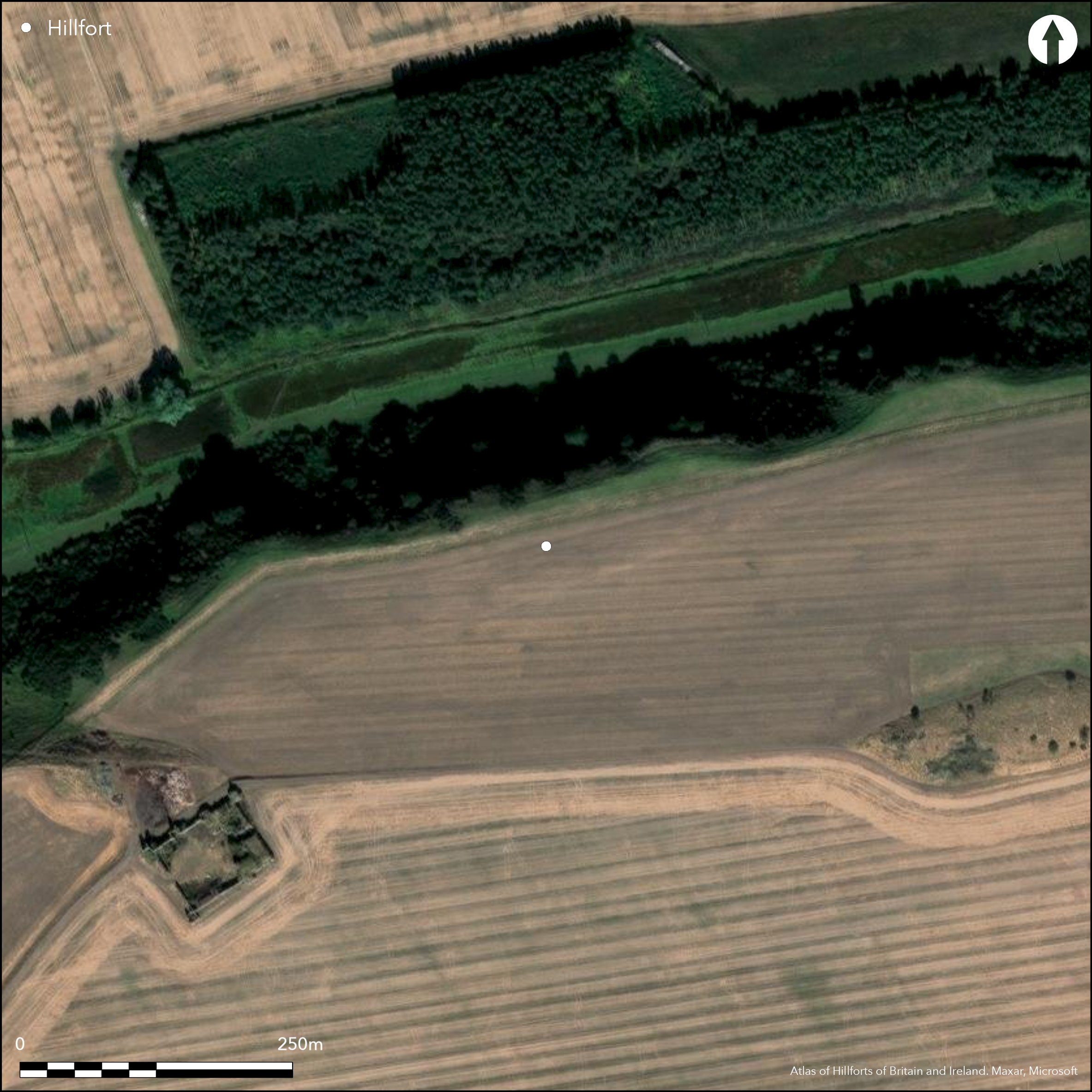
This fort, which is known only from cropmarkings, is situated on the N margin of the broad spur that terminates in Seaton Law, and exploits the steep and craggy slope known as Hanging Craig dropping away to the Cogtail Burn on the N. As revealed by the cropmarks, the fort is D-shaped on plan, backing onto the lip of the slope above the burn, and measures internally about 150m from ENE to WSW along the chord by about 75m transversely (0.95ha); making some allowance for the presence of a rampart, the interior probably extends to about 0.84ha, and is occupied largely by a probable rectilinear settlement enclosure, though only S the side of the latter and the adjacent angles can be seen with any clarity. The defences of the fort comprise at least four ditches, though again none is clearly defined, varying in breadth from 3m or 4m down to the faintest of traces. The inner two seem to be concentric about 5m apart and are broken by at least one entrance on the ENE and possibly by a second on the WSW. The third ditch, which is also the broadest, is also roughly concentric, but appears to splay a little wider at either end, and these features may indicate that it was once a free-standing enclosure; if so, its interior was in the order of 1.3ha. An intermittent outer ditch lies on the SE quarter, with possibly two shadowy lines beyond it, while another faint line immediately within the third ditch on the SW is possibly a palisade trench. Probable entrances through the third ditch lie on the ENE, S and W; at the last only the S ditch terminal is visible, but the butt end and the inner lip have apparently been drawn out into an elongated point, probably to narrow the inner end of the causeway.
Citizen Science: ✗
Reliability of Data: Confirmed
Reliability of Interpretation: Confirmed
X: -306577 Y: 7554657 (EPSG: 3857)
Longitude: -2.754026153149863 Latitude: 55.98111570002971 (EPSG:4326)
Country: Scotland
Current County or Unitary Authority: East Lothian
Historic County: East Lothian
Current Parish/Community/Council/Townland: Haddington
None
| Extant | ✗ |
| Cropmark | ✓ |
| Likely Destroyed | ✗ |
None
| Woodland | ✗ |
| Commercial Forestry Plantation | ✗ |
| Parkland | ✗ |
| Pasture (Grazing) | ✓ |
| Arable | ✓ |
| Scrub/Bracken | ✗ |
| Bare Outcrop | ✗ |
| Heather/Moorland | ✗ |
| Heath | ✗ |
| Built-up | ✗ |
| Coastal Grassland | ✗ |
| Other | ✗ |
None
| Contour Fort | ✗ |
| Partial Contour Fort | ✗ |
| Promontory Fort | ✗ |
| Hillslope Fort | ✗ |
| Level Terrain Fort | ✓ |
| Marsh Fort | ✗ |
| Multiple Enclosure Fort | ✗ |
| Hilltop | ✗ |
| Coastal Promontory | ✗ |
| Inland Promontory | ✗ |
| Valley Bottom | ✗ |
| Knoll/Hillock/Outcrop | ✗ |
| Ridge | ✗ |
| Cliff/Plateau-edge/Scarp | ✓ |
| Hillslope | ✗ |
| Lowland | ✗ |
| Spur | ✗ |
Dominant Topographic Feature: None
| North | ✗ |
| Northeast | ✗ |
| East | ✗ |
| Southeast | ✗ |
| South | ✗ |
| Southwest | ✗ |
| West | ✗ |
| Northwest | ✗ |
| Level | ✓ |
Altitude: 112.0m
N/A
In the absence of excavation, there are neither stratified artefacts nor radiocarbon dates to provide a chronology for the defences.
Reliability: D - None
| Pre 1200BC | ✗ |
| 1200BC - 800BC | ✗ |
| 800BC - 400BC | ✗ |
| 400BC - AD50 | ✗ |
| AD50 - AD400 | ✗ |
| AD400 - AD 800 | ✗ |
| Post AD800 | ✗ |
| Unknown | ✓ |
| Pre Hillfort: | None |
| Post Hillfort: | Overlain by what is probably a late Iron Age rectilinear settlement, and subsequently ploughed flat |
Photographed by CUCAP in 1964, and RCAHMS Aerial Survey Programme in 1977, 1979, 1990, 1992, 1994, 1995, 1996, 1999, 2001 and 2015
| 1st Identified Written Reference (1954): | Identified from vertical aerial photographs during RCAHMS Survey of Marginal Lands |
| Other (1994): | Scheduled |
Largely occupied by a probable late Iron Age rectilinear settlement enclosure
None
| None | ✓ |
| Spring | ✗ |
| Stream | ✗ |
| Pool | ✗ |
| Flush | ✗ |
| Well | ✗ |
| Other | ✗ |
None
| No Known Features | ✓ |
| Round Stone Structures | ✗ |
| Rectangular Stone Structures | ✗ |
| Curvilinear Platforms | ✗ |
| Other Roundhouse Evidence | ✗ |
| Pits | ✗ |
| Quarry Hollows | ✗ |
| Other | ✗ |
None
| No Known Excavation | ✓ |
| Pits | ✗ |
| Postholes | ✗ |
| Roundhouses | ✗ |
| Rectangular Structures | ✗ |
| Roads/Tracks | ✗ |
| Quarry Hollows | ✗ |
| Other | ✗ |
| Nothing Found | ✗ |
None
| No Known Geophysics | ✓ |
| Pits | ✗ |
| Roundhouses | ✗ |
| Rectangular Structures | ✗ |
| Roads/Tracks | ✗ |
| Quarry Hollows | ✗ |
| Other | ✗ |
| Nothing Found | ✗ |
None
| No Known Finds | ✓ |
| Pottery | ✗ |
| Metal | ✗ |
| Metalworking | ✗ |
| Human Bones | ✗ |
| Animal Bones | ✗ |
| Lithics | ✗ |
| Environmental | ✗ |
| Other | ✗ |
Probable rectilinear settlement enclosure
| APs Not Checked | ✗ |
| None | ✗ |
| Roundhouses | ✗ |
| Rectangular Structures | ✗ |
| Pits | ✗ |
| Postholes | ✗ |
| Roads/Tracks | ✗ |
| Other | ✓ |
See main summary
| 5: | Ploughed flat |
| 2: | Generalised to three gaps in the outer perimeter, the inner having at least two and probably representing a separate period of construction |
Guard Chambers: ✗
Chevaux de Frise: ✗
| 1. Simple Gap (East): | Through the two inner ditches |
| 1. Simple Gap (East): | Possible broad gap in the third ditch |
| 2. Simple Gap (West): | Through the two inner ditches |
| 2. Simple Gap (West): | One terminal visible, in the third ditch |
| 3. Simple Gap (South): | One terminal visible, in the third ditch |
Excluding the rectilinear enclosure within the interior, the defences comprise three or four ditches, presumably with upcast ramparts, forming a D-shaped enclosure backing onto the edge of an escarpment. Traces of probable palisade trenches can be detected also
| Area 1: | 0.84ha. |
| Total: | 0.84ha. |
Total Footprint Area: 1.7ha.
None
| ✗ | None |
| ✗ | None |
| NE Quadrant: | 0 |
| SE Quadrant: | 4 |
| SW Quadrant: | 3 |
| NW Quadrant: | 0 |
| Total: | 4 |
| Partial Univallate | ✗ |
| Univallate | ✗ |
| Partial Bivallate | ✗ |
| Bivallate | ✗ |
| Partial Multivallate | ✓ |
| Multivallate | ✗ |
| Unknown | ✗ |
| Partial Univallate | ✗ |
| Univallate | ✗ |
| Partial Bivallate | ✗ |
| Bivallate | ✗ |
| Partial Multivallate | ✗ |
| Multivallate | ✗ |
None
| None | ✓ |
| Earthen Bank | ✗ |
| Stone Wall | ✗ |
| Rubble | ✗ |
| Wall-walk | ✗ |
| Evidence of Timber | ✗ |
| Vitrification | ✗ |
| Other Burning | ✗ |
| Palisade | ✗ |
| Counter Scarp Bank | ✗ |
| Berm | ✗ |
| Unfinished | ✗ |
| Other | ✗ |
None
| None | ✗ |
| Earthen Bank | ✗ |
| Stone Wall | ✗ |
| Murus Duplex | ✗ |
| Timber-framed | ✗ |
| Timber-laced | ✗ |
| Vitrification | ✗ |
| Other Burning | ✗ |
| Palisade | ✗ |
| Counter Scarp Bank | ✗ |
| Berm | ✗ |
| Unfinished | ✗ |
| No Known Excavation | ✓ |
| Other | ✗ |
| ✗ | None |
| ✓ | Up to four ragged and irregular ditches |
Number of Ditches: 4
| ✗ | None |
No related records
Atlas of Hillforts:
Wikidata:
This work is licensed under CC BY-SA 4.0![]()
![]()
![]() and should be cited as:
and should be cited as:
Lock, Gary and Ralston, Ian. 2024. Atlas of Hillforts of Britain and Ireland. Available at: https://hillforts.arch.ox.ac.uk
Document Version 1.1