
LiDAR 1m DTM Hillshade
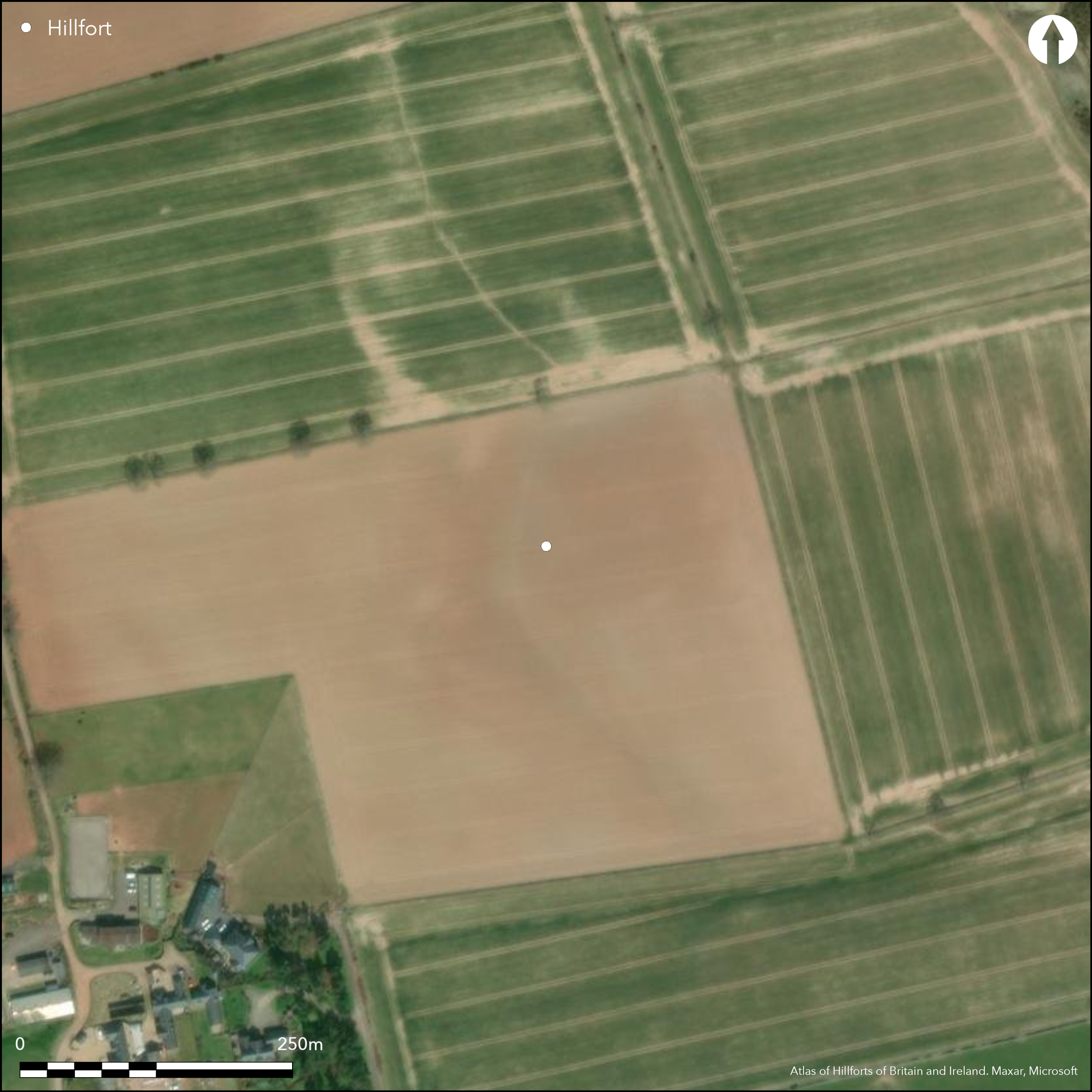
Satellite Imagery
LiDAR 1m DTM Hillshade
Satellite Imagery
Scroll left/right to view further images.
HER: Scottish Borders 55490 (None)
NMR: NT 53 NE 1 (55490)
SM: None
NGR: NT 5745 3995
X: 357450 Y: 639950 (OSGB36)
This fort, rather than occupying the summit of Huntshaw Hill, is situated on the sloping SE flank of the hill to the NE of the farm, and is remarkable for the complex array of enclosures revealed by cropmarks, comprising a double-ditched inner enclosure, an outer enclosure, two phases of a subsidiary enclosure lying between the inner and outer enclosures on the SW, and a small rectangular enclosure attached externally to the outer on the NNW; surrounding the whole is a system of linear boundaries. The sequence of any of these elements is difficult to determine without excavation, but the rectangular enclosure on the NNW appears likely to have been butted onto the outer enclosure, while the two successive enclosures on the SW appear to have both adopted elements of the inner and outer circuits, and indeed, at one point obliterated all trace of the outer. The inner enclosure is an irregular circle on plan and encloses an area measuring some 85m across, but its inner ditch is no more than 3m in maximum breadth, contrasting strongly with the ditch between 4m and 6m in breadth set some 10m outside it. Thus, despite their strictly concentric arrangement, with two corresponding entrances on the S and E respectively, these two ditches may represent successive phases of enclosure; allowing for the presence of ramparts on the inner lip of each ditch, they would have enclosed 0.5ha and 1ha respectively. Likewise the concentric arrangement of the outer enclosure, which forms a regular oval on plan, measuring internally about 210m from ENE to WSW by 170m transversely, is no guarantee that it is a subsidiary enclosure of the inner defences; with a ditch up to 5m in breadth and an internal rampart of commensurate size it is likely to have been a free-standing enclosure of some 2.5ha. A possible entrance into the outer enclosure can be seen on the S, though it is not aligned with the one through this side of the inner enclosure, but the cropmarks around the rest of the circuit are not sufficiently clear to identify any others. other entrances into the inner enclosure may also have been obscured by a superimposed field boundary on the N and what appears to be a natural drainage gully traversing the enclosures on the W. The perimeters of both inner and outer lines on the SW are also obscured by the two successive enclosures, which give the impression that they have been imposed on the defences of the fort. The inner appears to adopt the line of the outer fort circuit on its SW and is shaped like a teardrop on plan, tapering to a point on the SE; traces of an internal bank form a continuous feature around its perimeter, enclosing an area measuring about 40m from NW to SE by a maximum of 25m transversely. On its SE side are traces of another ditch forming what is probably a polygonal enclosure, apparently springing tangentially from the broader end of the 'teardrop'. This utilises the outer ditch of the inner circuit to make its N side, crossing over the line of the outer enclosure on its SE side before turning sharply back at right angles to return on the SW; at least one entrance causeway can be seen on the SE near the southern corner. While it is impossible to be certain without excavation, these are likely to be the remains of late Iron Age settlements occupying elements of an earlier fort.
Citizen Science: ✗
Reliability of Data: Confirmed
Reliability of Interpretation: Confirmed
X: -298082 Y: 7489300 (EPSG: 3857)
Longitude: -2.67772053371637 Latitude: 55.65124775212872 (EPSG:4326)
Country: Scotland
Current County or Unitary Authority: Scottish Borders
Historic County: Berwickshire
Current Parish/Community/Council/Townland: Earlston
None
| Extant | ✗ |
| Cropmark | ✓ |
| Likely Destroyed | ✗ |
None
| Woodland | ✗ |
| Commercial Forestry Plantation | ✗ |
| Parkland | ✗ |
| Pasture (Grazing) | ✓ |
| Arable | ✓ |
| Scrub/Bracken | ✗ |
| Bare Outcrop | ✗ |
| Heather/Moorland | ✗ |
| Heath | ✗ |
| Built-up | ✗ |
| Coastal Grassland | ✗ |
| Other | ✗ |
None
| Contour Fort | ✗ |
| Partial Contour Fort | ✗ |
| Promontory Fort | ✗ |
| Hillslope Fort | ✓ |
| Level Terrain Fort | ✗ |
| Marsh Fort | ✗ |
| Multiple Enclosure Fort | ✗ |
| Hilltop | ✗ |
| Coastal Promontory | ✗ |
| Inland Promontory | ✗ |
| Valley Bottom | ✗ |
| Knoll/Hillock/Outcrop | ✗ |
| Ridge | ✗ |
| Cliff/Plateau-edge/Scarp | ✗ |
| Hillslope | ✓ |
| Lowland | ✗ |
| Spur | ✗ |
Dominant Topographic Feature: None
| North | ✗ |
| Northeast | ✗ |
| East | ✗ |
| Southeast | ✓ |
| South | ✗ |
| Southwest | ✗ |
| West | ✗ |
| Northwest | ✗ |
| Level | ✗ |
Altitude: 190.0m
N/A
A glass bangle dating from the 1st-2nd century AD from the site is in the Hunterian Museum (Stevenson 1955, 220), but there is no reason to believe this dates any of the defensive enclosure and is more likely to come from what has been presented in the summary as a late Iron Age settlement enclosure.
Reliability: D - None
| Pre 1200BC | ✗ |
| 1200BC - 800BC | ✗ |
| 800BC - 400BC | ✗ |
| 400BC - AD50 | ✗ |
| AD50 - AD400 | ✗ |
| AD400 - AD 800 | ✗ |
| Post AD800 | ✗ |
| Unknown | ✓ |
| Pre Hillfort: | None |
| Post Hillfort: | Probably occupied by Late Iron Age settlement enclosures. Subsequently all have been ploughed down |
Photographed by CUCAP in 1961, 1964 and 1972, and by the RCAHMS Aerial Survey Programme in 1979, 1980, 1983, 1984, 1993, 1994, 1997, 1998, 1999 and 2000
| Other (1870): | Known to the farmer (Craw 1921, 244n) |
| 1st Identified Written Reference (1921): | Description by James Hewat Craw (1921, 244n) |
| Other (1956): | Visited by the OS |
| Other (1961): | First photographed by CUCAP |
Featureless apart from what are probably several sumps belonging to the natural drainage gully and the probably late Iron Age settlement enclosures
The natural drainage gully and the probable sumps along its line suggest that water would have been available internally
| None | ✗ |
| Spring | ✗ |
| Stream | ✗ |
| Pool | ✗ |
| Flush | ✗ |
| Well | ✗ |
| Other | ✓ |
None
| No Known Features | ✓ |
| Round Stone Structures | ✗ |
| Rectangular Stone Structures | ✗ |
| Curvilinear Platforms | ✗ |
| Other Roundhouse Evidence | ✗ |
| Pits | ✗ |
| Quarry Hollows | ✗ |
| Other | ✗ |
None
| No Known Excavation | ✓ |
| Pits | ✗ |
| Postholes | ✗ |
| Roundhouses | ✗ |
| Rectangular Structures | ✗ |
| Roads/Tracks | ✗ |
| Quarry Hollows | ✗ |
| Other | ✗ |
| Nothing Found | ✗ |
None
| No Known Geophysics | ✓ |
| Pits | ✗ |
| Roundhouses | ✗ |
| Rectangular Structures | ✗ |
| Roads/Tracks | ✗ |
| Quarry Hollows | ✗ |
| Other | ✗ |
| Nothing Found | ✗ |
Though their contexts are unknown, a glass bangle dating from the 1st-2nd century AD from the site is in the Hunterian Museum (Stevenson 1955, 220), while a whetstone from the farm is also in the Wilton Lodge Museum, Hawick (HAKMG 4082)
| No Known Finds | ✗ |
| Pottery | ✗ |
| Metal | ✗ |
| Metalworking | ✗ |
| Human Bones | ✗ |
| Animal Bones | ✗ |
| Lithics | ✗ |
| Environmental | ✗ |
| Other | ✓ |
NO APPARENT FEATURES
| APs Not Checked | ✗ |
| None | ✓ |
| Roundhouses | ✗ |
| Rectangular Structures | ✗ |
| Pits | ✗ |
| Postholes | ✗ |
| Roads/Tracks | ✗ |
| Other | ✗ |
See main summary
| 3: | The whole circuit is ploughed flat |
| 2: | There are almost certainly other gaps elswhere, but these are hidden in diffuse cropmarks or obscured by natural fetures |
Guard Chambers: ✗
Chevaux de Frise: ✗
| 1. Simple Gap (East): | Through both ditches of the inner enclosure |
| 2. Simple Gap (South): | Through both ditches of the inner enclosure |
| 2. Simple Gap (South): | A possible gap in the outer enclosure |
Three roughly concentric enclosures, probably representing successive enclosures, and in the case of the outer ditch of the inner enclosure and the outer enclosure, apparently largest around the uphill side
| Area 1: | 0.5ha. |
| Area 2: | 1.0ha. |
| Area 3: | 2.5ha. |
| Total: | 2.5ha. |
Total Footprint Area: Noneha.
None
| ✓ | While there is no discernible stratigraphy between the defensive circuits, there is clear evidence of sequence with what are probably the overlying enclosures, albeit that the sequence cannot be demonstrated conclusively without excavation. |
| ✓ | None |
| NE Quadrant: | 3 |
| SE Quadrant: | 3 |
| SW Quadrant: | 3 |
| NW Quadrant: | 3 |
| Total: | 3 |
| Partial Univallate | ✗ |
| Univallate | ✗ |
| Partial Bivallate | ✗ |
| Bivallate | ✗ |
| Partial Multivallate | ✗ |
| Multivallate | ✓ |
| Unknown | ✗ |
| Partial Univallate | ✗ |
| Univallate | ✓ |
| Partial Bivallate | ✗ |
| Bivallate | ✓ |
| Partial Multivallate | ✗ |
| Multivallate | ✗ |
None
| None | ✓ |
| Earthen Bank | ✗ |
| Stone Wall | ✗ |
| Rubble | ✗ |
| Wall-walk | ✗ |
| Evidence of Timber | ✗ |
| Vitrification | ✗ |
| Other Burning | ✗ |
| Palisade | ✗ |
| Counter Scarp Bank | ✗ |
| Berm | ✗ |
| Unfinished | ✗ |
| Other | ✗ |
None
| None | ✗ |
| Earthen Bank | ✗ |
| Stone Wall | ✗ |
| Murus Duplex | ✗ |
| Timber-framed | ✗ |
| Timber-laced | ✗ |
| Vitrification | ✗ |
| Other Burning | ✗ |
| Palisade | ✗ |
| Counter Scarp Bank | ✗ |
| Berm | ✗ |
| Unfinished | ✗ |
| No Known Excavation | ✓ |
| Other | ✗ |
| ✗ | None |
| ✓ | Excludes the overlying settlement enclosures and the outlying linear earthwork |
Number of Ditches: 3
| ✗ | The outer enclosure here is regarded as a free-standing enclosure rather than an annexe to the inner enclosure |
Craw, J H (1921) 'Notes on Berwickshire Forts, with a description of those recently discovered'. Proc Soc Antiq Scot 55 (1920-1), 231-55
Stevenson, R B K (1955) 'Native bangles and Roman glass'. Proc Soc Antiq Scot 88 (1953-5), 208-21
Atlas of Hillforts:
Wikidata:
This work is licensed under CC BY-SA 4.0![]()
![]()
![]() and should be cited as:
and should be cited as:
Lock, Gary and Ralston, Ian. 2024. Atlas of Hillforts of Britain and Ireland. Available at: https://hillforts.arch.ox.ac.uk
Document Version 1.1