LiDAR 1m DTM Hillshade

Satellite Imagery
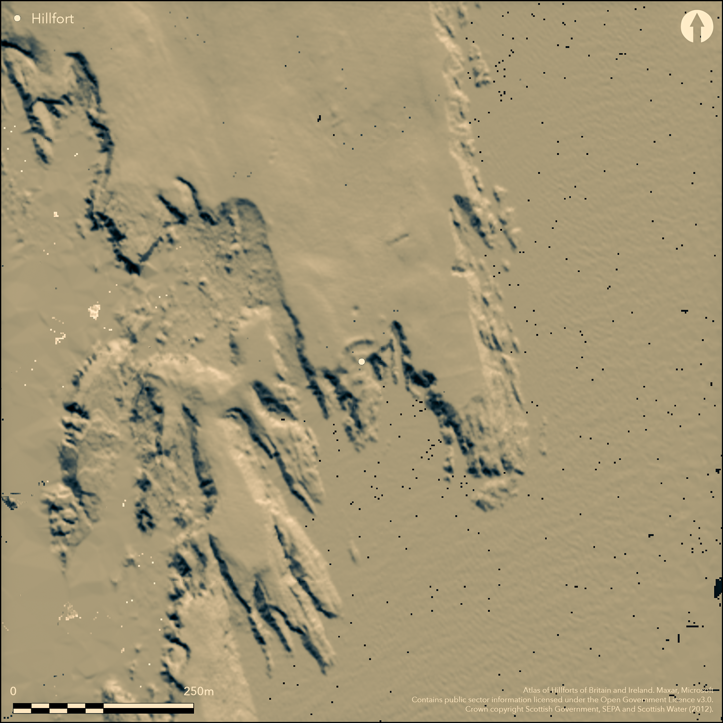
LiDAR 1m DTM Hillshade
Satellite Imagery
Scroll left/right to view further images.
HER: Shetland Amenity Trust 556 (None)
NMR: HU 30 NE 5 (518)
SM: None
NGR: HU 3887 0880
X: 438877 Y: 1108808 (OSGB36)
The remains of a blockhouse standing behind a broad ditch with an external rampart on a minor promontory on the E shore of the West Voe of Sumburgh 400m N of Ness of Burgi (Atlas No.4180), was excavated in 1983 (Carter et al 1995) in advance of ongoing marine erosion, which by then had destroyed E half of the structure. The surviving W half, which measured at least 9m in length from E to W by 4m in breadth, and had a doorway in its S wall lead into an axial chamber to which a smaller chamber at the W end was linked by an opening measuring no more than 0.4m by 0.2m. Both sides of what was presumably a central entrance passage survived on the edge of the cliff on the E and retained checks and a bar-hole. At a later stage the whole blockhouse had been extensively rebuilt and the southern wall thickened, hiding what were probably stone steps up its outside wall at the W end, and all the deposits excavated within the interior dated from after this modification. The relationship between the blockhouse and the outlying ditch with its external rampart could not be established stratigraphically, and while it is assumed to be associated, the blockhouse lies eccentrically within the enclosed area. This currently measures about 30m in depth from N to S by 15m in breadth (0.03ha), but the arc of the ditch, which is over 7m broad and 1.7m deep where sectioned, springs from the cliff-edge immediately W of the blockhouse and swings on a wide, ragged, arc some 14m to the N, ending 9m short of a geo on the NE to leave what was presumably an entrance causeway. Thus configured, the promontory must have measured at least 25m in breadth, and the blockhouse was positioned across the middle of the interior, with as much ground in front of it as behind. No trace of any other structures were found on the surviving portion of the promontory, though ten deposits of charcoal and ash interpreted as fire-spots were excavated, two of them dated 6th-10th centuries AD, as was another sample of charcoal from the entrance passage into the W chamber; these probably relate to a post-abandonment phase before the walls began to collapse and provide no more than a terminus ante quem for the construction, use and modification of the blockhouse.
Citizen Science: ✗
Reliability of Data: Confirmed
Reliability of Interpretation: Confirmed
X: -145563 Y: 8369242 (EPSG: 3857)
Longitude: -1.307618086129417 Latitude: 59.862739361149586 (EPSG:4326)
Country: Scotland
Current County or Unitary Authority: Shetland Islands
Historic County: Shetland
Current Parish/Community/Council/Townland: Dunrossness
None
| Extant | ✓ |
| Cropmark | ✗ |
| Likely Destroyed | ✗ |
None
| Woodland | ✗ |
| Commercial Forestry Plantation | ✗ |
| Parkland | ✗ |
| Pasture (Grazing) | ✓ |
| Arable | ✗ |
| Scrub/Bracken | ✗ |
| Bare Outcrop | ✗ |
| Heather/Moorland | ✓ |
| Heath | ✗ |
| Built-up | ✗ |
| Coastal Grassland | ✗ |
| Other | ✗ |
None
| Contour Fort | ✗ |
| Partial Contour Fort | ✗ |
| Promontory Fort | ✓ |
| Hillslope Fort | ✗ |
| Level Terrain Fort | ✗ |
| Marsh Fort | ✗ |
| Multiple Enclosure Fort | ✗ |
| Hilltop | ✗ |
| Coastal Promontory | ✓ |
| Inland Promontory | ✗ |
| Valley Bottom | ✗ |
| Knoll/Hillock/Outcrop | ✗ |
| Ridge | ✗ |
| Cliff/Plateau-edge/Scarp | ✗ |
| Hillslope | ✗ |
| Lowland | ✗ |
| Spur | ✗ |
Dominant Topographic Feature: None
| North | ✗ |
| Northeast | ✗ |
| East | ✗ |
| Southeast | ✗ |
| South | ✗ |
| Southwest | ✗ |
| West | ✗ |
| Northwest | ✗ |
| Level | ✓ |
Altitude: 10.0m
N/A
No samples were recovered that relate to the construction of the blockhouse. The dates show ongoing activity on the promontory in the 6th-10th centuries AD
Reliability: D - None
| Pre 1200BC | ✗ |
| 1200BC - 800BC | ✗ |
| 800BC - 400BC | ✗ |
| 400BC - AD50 | ✗ |
| AD50 - AD400 | ✗ |
| AD400 - AD 800 | ✗ |
| Post AD800 | ✗ |
| Unknown | ✓ |
| Pre Hillfort: | None |
| Post Hillfort: | None |
| C14: | Three dates from post abandonment contexts |
None
| Earthwork Survey (1971): | Description and sketch-plan by Raymond Lamb (1971; 1980, 32 fog 12, 81; RCAHMS DC1933, SHD 100/1 SO/CO) |
| Earthwork Survey (1983): | As part of the excavation (Carter et al 1995, 432, fig 2) |
| Excavation (1983): | Interior and blockhouse fully excavated under the direction of Peter Strong and Anne Crone (Carter et al 1995, 430-45, 473-80; Archive held in RCAHMS) |
The blockhouse is effectively a feature of the interior
None
| None | ✓ |
| Spring | ✗ |
| Stream | ✗ |
| Pool | ✗ |
| Flush | ✗ |
| Well | ✗ |
| Other | ✗ |
Blockhouse and evidence of fire-spots to its rear
| No Known Features | ✗ |
| Round Stone Structures | ✗ |
| Rectangular Stone Structures | ✗ |
| Curvilinear Platforms | ✗ |
| Other Roundhouse Evidence | ✗ |
| Pits | ✗ |
| Quarry Hollows | ✗ |
| Other | ✓ |
None
| No Known Excavation | ✓ |
| Pits | ✗ |
| Postholes | ✗ |
| Roundhouses | ✗ |
| Rectangular Structures | ✗ |
| Roads/Tracks | ✗ |
| Quarry Hollows | ✗ |
| Other | ✗ |
| Nothing Found | ✗ |
None
| No Known Geophysics | ✓ |
| Pits | ✗ |
| Roundhouses | ✗ |
| Rectangular Structures | ✗ |
| Roads/Tracks | ✗ |
| Quarry Hollows | ✗ |
| Other | ✗ |
| Nothing Found | ✗ |
Coarse sherds representing 21 vessels; a stone axe roughout and a stone disc
| No Known Finds | ✗ |
| Pottery | ✓ |
| Metal | ✗ |
| Metalworking | ✗ |
| Human Bones | ✗ |
| Animal Bones | ✓ |
| Lithics | ✗ |
| Environmental | ✓ |
| Other | ✓ |
Blockhouse
| APs Not Checked | ✗ |
| None | ✓ |
| Roundhouses | ✗ |
| Rectangular Structures | ✗ |
| Pits | ✗ |
| Postholes | ✗ |
| Roads/Tracks | ✗ |
| Other | ✗ |
See main summary
| 2: | None |
| 2: | None |
Guard Chambers: ✗
Chevaux de Frise: ✗
| 1. Simple Gap (North): | Checked entrance with bar-holes through the blockhouse |
| 1. Simple Gap (North): | Through the outer defence |
A ditch and external bank cutting off the promontory are interpreted by the excavators (Carter et al 1995) as no more than a quarry and spoil to provide building material for the blockhouse, though this would have created a recognisable and lasting enclosure on the promontory
| Area 1: | Noneha. |
| Total: | Noneha. |
Total Footprint Area: Noneha.
None
| ✗ | Too heavily eroded to measure the interior |
| ✗ | Discounts the blockhouse |
| NE Quadrant: | 0 |
| SE Quadrant: | 0 |
| SW Quadrant: | 0 |
| NW Quadrant: | 1 |
| Total: | 1 |
| Partial Univallate | ✓ |
| Univallate | ✗ |
| Partial Bivallate | ✗ |
| Bivallate | ✗ |
| Partial Multivallate | ✗ |
| Multivallate | ✗ |
| Unknown | ✗ |
| Partial Univallate | ✗ |
| Univallate | ✗ |
| Partial Bivallate | ✗ |
| Bivallate | ✗ |
| Partial Multivallate | ✗ |
| Multivallate | ✗ |
Blockhouse
| None | ✗ |
| Earthen Bank | ✓ |
| Stone Wall | ✗ |
| Rubble | ✗ |
| Wall-walk | ✗ |
| Evidence of Timber | ✗ |
| Vitrification | ✗ |
| Other Burning | ✗ |
| Palisade | ✗ |
| Counter Scarp Bank | ✗ |
| Berm | ✗ |
| Unfinished | ✗ |
| Other | ✓ |
Ditch and blockhouse
| None | ✗ |
| Earthen Bank | ✓ |
| Stone Wall | ✗ |
| Murus Duplex | ✗ |
| Timber-framed | ✗ |
| Timber-laced | ✗ |
| Vitrification | ✗ |
| Other Burning | ✗ |
| Palisade | ✗ |
| Counter Scarp Bank | ✗ |
| Berm | ✗ |
| Unfinished | ✗ |
| No Known Excavation | ✗ |
| Other | ✓ |
| ✗ | None |
| ✓ | None |
Number of Ditches: 1
| ✗ | None |
Carter, S P, McCullagh, R P J and MacSween, A (1995) 'The Iron Age in Shetland: excavations at five sites threatened by coastal erosion'. Proc Soc Antiq Scot 125 (1995), 429-82
Lamb, R G (1971) 'Scatness - Coastal fort'. Disc Exc Scot (1971), 41
Lamb, R G (1980) Iron Age promontory forts in the Northern Isles. Brit Archaeol Rep, British Ser 79. BAR: Oxford
Atlas of Hillforts:
Wikidata:
This work is licensed under CC BY-SA 4.0![]()
![]()
![]() and should be cited as:
and should be cited as:
Lock, Gary and Ralston, Ian. 2024. Atlas of Hillforts of Britain and Ireland. Available at: https://hillforts.arch.ox.ac.uk
Document Version 1.1