LiDAR 1m DTM Hillshade
Satellite Imagery
LiDAR 1m DTM Hillshade
Satellite Imagery
Scroll left/right to view further images.
HER: Dyfed 1830 (None)
NMR: SN 44 SE 2 (303791)
SM: CM081(CAM)
NGR: SN46904001
X: 246900 Y: 240010 (OSGB36)
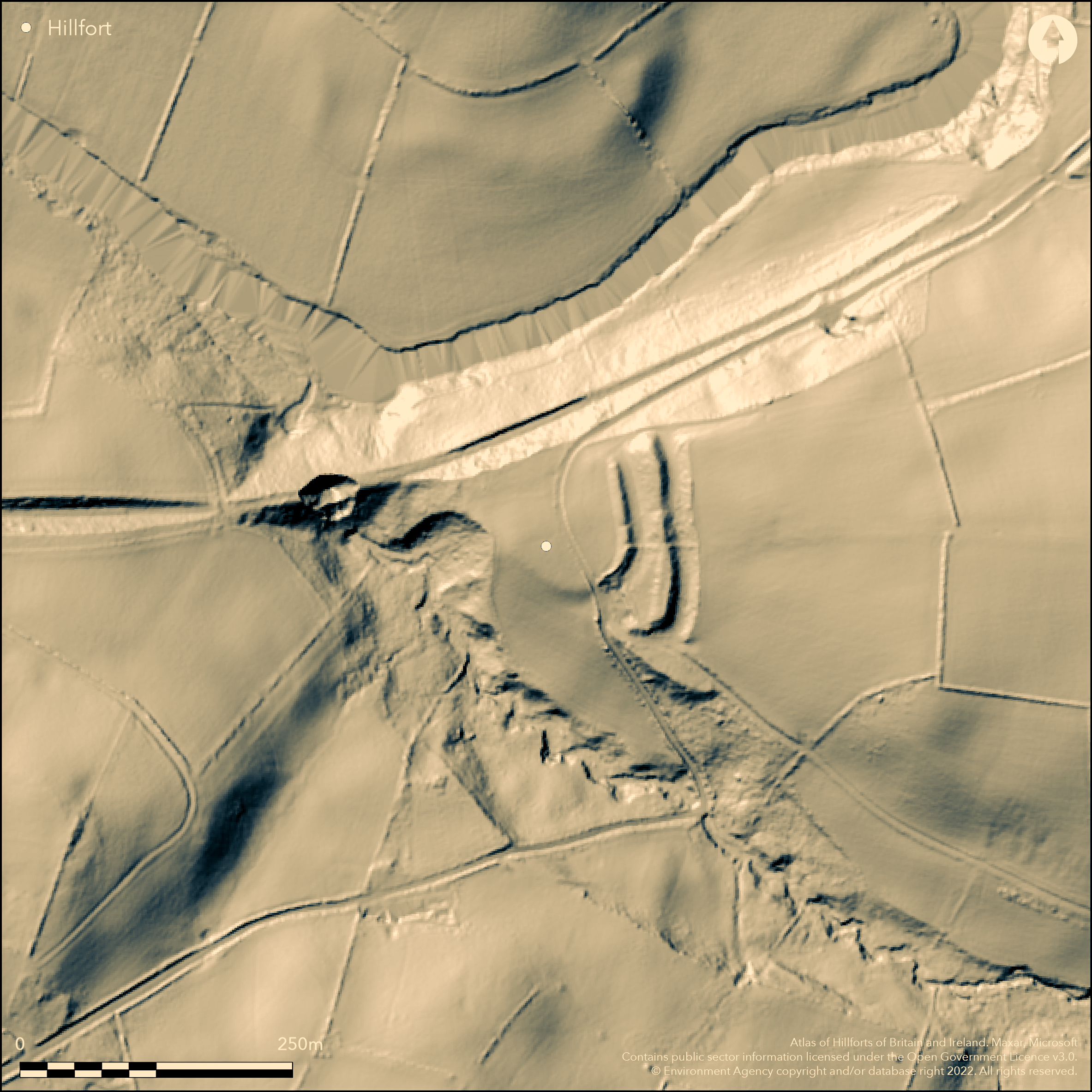
Inland promontory fort situated on a WNW-facing spur just above the Afon Teifi and Nant-Cwm-du stream confluence. Steep surrounding slopes on N (steepest), S and W, less on E along promontory. D-shaped measuring c. 70m across. Internal area estimated at 0.38ha. Road bisects site and area to W appears levelled and nothing remains. To E more substantial and defined by two ramparts and ditches cutting off the promontory from NNW-SSE, with natural scarps defence elsewhere, with the outer rampart, c. 3m-4m high, higher than the inner at c. 2m high. Ditch to outer rampart still substantial. Ordnance Survey in 1968 recorded outer bank to 8m high with ditch to 3.4m depth. Internal area unknown. Both banks stop short of the scarp at N end, where possible entrance. Overlooked from just outside. Most of site under pasture, with wooded Castle Pyr cottage grounds in S. On 1st Ed. OS map (1889). Minimal investigations, undated.
Citizen Science: ✗
Reliability of Data: Confirmed
Reliability of Interpretation: Confirmed
X: -471275 Y: 6806866 (EPSG: 3857)
Longitude: -4.233532420438258 Latitude: 52.03726204385989 (EPSG:4326)
Country: Wales
Current County or Unitary Authority: Carmarthenshire
Historic County: Carmarthenshire
Current Parish/Community/Council/Townland: Llanllwni
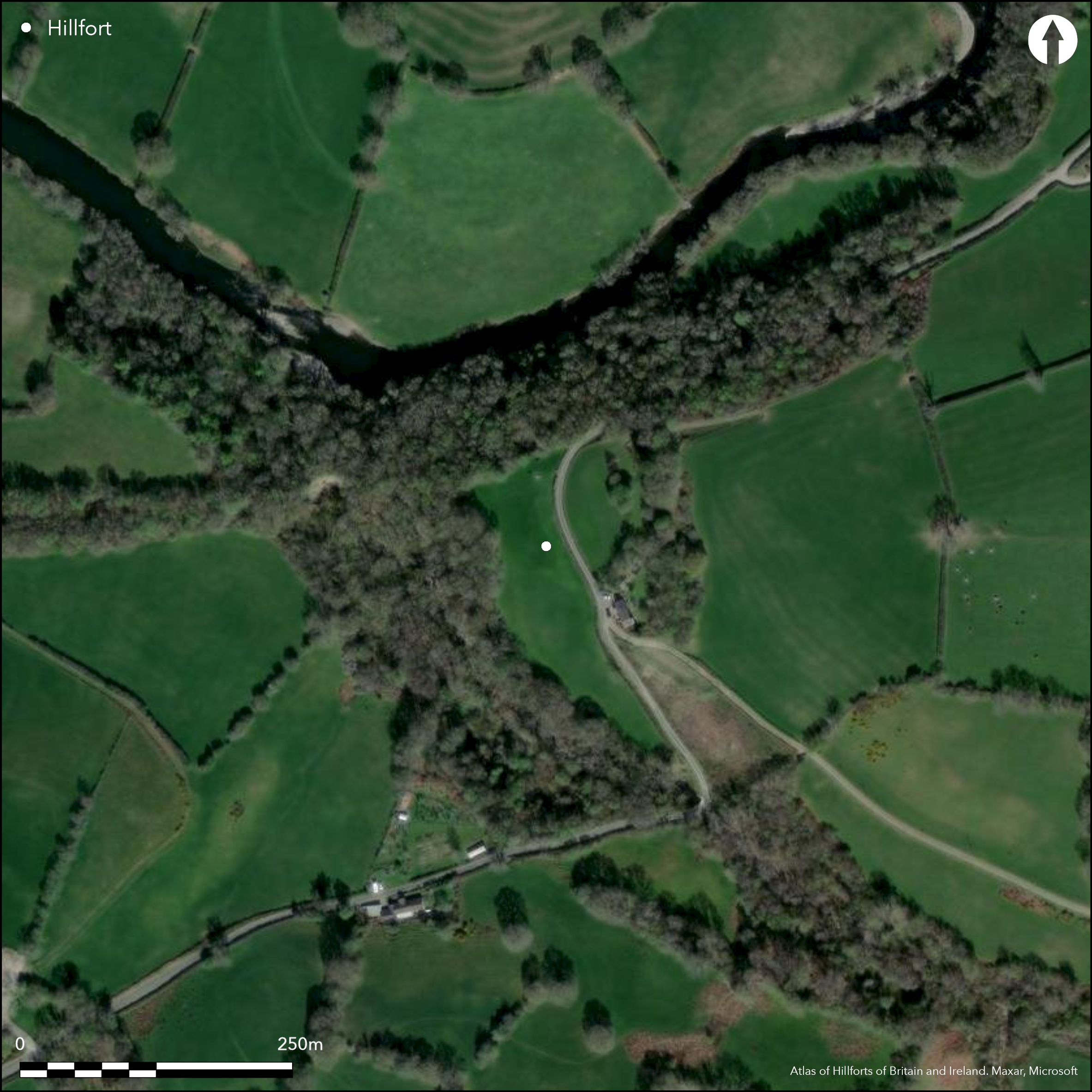
Road bisects site. Castle Pyr cottage grounds in S. Much erosion since Ordnance Survey visited site in 1968.
| Extant | ✓ |
| Cropmark | ✗ |
| Likely Destroyed | ✗ |
Most under improved pasture with wooded Castle Pyr cottage grounds in S.
| Woodland | ✓ |
| Commercial Forestry Plantation | ✗ |
| Parkland | ✗ |
| Pasture (Grazing) | ✓ |
| Arable | ✗ |
| Scrub/Bracken | ✗ |
| Bare Outcrop | ✗ |
| Heather/Moorland | ✗ |
| Heath | ✗ |
| Built-up | ✗ |
| Coastal Grassland | ✗ |
| Other | ✓ |
Inland promontory fort situated on a WNW-facing spur just above the Afon Teifi and Nant-Cwm-du stream confluence. Steep surrounding slopes on N (steepest), S and W, less on E along promontory.
| Contour Fort | ✗ |
| Partial Contour Fort | ✗ |
| Promontory Fort | ✓ |
| Hillslope Fort | ✗ |
| Level Terrain Fort | ✗ |
| Marsh Fort | ✗ |
| Multiple Enclosure Fort | ✗ |
| Hilltop | ✗ |
| Coastal Promontory | ✗ |
| Inland Promontory | ✓ |
| Valley Bottom | ✗ |
| Knoll/Hillock/Outcrop | ✗ |
| Ridge | ✗ |
| Cliff/Plateau-edge/Scarp | ✗ |
| Hillslope | ✗ |
| Lowland | ✗ |
| Spur | ✓ |
Dominant Topographic Feature: Spur
| North | ✗ |
| Northeast | ✗ |
| East | ✗ |
| Southeast | ✗ |
| South | ✗ |
| Southwest | ✗ |
| West | ✗ |
| Northwest | ✓ |
| Level | ✗ |
Altitude: 120.0m
N/A
None
Reliability: D - None
| Pre 1200BC | ✗ |
| 1200BC - 800BC | ✗ |
| 800BC - 400BC | ✗ |
| 400BC - AD50 | ✗ |
| AD50 - AD400 | ✗ |
| AD400 - AD 800 | ✗ |
| Post AD800 | ✗ |
| Unknown | ✓ |
| Pre Hillfort: | None |
| Post Hillfort: | None |
On 1st Ed. OS map (1889). Field Observation OS 1968. Field Observation DAT 1983. Field Observation CADW 1994, 2002. Dyfed Archaeological Trust defended enclosures survey 2007-2008.
| 1st Identified Map Depiction (1889): | OS map. |
| Other (1968): | Field observation OS. |
| Other (1983): | Field observation DAT. |
| Other (None): | Field observation CADW. |
| Other (None): | Dyfed Archaeological Trust defended enclosures survey. |
None
Stream 0.1km outside fort.
| None | ✓ |
| Spring | ✗ |
| Stream | ✗ |
| Pool | ✗ |
| Flush | ✗ |
| Well | ✗ |
| Other | ✗ |
None
| No Known Features | ✓ |
| Round Stone Structures | ✗ |
| Rectangular Stone Structures | ✗ |
| Curvilinear Platforms | ✗ |
| Other Roundhouse Evidence | ✗ |
| Pits | ✗ |
| Quarry Hollows | ✗ |
| Other | ✗ |
None
| No Known Excavation | ✓ |
| Pits | ✗ |
| Postholes | ✗ |
| Roundhouses | ✗ |
| Rectangular Structures | ✗ |
| Roads/Tracks | ✗ |
| Quarry Hollows | ✗ |
| Other | ✗ |
| Nothing Found | ✗ |
None
| No Known Geophysics | ✓ |
| Pits | ✗ |
| Roundhouses | ✗ |
| Rectangular Structures | ✗ |
| Roads/Tracks | ✗ |
| Quarry Hollows | ✗ |
| Other | ✗ |
| Nothing Found | ✗ |
None
| No Known Finds | ✓ |
| Pottery | ✗ |
| Metal | ✗ |
| Metalworking | ✗ |
| Human Bones | ✗ |
| Animal Bones | ✗ |
| Lithics | ✗ |
| Environmental | ✗ |
| Other | ✗ |
None
| APs Not Checked | ✓ |
| None | ✗ |
| Roundhouses | ✗ |
| Rectangular Structures | ✗ |
| Pits | ✗ |
| Postholes | ✗ |
| Roads/Tracks | ✗ |
| Other | ✗ |
Both banks stop short of the scarp at N end, where possible entrance.
| 1: | None |
| 2: | None |
Guard Chambers: ✗
Chevaux de Frise: ✗
| 1. Simple Gap (North): | None |
Defined by two ramparts and ditches cutting off the promontory from NNW-SSE, with natural scarps defence elsewhere, with the outer rampart, c. 3m-4m high, higher than the inner at c. 2m high. Ditch to outer rampart still substantial.
| Area 1: | 0.38ha. |
| Total: | 0.38ha. |
Total Footprint Area: Noneha.
None
| ✗ | Internal area estimated. |
| ✗ | None |
| NE Quadrant: | 0 |
| SE Quadrant: | 1 |
| SW Quadrant: | 1 |
| NW Quadrant: | 0 |
| Total: | 1 |
| Partial Univallate | ✓ |
| Univallate | ✗ |
| Partial Bivallate | ✗ |
| Bivallate | ✗ |
| Partial Multivallate | ✗ |
| Multivallate | ✗ |
| Unknown | ✗ |
| Partial Univallate | ✗ |
| Univallate | ✗ |
| Partial Bivallate | ✗ |
| Bivallate | ✗ |
| Partial Multivallate | ✗ |
| Multivallate | ✗ |
None
| None | ✗ |
| Earthen Bank | ✓ |
| Stone Wall | ✗ |
| Rubble | ✗ |
| Wall-walk | ✗ |
| Evidence of Timber | ✗ |
| Vitrification | ✗ |
| Other Burning | ✗ |
| Palisade | ✗ |
| Counter Scarp Bank | ✗ |
| Berm | ✗ |
| Unfinished | ✗ |
| Other | ✗ |
None
| None | ✗ |
| Earthen Bank | ✗ |
| Stone Wall | ✗ |
| Murus Duplex | ✗ |
| Timber-framed | ✗ |
| Timber-laced | ✗ |
| Vitrification | ✗ |
| Other Burning | ✗ |
| Palisade | ✗ |
| Counter Scarp Bank | ✗ |
| Berm | ✗ |
| Unfinished | ✗ |
| No Known Excavation | ✓ |
| Other | ✗ |
| ✗ | None |
| ✓ | None |
Number of Ditches: 2
| ✗ | None |
Murphy, F., Ramsey, R., Page, M. and Murphy, K. 2008. A Survey of Defended Enclosures in Carmarthenshire, 2007-08: Gazetteer of Ordnance Survey Grid Squares SN40, SN41, SN42, SN43 and SN44, Dyfed Archaeological Trust Report No. 2007/27, Project Record No. 62767, Llandeilo: Dyfed Archaeological Trust.
Royal Commission on the ancient and historical monuments and constructions in Wales and Monmouthshire 1917. An inventory of the ancient monuments in Wales and Monmouthshire, V, Carmarthen, 522, London: HMSO.
Savory, H.N. 1954. List of hill-forts and other earthworks in Carmarthenshire. Bull Board Celtic Stud, 16, 63.
Atlas of Hillforts:
Wikidata:
This work is licensed under CC BY-SA 4.0![]()
![]()
![]() and should be cited as:
and should be cited as:
Lock, Gary and Ralston, Ian. 2024. Atlas of Hillforts of Britain and Ireland. Available at: https://hillforts.arch.ox.ac.uk
Document Version 1.1