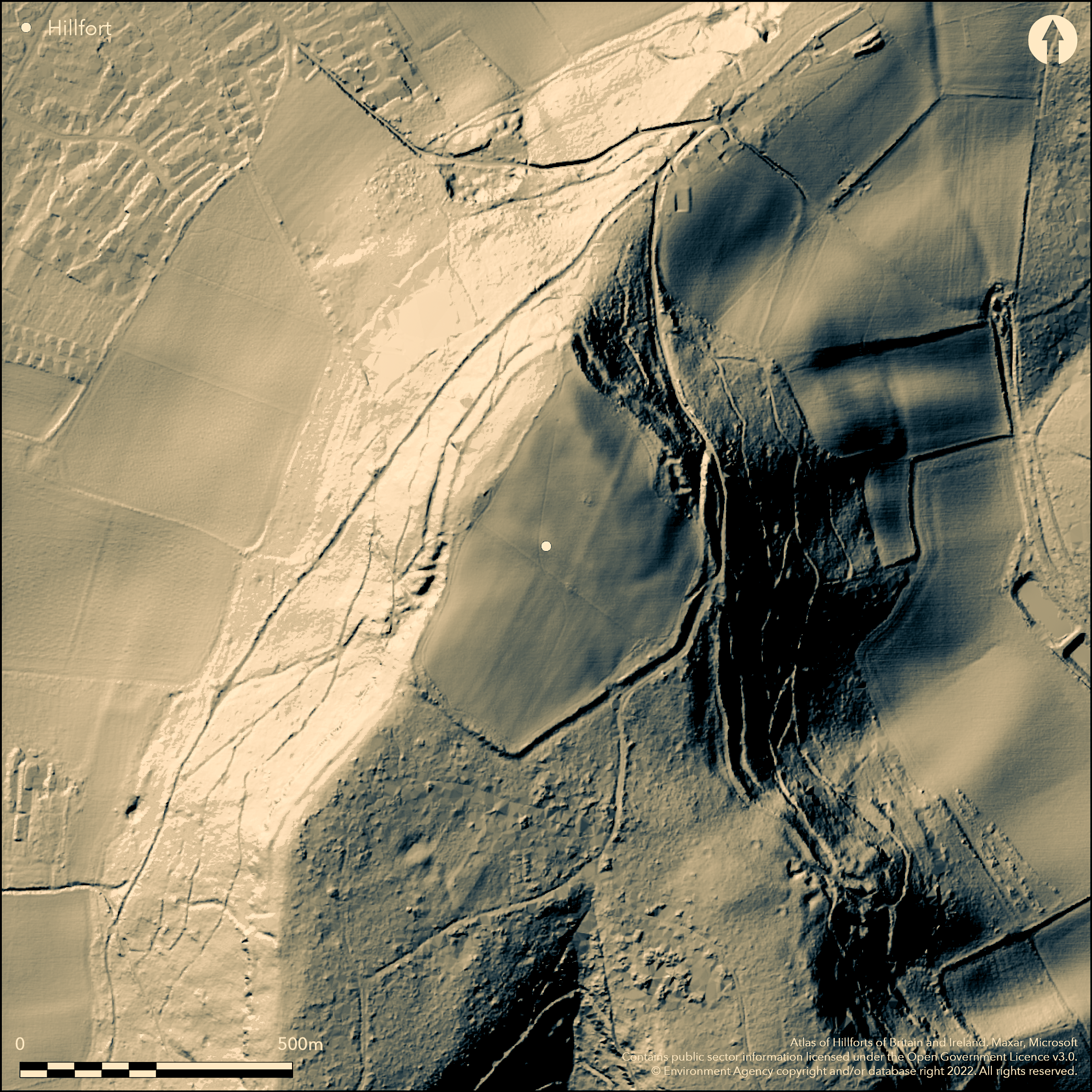
LiDAR 1m DTM Hillshade
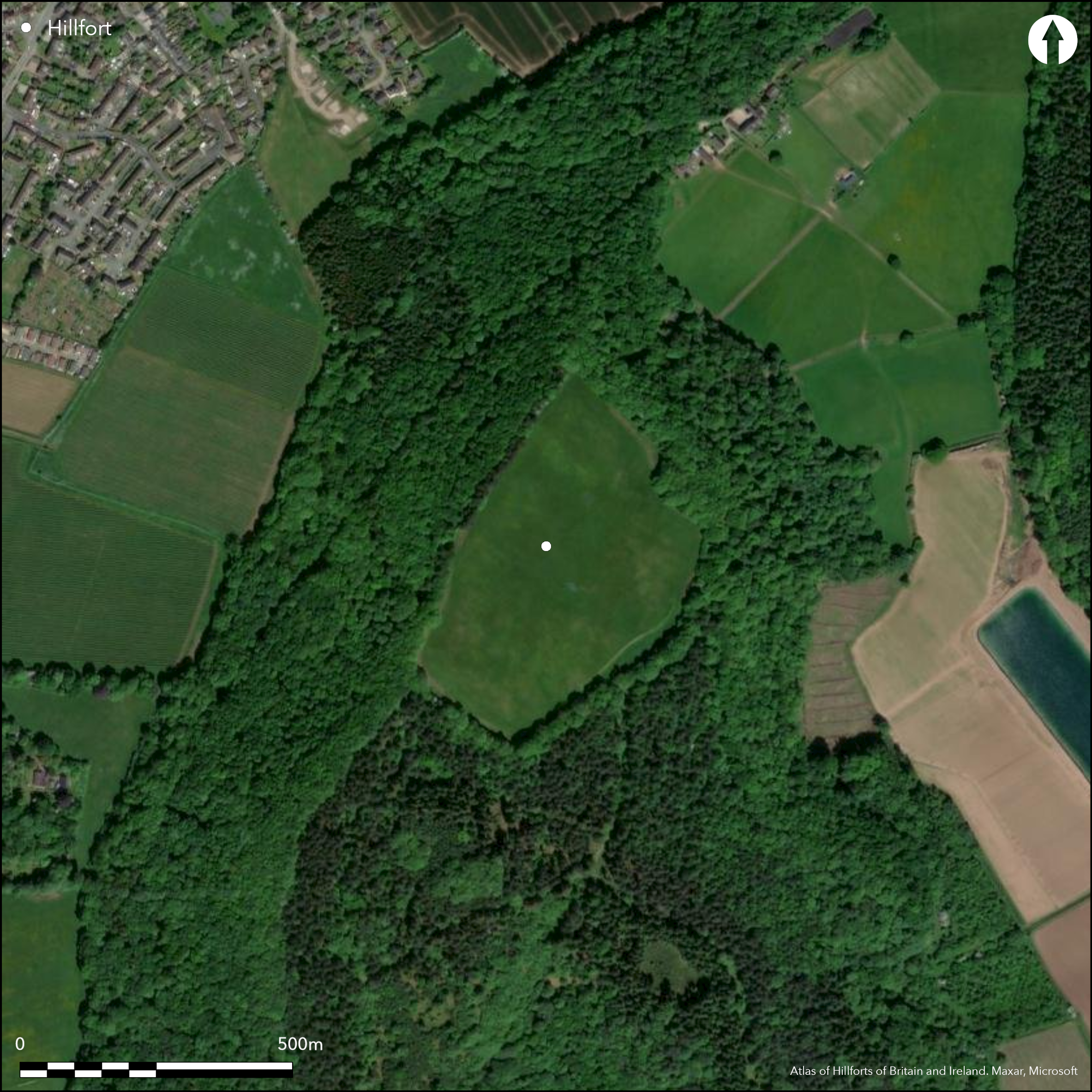
Satellite Imagery
LiDAR 1m DTM Hillshade
Satellite Imagery
Scroll left/right to view further images.
HER: Herefordshire MHE407 (904)
NMR: SO 62 SW 8 (111919)
SM: 1001743
NGR: SO 602224
X: 360214 Y: 222396 (OSGB36)
Isolated, large, partial contour hillfort strategically sited within Chase Wood on a prominent hill above the lower Wye valley and above Ross-on-Wye. Only hillfort situated near to the Forest of Dean. Oval shape with internal area c. 10.8ha. Unusual W defences as located 40m downslope from the interior with a berm at the base of the scarp, then a ditch and counterscarp. Steep slopes surround site, except on the S side where it is defended by a rampart to nearly 2m high. On other sides scarping of the natural slope with berm form the defence and give a sense of monumentality to the site, with traces of an outer bank to the berm to the W. Possible three entrances; very impressive on NE. Chance finds of Neolithic implements and Mesolithic microlith found as result of tree clearance. Interior has been regularly ploughed. FC conifer plantation on W ramparts, which are vulnerable. Animal disturbance, particularly around the S rampart. Tree clearance has taken place. Two public footpaths close-by. Despite the regular ploughing, with probable deterioration of archaeological layers, site generally stable and little has changed over the past 25 years. Undated.
Citizen Science: ✗
Reliability of Data: Confirmed
Reliability of Interpretation: Confirmed
X: -287166 Y: 6781819 (EPSG: 3857)
Longitude: -2.5796575546081306 Latitude: 51.89863952298304 (EPSG:4326)
Country: England
Current County or Unitary Authority: Herefordshire
Historic County: Herefordshire
Current Parish/Community/Council/Townland: Ross Rural
Animal disturbance, particularly around the S rampart. Tree clearance has taken place. Two public footpaths close-by. Despite regular ploughing, with probable deterioration of archaeological layers, site generally stable and little has changed over the past 25 years.
| Extant | ✓ |
| Cropmark | ✗ |
| Likely Destroyed | ✗ |
Interior has been regularly ploughed. FC conifer plantation on W ramparts, which are vulnerable.
| Woodland | ✗ |
| Commercial Forestry Plantation | ✓ |
| Parkland | ✗ |
| Pasture (Grazing) | ✓ |
| Arable | ✓ |
| Scrub/Bracken | ✗ |
| Bare Outcrop | ✗ |
| Heather/Moorland | ✗ |
| Heath | ✗ |
| Built-up | ✗ |
| Coastal Grassland | ✗ |
| Other | ✗ |
Partial contour hillfort, the site including the summit of the hill, but slopes to SW. Located within Chase Wood on a prominent hill above Ross-on-Wye with steep surrounding slopes apart from on S side.
| Contour Fort | ✗ |
| Partial Contour Fort | ✓ |
| Promontory Fort | ✗ |
| Hillslope Fort | ✗ |
| Level Terrain Fort | ✗ |
| Marsh Fort | ✗ |
| Multiple Enclosure Fort | ✗ |
| Hilltop | ✓ |
| Coastal Promontory | ✗ |
| Inland Promontory | ✗ |
| Valley Bottom | ✗ |
| Knoll/Hillock/Outcrop | ✗ |
| Ridge | ✗ |
| Cliff/Plateau-edge/Scarp | ✗ |
| Hillslope | ✗ |
| Lowland | ✗ |
| Spur | ✗ |
Dominant Topographic Feature: Prominent hill location.
| North | ✗ |
| Northeast | ✗ |
| East | ✗ |
| Southeast | ✗ |
| South | ✗ |
| Southwest | ✓ |
| West | ✗ |
| Northwest | ✗ |
| Level | ✗ |
Altitude: 203.0m
N/A
None
Reliability: D - None
| Pre 1200BC | ✗ |
| 1200BC - 800BC | ✗ |
| 800BC - 400BC | ✗ |
| 400BC - AD50 | ✗ |
| AD50 - AD400 | ✗ |
| AD400 - AD 800 | ✗ |
| Post AD800 | ✗ |
| Unknown | ✓ |
| Pre Hillfort: | Neolithic implements and Mesolothic microlith found as result of tree clearance. |
| Post Hillfort: | None |
| Artefactual: | Neolithic implements and Mesolothic microlith found as result of tree clearance. |
Herefordshire Council survey 2012.
| Other (2012): | Herefordshire Council survey |
No features apparent, but tree clearance and ploughing unearthed Neolithic implements, including scrapers, burins, and arrowhead of lozenge shape. Also Mesolithic microlith. To W of hillfort ramparts outside the fort quantity of Iron Age pottery, blue glass bead and worn 3rd or 4th century Roman coin found.
Stream 0.8 km located outside the hillfort
| None | ✓ |
| Spring | ✗ |
| Stream | ✗ |
| Pool | ✗ |
| Flush | ✗ |
| Well | ✗ |
| Other | ✗ |
None
| No Known Features | ✓ |
| Round Stone Structures | ✗ |
| Rectangular Stone Structures | ✗ |
| Curvilinear Platforms | ✗ |
| Other Roundhouse Evidence | ✗ |
| Pits | ✗ |
| Quarry Hollows | ✗ |
| Other | ✗ |
None
| No Known Excavation | ✓ |
| Pits | ✗ |
| Postholes | ✗ |
| Roundhouses | ✗ |
| Rectangular Structures | ✗ |
| Roads/Tracks | ✗ |
| Quarry Hollows | ✗ |
| Other | ✗ |
| Nothing Found | ✗ |
None
| No Known Geophysics | ✓ |
| Pits | ✗ |
| Roundhouses | ✗ |
| Rectangular Structures | ✗ |
| Roads/Tracks | ✗ |
| Quarry Hollows | ✗ |
| Other | ✗ |
| Nothing Found | ✗ |
Tree clearance and ploughing unearthed Neolithic implements, including scrapers, burins, and arrowhead of lozenge shape. Also mesolithic microlith. To W of hillfort ramparts outside the fort quantity of Iron Age pottery, blue glass bead and worn 3rd or 4th century Roman coin chance finds.
| No Known Finds | ✗ |
| Pottery | ✗ |
| Metal | ✗ |
| Metalworking | ✗ |
| Human Bones | ✗ |
| Animal Bones | ✗ |
| Lithics | ✓ |
| Environmental | ✗ |
| Other | ✗ |
None
| APs Not Checked | ✓ |
| None | ✗ |
| Roundhouses | ✗ |
| Rectangular Structures | ✗ |
| Pits | ✗ |
| Postholes | ✗ |
| Roads/Tracks | ✗ |
| Other | ✗ |
That to the NE is original, and raking in form cut through the rock. Those to the extreme N and middle of the W side probably of later date.
| 3: | Those to the extreme N and middle of the W side may be of later date. |
| 2: | An original entrance on the NE side. |
Guard Chambers: ✗
Chevaux de Frise: ✗
| 1. Oblique (North east): | This original entrance has a raking form (or oblique?) cut through the rock. |
Defended on S by rampart rising to nearly 2m above ground surface. Elsewhere there is a scarped natural slope with berm and traces of outer bank on W side. Unusual western defences as located 40m downslope from the interior with a berm at the base of the scarp, then a ditch and counterscarp.
| Area 1: | 10.8ha. |
| Total: | 10.8ha. |
Total Footprint Area: Noneha.
None
| ✗ | Major use of natural slopes define the site. |
| ✓ | Ramparts form the circuit making full use of the natural slopes. |
| NE Quadrant: | 1 |
| SE Quadrant: | 1 |
| SW Quadrant: | 1 |
| NW Quadrant: | 1 |
| Total: | 1 |
| Partial Univallate | ✗ |
| Univallate | ✓ |
| Partial Bivallate | ✗ |
| Bivallate | ✗ |
| Partial Multivallate | ✗ |
| Multivallate | ✗ |
| Unknown | ✗ |
| Partial Univallate | ✗ |
| Univallate | ✗ |
| Partial Bivallate | ✗ |
| Bivallate | ✗ |
| Partial Multivallate | ✗ |
| Multivallate | ✗ |
Scarped natural slopes with berm and counterscarp a feature of the site.
| None | ✗ |
| Earthen Bank | ✓ |
| Stone Wall | ✗ |
| Rubble | ✗ |
| Wall-walk | ✗ |
| Evidence of Timber | ✗ |
| Vitrification | ✗ |
| Other Burning | ✗ |
| Palisade | ✗ |
| Counter Scarp Bank | ✓ |
| Berm | ✓ |
| Unfinished | ✗ |
| Other | ✗ |
None
| None | ✗ |
| Earthen Bank | ✗ |
| Stone Wall | ✗ |
| Murus Duplex | ✗ |
| Timber-framed | ✗ |
| Timber-laced | ✗ |
| Vitrification | ✗ |
| Other Burning | ✗ |
| Palisade | ✗ |
| Counter Scarp Bank | ✗ |
| Berm | ✗ |
| Unfinished | ✗ |
| No Known Excavation | ✓ |
| Other | ✗ |
| ✗ | None |
| ✓ | On the W. |
Number of Ditches: 1
| ✗ | None |
Dorling, P. and Wigley, A. 2012. Assessment of the archaeological and conservation status of major later prehistoric enclosures in Herefordshire and Shropshire, EH PNUM, Version 3.2, Hereford and Shrewsbury: Herefordshire Council/Shropshire Council.
Page, W. ed. 1908. The Victoria County History of the County of Herefordshire, 1, 219, London: St Catherine Press.
RCHME 1931-34. An Inventory of the Historical Monuments in Herefordshire, 2 (E), 167, 6, London: HMSO.
Stanford, S. C. (ed.). 1976. Guide to Prehistoric and Roman Sites in Herefordshire. Woolhope Naturalists' Field Club Archaeological Research Section, 24-25.
Atlas of Hillforts:
Wikidata:
This work is licensed under CC BY-SA 4.0

 and should be cited as:
Lock, Gary and Ralston, Ian. 2024. Atlas of Hillforts of Britain and Ireland. Available at: https://hillforts.arch.ox.ac.uk
Document Version 1.1