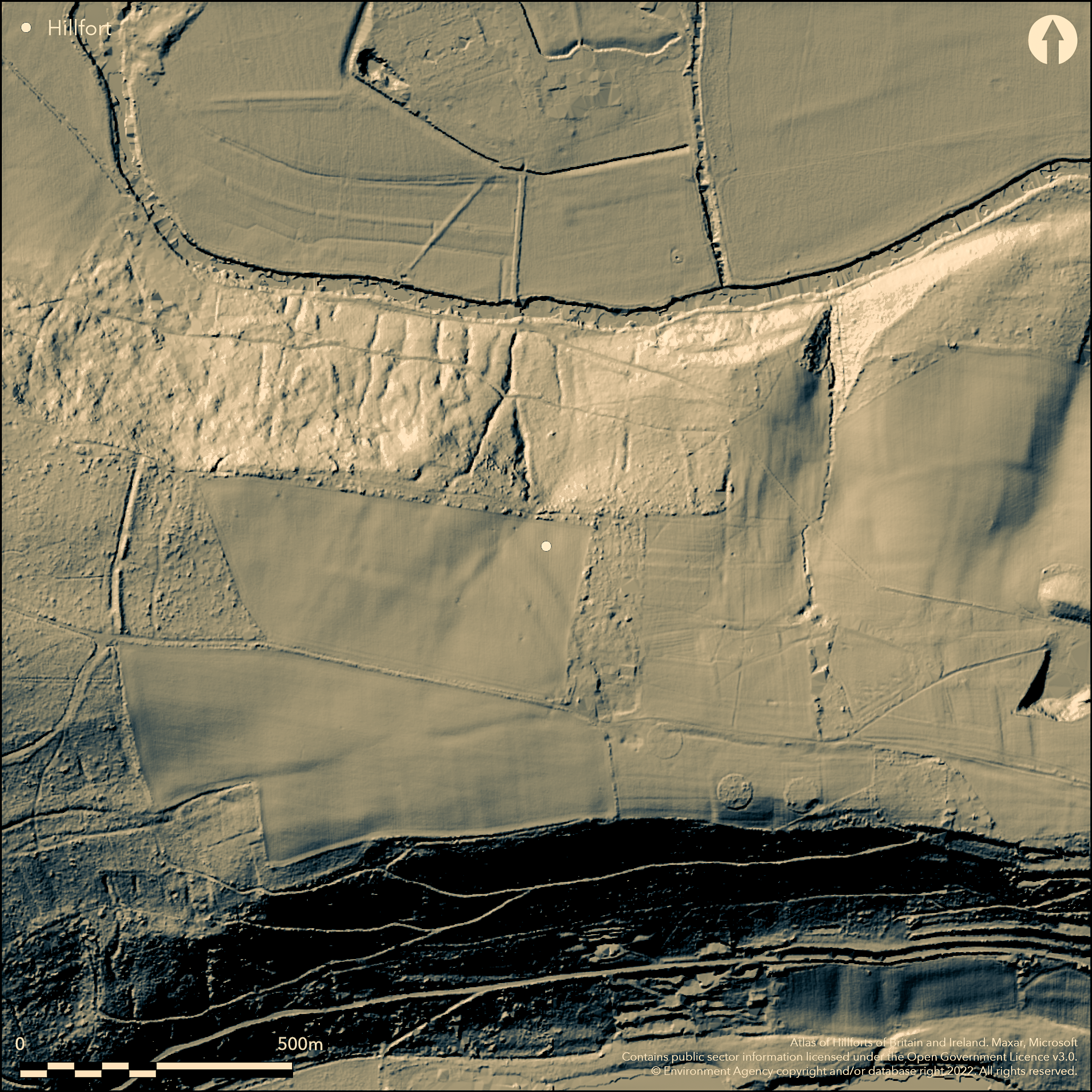
LiDAR 1m DTM Hillshade
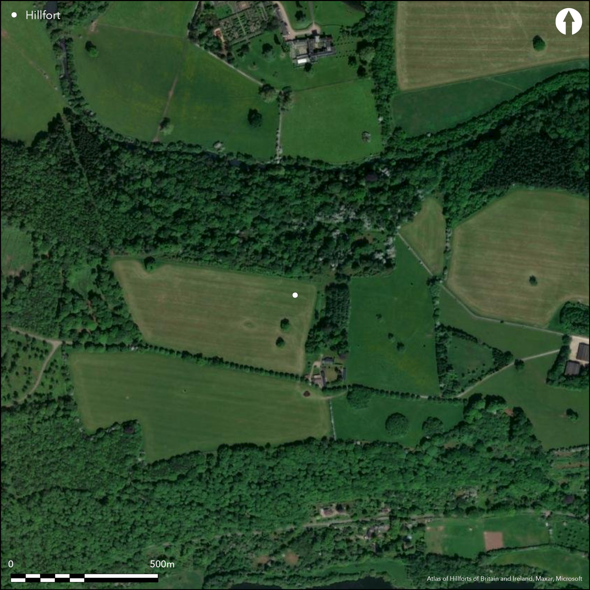
Satellite Imagery
LiDAR 1m DTM Hillshade
Satellite Imagery
Scroll left/right to view further images.
HER: Herefordshire MHE872 (1733)
NMR: None (None)
SM: None
NGR: SO 520519
X: 352000 Y: 251900 (OSGB36)
Little is know about the site, which is a large, unscheduled, possible inland promontory fort located on a spur on a bend of the River Lugg. There is a single bank and rock-cut ditch on the W. Earthworks at the E end have been confirmed by aerial photography and geophysics and confirmed by excavation. The W bank effectively cuts off the promontory, with steep slopes on the other three sides, and could be interpreted as a possible cross-dyke. The site was the subject of Time Team investigations in 2009, report forthcoming. Mostly wooded site with some improved pasture. Undated. On 1st Ed. OS map (1888).
Citizen Science: ✗
Reliability of Data: Unconfirmed
Reliability of Interpretation: Unconfirmed
X: -300916 Y: 6829695 (EPSG: 3857)
Longitude: -2.7031767209465327 Latitude: 52.16323670276651 (EPSG:4326)
Country: England
Current County or Unitary Authority: Herefordshire
Historic County: Herefordshire
Current Parish/Community/Council/Townland: Hope under Dinmore
Little is known about the site, but damaged.
| Extant | ✓ |
| Cropmark | ✗ |
| Likely Destroyed | ✗ |
Wooded and improved pasture.
| Woodland | ✓ |
| Commercial Forestry Plantation | ✗ |
| Parkland | ✗ |
| Pasture (Grazing) | ✓ |
| Arable | ✗ |
| Scrub/Bracken | ✓ |
| Bare Outcrop | ✗ |
| Heather/Moorland | ✗ |
| Heath | ✗ |
| Built-up | ✗ |
| Coastal Grassland | ✗ |
| Other | ✗ |
The location of the site is not exact. Located on NE spur slopes on a bend of the River Lugg.
| Contour Fort | ✗ |
| Partial Contour Fort | ✗ |
| Promontory Fort | ✓ |
| Hillslope Fort | ✗ |
| Level Terrain Fort | ✗ |
| Marsh Fort | ✗ |
| Multiple Enclosure Fort | ✗ |
| Hilltop | ✗ |
| Coastal Promontory | ✗ |
| Inland Promontory | ✗ |
| Valley Bottom | ✗ |
| Knoll/Hillock/Outcrop | ✗ |
| Ridge | ✗ |
| Cliff/Plateau-edge/Scarp | ✗ |
| Hillslope | ✓ |
| Lowland | ✗ |
| Spur | ✓ |
Dominant Topographic Feature: Spur above the River Lugg.
| North | ✗ |
| Northeast | ✓ |
| East | ✗ |
| Southeast | ✗ |
| South | ✗ |
| Southwest | ✗ |
| West | ✗ |
| Northwest | ✗ |
| Level | ✗ |
Altitude: 160.0m
N/A
None
Reliability: D - None
| Pre 1200BC | ✗ |
| 1200BC - 800BC | ✗ |
| 800BC - 400BC | ✗ |
| 400BC - AD50 | ✗ |
| AD50 - AD400 | ✗ |
| AD400 - AD 800 | ✗ |
| Post AD800 | ✗ |
| Unknown | ✓ |
| Pre Hillfort: | None |
| Post Hillfort: | None |
On 1st Ed. OS map (1888). Time Team investigation 2009. Detail not known and report forthcoming but environmental sampling undertaken. Herefordshire Council survey. 2009 Geophysical survey, GSB (available on ADS, Oasis report no: gsbprosp1-75274).
| 1st Identified Map Depiction (1888): | OS map |
| Excavation (2009): | Report forthcoming of excavation detail. |
| Geophysical Survey (2009): | GSB (available on ADS, Oasis report no: gsbprosp1-75274). |
| Other (2012): | Herefordshire Council survey. |
Antler fragment dated to 1450 BC. Charcoal. Excavation report forthcoming.
River Lugg located 0.6 km outside the hillfort.
| None | ✓ |
| Spring | ✗ |
| Stream | ✗ |
| Pool | ✗ |
| Flush | ✗ |
| Well | ✗ |
| Other | ✗ |
None
| No Known Features | ✓ |
| Round Stone Structures | ✗ |
| Rectangular Stone Structures | ✗ |
| Curvilinear Platforms | ✗ |
| Other Roundhouse Evidence | ✗ |
| Pits | ✗ |
| Quarry Hollows | ✗ |
| Other | ✗ |
Excavation report forthcoming.
| No Known Excavation | ✗ |
| Pits | ✗ |
| Postholes | ✗ |
| Roundhouses | ✗ |
| Rectangular Structures | ✗ |
| Roads/Tracks | ✗ |
| Quarry Hollows | ✗ |
| Other | ✓ |
| Nothing Found | ✗ |
Report on geophysics forthcoming.
| No Known Geophysics | ✗ |
| Pits | ✗ |
| Roundhouses | ✗ |
| Rectangular Structures | ✗ |
| Roads/Tracks | ✗ |
| Quarry Hollows | ✗ |
| Other | ✓ |
| Nothing Found | ✗ |
Antler fragment dated to 1450 BC. Charcoal and waterlogged ditch deposits. Carbonised grain.
| No Known Finds | ✗ |
| Pottery | ✗ |
| Metal | ✗ |
| Metalworking | ✗ |
| Human Bones | ✗ |
| Animal Bones | ✓ |
| Lithics | ✗ |
| Environmental | ✓ |
| Other | ✓ |
None
| APs Not Checked | ✓ |
| None | ✗ |
| Roundhouses | ✗ |
| Rectangular Structures | ✗ |
| Pits | ✗ |
| Postholes | ✗ |
| Roads/Tracks | ✗ |
| Other | ✗ |
No entrances have yet been determined, but report forthcoming.
| 0: | No entrances or breaks have been determined |
| 2: | None determined. |
Guard Chambers: ✗
Chevaux de Frise: ✗
There is a single rampart and ditch and rock cut ditch and bank to W and earthworks at the E end have been confirmed by excavation. The W bank effectively cuts off the promontory, with steep slopes on the other three sides, and could be interpreted as a possible cross-dyke.
| Area 1: | 9.6ha. |
| Total: | 9.6ha. |
Total Footprint Area: Noneha.
None
| ✗ | Much has yet to be determined as to the exact boundary of the site. |
| ✗ | No detail known but single rampart and ditch and rock cut ditch and bank to W and earthworks at the E end have been confirmed by excavation. Quadrants here postulated. |
| NE Quadrant: | 1 |
| SE Quadrant: | 1 |
| SW Quadrant: | 0 |
| NW Quadrant: | 1 |
| Total: | 1 |
| Partial Univallate | ✓ |
| Univallate | ✗ |
| Partial Bivallate | ✗ |
| Bivallate | ✗ |
| Partial Multivallate | ✗ |
| Multivallate | ✗ |
| Unknown | ✗ |
| Partial Univallate | ✗ |
| Univallate | ✗ |
| Partial Bivallate | ✗ |
| Bivallate | ✗ |
| Partial Multivallate | ✗ |
| Multivallate | ✗ |
None
| None | ✗ |
| Earthen Bank | ✓ |
| Stone Wall | ✗ |
| Rubble | ✗ |
| Wall-walk | ✗ |
| Evidence of Timber | ✗ |
| Vitrification | ✗ |
| Other Burning | ✗ |
| Palisade | ✗ |
| Counter Scarp Bank | ✗ |
| Berm | ✗ |
| Unfinished | ✗ |
| Other | ✗ |
Single rampart and ditch and rock-cut ditch and bank to W and earthworks at the E end have been confirmed by excavation.
| None | ✗ |
| Earthen Bank | ✓ |
| Stone Wall | ✗ |
| Murus Duplex | ✗ |
| Timber-framed | ✗ |
| Timber-laced | ✗ |
| Vitrification | ✗ |
| Other Burning | ✗ |
| Palisade | ✗ |
| Counter Scarp Bank | ✗ |
| Berm | ✗ |
| Unfinished | ✗ |
| No Known Excavation | ✗ |
| Other | ✗ |
| ✗ | None |
| ✓ | Rock-cut ditch to the W bank determined. Aerial photographs determined ditch cut some 2m into clay soils. Geophysics found rock cut ditch butt end to 1.5m deep to SE. |
Number of Ditches: 1
| ✗ | None |
Dorling, P. and Wigley, A. 2012. Assessment of the archaeological and conservation status of major later prehistoric enclosures in Herefordshire and Shropshire, EH PNUM, Version 3.2, Hereford and Shrewsbury: Herefordshire Council/Shropshire Council.
Pryor, F., Dorling, P. and Ray, K. forthcoming. Surveys and excavation on Dinmore Hill, Herefordshire, Herefordshire Archaeology Report.
Atlas of Hillforts:
Wikidata:
This work is licensed under CC BY-SA 4.0

 and should be cited as:
Lock, Gary and Ralston, Ian. 2024. Atlas of Hillforts of Britain and Ireland. Available at: https://hillforts.arch.ox.ac.uk
Document Version 1.1