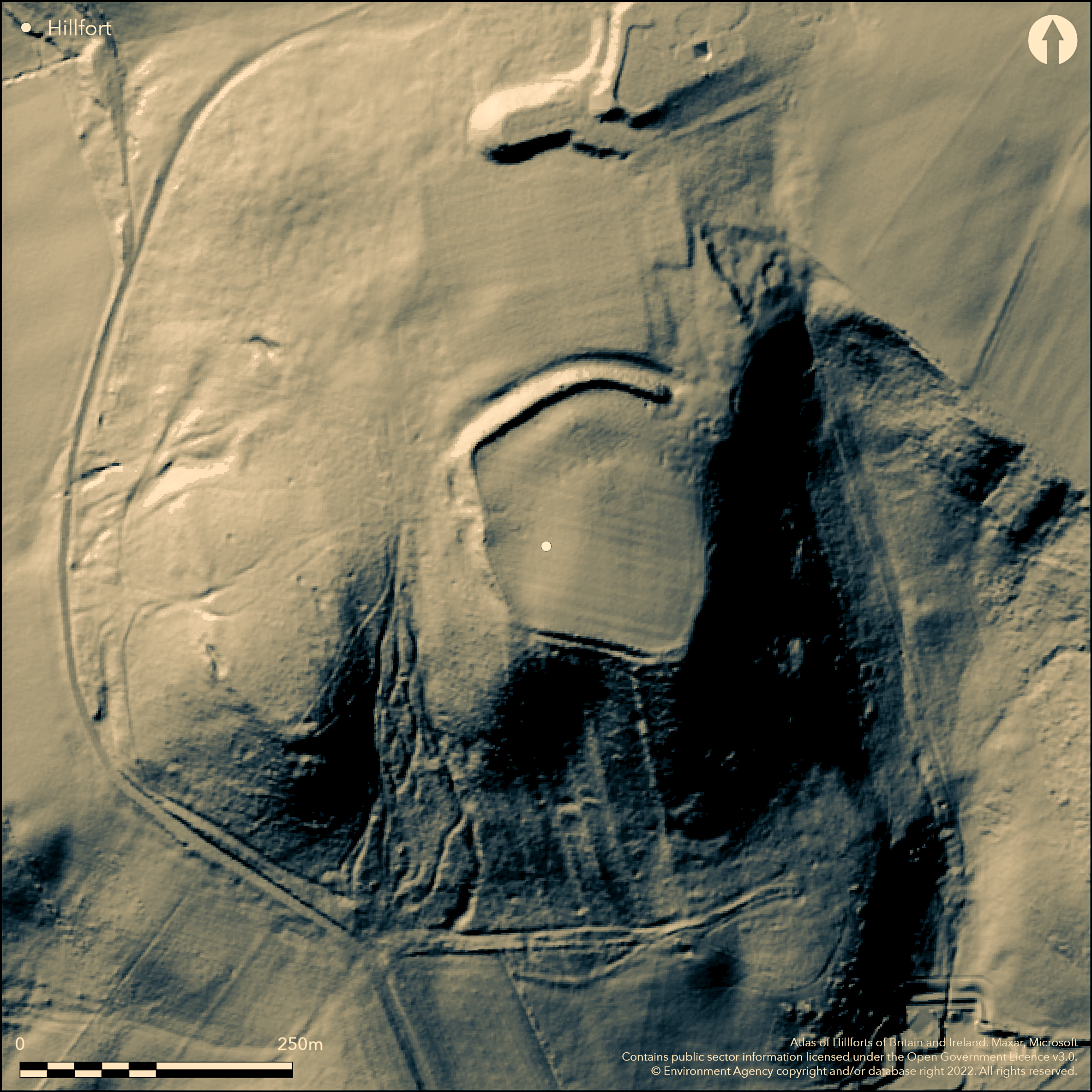
LiDAR 1m DTM Hillshade
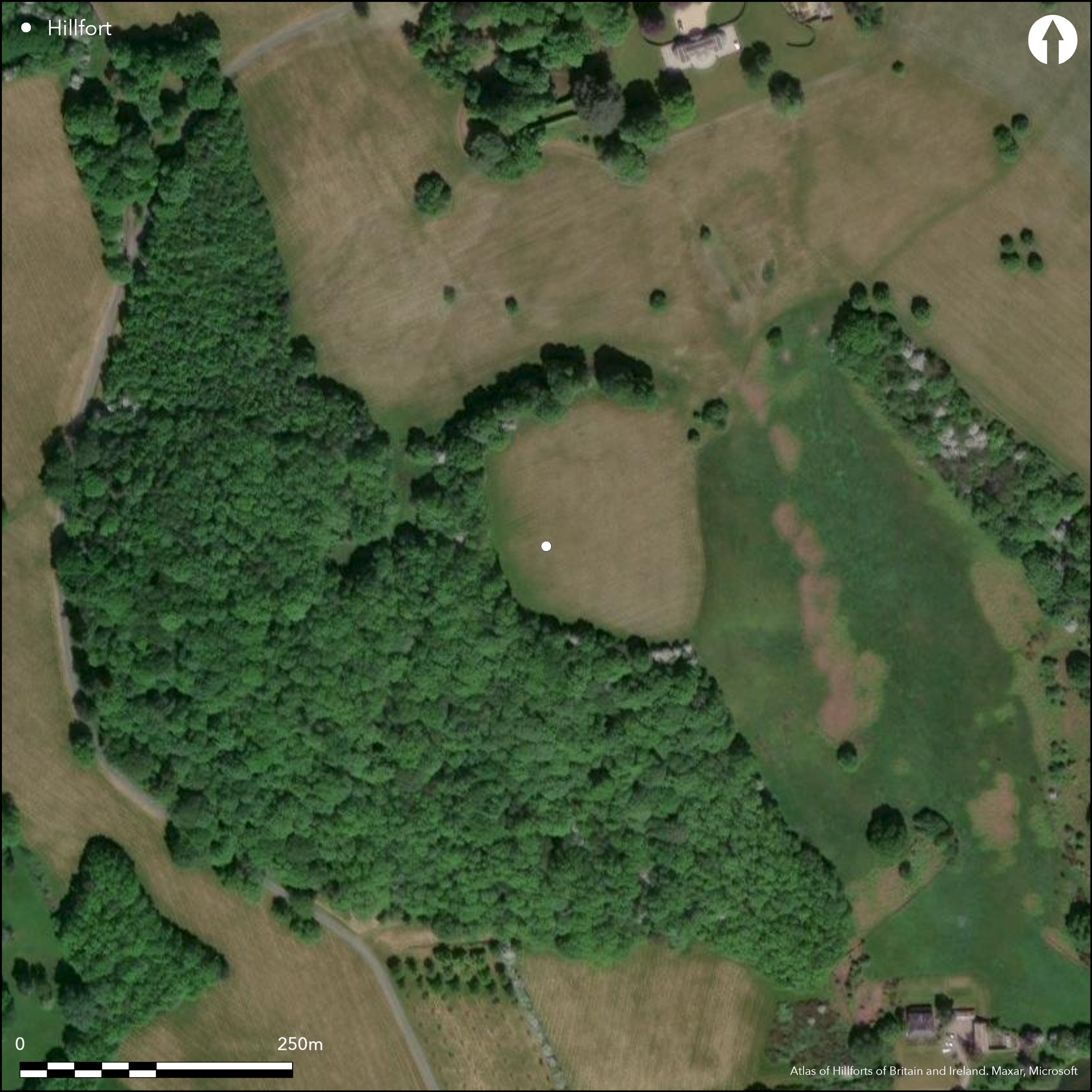
Satellite Imagery
LiDAR 1m DTM Hillshade
Satellite Imagery
Scroll left/right to view further images.
HER: Herefordshire MHE695 (1462)
NMR: SO 33 NE 11 (105765)
SM: 1001775
NGR: SO359376
X: 335900 Y: 237650 (OSGB36)
Excavated, inland promontory fort located on a SSE-facing spur above the River Dore in the Golden Valley. Internal area 1.7ha. Single massive rampart curving from NW-NE with outer ditch; scarping with a berm to the W and S. On Taylor's 1754 map. Precipitous with no defences from NE. Possibility of at least a further inner rampart suggested by excavations of Gavin Robinson et al 1932-37, but removed by agriculture operations in the early 19th century. The E end of the rampart stops c. 20m from the scarp edge and it it here that there was possibly an entrance. Part of the NE and SW sectors have no ramparts. W end of rampart and scarp and berm lies in a wood, otherwise pasture. Evidence of Roman occupation. W end of main rampart, scarp slope and berm lie in woodland. Otherwise pasture. Management since the 1980's has improved a severe erosion problem of the rampart. These measures have included cessation of past ploughing and stock control. On 1st Ed. OS map (1888).
Citizen Science: ✗
Reliability of Data: Confirmed
Reliability of Interpretation: Confirmed
X: -326816 Y: 6806185 (EPSG: 3857)
Longitude: -2.9358396509998093 Latitude: 52.03349826179177 (EPSG:4326)
Country: England
Current County or Unitary Authority: Herefordshire
Historic County: Herefordshire
Current Parish/Community/Council/Townland: Vowchurch
Management in 1980's has halted deterioration. W end of main rampart, scarp slope and berm lie in woodland. Rest of rampart has scattered beech trees capable of windthrow. Some animal erosion.
| Extant | ✓ |
| Cropmark | ✗ |
| Likely Destroyed | ✗ |
W end of main rampart, scarp slope and berm lie in woodland. Otherwise pasture.
| Woodland | ✓ |
| Commercial Forestry Plantation | ✗ |
| Parkland | ✗ |
| Pasture (Grazing) | ✓ |
| Arable | ✗ |
| Scrub/Bracken | ✗ |
| Bare Outcrop | ✗ |
| Heather/Moorland | ✗ |
| Heath | ✗ |
| Built-up | ✗ |
| Coastal Grassland | ✗ |
| Other | ✗ |
Inland promontory fort, the single massive rampart cutting off the promontory spur and sited above the River Dore in the Golden Valley.
| Contour Fort | ✗ |
| Partial Contour Fort | ✗ |
| Promontory Fort | ✓ |
| Hillslope Fort | ✗ |
| Level Terrain Fort | ✗ |
| Marsh Fort | ✗ |
| Multiple Enclosure Fort | ✗ |
| Hilltop | ✗ |
| Coastal Promontory | ✗ |
| Inland Promontory | ✓ |
| Valley Bottom | ✗ |
| Knoll/Hillock/Outcrop | ✗ |
| Ridge | ✗ |
| Cliff/Plateau-edge/Scarp | ✗ |
| Hillslope | ✗ |
| Lowland | ✗ |
| Spur | ✓ |
Dominant Topographic Feature: Inland promontory spur.
| North | ✗ |
| Northeast | ✗ |
| East | ✗ |
| Southeast | ✗ |
| South | ✗ |
| Southwest | ✗ |
| West | ✗ |
| Northwest | ✗ |
| Level | ✓ |
Altitude: 221.0m
N/A
Evidence of Roman occupation. Iron Age pottery, but that in Roman level greater than earlier layers. Thus evidence of Roman occupation. Site evacuated sometime during the 2nd century AD (Marshall, 1934).
Reliability: B - Medium
| Pre 1200BC | ✗ |
| 1200BC - 800BC | ✗ |
| 800BC - 400BC | ✗ |
| 400BC - AD50 | ✓ |
| AD50 - AD400 | ✓ |
| AD400 - AD 800 | ✗ |
| Post AD800 | ✗ |
| Unknown | ✗ |
| Pre Hillfort: | None |
| Post Hillfort: | None |
| Artefactual: | Evidence of Roman occupation. Pottery in Roman level greater than earlier layers. |
On Taylor's 1754 map. On 1st Ed. OS map (1888). Excavation R.S. Gavin Robinson et al in 1932-7. Herefordshire Council survey 2012.
| 1st Identified Map Depiction (1754): | Earliest record of site on Isaac Taylor's map of Herefordshire marked as a 'camp'. |
| Other (1888): | OS map. |
| Other (2012): | Herefordshire Council survey. |
| Excavation (None): | Excavation by R.S. Gavin Robinson et al. |
Some finds of pottery from the 'Roman layers' and 'ash' (Marshall 1934). Occupation layers found. Quarry hollows.
Stream located 0.6 km outside the fort.
| None | ✓ |
| Spring | ✗ |
| Stream | ✗ |
| Pool | ✗ |
| Flush | ✗ |
| Well | ✗ |
| Other | ✗ |
Quarry scoops.
| No Known Features | ✗ |
| Round Stone Structures | ✗ |
| Rectangular Stone Structures | ✗ |
| Curvilinear Platforms | ✗ |
| Other Roundhouse Evidence | ✗ |
| Pits | ✗ |
| Quarry Hollows | ✓ |
| Other | ✗ |
Occupation layers found.
| No Known Excavation | ✗ |
| Pits | ✗ |
| Postholes | ✗ |
| Roundhouses | ✗ |
| Rectangular Structures | ✗ |
| Roads/Tracks | ✗ |
| Quarry Hollows | ✗ |
| Other | ✓ |
| Nothing Found | ✗ |
None
| No Known Geophysics | ✓ |
| Pits | ✗ |
| Roundhouses | ✗ |
| Rectangular Structures | ✗ |
| Roads/Tracks | ✗ |
| Quarry Hollows | ✗ |
| Other | ✗ |
| Nothing Found | ✗ |
Finds of Iron Age pottery, but that from the 'Roman layers' greater. Also 'ash' found (Marshall 1934). Rotary querns. Animal and some human bone. Bone survival good.
| No Known Finds | ✗ |
| Pottery | ✓ |
| Metal | ✗ |
| Metalworking | ✗ |
| Human Bones | ✓ |
| Animal Bones | ✓ |
| Lithics | ✓ |
| Environmental | ✗ |
| Other | ✓ |
None
| APs Not Checked | ✓ |
| None | ✗ |
| Roundhouses | ✗ |
| Rectangular Structures | ✗ |
| Pits | ✗ |
| Postholes | ✗ |
| Roads/Tracks | ✗ |
| Other | ✗ |
Possible entrance at E end of rampart where there is a 20m gap before the scarp edge. There is a slight possibility that there might be an entrance on the W side.
| 2: | None |
| 2: | Possible entrance at E end of rampart where 20m gap before scarp edge. Slight possibility of W entrance, but conjecture. |
Guard Chambers: ✗
Chevaux de Frise: ✗
| 1. Simple Gap (North east): | Possible entrance at E end of rampart where 20m gap before scarp edge. |
| 2. Simple Gap (West): | There is a slight possibility that there might be an entrance on the W side. |
Single massive rampart curving from NW-NE with outer ditch; scarping with a berm to the W and S. Precipitous with no defences from NE. Possible of at least a further inner rampart suggested by excavations of 1932-37. Part of the NE and SW sectors have no ramparts.
| Area 1: | 1.7ha. |
| Total: | 1.7ha. |
Total Footprint Area: Noneha.
None
| ✗ | Massive rampart cuts off the promontory. |
| ✗ | Whole of the E side is protected by precipitous slopes. |
| NE Quadrant: | 0 |
| SE Quadrant: | 0 |
| SW Quadrant: | 1 |
| NW Quadrant: | 1 |
| Total: | 1 |
| Partial Univallate | ✓ |
| Univallate | ✗ |
| Partial Bivallate | ✗ |
| Bivallate | ✗ |
| Partial Multivallate | ✗ |
| Multivallate | ✗ |
| Unknown | ✗ |
| Partial Univallate | ✗ |
| Univallate | ✗ |
| Partial Bivallate | ✗ |
| Bivallate | ✗ |
| Partial Multivallate | ✗ |
| Multivallate | ✗ |
Possibly an earthen bank, with a berm to the W and S.
| None | ✗ |
| Earthen Bank | ✓ |
| Stone Wall | ✗ |
| Rubble | ✗ |
| Wall-walk | ✗ |
| Evidence of Timber | ✗ |
| Vitrification | ✗ |
| Other Burning | ✗ |
| Palisade | ✗ |
| Counter Scarp Bank | ✗ |
| Berm | ✓ |
| Unfinished | ✗ |
| Other | ✗ |
Possibility of at least a further inner rampart suggested by excavations of 1932-37, but removed by agriculture operations in the 19th century.
| None | ✗ |
| Earthen Bank | ✓ |
| Stone Wall | ✗ |
| Murus Duplex | ✗ |
| Timber-framed | ✗ |
| Timber-laced | ✗ |
| Vitrification | ✗ |
| Other Burning | ✗ |
| Palisade | ✗ |
| Counter Scarp Bank | ✗ |
| Berm | ✗ |
| Unfinished | ✗ |
| No Known Excavation | ✗ |
| Other | ✓ |
| ✗ | None |
| ✓ | Outer ditch to massive N rampart. |
Number of Ditches: 1
| ✗ | None |
Anthony, I.E. 1958. The Iron Age camp at Poston, Herefordshire, Hereford: The Woolhope Club.
Dorling, P. and Wigley, A. 2012. Assessment of the archaeological and conservation status of major later prehistoric enclosures in Herefordshire and Shropshire, EH PNUM, Version 3.2, Hereford and Shrewsbury: Herefordshire Council/Shropshire Council.
Marshall, G. 1933. Lower Park Wood Camp, Poston, in the Parish of Vowchurch, and some remarks on the Iron Age in Herefordshire. TWNFC 1933, pp 21-29.
Marshall, G. 1934. Interim report on the excavation of the Iron Age camp at Poston, Vowchurch, Trans Woolhope Natur Fld Club, 89-99.
RCHME 1931-34. An Inventory of the Historical Monuments in Herefordshire, 31(SW), 245, 6, London: HMSO.
Atlas of Hillforts:
Wikidata:
This work is licensed under CC BY-SA 4.0

 and should be cited as:
Lock, Gary and Ralston, Ian. 2024. Atlas of Hillforts of Britain and Ireland. Available at: https://hillforts.arch.ox.ac.uk
Document Version 1.1