LiDAR 1m DTM Hillshade
Satellite Imagery
LiDAR 1m DTM Hillshade
Satellite Imagery
Scroll left/right to view further images.
HER: Herefordshire MHE696 (1463)
NMR: SO 33 NE 12 (105768)
SM: None
NGR: SO387367
X: 338770 Y: 236807 (OSGB36)
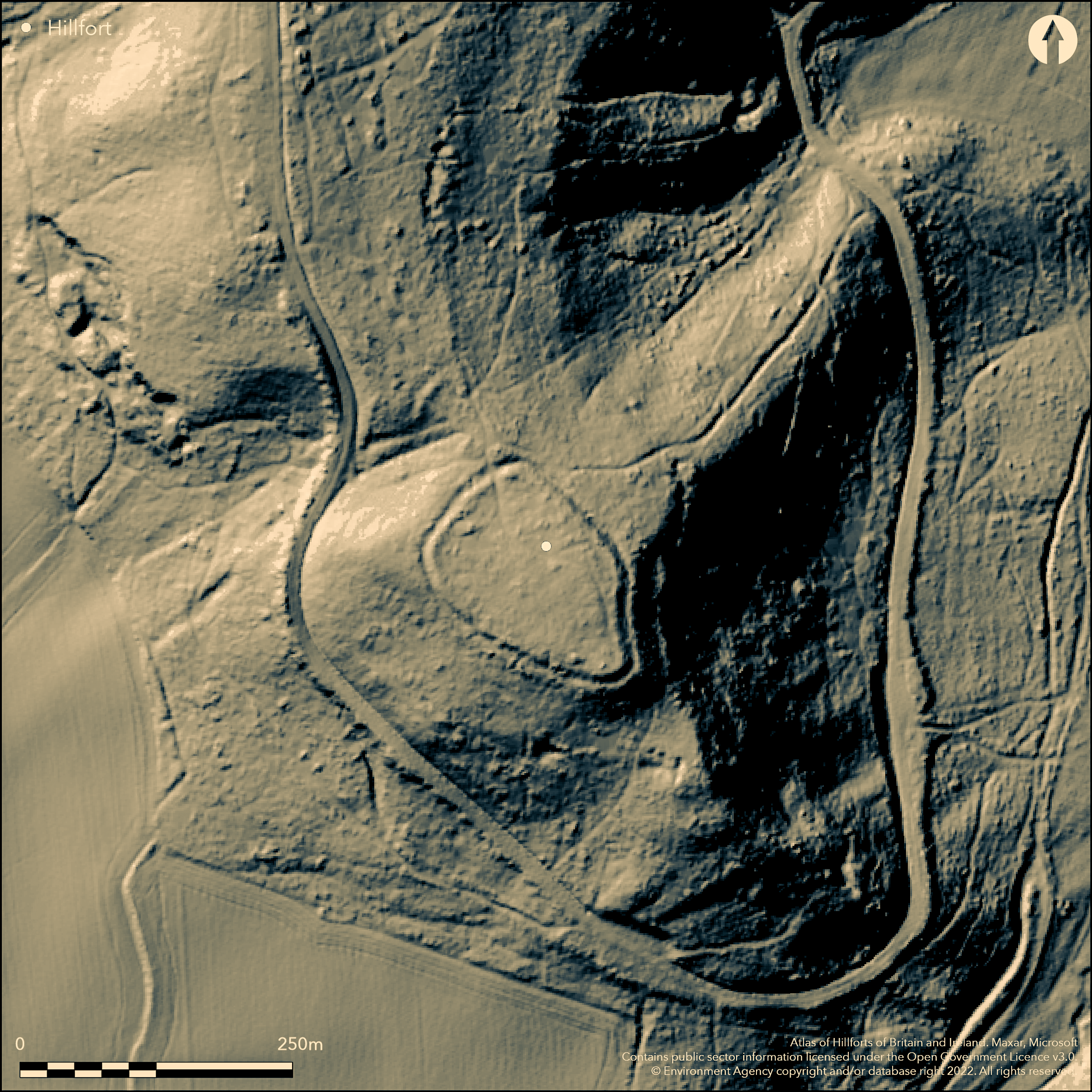
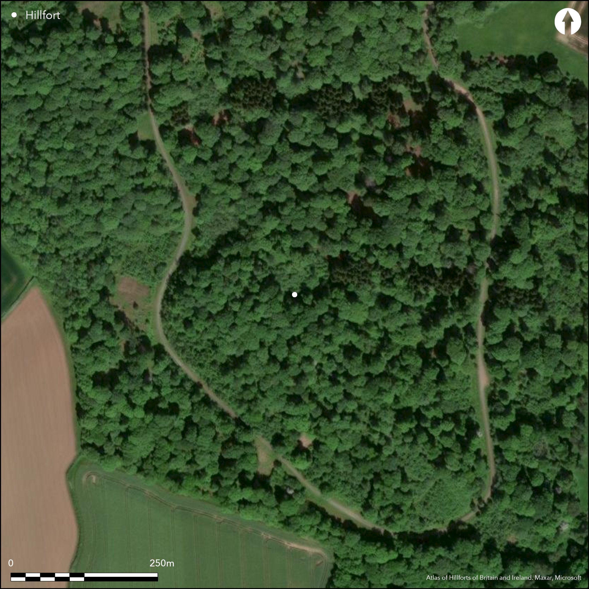
Wooded, univallate, contour hillfort located in Timberline Wood on a significant SE spur above the River Dore and Golden Valley on the SW and the River Wye on the NW. Internal area 2ha. Site roughly follows the contours of the hill and has two simple entrances, one to the N is original and inturned, but that on SW may be modern. Cobbled paving found in former in 1952. Trial excavations in 1932 and 1952 revealed little about the structure of the fort, albeit some Romano-British pottery on occupation layers and a spearhead in the silt infill of the ditch found. Section across the rampart near the presumed N entrance suggested a rampart some 5.6m high, with possible revetment to the inside face, and ditch, latter surviving on W, N and E sides. Berm 4m wide from the SE to SW. Survey by Herefordshire Council in 2012 suggested that the crest of the bank now around 3m above the infilled exterior ditch and questioned whether the earlier 5.6m was accurate. Despite the wooded and damaged nature of the site, much can be ascertained. A private track runs through the site from N to S. No management at present.
Citizen Science: ✗
Reliability of Data: Confirmed
Reliability of Interpretation: Confirmed
X: -322143 Y: 6804872 (EPSG: 3857)
Longitude: -2.8938569095526745 Latitude: 52.026244741802216 (EPSG:4326)
Country: England
Current County or Unitary Authority: Herefordshire
Historic County: Herefordshire
Current Parish/Community/Council/Townland: Madley
Despite the wooded and damaged nature of the site, much can be ascertained. A private track runs through the site from N to S. No management at present.
| Extant | ✓ |
| Cropmark | ✗ |
| Likely Destroyed | ✗ |
Deciduous woodland (oak, ask with some sweet chestnut planting in the interior) with dense bramble.
| Woodland | ✓ |
| Commercial Forestry Plantation | ✗ |
| Parkland | ✗ |
| Pasture (Grazing) | ✗ |
| Arable | ✗ |
| Scrub/Bracken | ✓ |
| Bare Outcrop | ✗ |
| Heather/Moorland | ✗ |
| Heath | ✗ |
| Built-up | ✗ |
| Coastal Grassland | ✗ |
| Other | ✗ |
The site roughly follows the contours of the spur. Located in Timberline Wood on a significant SE spur above the River Dore and Golden Valley on the SW and the River Wye on the NW.
| Contour Fort | ✓ |
| Partial Contour Fort | ✗ |
| Promontory Fort | ✗ |
| Hillslope Fort | ✗ |
| Level Terrain Fort | ✗ |
| Marsh Fort | ✗ |
| Multiple Enclosure Fort | ✗ |
| Hilltop | ✗ |
| Coastal Promontory | ✗ |
| Inland Promontory | ✗ |
| Valley Bottom | ✗ |
| Knoll/Hillock/Outcrop | ✗ |
| Ridge | ✗ |
| Cliff/Plateau-edge/Scarp | ✗ |
| Hillslope | ✗ |
| Lowland | ✗ |
| Spur | ✓ |
Dominant Topographic Feature: Prominent SE- facing spur.
| North | ✗ |
| Northeast | ✗ |
| East | ✗ |
| Southeast | ✗ |
| South | ✗ |
| Southwest | ✗ |
| West | ✗ |
| Northwest | ✗ |
| Level | ✓ |
Altitude: 196.0m
N/A
The only dating evidence is that of some Romano-British pottery in occupation layers. However, the site could be earlier.
Reliability: B - Medium
| Pre 1200BC | ✗ |
| 1200BC - 800BC | ✗ |
| 800BC - 400BC | ✗ |
| 400BC - AD50 | ✓ |
| AD50 - AD400 | ✗ |
| AD400 - AD 800 | ✗ |
| Post AD800 | ✗ |
| Unknown | ✗ |
| Pre Hillfort: | None |
| Post Hillfort: | None |
| Artefactual: | The only dating evidence is that of some Romano-British pottery in occupation layers. |
Trial excavations were undertaken in 1932 by R.S. Gavin Robinson and Marshal and in 1952 by the Hereford WMAS group under K.O.M. Dauncey. Herefordshire Council survey 2012.
| Excavation (1932): | Trial excavations were undertaken in 1932 by R.S Gavin Robinson. |
| Excavation (1952): | Hereford WMAS group under K.O.M. Dauncey. |
| Other (2012): | Herefordshire Council survey |
Nothing was determined concerning the interior in the trial excavations of 1932 and 1952. Some Roman-British pottery was found in occupation layers. Tip of 'spear head' found in ditch.
Spring located 0.5 km outside the hillfort.
| None | ✓ |
| Spring | ✗ |
| Stream | ✗ |
| Pool | ✗ |
| Flush | ✗ |
| Well | ✗ |
| Other | ✗ |
None
| No Known Features | ✓ |
| Round Stone Structures | ✗ |
| Rectangular Stone Structures | ✗ |
| Curvilinear Platforms | ✗ |
| Other Roundhouse Evidence | ✗ |
| Pits | ✗ |
| Quarry Hollows | ✗ |
| Other | ✗ |
Nothing determined in the trial excavations.
| No Known Excavation | ✗ |
| Pits | ✗ |
| Postholes | ✗ |
| Roundhouses | ✗ |
| Rectangular Structures | ✗ |
| Roads/Tracks | ✗ |
| Quarry Hollows | ✗ |
| Other | ✗ |
| Nothing Found | ✓ |
None
| No Known Geophysics | ✓ |
| Pits | ✗ |
| Roundhouses | ✗ |
| Rectangular Structures | ✗ |
| Roads/Tracks | ✗ |
| Quarry Hollows | ✗ |
| Other | ✗ |
| Nothing Found | ✗ |
Some Roman-British pottery in occupation layers. Tip of 'spear head' found in ditch silt.
| No Known Finds | ✗ |
| Pottery | ✓ |
| Metal | ✓ |
| Metalworking | ✗ |
| Human Bones | ✗ |
| Animal Bones | ✗ |
| Lithics | ✗ |
| Environmental | ✗ |
| Other | ✗ |
None
| APs Not Checked | ✓ |
| None | ✗ |
| Roundhouses | ✗ |
| Rectangular Structures | ✗ |
| Pits | ✗ |
| Postholes | ✗ |
| Roads/Tracks | ✗ |
| Other | ✗ |
Two simple entrances, the one to the N is original and inturned, but that on the SW may be modern. Cobbled paving was found in the former in 1952.
| 2: | That to the SW probably modern. |
| 2: | That to the N original. |
Guard Chambers: ✗
Chevaux de Frise: ✗
| 1. In-turned (North): | Simple inturned entrance with cobbled paving. |
A section across the rampart near the presumed N entrance suggested a rampart some 5.6m high, with possible revetment to the inside face, and ditch. The ditch survives on the W, N and E sides. There is a berm 4m wide to the S and E. A survey by Herefordshire Council in 2012, however, suggested that the crest of the bank is now around 3m above the infilled exterior ditch and questioned whether the earlier 5.6m was accurate. The exact location of the surviving bank is uncertain but thought to survive in places and above estimated.
| Area 1: | 2.0ha. |
| Total: | 2.0ha. |
Total Footprint Area: Noneha.
None
| ✗ | The site area is unknown and estimated. |
| ✓ | The exact location of the surviving bank is uncertain, but thought to survive from the SE to SW the rest of the circuit, with slight ditch and no counterscarp. |
| NE Quadrant: | 1 |
| SE Quadrant: | 1 |
| SW Quadrant: | 1 |
| NW Quadrant: | 1 |
| Total: | 1 |
| Partial Univallate | ✗ |
| Univallate | ✓ |
| Partial Bivallate | ✗ |
| Bivallate | ✗ |
| Partial Multivallate | ✗ |
| Multivallate | ✗ |
| Unknown | ✗ |
| Partial Univallate | ✗ |
| Univallate | ✗ |
| Partial Bivallate | ✗ |
| Bivallate | ✗ |
| Partial Multivallate | ✗ |
| Multivallate | ✗ |
Possible earthen bank. Berm 4m wide from the SE to SW.
| None | ✗ |
| Earthen Bank | ✓ |
| Stone Wall | ✗ |
| Rubble | ✗ |
| Wall-walk | ✗ |
| Evidence of Timber | ✗ |
| Vitrification | ✗ |
| Other Burning | ✗ |
| Palisade | ✗ |
| Counter Scarp Bank | ✗ |
| Berm | ✓ |
| Unfinished | ✗ |
| Other | ✗ |
Possible revetment to the inner face of the rampart.
| None | ✗ |
| Earthen Bank | ✓ |
| Stone Wall | ✓ |
| Murus Duplex | ✗ |
| Timber-framed | ✗ |
| Timber-laced | ✗ |
| Vitrification | ✗ |
| Other Burning | ✗ |
| Palisade | ✗ |
| Counter Scarp Bank | ✗ |
| Berm | ✗ |
| Unfinished | ✗ |
| No Known Excavation | ✗ |
| Other | ✗ |
| ✗ | None |
| ✓ | The ditch c 2.5m wide survives on the W, N and E sides, with 1m to the interior. |
Number of Ditches: 1
| ✗ | None |
Anthony, I.E. 1958. The Iron Age camp at Poston, Herefordshire, Hereford: The Woolhope Club.
Dorling, P. and Wigley, A. 2012. Assessment of the archaeological and conservation status of major later prehistoric enclosures in Herefordshire and Shropshire, EH PNUM, Version 3.2, Hereford and Shrewsbury: Herefordshire Council/Shropshire Council.
Atlas of Hillforts:
Wikidata:
This work is licensed under CC BY-SA 4.0![]()
![]()
![]() and should be cited as:
and should be cited as:
Lock, Gary and Ralston, Ian. 2024. Atlas of Hillforts of Britain and Ireland. Available at: https://hillforts.arch.ox.ac.uk
Document Version 1.1