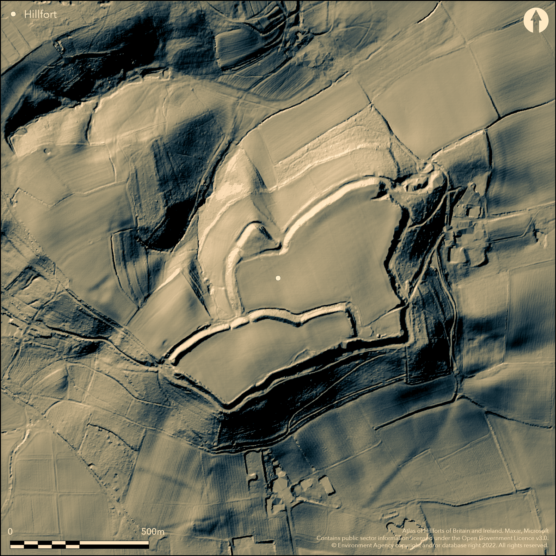
LiDAR 1m DTM Hillshade
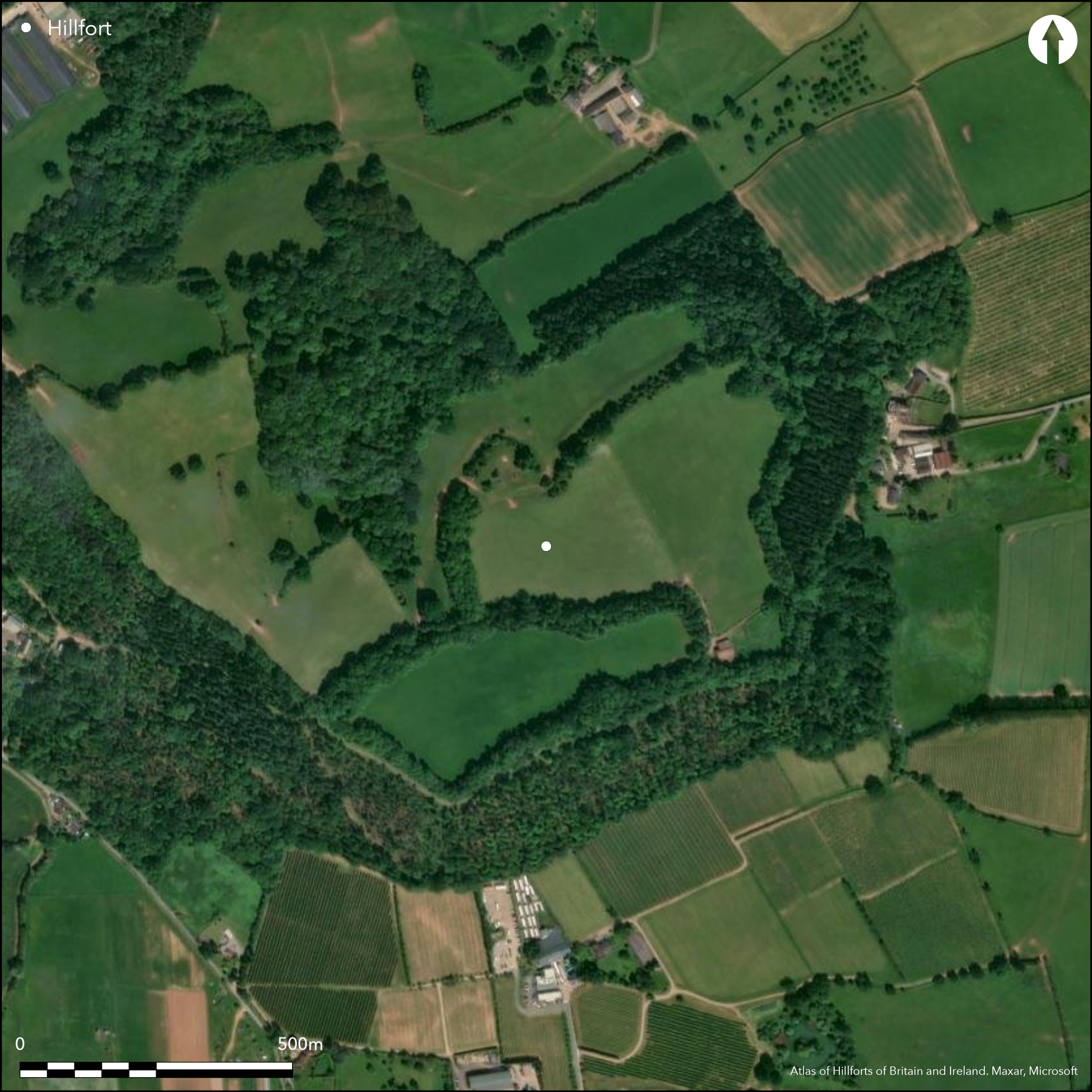
Satellite Imagery
LiDAR 1m DTM Hillshade
Satellite Imagery
Scroll left/right to view further images.
HER: Herefordshire MHE307 (557)
NMR: SO 63 NE 1 (111943)
SM: 1001760
NGR: SO 690381
X: 369074 Y: 238213 (OSGB36)
Isolated, large, multivallate, partial contour hillfort located on a knoll summit of Wall Hills overlooking the upper reaches of the River Leadon to the E and the valley of Preston Brook to the W. Internal area 10.1ha. The site is characterised by having two enclosures, that to the S being c. 6m higher and separated from the N enclosure by a rampart and a wet outer ditch. There is a counterscarp bank. There is a small bank running down the hill from the SE angle and a probable ditch with a high steep inner scarp and outer rampart following the natural contours ran around the outer perimeter of the fort. The ditch is filled and resembles a berm for much of its length. The outer rampart is also fragmentary. There are four entrances, one probably modern. Iron Age and Roman-British pottery and bronze Roman coins found on site. The site has access problems, and management agreements in the 1980's and 1990's resulted in tree thinning and coppicing of rampart trees. Damage to the site, including dumping, trackwork and grading resulted in repairs completed in 2011. On 1st Ed OS map (1887).
Citizen Science: ✗
Reliability of Data: Confirmed
Reliability of Interpretation: Confirmed
X: -272991 Y: 6807616 (EPSG: 3857)
Longitude: -2.452323758891081 Latitude: 52.041408318154446 (EPSG:4326)
Country: England
Current County or Unitary Authority: Herefordshire
Historic County: Herefordshire
Current Parish/Community/Council/Townland: Ledbury
Affected by development and trees on ramparts. Conservation issues continue with access problems. Management agreements in the 1980's and 1990's resulted in tree thinning and coppicing of rampart trees. Damage to the site, including dumping, trackwork and grading resulted in repairs completed in 2011. The outer bank is fragmentary and ditch filled in. Deep ploughed during WWII, but it appears that ploughing ceased in the 1970's.
| Extant | ✓ |
| Cropmark | ✗ |
| Likely Destroyed | ✗ |
General arable and pasture. Some wood on ramparts.
| Woodland | ✓ |
| Commercial Forestry Plantation | ✗ |
| Parkland | ✗ |
| Pasture (Grazing) | ✓ |
| Arable | ✓ |
| Scrub/Bracken | ✗ |
| Bare Outcrop | ✗ |
| Heather/Moorland | ✗ |
| Heath | ✗ |
| Built-up | ✗ |
| Coastal Grassland | ✗ |
| Other | ✗ |
Isolated, large, partial contour fort, with two enclosures, that to the S c. 6m higher than that to the N and located on a knoll overlooking the upper reaches of the River Leadon and the valley of Preston Brook to the W.
| Contour Fort | ✗ |
| Partial Contour Fort | ✓ |
| Promontory Fort | ✗ |
| Hillslope Fort | ✗ |
| Level Terrain Fort | ✗ |
| Marsh Fort | ✗ |
| Multiple Enclosure Fort | ✗ |
| Hilltop | ✗ |
| Coastal Promontory | ✗ |
| Inland Promontory | ✗ |
| Valley Bottom | ✗ |
| Knoll/Hillock/Outcrop | ✓ |
| Ridge | ✗ |
| Cliff/Plateau-edge/Scarp | ✗ |
| Hillslope | ✗ |
| Lowland | ✗ |
| Spur | ✗ |
Dominant Topographic Feature: Isolated knoll.
| North | ✓ |
| Northeast | ✗ |
| East | ✗ |
| Southeast | ✗ |
| South | ✗ |
| Southwest | ✗ |
| West | ✗ |
| Northwest | ✗ |
| Level | ✗ |
Altitude: 120.0m
N/A
Possible Iron Age to Romano-British occupation, as following chance finds recorded: fragments of dark grey/black ware, similar to that from British Camp (Atlas No 0005) and light red ware, similar to that from Sutton Walls (Atlas No 0031). Some Romano-British sherds. Some Romano-British sherds. A number of flint flakes.
Reliability: C - Low
| Pre 1200BC | ✗ |
| 1200BC - 800BC | ✗ |
| 800BC - 400BC | ✗ |
| 400BC - AD50 | ✓ |
| AD50 - AD400 | ✓ |
| AD400 - AD 800 | ✗ |
| Post AD800 | ✗ |
| Unknown | ✗ |
| Pre Hillfort: | None |
| Post Hillfort: | None |
| Artefactual: | Bronze Roman coins. |
| Artefactual: | Fragments of dark grey/black ware, similar to that from British Camp and light red ware, similar to that from Sutton Walls. Some Romano-British sherds. |
On 1st Ed OS map (1887). Herefordshire Council survey 2012
| 1st Identified Map Depiction (1887): | OS map. |
| Other (2012): | Herefordshire Council survey. |
No surface features recorded. Chance finds of the following: fragments of dark grey/black ware, similar to that from British Camp Atlas No 0005) and light red ware, similar to that from Sutton Walls (Atlas No 0031). Some Romano-British sherds. Bronze Roman coins. A number of flint flakes.
Spring located 0.4 km outside the hillfort.
| None | ✓ |
| Spring | ✗ |
| Stream | ✗ |
| Pool | ✗ |
| Flush | ✗ |
| Well | ✗ |
| Other | ✗ |
None
| No Known Features | ✓ |
| Round Stone Structures | ✗ |
| Rectangular Stone Structures | ✗ |
| Curvilinear Platforms | ✗ |
| Other Roundhouse Evidence | ✗ |
| Pits | ✗ |
| Quarry Hollows | ✗ |
| Other | ✗ |
None
| No Known Excavation | ✓ |
| Pits | ✗ |
| Postholes | ✗ |
| Roundhouses | ✗ |
| Rectangular Structures | ✗ |
| Roads/Tracks | ✗ |
| Quarry Hollows | ✗ |
| Other | ✗ |
| Nothing Found | ✗ |
None
| No Known Geophysics | ✓ |
| Pits | ✗ |
| Roundhouses | ✗ |
| Rectangular Structures | ✗ |
| Roads/Tracks | ✗ |
| Quarry Hollows | ✗ |
| Other | ✗ |
| Nothing Found | ✗ |
Chance finds of the following: fragments of dark grey/black ware, similar to that from British Camp and light red ware, similar to that from Sutton Walls. Some Romano-British sherds. Bronze Roman coins. A number of flint flakes.
| No Known Finds | ✗ |
| Pottery | ✓ |
| Metal | ✗ |
| Metalworking | ✗ |
| Human Bones | ✗ |
| Animal Bones | ✗ |
| Lithics | ✓ |
| Environmental | ✗ |
| Other | ✓ |
None
| APs Not Checked | ✓ |
| None | ✗ |
| Roundhouses | ✗ |
| Rectangular Structures | ✗ |
| Pits | ✗ |
| Postholes | ✗ |
| Roads/Tracks | ✗ |
| Other | ✗ |
It is possible that all of the entrances are original, but any details of this have not been determined. Inturned entrances on the N and NE sides could be original. That to the W could also be original, but is much mutilated.
| 4: | The entrance to the SE is probably modern. |
| 2: | Inturned entrances on the N and NE sides could be original. That to the W could also be original, but is much mutilated. |
Guard Chambers: ✗
Chevaux de Frise: ✗
| 1. In-turned (North): | Inturned and curved entrance possibly original in re-entrant angle of site. |
| 1. Oblique (North): | Curved. |
| 2. In-turned (North east): | Inturned entrance possibly original. |
| 3. Simple Gap (West): | Mutilated entrance, possibly original. |
The site is characterised by having two enclosures, that to the S being c. 6m higher and separated from the N enclosure by a wet outer ditch. Counterscarp bank. There was a probable ditch with a high steep inner scarp and outer rampart following the natural contours around the outer perimeter of the fort. The ditch is filled and looks like a berm for much of its length. The outer rampart is also fragmentary. The circuit is complete, but its exact nature is not recorded.
| Area 1: | 10.1ha. |
| Total: | 10.1ha. |
Total Footprint Area: Noneha.
None
| ✗ | Two enclosures - that to W is 3.3ha in area; that to E 8.4ha. No indication of phasing, but possible. |
| ✓ | The circuit is complete. |
| NE Quadrant: | 2 |
| SE Quadrant: | 2 |
| SW Quadrant: | 1 |
| NW Quadrant: | 1 |
| Total: | 2 |
| Partial Univallate | ✓ |
| Univallate | ✗ |
| Partial Bivallate | ✓ |
| Bivallate | ✗ |
| Partial Multivallate | ✗ |
| Multivallate | ✗ |
| Unknown | ✗ |
| Partial Univallate | ✗ |
| Univallate | ✗ |
| Partial Bivallate | ✗ |
| Bivallate | ✗ |
| Partial Multivallate | ✗ |
| Multivallate | ✗ |
Earthen bank is conjecture only. The visible berm is the remains of the filled-in outer ditch. There is a counterscarp bank.
| None | ✗ |
| Earthen Bank | ✓ |
| Stone Wall | ✗ |
| Rubble | ✗ |
| Wall-walk | ✗ |
| Evidence of Timber | ✗ |
| Vitrification | ✗ |
| Other Burning | ✗ |
| Palisade | ✗ |
| Counter Scarp Bank | ✓ |
| Berm | ✓ |
| Unfinished | ✗ |
| Other | ✗ |
None
| None | ✗ |
| Earthen Bank | ✗ |
| Stone Wall | ✗ |
| Murus Duplex | ✗ |
| Timber-framed | ✗ |
| Timber-laced | ✗ |
| Vitrification | ✗ |
| Other Burning | ✗ |
| Palisade | ✗ |
| Counter Scarp Bank | ✗ |
| Berm | ✗ |
| Unfinished | ✗ |
| No Known Excavation | ✓ |
| Other | ✗ |
| ✗ | None |
| ✓ | Wet ditch between the two enclosures. There was a probable ditch with a high steep inner scarp and outer rampart following the natural contours around the outer perimeter of the fort. The ditch is filled and looks like a berm for much of its length. |
Number of Ditches: 2
| ✗ | None |
Dorling, P. and Wigley, A. 2012: Assessment of the archaeological and conservation status of major later prehistoric enclosures in Herefordshire and Shropshire, EH PNUM, Version 3.2, Hereford and Shrewsbury: Herefordshire Council/Shropshire Council.
Page, W. ed. 1908. The Victoria County History of the County of Herefordshire, 1, 193, 215, London: St Catherine Press.
RCHME 1931-34. An Inventory of the Historical Monuments in Herefordshire, 2, (E), 117-18, 44, London: HMSO.
Atlas of Hillforts:
Wikidata:
This work is licensed under CC BY-SA 4.0

 and should be cited as:
Lock, Gary and Ralston, Ian. 2024. Atlas of Hillforts of Britain and Ireland. Available at: https://hillforts.arch.ox.ac.uk
Document Version 1.1