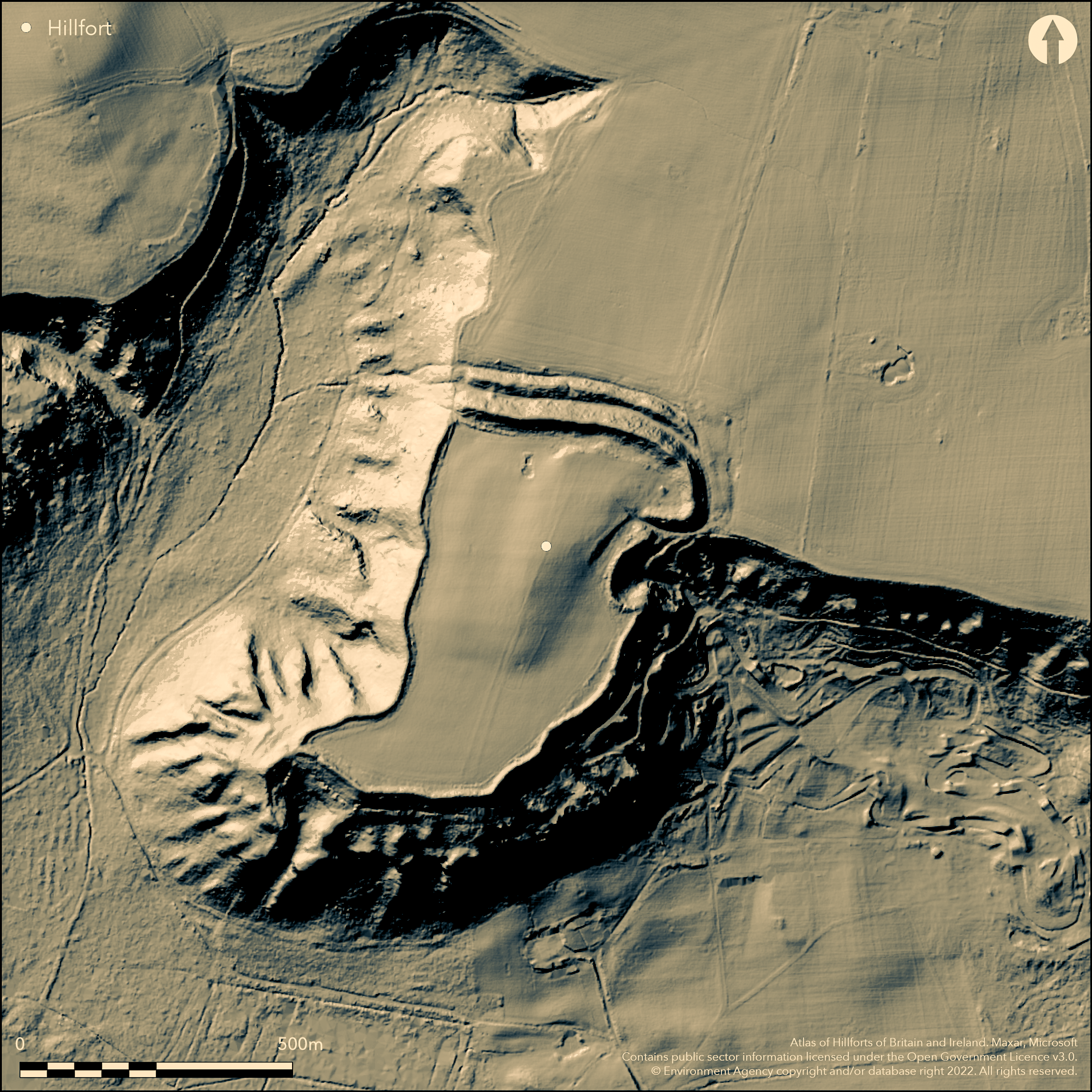
LiDAR 1m DTM Hillshade
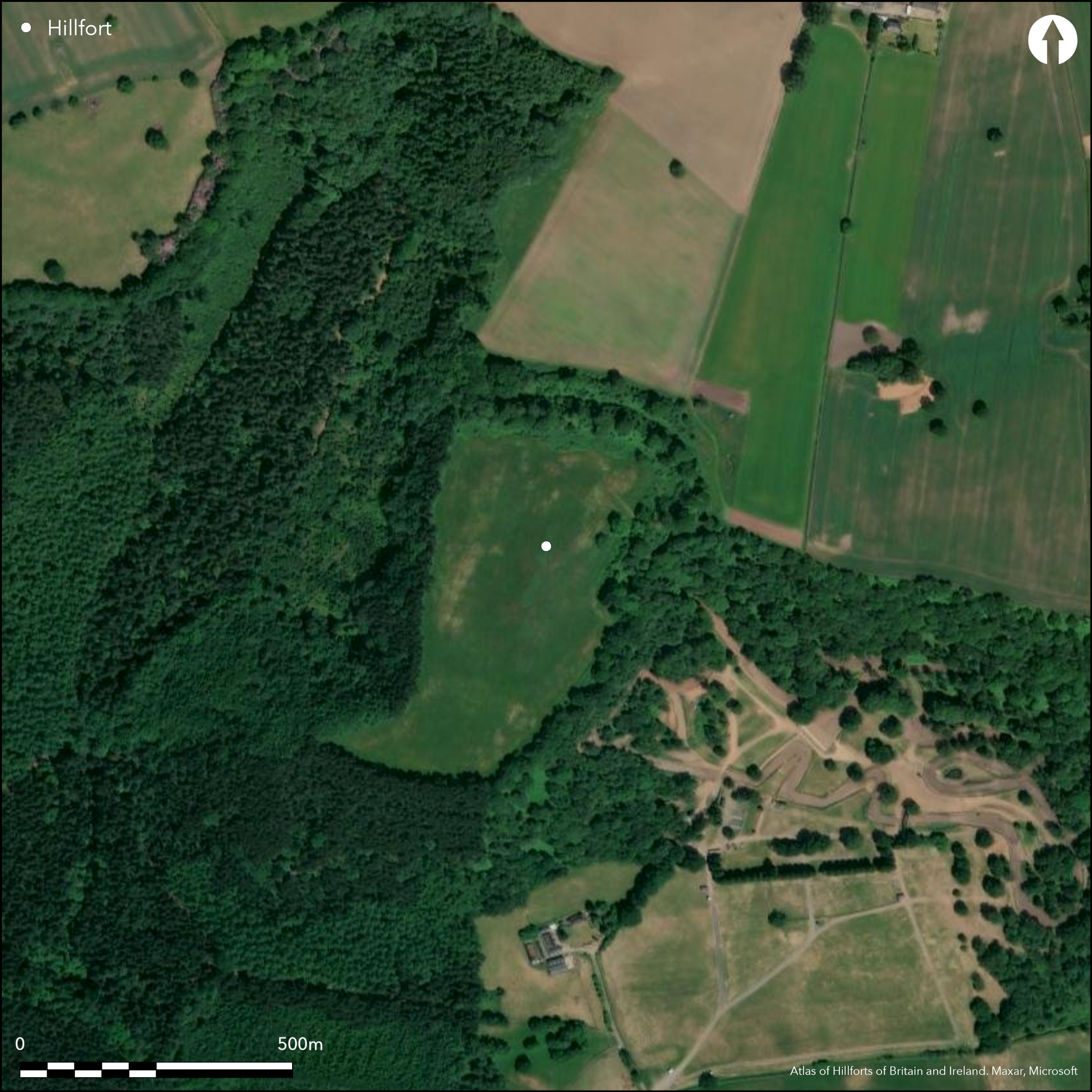
Satellite Imagery
LiDAR 1m DTM Hillshade
Satellite Imagery
Scroll left/right to view further images.
HER: Shropshire 1139 (None)
NMR: SJ 52 NE 11 (70635)
SM: 1020284
NGR: SJ577274
X: 357689 Y: 327559 (OSGB36)
Large, isolated and major, part multivallate, contour hillfort located on a sandstone ridge with wooded slopes overlooking the plain of the River Roden. Internal area c. 8.8ha. Single rampart built on the steepest S, E and W slopes and double ramparts and ditches on the less steep N edge of the hill. In places inner bank 11.6m high. Quarry ditches and evidence of roundhouses. Ditch cutting across site may be an earlier rampart to smaller enclosure. Rubble walled rectangular building (Roman temple?) at the S end of the central ridge excavated in the 1930's, with a room 4.5m by 8.75m internally and a smaller part-paved, possible annexe to the N. Also possible hearths in interior (Morris, 1932). Possible quern and iron object found in 1930's excavations. Excavation in 1932 and topographical and geophysical survey 1999-2000. Formerly cultivated interior, the site is now well managed. On 1st Ed OS map (1885-1900).
Citizen Science: ✗
Reliability of Data: Confirmed
Reliability of Interpretation: Confirmed
X: -292732 Y: 6954166 (EPSG: 3857)
Longitude: -2.6296547236603764 Latitude: 52.84384522583767 (EPSG:4326)
Country: England
Current County or Unitary Authority: Shropshire
Historic County: Shropshire
Current Parish/Community/Council/Townland: Weston-under-Redcastle
Interior taken out of cultivation in the 1990's. Site now in good private management. 15-20 m buffer strip to ramparts in field to the N side. Area of site to the W in separate ownership.
| Extant | ✓ |
| Cropmark | ✗ |
| Likely Destroyed | ✗ |
Tree-covered slopes and part-wooded defences especially on the N, S and W ramparts. Holly scrub and bracken. Grazed areas within wooded areas. Past history of ploughing.
| Woodland | ✓ |
| Commercial Forestry Plantation | ✗ |
| Parkland | ✗ |
| Pasture (Grazing) | ✓ |
| Arable | ✗ |
| Scrub/Bracken | ✗ |
| Bare Outcrop | ✗ |
| Heather/Moorland | ✗ |
| Heath | ✗ |
| Built-up | ✗ |
| Coastal Grassland | ✗ |
| Other | ✗ |
Situated on a sandstone ridge, with wooded slopes overlooking the plain of the River Roden.
| Contour Fort | ✓ |
| Partial Contour Fort | ✗ |
| Promontory Fort | ✗ |
| Hillslope Fort | ✗ |
| Level Terrain Fort | ✗ |
| Marsh Fort | ✗ |
| Multiple Enclosure Fort | ✗ |
| Hilltop | ✗ |
| Coastal Promontory | ✗ |
| Inland Promontory | ✗ |
| Valley Bottom | ✗ |
| Knoll/Hillock/Outcrop | ✗ |
| Ridge | ✓ |
| Cliff/Plateau-edge/Scarp | ✗ |
| Hillslope | ✗ |
| Lowland | ✗ |
| Spur | ✗ |
Dominant Topographic Feature: Sandstone ridge.
| North | ✗ |
| Northeast | ✗ |
| East | ✗ |
| Southeast | ✗ |
| South | ✗ |
| Southwest | ✗ |
| West | ✗ |
| Northwest | ✗ |
| Level | ✓ |
Altitude: 152.0m
N/A
Probable late Iron Age site based on morphology, but possible evidence of Roman activity as rectangular building (Roman temple?) excavated in the 1930's.
Reliability: C - Low
| Pre 1200BC | ✗ |
| 1200BC - 800BC | ✗ |
| 800BC - 400BC | ✗ |
| 400BC - AD50 | ✓ |
| AD50 - AD400 | ✓ |
| AD400 - AD 800 | ✗ |
| Post AD800 | ✗ |
| Unknown | ✗ |
| Pre Hillfort: | None |
| Post Hillfort: | None |
| Morphology/Earthwork/Typology: | None |
| Other: | Rectangular building (Roman temple?) excavated in the 1930's. |
On 1st Ed OS map (1885-1900). Excavation J.A. Morris, 1932. Field observation Ordnance Survey 1962. Field observations Shropshire CC 1976, 1981. Field observations English Heritage 1979, 1980, 1982, 1984. Surveys and investigation by Birmingham University 1998-2000 included topographical survey and geophysics. Air Photograph Interpretation RCHME: Marches Uplands NMP 1993-2000. Shropshire Council survey 2012.
| Excavation (1930): | Excavation by J.A. Morris (1932). |
| Other (1962): | Field observation OS. |
| Other (2012): | Shropshire Council survey 2012. |
| 1st Identified Map Depiction (None): | 1st Ed OS map |
| Other (None): | Field observations Shropshire CC. |
| Other (None): | Field observations EH. |
| Other (None): | Air Photograph Interpretation RCHME: Marches Uplands NMP. |
| Geophysical Survey (None): | Surveys by Birmingham University. |
| Earthwork Survey (None): | Surveys by Birmingham University. |
Rubble walled rectangular building (Roman temple?) at the S end of the central ridge excavated in the 1930's with a room 4.5 m by 8.75 m internally and a smaller part-paved, possible annexe to the N. Also possible hearths in interior (Morris, 1932). Possible quern and iron object found in 1930's excavations. Possible evidence of roundhouses. Quarry ditches evident.
Spring located on site.
| None | ✗ |
| Spring | ✓ |
| Stream | ✗ |
| Pool | ✗ |
| Flush | ✗ |
| Well | ✗ |
| Other | ✗ |
Quarry ditches evident. Possible roundhouse evidence.
| No Known Features | ✗ |
| Round Stone Structures | ✗ |
| Rectangular Stone Structures | ✗ |
| Curvilinear Platforms | ✗ |
| Other Roundhouse Evidence | ✓ |
| Pits | ✗ |
| Quarry Hollows | ✓ |
| Other | ✗ |
Rectangular building (Roman temple?) at the S end of the central ridge excavated in the 1930's with a room 4.5m by 8.75m internally and a smaller part-paved, possible annexe to the N. Rubble walls, 0.8m-1.45m thick. Also possible hearths in interior (Morris, 1932).
| No Known Excavation | ✗ |
| Pits | ✗ |
| Postholes | ✗ |
| Roundhouses | ✗ |
| Rectangular Structures | ✓ |
| Roads/Tracks | ✗ |
| Quarry Hollows | ✗ |
| Other | ✓ |
| Nothing Found | ✗ |
Topographical and geophysical surveys found a domed interior with extensive Iron Age terracing and revealed a possible cross-ridge dyke as well as roads and circular structures.
| No Known Geophysics | ✗ |
| Pits | ✗ |
| Roundhouses | ✓ |
| Rectangular Structures | ✗ |
| Roads/Tracks | ✓ |
| Quarry Hollows | ✗ |
| Other | ✓ |
| Nothing Found | ✗ |
Possible quern and iron object found in 1930's excavations.
| No Known Finds | ✗ |
| Pottery | ✗ |
| Metal | ✓ |
| Metalworking | ✗ |
| Human Bones | ✗ |
| Animal Bones | ✗ |
| Lithics | ✗ |
| Environmental | ✗ |
| Other | ✓ |
None
| APs Not Checked | ✓ |
| None | ✗ |
| Roundhouses | ✗ |
| Rectangular Structures | ✗ |
| Pits | ✗ |
| Postholes | ✗ |
| Roads/Tracks | ✗ |
| Other | ✗ |
NE entrance, in-turned, show bedrock ruts cut by cart wheels. E has a heavy inturn on the N side.
| 2: | No modern gaps in evidence. |
| 2: | NW and E (with heavy inturn on the N side) entrances. |
Guard Chambers: ✗
Chevaux de Frise: ✗
| 1. In-turned (North west): | Entrance shows bedrock ruts cut by cart wheels. |
| 2. In-turned (East): | Heavy inturn on the N side. |
Single rampart built on the steepest S,E and W slopes and double ramparts and ditches on the less steep N edge of the hill. In places inner bank 11.6 m high. Ditch cutting across site may be an earlier rampart to smaller enclosure.
| Area 1: | 8.8ha. |
| Total: | 8.8ha. |
Total Footprint Area: Noneha.
None
| ✗ | None |
| ✗ | None |
| NE Quadrant: | 2 |
| SE Quadrant: | 1 |
| SW Quadrant: | 1 |
| NW Quadrant: | 2 |
| Total: | 2 |
| Partial Univallate | ✓ |
| Univallate | ✗ |
| Partial Bivallate | ✓ |
| Bivallate | ✗ |
| Partial Multivallate | ✗ |
| Multivallate | ✗ |
| Unknown | ✗ |
| Partial Univallate | ✗ |
| Univallate | ✗ |
| Partial Bivallate | ✗ |
| Bivallate | ✗ |
| Partial Multivallate | ✗ |
| Multivallate | ✗ |
None
| None | ✗ |
| Earthen Bank | ✓ |
| Stone Wall | ✗ |
| Rubble | ✗ |
| Wall-walk | ✗ |
| Evidence of Timber | ✗ |
| Vitrification | ✗ |
| Other Burning | ✗ |
| Palisade | ✗ |
| Counter Scarp Bank | ✗ |
| Berm | ✗ |
| Unfinished | ✗ |
| Other | ✗ |
None
| None | ✗ |
| Earthen Bank | ✗ |
| Stone Wall | ✗ |
| Murus Duplex | ✗ |
| Timber-framed | ✗ |
| Timber-laced | ✗ |
| Vitrification | ✗ |
| Other Burning | ✗ |
| Palisade | ✗ |
| Counter Scarp Bank | ✗ |
| Berm | ✗ |
| Unfinished | ✗ |
| No Known Excavation | ✓ |
| Other | ✗ |
| ✗ | None |
| ✓ | Ditch cutting across site may be an earlier rampart to smaller enclosure. |
Number of Ditches: 2
| ✗ | None |
Dorling, P. and Wigley, A. 2012: Assessment of the archaeological and conservation status of major later prehistoric enclosures in Herefordshire and Shropshire, EH PNUM, Version 3.2, Hereford and Shrewsbury: Herefordshire Council/Shropshire Council.
Murdie, R.E., White, R.H., Baratt, G., Gaffney, V. and Goulty, R. 2003. Geophysical surveys of Bury Walls Hill Fort, Shropshire, Archaeol Prospect, 10, 249-63.
Morris, J.A. 1934. Bury Walls, Hawkestone, Trans Shropshire Arch Hist Soc, 46, 85-9.
Page, W. ed. 1908. Victoria County History of Shropshire, 1, 357, Institute of Historical Research.
Atlas of Hillforts:
Wikidata:
This work is licensed under CC BY-SA 4.0

 and should be cited as:
Lock, Gary and Ralston, Ian. 2024. Atlas of Hillforts of Britain and Ireland. Available at: https://hillforts.arch.ox.ac.uk
Document Version 1.1