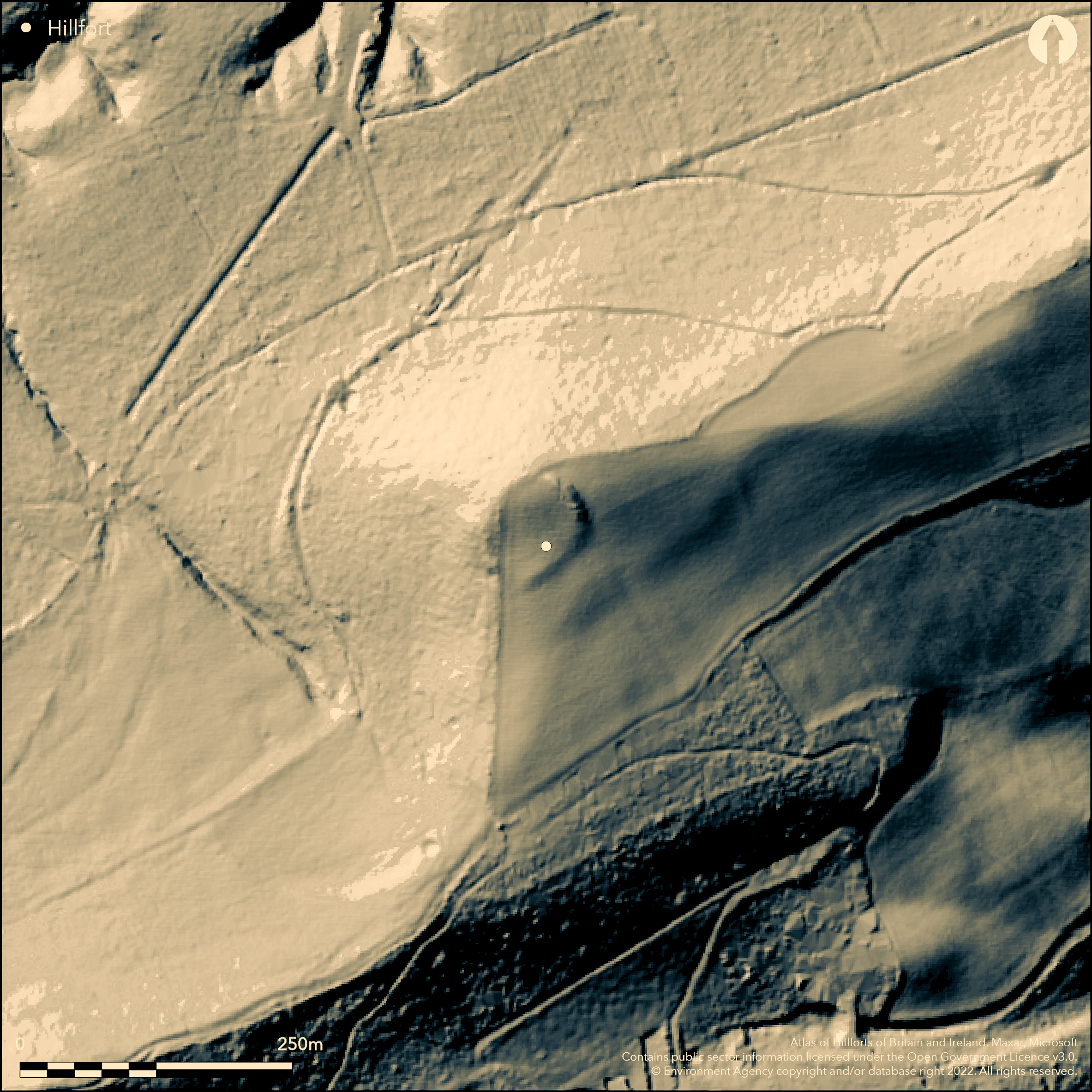
LiDAR 1m DTM Hillshade
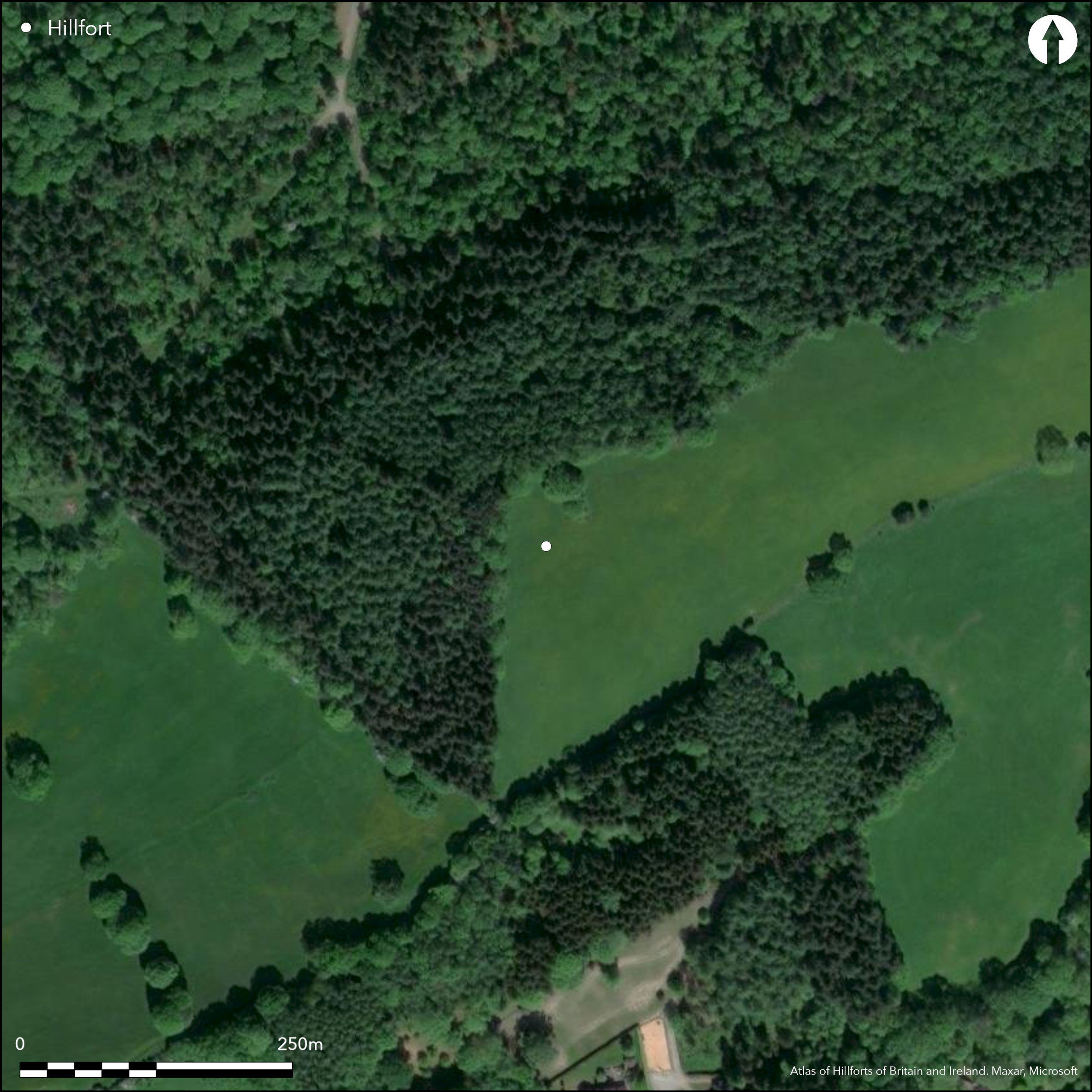
Satellite Imagery
LiDAR 1m DTM Hillshade
Satellite Imagery
Scroll left/right to view further images.
HER: Shropshire 173 (None)
NMR: SO 48 NW 8 (108915)
SM: 1013511
NGR: SO 401869
X: 340125 Y: 286878 (OSGB36)
Small inland promontory fort, Castle Ring often referred to as defended Iron Age farmstead, but, despite it small size, occupies strong defensive position, with substantial defences on marked Ridgeway Hill above, and SW of, bend of River Onny at the edge of Plowden Woods and in an area of prominent hillforts. The site is roughly triangular in shape measuring 74m by 60m, with internal area c. 0.1ha. Maximum use made of the natural topography with minimum use made of artificial defences. To the W and NW are precipitous slopes, requiring no defence, whilst on the lesser slopes of the NE and SE are substantial earthworks sited roughly at right-angles to each other. The N rampart is better preserved and rises to 2m on its outer face; that to the S being ploughed-down and dispersed and rising to only 0.5m. The ditches are now only traces in places, most being now buried features. Gaps on the NW and SW may possibly be original entrances, the latter more difficult to interpret. Most of the site is down to arable cultivation. Undated. On 1st Ed. OS map (1885-1900).
Citizen Science: ✗
Reliability of Data: Confirmed
Reliability of Interpretation: Unconfirmed
X: -320934 Y: 6886746 (EPSG: 3857)
Longitude: -2.8830027842652797 Latitude: 52.47650296316978 (EPSG:4326)
Country: England
Current County or Unitary Authority: Shropshire
Historic County: Shropshire
Current Parish/Community/Council/Townland: Edgton
The S rampart has been ploughed-down and dispersed.
| Extant | ✓ |
| Cropmark | ✗ |
| Likely Destroyed | ✗ |
In arable cultivation.
| Woodland | ✗ |
| Commercial Forestry Plantation | ✗ |
| Parkland | ✗ |
| Pasture (Grazing) | ✗ |
| Arable | ✓ |
| Scrub/Bracken | ✗ |
| Bare Outcrop | ✗ |
| Heather/Moorland | ✗ |
| Heath | ✗ |
| Built-up | ✗ |
| Coastal Grassland | ✗ |
| Other | ✗ |
Inland promontory fort, Castle Ring often referred to as defended Iron Age farmstead, but, despite it small size, occupies strong defensive position, with substantial defences on marked Ridgeway Hill above, and SW of, bend of River Onny at the edge of Plowden Woods and in an area of prominent hillforts.
| Contour Fort | ✗ |
| Partial Contour Fort | ✗ |
| Promontory Fort | ✓ |
| Hillslope Fort | ✗ |
| Level Terrain Fort | ✗ |
| Marsh Fort | ✗ |
| Multiple Enclosure Fort | ✗ |
| Hilltop | ✗ |
| Coastal Promontory | ✗ |
| Inland Promontory | ✓ |
| Valley Bottom | ✗ |
| Knoll/Hillock/Outcrop | ✗ |
| Ridge | ✗ |
| Cliff/Plateau-edge/Scarp | ✗ |
| Hillslope | ✗ |
| Lowland | ✗ |
| Spur | ✗ |
Dominant Topographic Feature: Marked promontory above the River Onny.
| North | ✗ |
| Northeast | ✗ |
| East | ✗ |
| Southeast | ✗ |
| South | ✗ |
| Southwest | ✗ |
| West | ✗ |
| Northwest | ✗ |
| Level | ✓ |
Altitude: 230.0m
N/A
None
Reliability: D - None
| Pre 1200BC | ✗ |
| 1200BC - 800BC | ✗ |
| 800BC - 400BC | ✗ |
| 400BC - AD50 | ✗ |
| AD50 - AD400 | ✗ |
| AD400 - AD 800 | ✗ |
| Post AD800 | ✗ |
| Unknown | ✓ |
| Pre Hillfort: | None |
| Post Hillfort: | None |
On 1st Ed. OS map (1885-1900). Field observation Ordnance Survey 1972. Field observarion English Heritage 1981, 1986. Air Photograph Interpretation RCHME: Marches Uplands NMP 1993-2000.
| Other (1972): | Field observation OS. |
| 1st Identified Map Depiction (None): | 1st Ed OS. |
| Other (None): | Field observation EH. |
| Other (None): | Air Photograph Interpretation RCHME: Marches Uplands NMP. |
None
River Onny located 0.4km outside the fort.
| None | ✓ |
| Spring | ✗ |
| Stream | ✗ |
| Pool | ✗ |
| Flush | ✗ |
| Well | ✗ |
| Other | ✗ |
None
| No Known Features | ✓ |
| Round Stone Structures | ✗ |
| Rectangular Stone Structures | ✗ |
| Curvilinear Platforms | ✗ |
| Other Roundhouse Evidence | ✗ |
| Pits | ✗ |
| Quarry Hollows | ✗ |
| Other | ✗ |
None
| No Known Excavation | ✓ |
| Pits | ✗ |
| Postholes | ✗ |
| Roundhouses | ✗ |
| Rectangular Structures | ✗ |
| Roads/Tracks | ✗ |
| Quarry Hollows | ✗ |
| Other | ✗ |
| Nothing Found | ✗ |
None
| No Known Geophysics | ✓ |
| Pits | ✗ |
| Roundhouses | ✗ |
| Rectangular Structures | ✗ |
| Roads/Tracks | ✗ |
| Quarry Hollows | ✗ |
| Other | ✗ |
| Nothing Found | ✗ |
None
| No Known Finds | ✓ |
| Pottery | ✗ |
| Metal | ✗ |
| Metalworking | ✗ |
| Human Bones | ✗ |
| Animal Bones | ✗ |
| Lithics | ✗ |
| Environmental | ✗ |
| Other | ✗ |
None
| APs Not Checked | ✓ |
| None | ✗ |
| Roundhouses | ✗ |
| Rectangular Structures | ✗ |
| Pits | ✗ |
| Postholes | ✗ |
| Roads/Tracks | ✗ |
| Other | ✗ |
Two possible entrances, both simple gaps now. That on the NW is possibly where the N rampart arm stops 6m short of the W natural slope edge. That to the SW where the S rampart stops short of the SW natural slope edge.
| 2: | None |
| 2: | Gaps on the NW and SW may possibly be original entrances, the latter more difficult to interpret. |
Guard Chambers: ✗
Chevaux de Frise: ✗
| 1. Simple Gap (North west): | Possible. |
| 2. Simple Gap (South west): | Possible. |
The site is roughly triangular in shape measuring 74m by 60m, maximum use made of the natural topography with minimum use made of artificial defences. To the W and NW are precipitous slopes, requiring no defence, whilst on the lesser slopes of the NE and SE are substantial earthworks sited roughly at right-angles to each other. The N rampart is better preserved and rises to 2m on its outer face; that to the S being ploughed-down and dispersed and rising to only 0.5m. The ditches are now only traces in places, most being now buried features.
| Area 1: | 0.1ha. |
| Total: | 0.1ha. |
Total Footprint Area: Noneha.
None
| ✗ | None |
| ✗ | The W and NW sides are precipitous natural slopes. |
| NE Quadrant: | 1 |
| SE Quadrant: | 1 |
| SW Quadrant: | 0 |
| NW Quadrant: | 0 |
| Total: | 1 |
| Partial Univallate | ✓ |
| Univallate | ✗ |
| Partial Bivallate | ✗ |
| Bivallate | ✗ |
| Partial Multivallate | ✗ |
| Multivallate | ✗ |
| Unknown | ✗ |
| Partial Univallate | ✗ |
| Univallate | ✗ |
| Partial Bivallate | ✗ |
| Bivallate | ✗ |
| Partial Multivallate | ✗ |
| Multivallate | ✗ |
None
| None | ✗ |
| Earthen Bank | ✓ |
| Stone Wall | ✗ |
| Rubble | ✗ |
| Wall-walk | ✗ |
| Evidence of Timber | ✗ |
| Vitrification | ✗ |
| Other Burning | ✗ |
| Palisade | ✗ |
| Counter Scarp Bank | ✗ |
| Berm | ✗ |
| Unfinished | ✗ |
| Other | ✗ |
None
| None | ✗ |
| Earthen Bank | ✗ |
| Stone Wall | ✗ |
| Murus Duplex | ✗ |
| Timber-framed | ✗ |
| Timber-laced | ✗ |
| Vitrification | ✗ |
| Other Burning | ✗ |
| Palisade | ✗ |
| Counter Scarp Bank | ✗ |
| Berm | ✗ |
| Unfinished | ✗ |
| No Known Excavation | ✓ |
| Other | ✗ |
| ✗ | None |
| ✓ | The ditches are now only traces in places, most being now buried features. |
Number of Ditches: 1
| ✗ | None |
Page, W. ed. Salop 1908. Victoria County History of Shropshire, 1, 355-56, Institute of Historical Research.
Atlas of Hillforts:
Wikidata:
This work is licensed under CC BY-SA 4.0

 and should be cited as:
Lock, Gary and Ralston, Ian. 2024. Atlas of Hillforts of Britain and Ireland. Available at: https://hillforts.arch.ox.ac.uk
Document Version 1.1