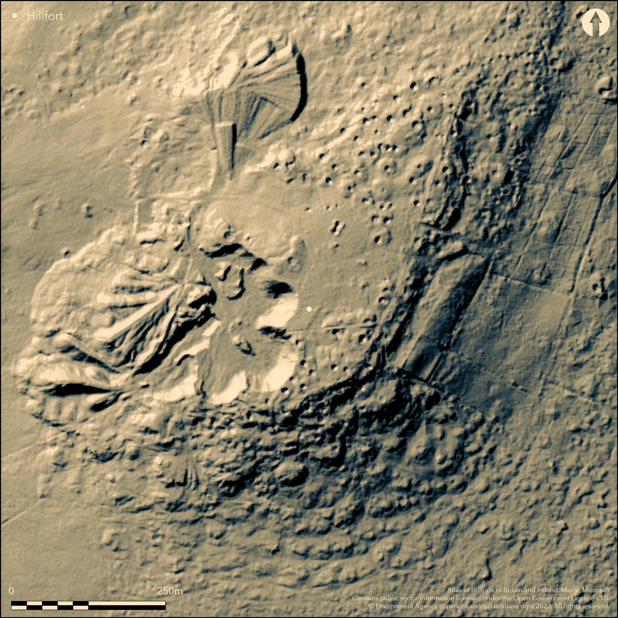
LiDAR 1m DTM Hillshade
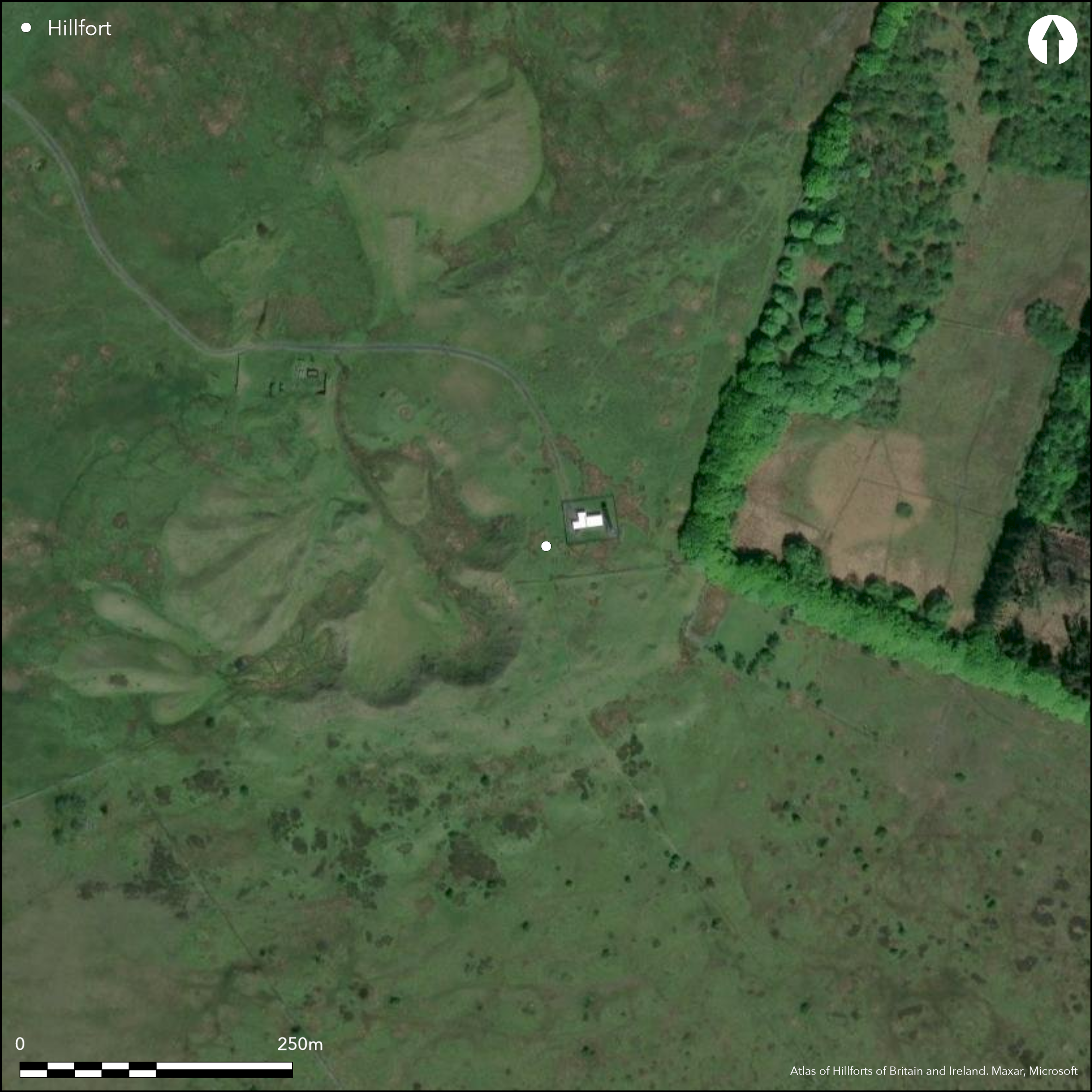
Satellite Imagery
LiDAR 1m DTM Hillshade
Satellite Imagery
Scroll left/right to view further images.
HER: Shropshire 181 (None)
NMR: SO 58 SE 1 (111281)
SM: None
NGR: SO 593843
X: 359329 Y: 284338 (OSGB36)
Largely destroyed, stone-walled, contour hillfort. One of the three forts formerly on the summits of the Clees that dominate SE Shropshire. High and prominent and sited on the rounded summit of Brown Clee Hill at 490m O.D., Clee Burf overlooks the valleys of the River Corve to W and River Rea/Rea Brooks to E, with long views in all directions, apart from the NE where it meets the main mass of Brown Clee. Only remnants of the site left are ragged remains of a stone rampart, now reduced to a stony scarp, for some 100m in length and to 2.7m in height, in the SE quadrant. Elsewhere, site has either been quarried away to the NW or dumped upon by later spoil dumps from quarry and mine. The former quarry and a relay station and masts dominate the summit of the hill. Original site plan can just be discerned and the 1st edition OS 2:500 map of the 1880's shows a generally ovoid fort of some 200m NE to to SW by 165m transversely, but quite strong in character at around 3.6ha. The existing ramparts to the S are hidden below mounds of spoil and to the W, N and E by bell-pits. Bell-pits cover what is left of the interior and no hut placements can be seen. There has been conjecture that the hollows and scrapes that extend around and down the hill and along the ridge to Abdon Burf hillfort (Atlas No 0039) could be traces of hut circles, but this is unlikely and could possibly be the result of searching for coal. Undated.
Citizen Science: ✗
Reliability of Data: Confirmed
Reliability of Interpretation: Confirmed
X: -289427 Y: 6882898 (EPSG: 3857)
Longitude: -2.599965166364992 Latitude: 52.45544155400869 (EPSG:4326)
Country: England; None
Current County or Unitary Authority: Shropshire
Historic County: Shropshire
Current Parish/Community/Council/Townland: Wheathill; Stoke St Milborough; Clee St Margaret
Nearly lost to quarrying with poor rampart survival as ragged scarp only on the SE. Bell-pits and spoil heaps over existing rampart, in relict interior and surrounds. Quarry taken rest of site to NW.
| Extant | ✓ |
| Cropmark | ✗ |
| Likely Destroyed | ✓ |
Moorland and heath on Brown Clee Hill summit. Quarry, spoil heaps.
| Woodland | ✗ |
| Commercial Forestry Plantation | ✗ |
| Parkland | ✗ |
| Pasture (Grazing) | ✗ |
| Arable | ✗ |
| Scrub/Bracken | ✗ |
| Bare Outcrop | ✗ |
| Heather/Moorland | ✓ |
| Heath | ✓ |
| Built-up | ✗ |
| Coastal Grassland | ✗ |
| Other | ✓ |
Possible contour fort but as most of site destroyed this cannot be certain. High and prominent on the rounded summit of Brown Clee Hill, Clee Burf occupies a very prominent location and overlooks the valleys of the River Corve to the W and the River Rea/Rea Brooks to the E.
| Contour Fort | ✓ |
| Partial Contour Fort | ✗ |
| Promontory Fort | ✗ |
| Hillslope Fort | ✗ |
| Level Terrain Fort | ✗ |
| Marsh Fort | ✗ |
| Multiple Enclosure Fort | ✗ |
| Hilltop | ✓ |
| Coastal Promontory | ✗ |
| Inland Promontory | ✗ |
| Valley Bottom | ✗ |
| Knoll/Hillock/Outcrop | ✗ |
| Ridge | ✗ |
| Cliff/Plateau-edge/Scarp | ✗ |
| Hillslope | ✗ |
| Lowland | ✗ |
| Spur | ✗ |
Dominant Topographic Feature: Rounded summit of Brown Clee Hill.
| North | ✗ |
| Northeast | ✗ |
| East | ✗ |
| Southeast | ✗ |
| South | ✗ |
| Southwest | ✗ |
| West | ✗ |
| Northwest | ✗ |
| Level | ✓ |
Altitude: 490.0m
Boundary Type: Parish/Townland
None
Reliability: D - None
| Pre 1200BC | ✗ |
| 1200BC - 800BC | ✗ |
| 800BC - 400BC | ✗ |
| 400BC - AD50 | ✗ |
| AD50 - AD400 | ✗ |
| AD400 - AD 800 | ✗ |
| Post AD800 | ✗ |
| Unknown | ✓ |
| Pre Hillfort: | None |
| Post Hillfort: | None |
On 1st Ed. OS map (1885-1900). Field observation Ordnance Survey. Air Photograph Interpretation RCHME: Marches Uplands NMP 1993-2000. Shropshire Council survey of 2012. Watching Brief SLR Consulting 2014.
| Other (1971): | Field observation OS. |
| Other (2012): | Shropshire Council survey. |
| Other (2014): | Watching Brief SLR Consulting. |
| 1st Identified Map Depiction (None): | 1st Ed OS. |
| Other (None): | Air Photograph Interpretation RCHME: Marches Uplands NMP. |
Bell-pits in interior.
Spring located 0.3 km outside the fort.
| None | ✓ |
| Spring | ✗ |
| Stream | ✗ |
| Pool | ✗ |
| Flush | ✗ |
| Well | ✗ |
| Other | ✗ |
Bell-pits in interior.
| No Known Features | ✗ |
| Round Stone Structures | ✗ |
| Rectangular Stone Structures | ✗ |
| Curvilinear Platforms | ✗ |
| Other Roundhouse Evidence | ✗ |
| Pits | ✗ |
| Quarry Hollows | ✗ |
| Other | ✓ |
None
| No Known Excavation | ✓ |
| Pits | ✗ |
| Postholes | ✗ |
| Roundhouses | ✗ |
| Rectangular Structures | ✗ |
| Roads/Tracks | ✗ |
| Quarry Hollows | ✗ |
| Other | ✗ |
| Nothing Found | ✗ |
None
| No Known Geophysics | ✓ |
| Pits | ✗ |
| Roundhouses | ✗ |
| Rectangular Structures | ✗ |
| Roads/Tracks | ✗ |
| Quarry Hollows | ✗ |
| Other | ✗ |
| Nothing Found | ✗ |
None
| No Known Finds | ✓ |
| Pottery | ✗ |
| Metal | ✗ |
| Metalworking | ✗ |
| Human Bones | ✗ |
| Animal Bones | ✗ |
| Lithics | ✗ |
| Environmental | ✗ |
| Other | ✗ |
None
| APs Not Checked | ✓ |
| None | ✗ |
| Roundhouses | ✗ |
| Rectangular Structures | ✗ |
| Pits | ✗ |
| Postholes | ✗ |
| Roads/Tracks | ✗ |
| Other | ✗ |
Entrances destroyed.
| 0: | None |
| 2: | None |
Guard Chambers: ✗
Chevaux de Frise: ✗
Only remnants left are ragged remains of stone rampart, now reduced to a stony scarp, for some 100m in length and to 2.7m in height, in the SE quadrant. Elsewhere, the site has been either quarried away to the NW or dumped upon by later spoil dumps from quarry and mine.
| Area 1: | 3.6ha. |
| Total: | 3.6ha. |
Total Footprint Area: Noneha.
None
| ✗ | The majority of the site has been destroyed and the whole site footprint cannot be determined. |
| ✗ | The only remnants of the circuit are in the SE quadrant, but it is possible to ascertain that the site was roughly ovoid in shape circling the hill and quite strong in character. |
| NE Quadrant: | 0 |
| SE Quadrant: | 1 |
| SW Quadrant: | 0 |
| NW Quadrant: | 0 |
| Total: | 1 |
| Partial Univallate | ✓ |
| Univallate | ✗ |
| Partial Bivallate | ✗ |
| Bivallate | ✗ |
| Partial Multivallate | ✗ |
| Multivallate | ✗ |
| Unknown | ✗ |
| Partial Univallate | ✗ |
| Univallate | ✗ |
| Partial Bivallate | ✗ |
| Bivallate | ✗ |
| Partial Multivallate | ✗ |
| Multivallate | ✗ |
Probably a stone-walled site from remaining evidence on site.
| None | ✗ |
| Earthen Bank | ✗ |
| Stone Wall | ✓ |
| Rubble | ✗ |
| Wall-walk | ✗ |
| Evidence of Timber | ✗ |
| Vitrification | ✗ |
| Other Burning | ✗ |
| Palisade | ✗ |
| Counter Scarp Bank | ✗ |
| Berm | ✗ |
| Unfinished | ✗ |
| Other | ✗ |
None
| None | ✗ |
| Earthen Bank | ✗ |
| Stone Wall | ✗ |
| Murus Duplex | ✗ |
| Timber-framed | ✗ |
| Timber-laced | ✗ |
| Vitrification | ✗ |
| Other Burning | ✗ |
| Palisade | ✗ |
| Counter Scarp Bank | ✗ |
| Berm | ✗ |
| Unfinished | ✗ |
| No Known Excavation | ✓ |
| Other | ✗ |
| ✗ | None |
| ✗ | Any evidence of ditches destroyed, but probably there was no ditch. |
Number of Ditches: 0
| ✗ | None |
Dorling, P. and Wigley, A. 2012. Assessment of the archaeological and conservation status of major later prehistoric enclosures in Herefordshire and Shropshire, EH PNUM, Version 3.2, Hereford and Shrewsbury: Herefordshire Council/Shropshire Council.
Page, W. ed. 1908. Victoria County History of Shropshire, 1, 371, Institute of Historical Research.
Rowley, T. 2001. The Welsh border, 200, Stroud: Tempus.
Atlas of Hillforts:
Wikidata:
This work is licensed under CC BY-SA 4.0![]()
![]()
![]() and should be cited as:
and should be cited as:
Lock, Gary and Ralston, Ian. 2024. Atlas of Hillforts of Britain and Ireland. Available at: https://hillforts.arch.ox.ac.uk
Document Version 1.1