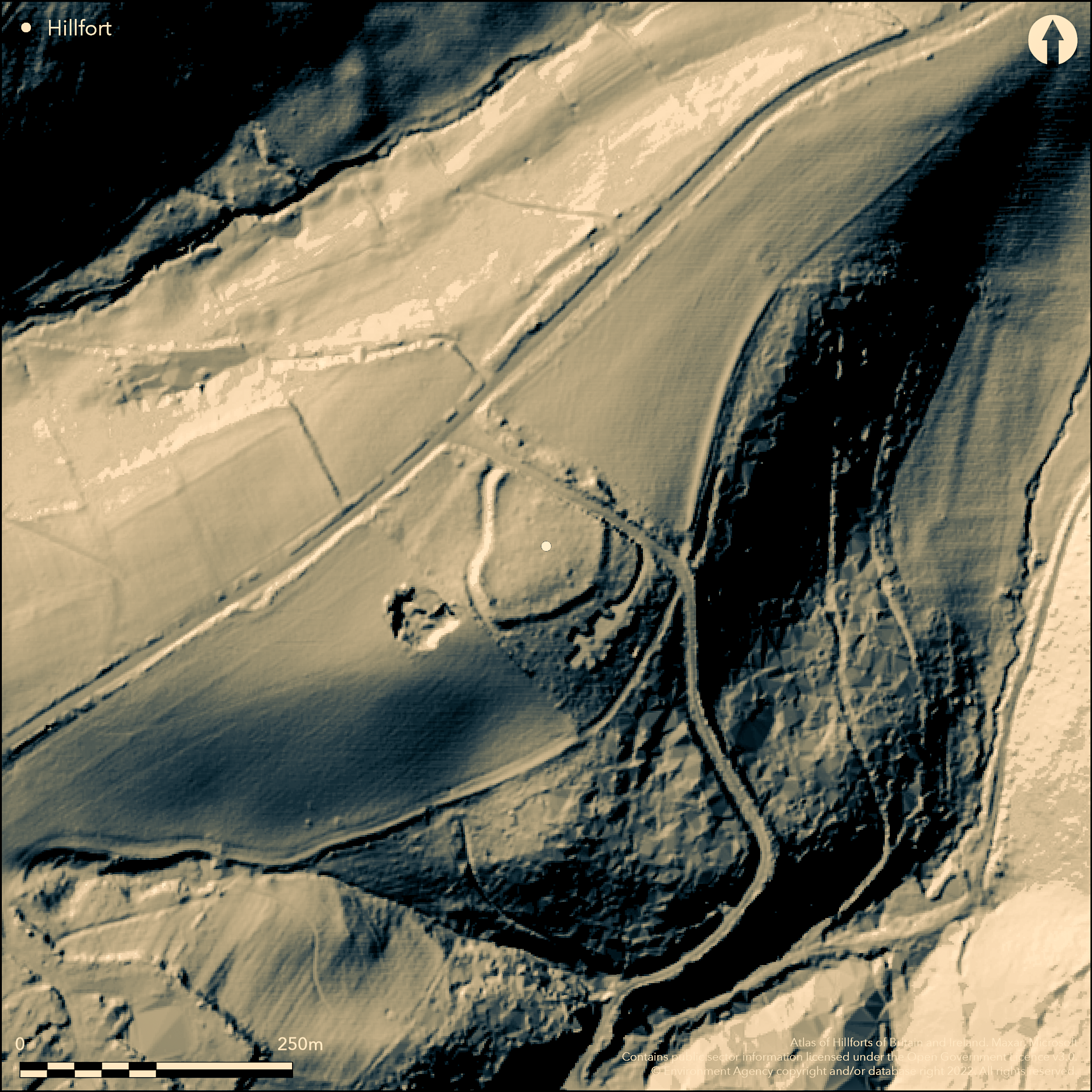
LiDAR 1m DTM Hillshade
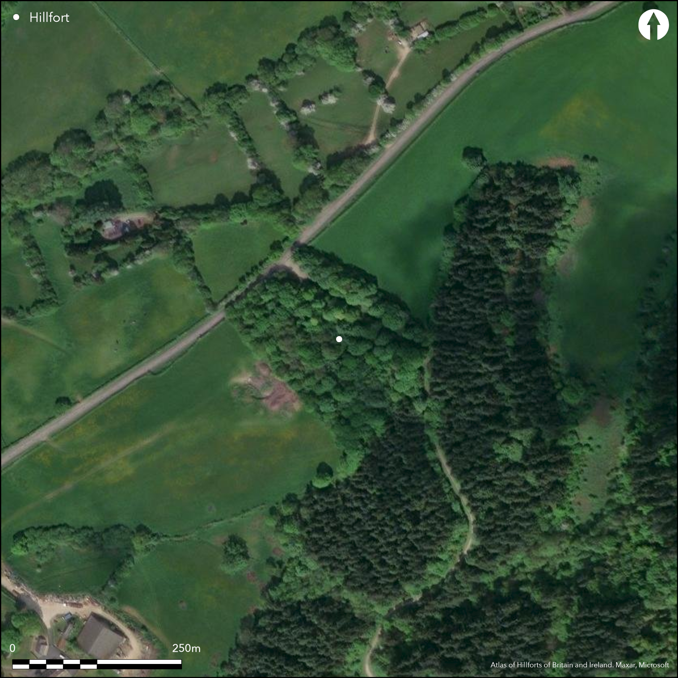
Satellite Imagery
LiDAR 1m DTM Hillshade
Satellite Imagery
Scroll left/right to view further images.
HER: Shropshire 177 (None)
NMR: SO 38 SW (None)
SM: 106239
NGR: SO304840
X: 330475 Y: 284096 (OSGB36)
Discovered by aerial photography in 1976 (Chris Musson), a hillslope enclosure sited on moderate slopes on a N-S spur above Cwm Colstey. Internal area c. 0.4ha. Defined by simple bank, 9m wide and up to 2m high, with ditch 4m wide and 0.5m deep. Ramparts are most massive on S where the approach is easier. Possible small, earlier or interior, enclosure of c. 0.1 ha has been suggested on W side. On E the bank is discontinuous. Rampart has been truncated on N side by a forestry road, but a possible outer rampart has been suggested here to the N of this track. Quarry pits outside the E rampart undated. Commercial forestry on a former ancient woodland site and heavily overgrown with young saplings. Generally, though damaged, the site is in fair condition. Undated.
Citizen Science: ✗
Reliability of Data: Confirmed
Reliability of Interpretation: Unconfirmed
X: -336684 Y: 6881968 (EPSG: 3857)
Longitude: -3.0244797600200903 Latitude: 52.450350697018955 (EPSG:4326)
Country: England
Current County or Unitary Authority: Shropshire
Historic County: Shropshire
Current Parish/Community/Council/Townland: Clun
Heavily overgrown with commercial forestry problems and defences truncated on the N by a forestry road and bank concealed by upcast. Quarry pits outside the E rampart undated.
| Extant | ✓ |
| Cropmark | ✗ |
| Likely Destroyed | ✗ |
Commercial forestry on a former ancient woodland site and heavily overgrown with young saplings. Forestry road.
| Woodland | ✓ |
| Commercial Forestry Plantation | ✓ |
| Parkland | ✗ |
| Pasture (Grazing) | ✗ |
| Arable | ✗ |
| Scrub/Bracken | ✓ |
| Bare Outcrop | ✗ |
| Heather/Moorland | ✗ |
| Heath | ✗ |
| Built-up | ✗ |
| Coastal Grassland | ✗ |
| Other | ✓ |
A hillslope enclosure on moderate slopes. Sited at the end of a N-S spur above Cwm Colstey with moderate slopes on the E and W and gradual on the N and S.
| Contour Fort | ✗ |
| Partial Contour Fort | ✗ |
| Promontory Fort | ✗ |
| Hillslope Fort | ✓ |
| Level Terrain Fort | ✗ |
| Marsh Fort | ✗ |
| Multiple Enclosure Fort | ✗ |
| Hilltop | ✗ |
| Coastal Promontory | ✗ |
| Inland Promontory | ✗ |
| Valley Bottom | ✗ |
| Knoll/Hillock/Outcrop | ✗ |
| Ridge | ✗ |
| Cliff/Plateau-edge/Scarp | ✗ |
| Hillslope | ✗ |
| Lowland | ✗ |
| Spur | ✓ |
Dominant Topographic Feature: Spur
| North | ✗ |
| Northeast | ✗ |
| East | ✗ |
| Southeast | ✗ |
| South | ✗ |
| Southwest | ✗ |
| West | ✗ |
| Northwest | ✓ |
| Level | ✗ |
Altitude: 260.0m
N/A
None
Reliability: D - None
| Pre 1200BC | ✗ |
| 1200BC - 800BC | ✗ |
| 800BC - 400BC | ✗ |
| 400BC - AD50 | ✗ |
| AD50 - AD400 | ✗ |
| AD400 - AD 800 | ✗ |
| Post AD800 | ✓ |
| Unknown | ✓ |
| Pre Hillfort: | None |
| Post Hillfort: | None |
Discovered by aerial photography by Chris Musson 1976. Shropshire CC survey 1976. Field observation Shropshire CC 1981. Field observation English Heritage 1976, 1980, 1987. Shropshire Council survey 2012. Air Photograph Interpretation RCHME: Marches Uplands NMP 1993-2000.
| Other (1976): | Survey Shropshire CC. |
| Other (1976): | Discovered by aerial photography by Chris Musson. |
| Other (1981): | Field observation Shropshire CC., |
| Other (2012): | Shropshire Council survey. |
| Other (None): | Field observation EH. |
| Other (None): | Air Photograph Interpretation RCHME: Marches Uplands NMP. |
None
None
| None | ✓ |
| Spring | ✗ |
| Stream | ✗ |
| Pool | ✗ |
| Flush | ✗ |
| Well | ✗ |
| Other | ✗ |
None
| No Known Features | ✓ |
| Round Stone Structures | ✗ |
| Rectangular Stone Structures | ✗ |
| Curvilinear Platforms | ✗ |
| Other Roundhouse Evidence | ✗ |
| Pits | ✗ |
| Quarry Hollows | ✗ |
| Other | ✗ |
None
| No Known Excavation | ✓ |
| Pits | ✗ |
| Postholes | ✗ |
| Roundhouses | ✗ |
| Rectangular Structures | ✗ |
| Roads/Tracks | ✗ |
| Quarry Hollows | ✗ |
| Other | ✗ |
| Nothing Found | ✗ |
None
| No Known Geophysics | ✓ |
| Pits | ✗ |
| Roundhouses | ✗ |
| Rectangular Structures | ✗ |
| Roads/Tracks | ✗ |
| Quarry Hollows | ✗ |
| Other | ✗ |
| Nothing Found | ✗ |
None
| No Known Finds | ✓ |
| Pottery | ✗ |
| Metal | ✗ |
| Metalworking | ✗ |
| Human Bones | ✗ |
| Animal Bones | ✗ |
| Lithics | ✗ |
| Environmental | ✗ |
| Other | ✗ |
None
| APs Not Checked | ✓ |
| None | ✗ |
| Roundhouses | ✗ |
| Rectangular Structures | ✗ |
| Pits | ✗ |
| Postholes | ✗ |
| Roads/Tracks | ✗ |
| Other | ✗ |
Possible original entrance on N side, simple gap, where the rampart is truncated by a forestry track.
| 1: | No modern gaps defined. |
| 2: | Possible original entrance. |
Guard Chambers: ✗
Chevaux de Frise: ✗
| 1. Simple Gap (North): | Located where the rampart tis truncated by a forestry track. |
The site is defined by a simple bank 9m wide and up to 2m high with ditch 4m wide and 0.5m deep. The ramparts are most massive on the S where the approach is better. A possible small earlier or interior enclosure of c. 0.1ha has been suggested on the W side. On the E the bank is discontinuous. The rampart has been truncated on the N side by a forestry road, but a possible outer rampart has been suggested here to the N of this track.
| Area 1: | 0.4ha. |
| Total: | 0.4ha. |
Total Footprint Area: Noneha.
The might be a possible outer bank on the N affected by a forestry track.
| ✗ | None |
| ✓ | Rampart truncated on the N side. |
| NE Quadrant: | 1 |
| SE Quadrant: | 1 |
| SW Quadrant: | 1 |
| NW Quadrant: | 1 |
| Total: | 1 |
| Partial Univallate | ✗ |
| Univallate | ✓ |
| Partial Bivallate | ✗ |
| Bivallate | ✗ |
| Partial Multivallate | ✗ |
| Multivallate | ✗ |
| Unknown | ✗ |
| Partial Univallate | ✗ |
| Univallate | ✗ |
| Partial Bivallate | ✗ |
| Bivallate | ✗ |
| Partial Multivallate | ✗ |
| Multivallate | ✗ |
Possible earthen bank.
| None | ✗ |
| Earthen Bank | ✓ |
| Stone Wall | ✗ |
| Rubble | ✗ |
| Wall-walk | ✗ |
| Evidence of Timber | ✗ |
| Vitrification | ✗ |
| Other Burning | ✗ |
| Palisade | ✗ |
| Counter Scarp Bank | ✗ |
| Berm | ✗ |
| Unfinished | ✗ |
| Other | ✗ |
None
| None | ✗ |
| Earthen Bank | ✗ |
| Stone Wall | ✗ |
| Murus Duplex | ✗ |
| Timber-framed | ✗ |
| Timber-laced | ✗ |
| Vitrification | ✗ |
| Other Burning | ✗ |
| Palisade | ✗ |
| Counter Scarp Bank | ✗ |
| Berm | ✗ |
| Unfinished | ✗ |
| No Known Excavation | ✓ |
| Other | ✗ |
| ✗ | None |
| ✓ | Good evidence of a ditch to 0.5 m in depth. |
Number of Ditches: 1
| ✗ | None |
Dorling, P. and Wigley, A. 2012: Assessment of the archaeological and conservation status of major later prehistoric enclosures in Herefordshire and Shropshire, EH PNUM, Version 3.2, Hereford and Shrewsbury: Herefordshire Council/Shropshire Council.
Atlas of Hillforts:
Wikidata:
This work is licensed under CC BY-SA 4.0

 and should be cited as:
Lock, Gary and Ralston, Ian. 2024. Atlas of Hillforts of Britain and Ireland. Available at: https://hillforts.arch.ox.ac.uk
Document Version 1.1