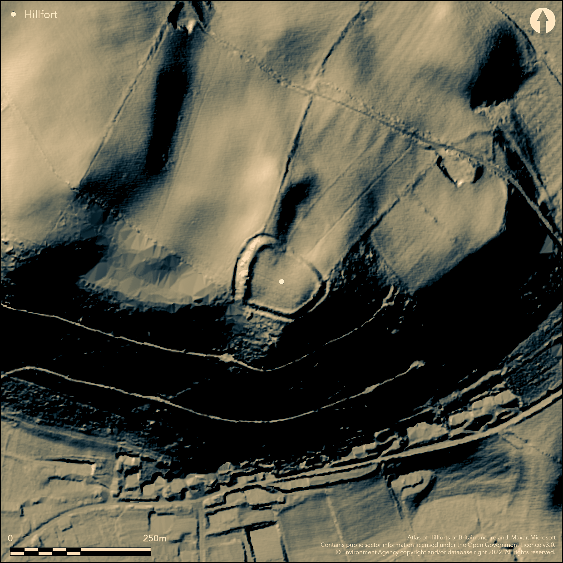
LiDAR 1m DTM Hillshade
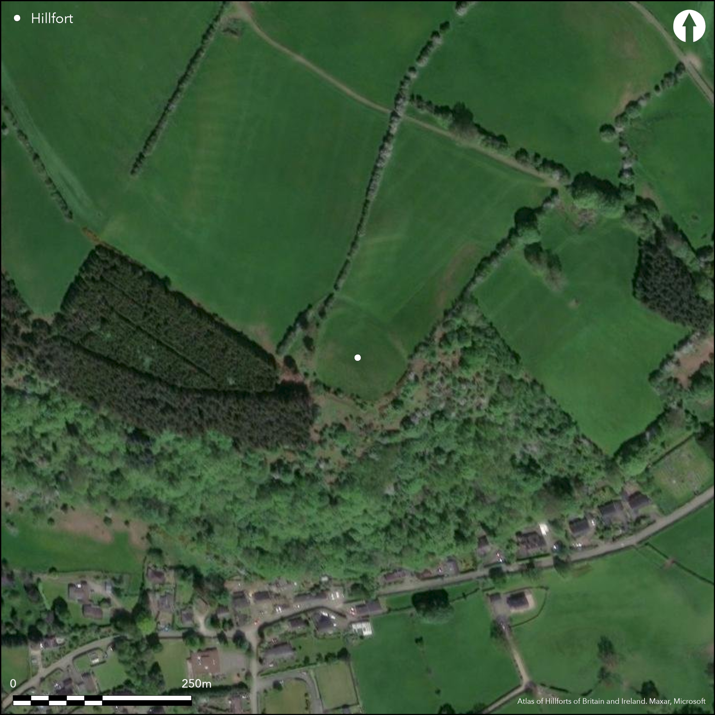
Satellite Imagery
LiDAR 1m DTM Hillshade
Satellite Imagery
Scroll left/right to view further images.
HER: Shropshire 1191 (None)
NMR: SO 28 SW 11 (105467)
SM: 1021069
NGR: SO249826
X: 324989 Y: 282677 (OSGB36)
Univallate, contour hillfort located on steep slopes, in a situation of great strength, on a knoll at the end of an elevated spur opposite to Castle Idris fort (Atlas No 0055) at Newcastle on Clun, and at the confluence of Folly Brook and the River Clun, in an area of small hillforts at the extreme point of the Clun Forest hills. The site is roughly rectangular in shape with rounded corners measuring 70m by 50m and internal area c. 0.28ha. The earth and stone rampart is strongest on the exposed NW side, but is lower and ploughed-out or reduced on the other sides, where slopes are precipitous, to little more than an outer facing scarp. There is a possible counterscarp bank on the SE and SW. The outer ditch averages 8m in width and has a depth of 1.2m on the NW, being completely ploughed-out to the NE. The domed interior has possibly also been ploughed. The probably original entrance is at the SW corner where the bank and ditch are broken and slightly hollowed. A pottery spindle whorl and worked flints are recorded and in Clun Museum. Ridge and furrow in the interior. The site of a possible later signal station of indeterminate recorded date, the site is now under management agreements and pasture. Undated.
Citizen Science: ✗
Reliability of Data: Confirmed
Reliability of Interpretation: Confirmed
X: -345633 Y: 6879506 (EPSG: 3857)
Longitude: -3.104869801658171 Latitude: 52.43686931491622 (EPSG:4326)
Country: England
Current County or Unitary Authority: Shropshire
Historic County: Shropshire
Current Parish/Community/Council/Townland: Clun
The site of a possible later signal station of indeterminate recorded date, the site is now under management agreement and pasture. Selected deciduous tree removal occurred in the 1990's and conifers were removed from the SW corner. Scrub and bracken have been controlled over the past decade.
| Extant | ✓ |
| Cropmark | ✗ |
| Likely Destroyed | ✗ |
Pasture with scrub and bracken management. Possible later signal station.
| Woodland | ✗ |
| Commercial Forestry Plantation | ✗ |
| Parkland | ✗ |
| Pasture (Grazing) | ✓ |
| Arable | ✗ |
| Scrub/Bracken | ✓ |
| Bare Outcrop | ✗ |
| Heather/Moorland | ✗ |
| Heath | ✗ |
| Built-up | ✗ |
| Coastal Grassland | ✗ |
| Other | ✓ |
Site generally follows the contours. Located on steep slopes, in a situation of great strength, on a knoll at the end of an elevated spur opposite to Castle Idris fort at Newcastle on Clun, and at the confluence of Folly Brook and the River Clun, in an area of small hillforts at the extreme point of the Clun Forest hills.
| Contour Fort | ✓ |
| Partial Contour Fort | ✗ |
| Promontory Fort | ✗ |
| Hillslope Fort | ✗ |
| Level Terrain Fort | ✗ |
| Marsh Fort | ✗ |
| Multiple Enclosure Fort | ✗ |
| Hilltop | ✗ |
| Coastal Promontory | ✗ |
| Inland Promontory | ✗ |
| Valley Bottom | ✗ |
| Knoll/Hillock/Outcrop | ✓ |
| Ridge | ✗ |
| Cliff/Plateau-edge/Scarp | ✗ |
| Hillslope | ✗ |
| Lowland | ✗ |
| Spur | ✓ |
Dominant Topographic Feature: Knoll at the end of an elevated spur.
| North | ✗ |
| Northeast | ✗ |
| East | ✗ |
| Southeast | ✗ |
| South | ✗ |
| Southwest | ✗ |
| West | ✗ |
| Northwest | ✗ |
| Level | ✓ |
Altitude: 310.0m
N/A
None
Reliability: D - None
| Pre 1200BC | ✗ |
| 1200BC - 800BC | ✗ |
| 800BC - 400BC | ✗ |
| 400BC - AD50 | ✗ |
| AD50 - AD400 | ✗ |
| AD400 - AD 800 | ✗ |
| Post AD800 | ✗ |
| Unknown | ✓ |
| Pre Hillfort: | None |
| Post Hillfort: | Possible later signal station. |
Field observations English Heritage 1966, 1987. Field observations Ordnance Survey 1973, 1979. Field observations Shropshire CC 1977, 1981, Shropshire Council survey of 2012. Air Photograph Interpretation RCHME: Marches Uplands NMP 1993-2000.
| Other (2012): | Shropshire Council survey. |
| Other (None): | Field observations EH. |
| Other (None): | Field observations OS. |
| Other (None): | Field observations Shropshire CC. |
| Other (None): | Air Photograph Interpretation RCHME: Marches Uplands NMP. |
Pottery spindle whorl and worked flints as surface finds.
Folly Brook located 0.45 km outside the fort.
| None | ✓ |
| Spring | ✗ |
| Stream | ✗ |
| Pool | ✗ |
| Flush | ✗ |
| Well | ✗ |
| Other | ✗ |
None
| No Known Features | ✓ |
| Round Stone Structures | ✗ |
| Rectangular Stone Structures | ✗ |
| Curvilinear Platforms | ✗ |
| Other Roundhouse Evidence | ✗ |
| Pits | ✗ |
| Quarry Hollows | ✗ |
| Other | ✗ |
None
| No Known Excavation | ✓ |
| Pits | ✗ |
| Postholes | ✗ |
| Roundhouses | ✗ |
| Rectangular Structures | ✗ |
| Roads/Tracks | ✗ |
| Quarry Hollows | ✗ |
| Other | ✗ |
| Nothing Found | ✗ |
None
| No Known Geophysics | ✓ |
| Pits | ✗ |
| Roundhouses | ✗ |
| Rectangular Structures | ✗ |
| Roads/Tracks | ✗ |
| Quarry Hollows | ✗ |
| Other | ✗ |
| Nothing Found | ✗ |
Pottery spindle whorl and worked flints.
| No Known Finds | ✗ |
| Pottery | ✗ |
| Metal | ✗ |
| Metalworking | ✗ |
| Human Bones | ✗ |
| Animal Bones | ✗ |
| Lithics | ✓ |
| Environmental | ✗ |
| Other | ✓ |
None
| APs Not Checked | ✓ |
| None | ✗ |
| Roundhouses | ✗ |
| Rectangular Structures | ✗ |
| Pits | ✗ |
| Postholes | ✗ |
| Roads/Tracks | ✗ |
| Other | ✗ |
The probably original entrance is at the SW corner where the bank and ditch are broken by a simple gap and slightly hollowed. No modern gaps.
| 1: | No modern gaps. |
| 2: | The bank and ditch are broken and slightly hollowed. |
Guard Chambers: ✗
Chevaux de Frise: ✗
| 1. Simple Gap (South west): | The bank and ditch are broken and slightly hollowed. The probably original entrance is at the SW corner where the bank and ditch are broken and slightly hollowed. |
| 1. Hollow Way (South west): | Slightly hollowed. |
The earth and stone rampart is strongest on the exposed NW side, but is lower and ploughed out or reduced on the other sides, where slopes are precipitous, to little more than an outer facing scarp. There is a possible counterscarp bank on the SE and SW. The outer ditch averages 8m in width and has a depth of 1.2m on the NW, being completely ploughed-out to the NE.
| Area 1: | 0.28ha. |
| Total: | 0.28ha. |
Total Footprint Area: Noneha.
None
| ✗ | Small site but very strong position. |
| ✓ | The earth and stone rampart is strongest on the exposed NW side, but is lower and ploughed out or reduced on the other sides, where slopes are precipitous, to little more than an outer facing scarp. |
| NE Quadrant: | 1 |
| SE Quadrant: | 1 |
| SW Quadrant: | 1 |
| NW Quadrant: | 1 |
| Total: | 1 |
| Partial Univallate | ✗ |
| Univallate | ✓ |
| Partial Bivallate | ✗ |
| Bivallate | ✗ |
| Partial Multivallate | ✗ |
| Multivallate | ✗ |
| Unknown | ✗ |
| Partial Univallate | ✗ |
| Univallate | ✗ |
| Partial Bivallate | ✗ |
| Bivallate | ✗ |
| Partial Multivallate | ✗ |
| Multivallate | ✗ |
Earth and stone bank recorded as surface evidence. Possible counterscarp bank on SE and SW.
| None | ✗ |
| Earthen Bank | ✓ |
| Stone Wall | ✗ |
| Rubble | ✓ |
| Wall-walk | ✗ |
| Evidence of Timber | ✗ |
| Vitrification | ✗ |
| Other Burning | ✗ |
| Palisade | ✗ |
| Counter Scarp Bank | ✓ |
| Berm | ✗ |
| Unfinished | ✗ |
| Other | ✗ |
None
| None | ✗ |
| Earthen Bank | ✗ |
| Stone Wall | ✗ |
| Murus Duplex | ✗ |
| Timber-framed | ✗ |
| Timber-laced | ✗ |
| Vitrification | ✗ |
| Other Burning | ✗ |
| Palisade | ✗ |
| Counter Scarp Bank | ✗ |
| Berm | ✗ |
| Unfinished | ✗ |
| No Known Excavation | ✓ |
| Other | ✗ |
| ✗ | None |
| ✓ | The outer ditch averages 8m in width and has a depth of 1.2m on the NW, being completely ploughed-out to the NE. |
Number of Ditches: 1
| ✗ | None |
Dorling, P. and Wigley, A. 2012. Assessment of the archaeological and conservation status of major later prehistoric enclosures in Herefordshire and Shropshire, EH PNUM, Version 3.2, Hereford and Shrewsbury: Herefordshire Council/Shropshire Council.
Page, W. ed. 1908. Victoria County History of Shropshire, 1, 354-55, Institute of Historical Research.
Atlas of Hillforts:
Wikidata:
This work is licensed under CC BY-SA 4.0

 and should be cited as:
Lock, Gary and Ralston, Ian. 2024. Atlas of Hillforts of Britain and Ireland. Available at: https://hillforts.arch.ox.ac.uk
Document Version 1.1