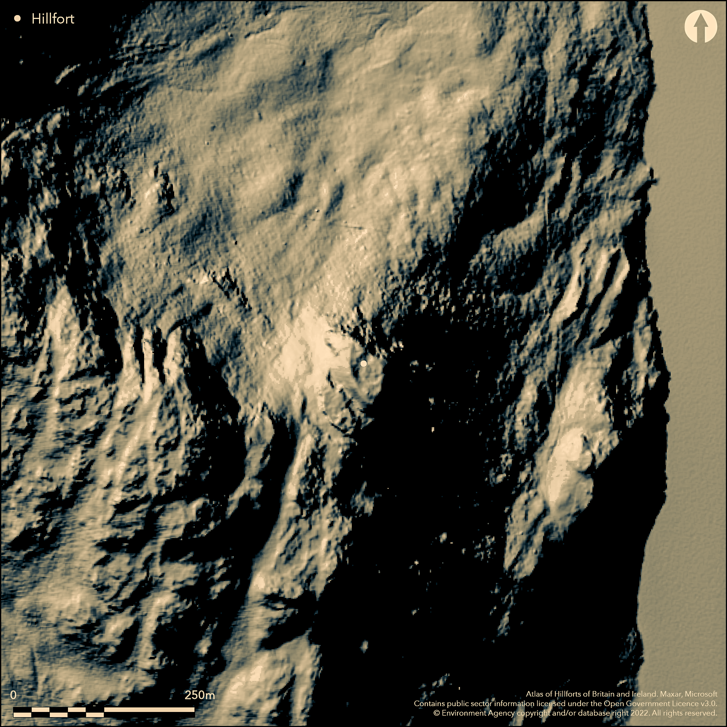
LiDAR 1m DTM Hillshade
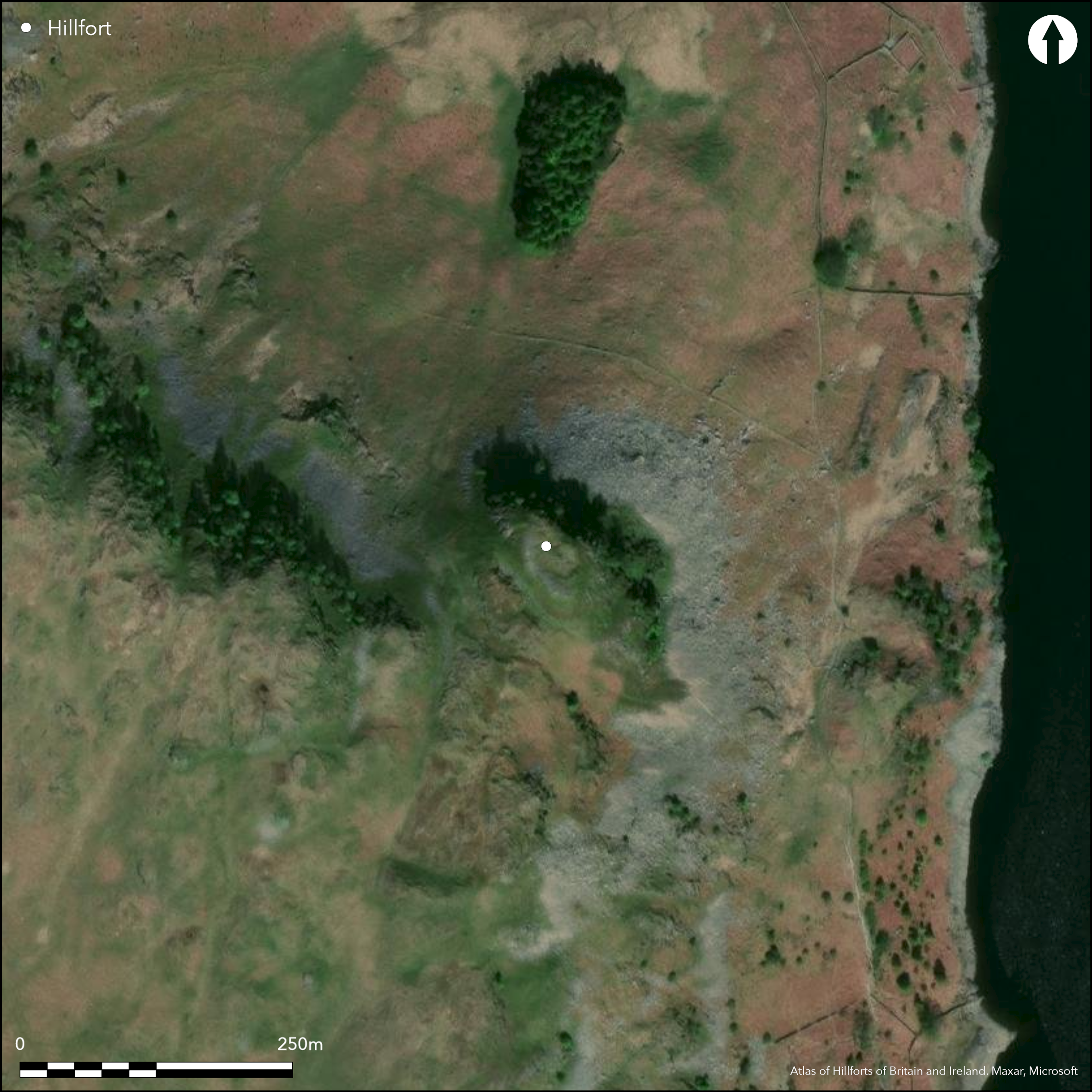
Satellite Imagery
LiDAR 1m DTM Hillshade
Satellite Imagery
Scroll left/right to view further images.
HER: Lake District National Park 1523 (None)
NMR: NY 41 SE 1 (11056)
SM: 1007411
NGR: NY 4692 1277
X: 346925 Y: 512775 (OSGB36)
Overlooking Haweswater Reservoir, a small oval, univallate hillfort of approximately 0.06ha situated on a natural promontory on the summit of Castle Crag at 366m OD. The site is precipitous on three sides precluding the need for ramparts and is only enclosed in the SW by a stone bank 2m wide and 1m high and two deep rock-cut ditches that cut across the neck of land which connects Castle Crag to the fell side. The enclosed area measures approximately 46m by 22m. A possible entrance lies in the SW. Within the fort there are several levelled areas, possibly hut platforms. Between the ditches a rocky knoll has been used as an outer enclosure and contains further artificially levelled areas. Excavations in the 1920's (Collingwood,1923) located a parapet rampart on the north side of the enclosure, clay floors and charcoal. Circular pits were found within the outer enclosure in the SW. A further rock-cut platform lies outside the outer ditch. The site is undated and an alternative interpretation of possible medieval ringwork has been proposed (Perriam & Robinson 1998). Recorded on 1885-1900 OS mapping.
Citizen Science: ✗
Reliability of Data: Confirmed
Reliability of Interpretation: Confirmed
X: -314055 Y: 7266864 (EPSG: 3857)
Longitude: -2.8212077612106556 Latitude: 54.50750800415639 (EPSG:4326)
Country: England
Current County or Unitary Authority: Cumbria
Historic County: Westmorland
Current Parish/Community/Council/Townland: Bampton
The rampart is now lost in the N and E
| Extant | ✓ |
| Cropmark | ✗ |
| Likely Destroyed | ✗ |
None
| Woodland | ✗ |
| Commercial Forestry Plantation | ✗ |
| Parkland | ✗ |
| Pasture (Grazing) | ✗ |
| Arable | ✗ |
| Scrub/Bracken | ✗ |
| Bare Outcrop | ✗ |
| Heather/Moorland | ✗ |
| Heath | ✗ |
| Built-up | ✗ |
| Coastal Grassland | ✗ |
| Other | ✗ |
Sited on an inland promontory on Castle Crag at 366m OD, a projection of rock extending NE from Birks Crag which is precipitous on three sides. On the fourth side in the SW it was enclosed by a stone rampart and two deep ditches.
| Contour Fort | ✗ |
| Partial Contour Fort | ✗ |
| Promontory Fort | ✓ |
| Hillslope Fort | ✗ |
| Level Terrain Fort | ✗ |
| Marsh Fort | ✗ |
| Multiple Enclosure Fort | ✗ |
| Hilltop | ✗ |
| Coastal Promontory | ✗ |
| Inland Promontory | ✓ |
| Valley Bottom | ✗ |
| Knoll/Hillock/Outcrop | ✗ |
| Ridge | ✗ |
| Cliff/Plateau-edge/Scarp | ✗ |
| Hillslope | ✗ |
| Lowland | ✗ |
| Spur | ✗ |
Dominant Topographic Feature: Summit of Castle Crag
| North | ✗ |
| Northeast | ✗ |
| East | ✗ |
| Southeast | ✗ |
| South | ✗ |
| Southwest | ✗ |
| West | ✗ |
| Northwest | ✗ |
| Level | ✓ |
Altitude: 366.0m
N/A
Undated, presumed Iron Age.
Reliability: D - None
| Pre 1200BC | ✗ |
| 1200BC - 800BC | ✗ |
| 800BC - 400BC | ✗ |
| 400BC - AD50 | ✗ |
| AD50 - AD400 | ✗ |
| AD400 - AD 800 | ✗ |
| Post AD800 | ✗ |
| Unknown | ✓ |
| Pre Hillfort: | None |
| Post Hillfort: | Perriam & Robinson (1998) suggest it is a possible medieval ringwork |
On 1st Ed OS map (1885-1900). Limited excavation in the early 1920's located a parapet rampart on the N side of the internal enclosure constructed of tightly laid flat stones on the inside. Clay floors and charcoal were found within the main enclosure and circular pits within the SW of the outer enclosure. Field Investigation in 1977. Scheduled.
| Excavation (1922): | Collingwood (1923) |
| Other (1925): | Scheduled |
| Other (1977): | Field Investigation |
| 1st Identified Map Depiction (None): | OS One-inch 1885-1900 |
Three artificially levelled areas, two of which are circular measuring approximately 3m in diameter and an irregularly shaped area measuring a maximum of 6.5m by 4.6m. Clay floors and charcoal were found during excavation from what was interpreted as living floors.
None
| None | ✓ |
| Spring | ✗ |
| Stream | ✗ |
| Pool | ✗ |
| Flush | ✗ |
| Well | ✗ |
| Other | ✗ |
None
| No Known Features | ✗ |
| Round Stone Structures | ✗ |
| Rectangular Stone Structures | ✗ |
| Curvilinear Platforms | ✓ |
| Other Roundhouse Evidence | ✗ |
| Pits | ✗ |
| Quarry Hollows | ✗ |
| Other | ✗ |
Excavation in 1922 found clay floors with charcoal trodden in. No other finds.
| No Known Excavation | ✗ |
| Pits | ✗ |
| Postholes | ✗ |
| Roundhouses | ✗ |
| Rectangular Structures | ✗ |
| Roads/Tracks | ✗ |
| Quarry Hollows | ✗ |
| Other | ✓ |
| Nothing Found | ✗ |
None
| No Known Geophysics | ✓ |
| Pits | ✗ |
| Roundhouses | ✗ |
| Rectangular Structures | ✗ |
| Roads/Tracks | ✗ |
| Quarry Hollows | ✗ |
| Other | ✗ |
| Nothing Found | ✗ |
Charcoal
| No Known Finds | ✗ |
| Pottery | ✗ |
| Metal | ✗ |
| Metalworking | ✗ |
| Human Bones | ✗ |
| Animal Bones | ✗ |
| Lithics | ✗ |
| Environmental | ✗ |
| Other | ✓ |
None
| APs Not Checked | ✓ |
| None | ✗ |
| Roundhouses | ✗ |
| Rectangular Structures | ✗ |
| Pits | ✗ |
| Postholes | ✗ |
| Roads/Tracks | ✗ |
| Other | ✗ |
Simple gap in the SW of the outer enclosure ditch 2.5m wide
| None: | None |
| 2: | None |
Guard Chambers: ✗
Chevaux de Frise: ✗
| 1. Simple Gap (South west): | None |
Rampart with parapet on the N side constructed of flat laid stones. In the SW a 2m wide and 1m high bank, outside of which is a rock-cut ditch 4m wide and up to 3m deep and a second ditch 10m wide and 2-3m deep. Between the ditches a rocky knoll acts as an outer enclosure containing further artificially levelled areas.
| Area 1: | 0.06ha. |
| Total: | 0.06ha. |
Total Footprint Area: Noneha.
Only in the north
| ✗ | A rectangular artificially-levelled platform measuring 19m by 15m lies outside the outer ditch. |
| ✗ | None |
| NE Quadrant: | 0 |
| SE Quadrant: | 0 |
| SW Quadrant: | 1 |
| NW Quadrant: | 0 |
| Total: | 1 |
| Partial Univallate | ✓ |
| Univallate | ✗ |
| Partial Bivallate | ✗ |
| Bivallate | ✗ |
| Partial Multivallate | ✗ |
| Multivallate | ✗ |
| Unknown | ✗ |
| Partial Univallate | ✗ |
| Univallate | ✗ |
| Partial Bivallate | ✗ |
| Bivallate | ✗ |
| Partial Multivallate | ✗ |
| Multivallate | ✗ |
None
| None | ✗ |
| Earthen Bank | ✗ |
| Stone Wall | ✓ |
| Rubble | ✗ |
| Wall-walk | ✗ |
| Evidence of Timber | ✗ |
| Vitrification | ✗ |
| Other Burning | ✗ |
| Palisade | ✗ |
| Counter Scarp Bank | ✗ |
| Berm | ✗ |
| Unfinished | ✗ |
| Other | ✗ |
None
| None | ✗ |
| Earthen Bank | ✗ |
| Stone Wall | ✓ |
| Murus Duplex | ✗ |
| Timber-framed | ✗ |
| Timber-laced | ✗ |
| Vitrification | ✗ |
| Other Burning | ✗ |
| Palisade | ✗ |
| Counter Scarp Bank | ✗ |
| Berm | ✗ |
| Unfinished | ✗ |
| No Known Excavation | ✗ |
| Other | ✗ |
| ✗ | None |
| ✓ | Two deep rock-cut ditches, the inner ditch is 4m wide and up to 3m deep and the outer ditch 10m wide and 2-3m deep |
Number of Ditches: 2
| ✗ | None |
Collingwood, R.G. 1923. Exploration of Castle Crag, Mardale, Westmorland (Note).Trans Cumberland Westmorland Antiq Archaeol Soc 23, 285-6
Perriam, D.R., Robinson J. 1998. The medieval fortified buildings of Cumbria : an illustrated gazetteer and research guide. Trans Cumberland Westmorland Antiq Archaeol Soc extra series vol. 29, 271
Atlas of Hillforts:
Wikidata:
This work is licensed under CC BY-SA 4.0

 and should be cited as:
Lock, Gary and Ralston, Ian. 2024. Atlas of Hillforts of Britain and Ireland. Available at: https://hillforts.arch.ox.ac.uk
Document Version 1.1