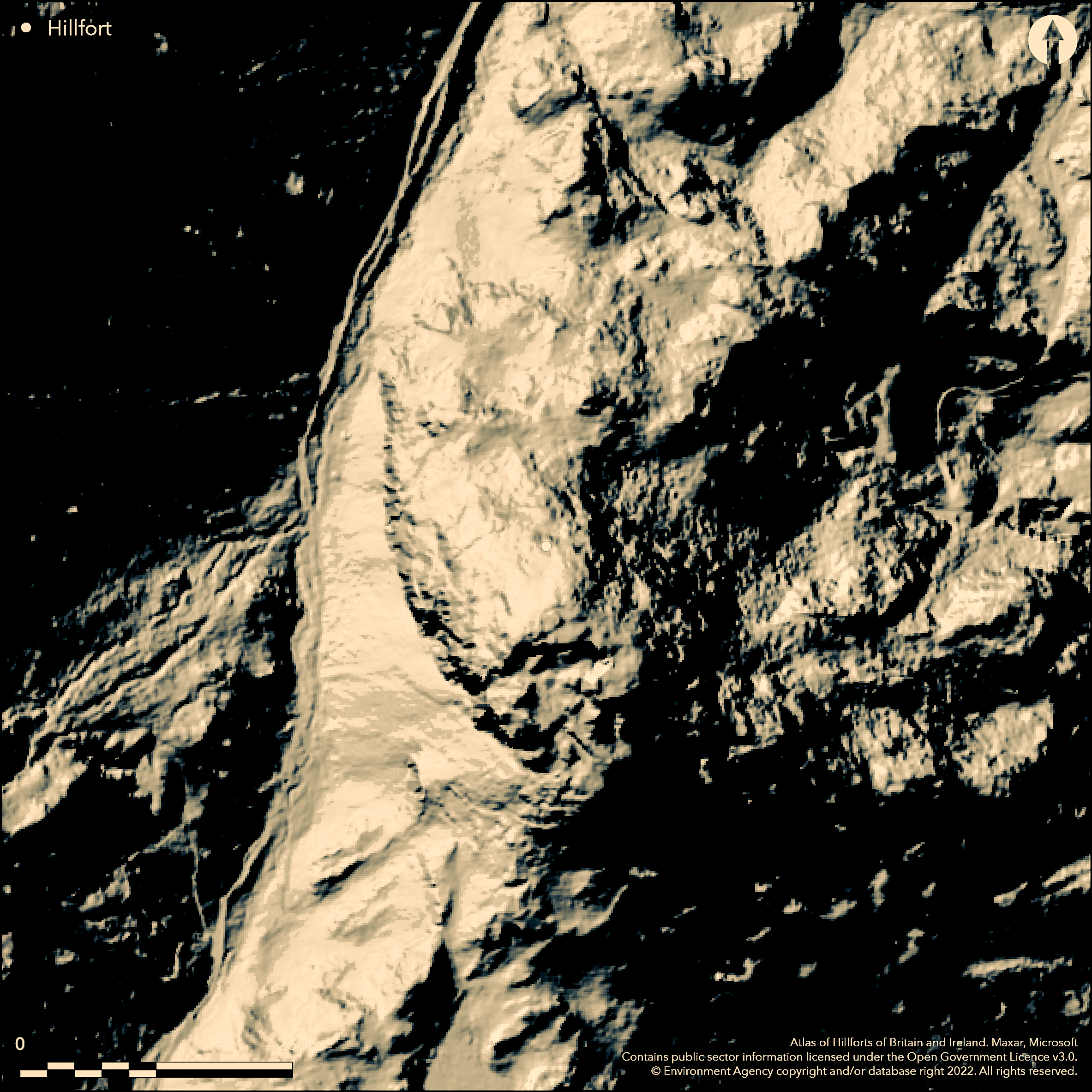
LiDAR 1m DTM Hillshade
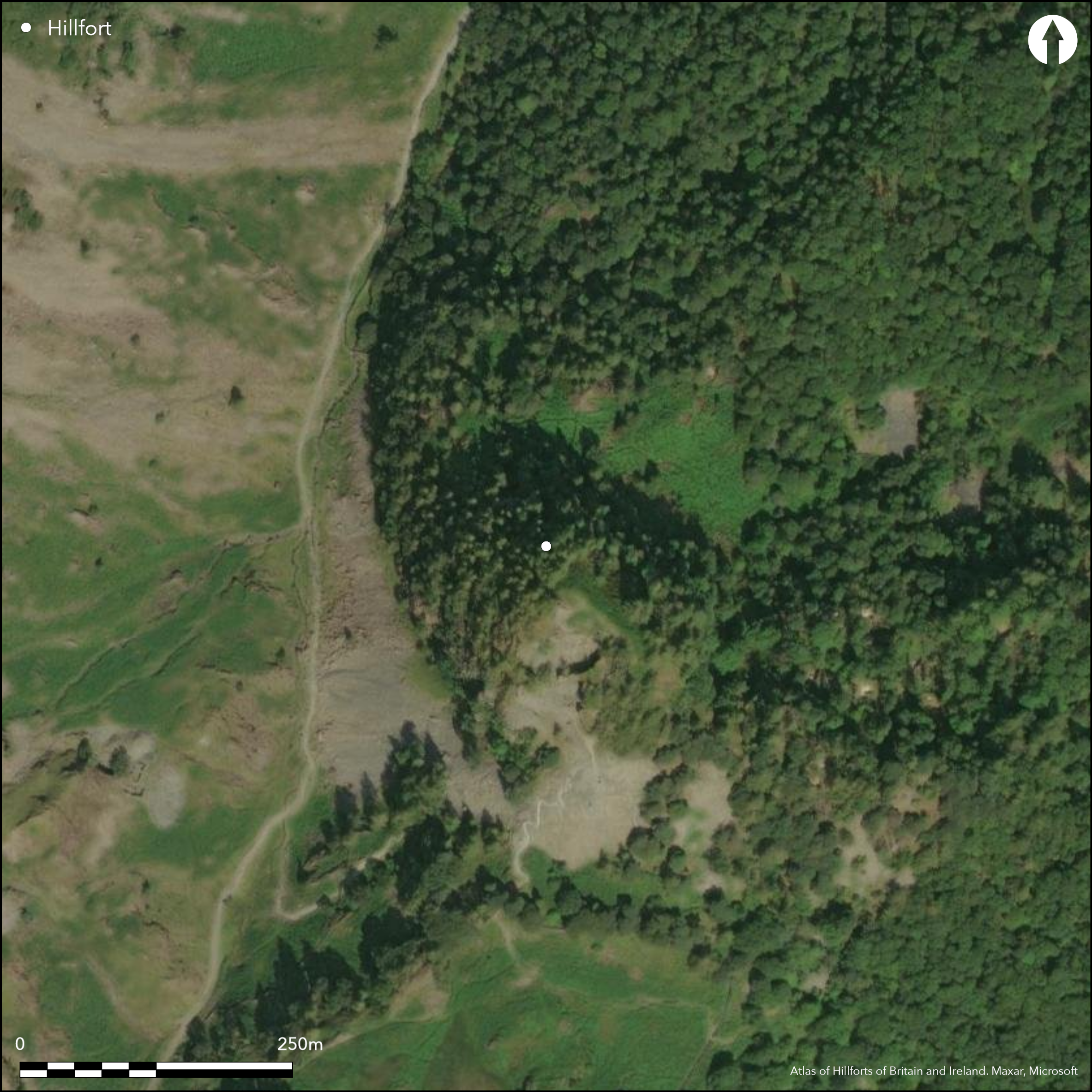
Satellite Imagery
LiDAR 1m DTM Hillshade
Satellite Imagery
Scroll left/right to view further images.
HER: Lake District National Park 1232 (None)
NMR: NY 21 NW 2 (9802)
SM: 1012940
NGR: NY 2493 1598
X: 324930 Y: 515980 (OSGB36)
Close to the foot of Honister Pass. A possible small hillfort covering 0.14ha situated on the summit of Castle Crag in Borrowdale. The ground falls precipitously in the N, W and E sides of the monument and steeply on the S side. Univallate in form, it measures approximately 60m by 25m internally, but its outline is now irregular owing to historic slate quarrying which has removed the SW corner. Where surviving it is enclosed by a single turf-covered stone rampart which runs along the edge of the precipice in the N and NE. No entrance has been identified but it is assumed to have been on the side of easiest access in the S which is now destroyed through quarrying. Three artificially levelled areas have been identified within the enclosure. Two are situated immediately to the S of a rocky knoll and measure approximately 11m by 10m and 6.5m by 5.5m. The third is situated in the eastern part of the enclosure and measures approximately 15m by 12m. There are no sign of huts. The site has seen only limited antiquarian investigation (Housman 1800) and only finds of a Roman date have been recovered. Recorded on 1883-1913 OS mapping.
Citizen Science: ✗
Reliability of Data: Confirmed
Reliability of Interpretation: Unconfirmed
X: -351954 Y: 7271854 (EPSG: 3857)
Longitude: -3.161652488633791 Latitude: 54.53352204095768 (EPSG:4326)
Country: England
Current County or Unitary Authority: Cumbria
Historic County: Cumberland
Current Parish/Community/Council/Townland: Borrowdale
Slate quarrying has removed the SW corner of the rampart
| Extant | ✓ |
| Cropmark | ✗ |
| Likely Destroyed | ✓ |
The land is now owned by the National Trust, HER Ref. 20125.
| Woodland | ✗ |
| Commercial Forestry Plantation | ✗ |
| Parkland | ✗ |
| Pasture (Grazing) | ✗ |
| Arable | ✗ |
| Scrub/Bracken | ✗ |
| Bare Outcrop | ✗ |
| Heather/Moorland | ✗ |
| Heath | ✗ |
| Built-up | ✗ |
| Coastal Grassland | ✗ |
| Other | ✗ |
A univallate contour fort situated at 305m OD on the relatively flat summit of Castle Crag
| Contour Fort | ✓ |
| Partial Contour Fort | ✗ |
| Promontory Fort | ✗ |
| Hillslope Fort | ✗ |
| Level Terrain Fort | ✗ |
| Marsh Fort | ✗ |
| Multiple Enclosure Fort | ✗ |
| Hilltop | ✓ |
| Coastal Promontory | ✗ |
| Inland Promontory | ✗ |
| Valley Bottom | ✗ |
| Knoll/Hillock/Outcrop | ✗ |
| Ridge | ✗ |
| Cliff/Plateau-edge/Scarp | ✗ |
| Hillslope | ✗ |
| Lowland | ✗ |
| Spur | ✗ |
Dominant Topographic Feature: Summit of Castle Crag
| North | ✗ |
| Northeast | ✗ |
| East | ✗ |
| Southeast | ✗ |
| South | ✗ |
| Southwest | ✗ |
| West | ✗ |
| Northwest | ✗ |
| Level | ✓ |
Altitude: 305.0m
N/A
Finds include a lead pan with an iron bow, two masses of smelted iron, Roman pottery including plain samian, and red sandstone.
Reliability: C - Low
| Pre 1200BC | ✗ |
| 1200BC - 800BC | ✗ |
| 800BC - 400BC | ✗ |
| 400BC - AD50 | ✗ |
| AD50 - AD400 | ✗ |
| AD400 - AD 800 | ✗ |
| Post AD800 | ✗ |
| Unknown | ✓ |
| Pre Hillfort: | None |
| Post Hillfort: | None |
| Artefactual: | Roman or later where dateable |
Recorded on 1883-1913 OS mapping. Antiquarian description (Housman 1800). Various artefacts recovered through a combination of quarrying and limited antiquarian investigation. Field investigation in 1973. Oxford Archaeology landscape survey (2007). Scheduled
| 1st Identified Written Reference (1800): | Topographic description |
| Other (1963): | Scheduled |
| Other (1973): | Field investigation |
| Other (2007): | Oxford Archaeology landscape survey |
| 1st Identified Map Depiction (None): | None |
| Excavation (None): | Antiquarian investigations (Housman 1800) |
Three artificially levelled areas lie within the enclosure. Two are situated immediately S of a rocky summit knoll and measure approximately 11m by 10m and 6.5m by 5.5m. The third is situated in the eastern part of the enclosure and measures approximately 15m by 12m. There are no sign of huts. Various finds from antiquarian activity.
None
| None | ✓ |
| Spring | ✗ |
| Stream | ✗ |
| Pool | ✗ |
| Flush | ✗ |
| Well | ✗ |
| Other | ✗ |
Artificially levelled platforms
| No Known Features | ✗ |
| Round Stone Structures | ✗ |
| Rectangular Stone Structures | ✗ |
| Curvilinear Platforms | ✓ |
| Other Roundhouse Evidence | ✗ |
| Pits | ✗ |
| Quarry Hollows | ✗ |
| Other | ✗ |
Limited antiquarian investigations
| No Known Excavation | ✗ |
| Pits | ✗ |
| Postholes | ✗ |
| Roundhouses | ✗ |
| Rectangular Structures | ✗ |
| Roads/Tracks | ✗ |
| Quarry Hollows | ✗ |
| Other | ✓ |
| Nothing Found | ✗ |
None
| No Known Geophysics | ✓ |
| Pits | ✗ |
| Roundhouses | ✗ |
| Rectangular Structures | ✗ |
| Roads/Tracks | ✗ |
| Quarry Hollows | ✗ |
| Other | ✗ |
| Nothing Found | ✗ |
Samian and other Roman pottery
| No Known Finds | ✗ |
| Pottery | ✓ |
| Metal | ✗ |
| Metalworking | ✓ |
| Human Bones | ✗ |
| Animal Bones | ✗ |
| Lithics | ✓ |
| Environmental | ✗ |
| Other | ✗ |
None
| APs Not Checked | ✗ |
| None | ✗ |
| Roundhouses | ✗ |
| Rectangular Structures | ✓ |
| Pits | ✗ |
| Postholes | ✗ |
| Roads/Tracks | ✗ |
| Other | ✗ |
No apparent entrance although it is assumed this was on the side of easiest access in the S which has now been quarried
| None: | None |
| 2: | None |
Guard Chambers: ✗
Chevaux de Frise: ✗
A turf-covered stone rampart up to 4m wide and 0.7m high runs along the edge of the precipice in the N and NE
| Area 1: | 0.14ha. |
| Total: | 0.14ha. |
Total Footprint Area: Noneha.
None
| ✗ | None |
| ✗ | None |
| NE Quadrant: | 1 |
| SE Quadrant: | None |
| SW Quadrant: | None |
| NW Quadrant: | None |
| Total: | 1 |
| Partial Univallate | ✓ |
| Univallate | ✗ |
| Partial Bivallate | ✗ |
| Bivallate | ✗ |
| Partial Multivallate | ✗ |
| Multivallate | ✗ |
| Unknown | ✗ |
| Partial Univallate | ✗ |
| Univallate | ✗ |
| Partial Bivallate | ✗ |
| Bivallate | ✗ |
| Partial Multivallate | ✗ |
| Multivallate | ✗ |
None
| None | ✗ |
| Earthen Bank | ✓ |
| Stone Wall | ✓ |
| Rubble | ✗ |
| Wall-walk | ✗ |
| Evidence of Timber | ✗ |
| Vitrification | ✗ |
| Other Burning | ✗ |
| Palisade | ✗ |
| Counter Scarp Bank | ✗ |
| Berm | ✗ |
| Unfinished | ✗ |
| Other | ✗ |
Limited antiquarian investigation
| None | ✗ |
| Earthen Bank | ✗ |
| Stone Wall | ✗ |
| Murus Duplex | ✗ |
| Timber-framed | ✗ |
| Timber-laced | ✗ |
| Vitrification | ✗ |
| Other Burning | ✗ |
| Palisade | ✗ |
| Counter Scarp Bank | ✗ |
| Berm | ✗ |
| Unfinished | ✗ |
| No Known Excavation | ✗ |
| Other | ✓ |
| ✗ | None |
| ✗ | None |
Number of Ditches: 0
| ✗ | None |
Housman, J. 1800. Topographical Description of Cumberland, Westmorland, Lancashire and part of the West Riding of Yorkshire. Carlisle.
Oxford Archaeology North (2007) Historic Landscape Survey of Borrowdale, Cumbria. Vol. 1: Archaeological Report and Figures.
Whitfield, C. Castle Crag, Borrowdale. Unpublished survey report.
Atlas of Hillforts:
Wikidata:
This work is licensed under CC BY-SA 4.0

 and should be cited as:
Lock, Gary and Ralston, Ian. 2024. Atlas of Hillforts of Britain and Ireland. Available at: https://hillforts.arch.ox.ac.uk
Document Version 1.1