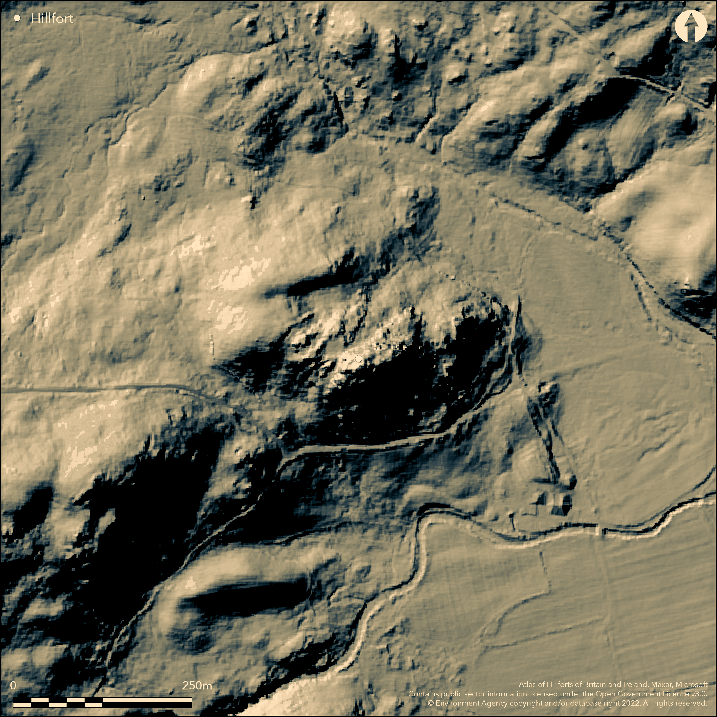
LiDAR 1m DTM Hillshade
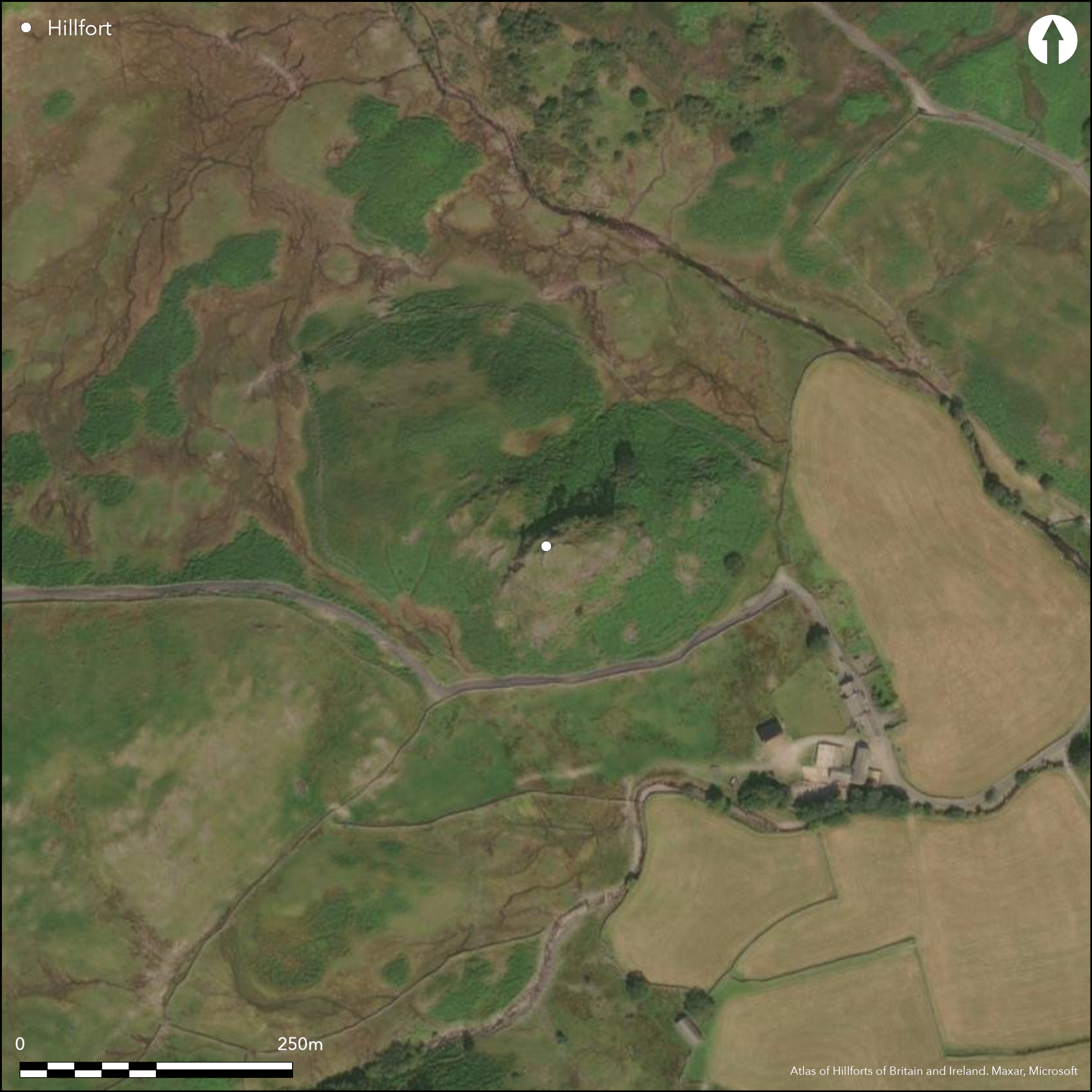
Satellite Imagery
LiDAR 1m DTM Hillshade
Satellite Imagery
Scroll left/right to view further images.
HER: Lake District National Park 14971 (None)
NMR: NY 20 SE 46 (1347853)
SM: 1019747
NGR: NY 29726 03282
X: 329726 Y: 503282 (OSGB36)
Now considered to be entirely natural feature (J. Hodgson, LD HER Officer pers comm.) Previous description: Lying at the eastern end of Wrynose Pass overlooking the Roman road from Ambleside to Ravenglass. Castle Howe is small, strategically placed, multivallate hillfort located on high ground rising steeply from Little Langdale valley, with a rocky knoll forming the highest point. It survives as a series of rock-cut concentric ditches in the E and W with no evidence for ramparts. Rectangular rock-cut levelled platforms between the ditches have been interpreted as house platforms. Access is possible from the W with difficulty. No excavation has been carried out and the site is undated but presumed Iron Age.
Citizen Science: ✗
Reliability of Data: Irreconciled issues
Reliability of Interpretation: Irreconciled issues
X: -343368 Y: 7250126 (EPSG: 3857)
Longitude: -3.084526885212349 Latitude: 54.42011308499222 (EPSG:4326)
Country: England
Current County or Unitary Authority: Cumbria
Historic County: Cumberland
Current Parish/Community/Council/Townland: Lakes
Survives as rock-cut ditches and platforms
| Extant | ✓ |
| Cropmark | ✗ |
| Likely Destroyed | ✗ |
Land owned by the National Trust Ref No 27504
| Woodland | ✗ |
| Commercial Forestry Plantation | ✗ |
| Parkland | ✗ |
| Pasture (Grazing) | ✗ |
| Arable | ✗ |
| Scrub/Bracken | ✗ |
| Bare Outcrop | ✗ |
| Heather/Moorland | ✗ |
| Heath | ✗ |
| Built-up | ✗ |
| Coastal Grassland | ✗ |
| Other | ✗ |
Multiple enclosure fort of concentric rock-cut ditches in the E and W at 170m OD.
| Contour Fort | ✗ |
| Partial Contour Fort | ✗ |
| Promontory Fort | ✗ |
| Hillslope Fort | ✗ |
| Level Terrain Fort | ✗ |
| Marsh Fort | ✗ |
| Multiple Enclosure Fort | ✓ |
| Hilltop | ✗ |
| Coastal Promontory | ✗ |
| Inland Promontory | ✗ |
| Valley Bottom | ✗ |
| Knoll/Hillock/Outcrop | ✓ |
| Ridge | ✗ |
| Cliff/Plateau-edge/Scarp | ✗ |
| Hillslope | ✗ |
| Lowland | ✗ |
| Spur | ✗ |
Dominant Topographic Feature: Rocky knoll at its highest point
| North | ✗ |
| Northeast | ✗ |
| East | ✗ |
| Southeast | ✗ |
| South | ✗ |
| Southwest | ✗ |
| West | ✗ |
| Northwest | ✗ |
| Level | ✓ |
Altitude: 170.0m
N/A
Undated, presumed Iron Age
Reliability: D - None
| Pre 1200BC | ✗ |
| 1200BC - 800BC | ✗ |
| 800BC - 400BC | ✗ |
| 400BC - AD50 | ✗ |
| AD50 - AD400 | ✗ |
| AD400 - AD 800 | ✗ |
| Post AD800 | ✗ |
| Unknown | ✓ |
| Pre Hillfort: | None |
| Post Hillfort: | Triangulation point |
None
Rectangular artificially leveled areas, interpreted as rock-cut hut platforms, lie on the northern and southern sides of the knoll, just below the summit. The smaller platform in the N measures approximately 6m by 3m, the one in the S approximately 8m by 5m.
None
| None | ✓ |
| Spring | ✗ |
| Stream | ✗ |
| Pool | ✗ |
| Flush | ✗ |
| Well | ✗ |
| Other | ✗ |
Rock-cut platforms
| No Known Features | ✗ |
| Round Stone Structures | ✗ |
| Rectangular Stone Structures | ✗ |
| Curvilinear Platforms | ✗ |
| Other Roundhouse Evidence | ✗ |
| Pits | ✗ |
| Quarry Hollows | ✗ |
| Other | ✓ |
None
| No Known Excavation | ✓ |
| Pits | ✗ |
| Postholes | ✗ |
| Roundhouses | ✗ |
| Rectangular Structures | ✗ |
| Roads/Tracks | ✗ |
| Quarry Hollows | ✗ |
| Other | ✗ |
| Nothing Found | ✗ |
None
| No Known Geophysics | ✓ |
| Pits | ✗ |
| Roundhouses | ✗ |
| Rectangular Structures | ✗ |
| Roads/Tracks | ✗ |
| Quarry Hollows | ✗ |
| Other | ✗ |
| Nothing Found | ✗ |
None
| No Known Finds | ✓ |
| Pottery | ✗ |
| Metal | ✗ |
| Metalworking | ✗ |
| Human Bones | ✗ |
| Animal Bones | ✗ |
| Lithics | ✗ |
| Environmental | ✗ |
| Other | ✗ |
Rock-cut platforms
| APs Not Checked | ✗ |
| None | ✗ |
| Roundhouses | ✗ |
| Rectangular Structures | ✗ |
| Pits | ✗ |
| Postholes | ✗ |
| Roads/Tracks | ✗ |
| Other | ✓ |
Single entrance in the W accessed with difficulty
| None: | None |
| 2: | None |
Guard Chambers: ✗
Chevaux de Frise: ✗
| 1. Simple Gap (West): | None |
Below the knoll In the W four-rock cut ditches dug across a spur of relatively level high ground extending towards the W. Three of the ditches are associated with rock-cut levelled areas: Inner-most ditch approximately 4m wide by 1.3m deep. The second ditch is approximately 5m wide by Im deep, terminating at its northern end in a sub-rectangular rock-cut levelled area measuring approximately 17m by 13m. At the northern end of the levelled area is a further rock-cut circular area measuring approximately 4m in diameter interpreted as a hut circle. A second, slightly smaller feature lies a short distance to the E. The third ditch measures 3-9m wide by 1.3m deep and terminates at its northern end in a rectangular rock-cut leveled area measuring approximately 7m by 5m. The outer ditch on the knoll's western side measures 7m wide by 1.5m deep. Two further rock-cut ditches lie at the base of the knoll's eastern face. The inner ditch measures 19m wide by 0.8m deep and the outer 8m wide by lm deep. The southern end of both ditches connects with a rock-cut levelled area of 10 m sq. No evidence for ramparts.
| Area 1: | Noneha. |
| Total: | Noneha. |
Total Footprint Area: Noneha.
Below the knoll In the west there are four-rock cut ditches dug across a spur of relatively level high ground extending towards the west, three of the ditches are associated with rock-cut levelled areas. The inner-most ditch is approximately 4m wide by 1.3m deep. The second ditch is approximately 5m wide by Im deep, terminating at its northern end in a sub-rectangular rock-cut levelled area measuring approximately 17m by 13m. At the northern end of the levelled area is a further rock-cut circular area measuring approximately 4m in diameter interpreted as a hut circle. A second, slightly smaller feature lies a short distance to the east. The third ditch measures 3m-9m wide by 1.3m deep and also terminates at its northern end in a rectangular rock-cut leveled area measuring approximately 7m by 5m. The outer ditch on the knoll's western side measures 7m wide by 1.5m deep. Two further rock-cut ditches lie at the base of the knoll's eastern face. The inner ditch measures 19m wide by 0.8m deep and the outer 8m wide by lm deep. The southern end of both ditches connects with a rock-cut levelled area of 10 sq. metres.
| ✗ | Not calculated |
| ✗ | Ditches occur in the E and W |
| NE Quadrant: | 2 |
| SE Quadrant: | 2 |
| SW Quadrant: | 4 |
| NW Quadrant: | 4 |
| Total: | 4 |
| Partial Univallate | ✗ |
| Univallate | ✗ |
| Partial Bivallate | ✓ |
| Bivallate | ✗ |
| Partial Multivallate | ✓ |
| Multivallate | ✗ |
| Unknown | ✗ |
| Partial Univallate | ✗ |
| Univallate | ✗ |
| Partial Bivallate | ✗ |
| Bivallate | ✗ |
| Partial Multivallate | ✗ |
| Multivallate | ✗ |
Ditches only
| None | ✗ |
| Earthen Bank | ✗ |
| Stone Wall | ✗ |
| Rubble | ✗ |
| Wall-walk | ✗ |
| Evidence of Timber | ✗ |
| Vitrification | ✗ |
| Other Burning | ✗ |
| Palisade | ✗ |
| Counter Scarp Bank | ✗ |
| Berm | ✗ |
| Unfinished | ✗ |
| Other | ✗ |
None
| None | ✓ |
| Earthen Bank | ✗ |
| Stone Wall | ✗ |
| Murus Duplex | ✗ |
| Timber-framed | ✗ |
| Timber-laced | ✗ |
| Vitrification | ✗ |
| Other Burning | ✗ |
| Palisade | ✗ |
| Counter Scarp Bank | ✗ |
| Berm | ✗ |
| Unfinished | ✗ |
| No Known Excavation | ✗ |
| Other | ✗ |
| ✗ | None |
| ✓ | Four in the W, 2 in the E |
Number of Ditches: 6
| ✗ | None |
No related records
Atlas of Hillforts:
Wikidata:
This work is licensed under CC BY-SA 4.0

 and should be cited as:
Lock, Gary and Ralston, Ian. 2024. Atlas of Hillforts of Britain and Ireland. Available at: https://hillforts.arch.ox.ac.uk
Document Version 1.1