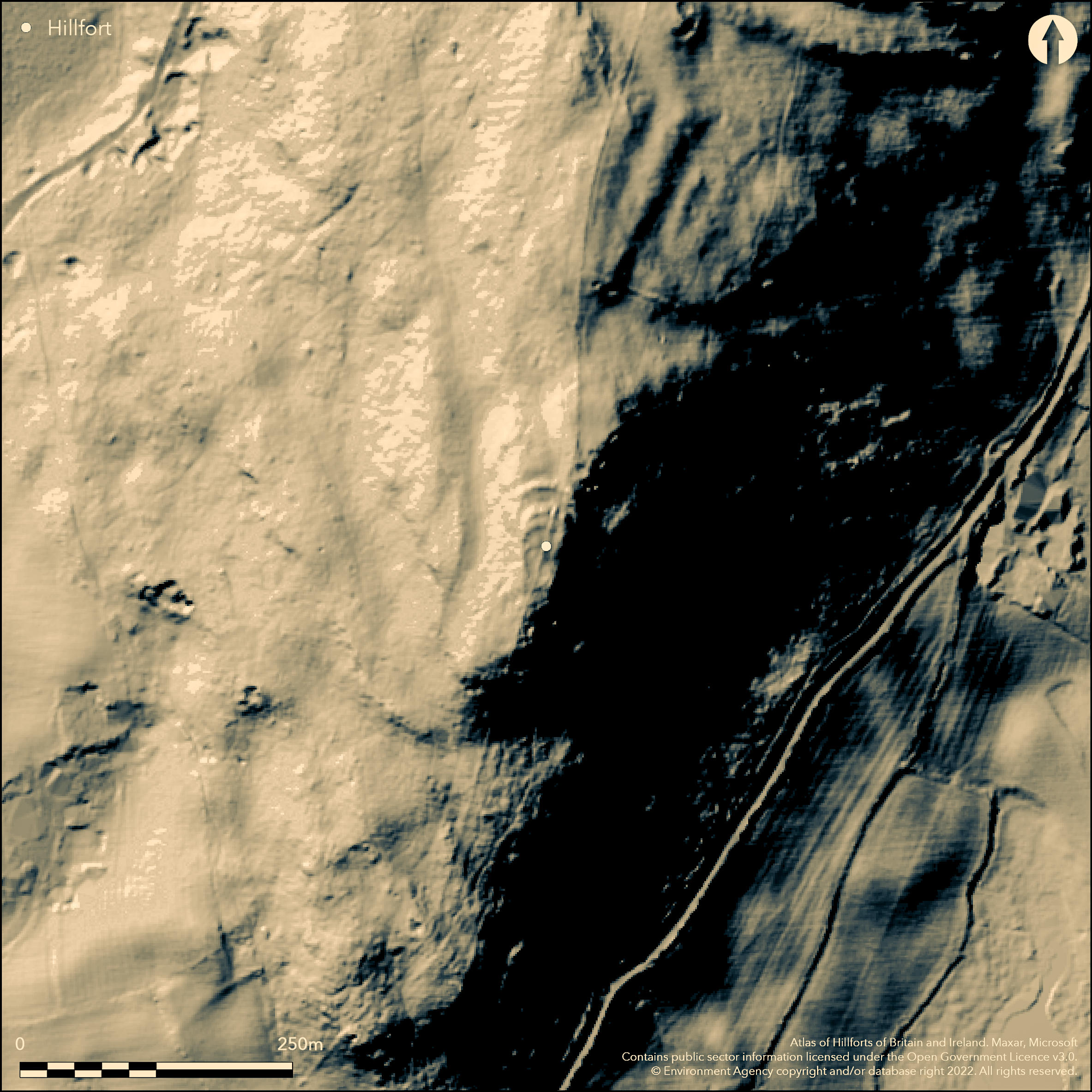
LiDAR 1m DTM Hillshade
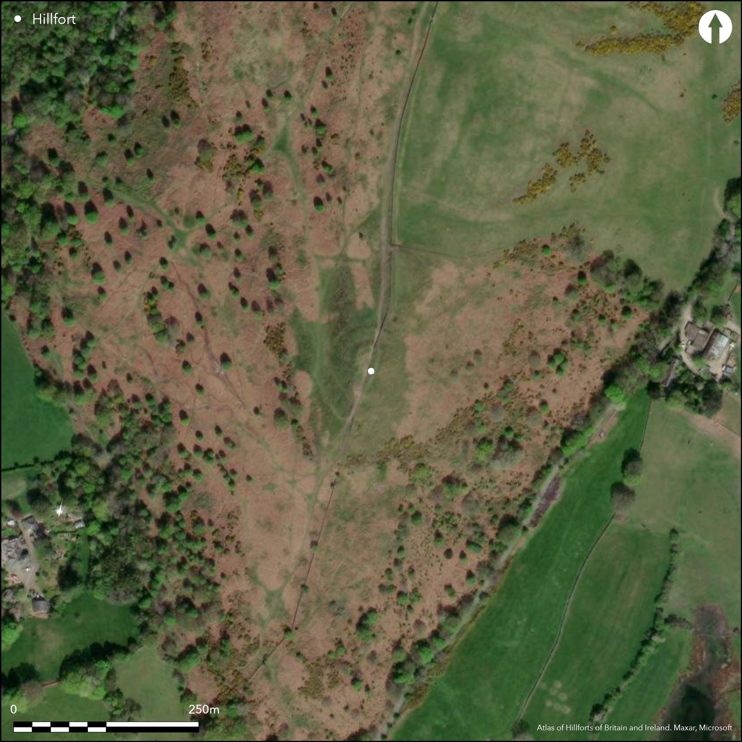
Satellite Imagery
LiDAR 1m DTM Hillshade
Satellite Imagery
Scroll left/right to view further images.
HER: Cumbria 2641 (None)
NMR: SD 58 NW 3 (43089)
SM: 1008263
NGR: SD 53078 88749
X: 353078 Y: 488749 (OSGB36)
To the S of Oxenholm, a small hillfort approximately 39m long and 17m wide at the southern end, widening to 25m in the N. The hillfort lies on the summit of a ridge known as 'The Helm' at a height of 182m OD. The ground falls away steeply in the E and W and today there is no evidence of ramparts on these sides, although an early 20th century survey noted faint traces in these areas suggesting it had originally been completely enclosed. A possible outer rampart, formed by artificially steepening the natural ridge to the SW of the hillfort was also recorded during the Lakes and Dales Upland Pilot in 2013. The ground falls away more gradually in the N and S with the weakest point in the N enclosed by two earth and stone banks both measuring up to 2m high separated by a ditch 8.5m wide which cuts across the line of the ridge. No entrances are recorded. There is a a single earth and stone bank in the S, 6.5m wide and 1m high. Three artificially levelled areas within the interior have been interpreted as house platforms. A semi-circular levelled area 17m in diameter abuts the NW part of the outside of the outer bank. To the E of this are faint traces of a shallow ditch approximately 3m wide. Outside the ramparts, at each end are two small rock-cut basins which might have been cut to collect rainwater. Recorded in a guide book of 1778 and first planned in 1832 and Collingwood (1908). No excavations have been carried out and it is currently undated, presumed Iron Age but may be later or have later re-use. Recorded on 1862-3 1:10,560 OS mapping. Scheduled as a multivallate hillfort
Citizen Science: ✗
Reliability of Data: Confirmed
Reliability of Interpretation: Confirmed
X: -303055 Y: 7225692 (EPSG: 3857)
Longitude: -2.7223851765796114 Latitude: 54.29220588298808 (EPSG:4326)
Country: England; None
Current County or Unitary Authority: Cumbria
Historic County: Westmorland
Current Parish/Community/Council/Townland: Natland and Stainton; Stainton
A measured survey by Green Lane Archaeology in 2012 recorded considerable differences in the state of erosion across the hillfort with heavy erosion on the western side which is common land. It is overgrown in the E but with only minor erosion. Erosion has been caused almost entirely by footfall and the use of motorbikes on the site. A trig point towards the SW of the site has been placed on top of an artificial earthwork forming part of the monument, and erosion is particularly severe in this area. Images of snowboarding on the ramparts on GE imagery
| Extant | ✓ |
| Cropmark | ✗ |
| Likely Destroyed | ✗ |
The fort is divided NS by the parish boundary which is marked by a wall. It is grazed in the W, but bracken and gorse have been allowed to grow in the east. The western side is common land in private ownership
| Woodland | ✗ |
| Commercial Forestry Plantation | ✗ |
| Parkland | ✗ |
| Pasture (Grazing) | ✓ |
| Arable | ✗ |
| Scrub/Bracken | ✓ |
| Bare Outcrop | ✗ |
| Heather/Moorland | ✗ |
| Heath | ✗ |
| Built-up | ✗ |
| Coastal Grassland | ✗ |
| Other | ✗ |
Contour fort lying at 182m OD on the summit of a hill known as The Helm. Possibly once completely enclosed.
| Contour Fort | ✓ |
| Partial Contour Fort | ✗ |
| Promontory Fort | ✗ |
| Hillslope Fort | ✗ |
| Level Terrain Fort | ✗ |
| Marsh Fort | ✗ |
| Multiple Enclosure Fort | ✗ |
| Hilltop | ✓ |
| Coastal Promontory | ✗ |
| Inland Promontory | ✗ |
| Valley Bottom | ✗ |
| Knoll/Hillock/Outcrop | ✗ |
| Ridge | ✓ |
| Cliff/Plateau-edge/Scarp | ✗ |
| Hillslope | ✗ |
| Lowland | ✗ |
| Spur | ✗ |
Dominant Topographic Feature: Summit of a ridge known as 'The Helm'
| North | ✗ |
| Northeast | ✗ |
| East | ✗ |
| Southeast | ✗ |
| South | ✗ |
| Southwest | ✗ |
| West | ✗ |
| Northwest | ✗ |
| Level | ✓ |
Altitude: 182.0m
The parish boundary runs centrally N-S through The Helm. A wall whch appears on the first edition Ordnance Survey map (1858), marks the boundary between Natland parish to the W and Stainton to the E.
Boundary Type: Parish/Townland
Undated, presumed Iron Age, possibly Roman or later.
Reliability: D - None
| Pre 1200BC | ✗ |
| 1200BC - 800BC | ✗ |
| 800BC - 400BC | ✗ |
| 400BC - AD50 | ✗ |
| AD50 - AD400 | ✗ |
| AD400 - AD 800 | ✗ |
| Post AD800 | ✗ |
| Unknown | ✓ |
| Pre Hillfort: | None |
| Post Hillfort: | Triangulation point 608 feet (185m) within the enclosed area. |
The site was recorded by Thomas West in his book 'A Guide to the Lakes' in 1778 ..."the castellum on the summit of a hill that rises immediately above Watercrook, at present called Castle Steads" (1778: 14). Plan showing what appears to ramparts around the entire circuit appears in The Annals of Kendal (Nicholson 1832). Plan by Collingwood (1908). Field investigation in 1967. Measured survey by Green Lane Archaeology in 2012. Recorded on 1862-3 1:10,560 OS mapping. Scheduled
| 1st Identified Written Reference (1778): | Guide Book, West (1778) |
| Other (1832): | Plan, black and white engraving (Nicholson 1832) |
| Other (1925): | Scheduled |
| Other (1967): | Field investigation |
| Earthwork Survey (2012): | Measured survey, Green Lane Archaeology |
| 1st Identified Map Depiction (None): | None |
Within the enclosure three artificially levelled areas have been interpreted as hut platforms. The first lies close to the NW corner and measures approximately 11.5m by 3.5m. The smallest lies towards the southern end measuring approximately 3m square. The largest lies at the centre measuring approximately 15m by 3m.
None
| None | ✓ |
| Spring | ✗ |
| Stream | ✗ |
| Pool | ✗ |
| Flush | ✗ |
| Well | ✗ |
| Other | ✗ |
Rectilinear platforms
| No Known Features | ✗ |
| Round Stone Structures | ✗ |
| Rectangular Stone Structures | ✗ |
| Curvilinear Platforms | ✗ |
| Other Roundhouse Evidence | ✗ |
| Pits | ✗ |
| Quarry Hollows | ✗ |
| Other | ✓ |
None
| No Known Excavation | ✓ |
| Pits | ✗ |
| Postholes | ✗ |
| Roundhouses | ✗ |
| Rectangular Structures | ✗ |
| Roads/Tracks | ✗ |
| Quarry Hollows | ✗ |
| Other | ✗ |
| Nothing Found | ✗ |
None
| No Known Geophysics | ✓ |
| Pits | ✗ |
| Roundhouses | ✗ |
| Rectangular Structures | ✗ |
| Roads/Tracks | ✗ |
| Quarry Hollows | ✗ |
| Other | ✗ |
| Nothing Found | ✗ |
None
| No Known Finds | ✓ |
| Pottery | ✗ |
| Metal | ✗ |
| Metalworking | ✗ |
| Human Bones | ✗ |
| Animal Bones | ✗ |
| Lithics | ✗ |
| Environmental | ✗ |
| Other | ✗ |
None
| APs Not Checked | ✓ |
| None | ✗ |
| Roundhouses | ✗ |
| Rectangular Structures | ✗ |
| Pits | ✗ |
| Postholes | ✗ |
| Roads/Tracks | ✗ |
| Other | ✗ |
The location of entrances is not recorded
| 0: | None |
| 2: | None |
Guard Chambers: ✗
Chevaux de Frise: ✗
Two earth and stone banks both measuring up to 2m high separated by a ditch 8.5m wide cuts across the line of the ridge in the N where the line of approach is weakest. There is a single earth and stone bank 6.5m wide and 1m high in the S. Abutting the NW part of the outside of the outer bank is a semicircular levelled area 17m in diameter
| Area 1: | 0.03ha. |
| Area 2: | 0.06ha. |
| Total: | 0.06ha. |
Total Footprint Area: Noneha.
Two earth and stone banks both measuring up to 2m high separated by a ditch 8.5m wide cuts across the line of the ridge in the north. There is a a single earth and stone bank in the south 6.5m wide and 1m high. Abutting the north-west part of the outside of the outer bank is a semicircular levelled area 17m in diameter
| ✓ | A measured earthwork survey interpreted evidence for various phases of development with its initial construction comprising the large outer earth and stone ramparts possibly preceded by a less substantial timber palisade, and with the smaller banks and houses added later. This interpretation is unsupported by excavation. Sizes calculated from map/satellite. |
| ✗ | Only in the N and S |
| NE Quadrant: | 2 |
| SE Quadrant: | 1 |
| SW Quadrant: | 1 |
| NW Quadrant: | 2 |
| Total: | 2 |
| Partial Univallate | ✓ |
| Univallate | ✗ |
| Partial Bivallate | ✓ |
| Bivallate | ✗ |
| Partial Multivallate | ✗ |
| Multivallate | ✗ |
| Unknown | ✗ |
| Partial Univallate | ✗ |
| Univallate | ✗ |
| Partial Bivallate | ✗ |
| Bivallate | ✗ |
| Partial Multivallate | ✗ |
| Multivallate | ✗ |
Earth and stone banks up to 2m high. From the description the outer bank does not appear to be a counterscarp
| None | ✗ |
| Earthen Bank | ✓ |
| Stone Wall | ✗ |
| Rubble | ✓ |
| Wall-walk | ✗ |
| Evidence of Timber | ✗ |
| Vitrification | ✗ |
| Other Burning | ✗ |
| Palisade | ✗ |
| Counter Scarp Bank | ✗ |
| Berm | ✗ |
| Unfinished | ✗ |
| Other | ✗ |
None
| None | ✗ |
| Earthen Bank | ✗ |
| Stone Wall | ✗ |
| Murus Duplex | ✗ |
| Timber-framed | ✗ |
| Timber-laced | ✗ |
| Vitrification | ✗ |
| Other Burning | ✗ |
| Palisade | ✗ |
| Counter Scarp Bank | ✗ |
| Berm | ✗ |
| Unfinished | ✗ |
| No Known Excavation | ✓ |
| Other | ✗ |
| ✗ | None |
| ✓ | None |
Number of Ditches: 1
| ✗ | None |
Collingwood, W. G. 1908. Three more ancient Castles of Kendal. Trans Cumberland and Westmorland Antiq Archaeol Soc 8: 108-112
Greenlane Archaeology Ltd, unpublished client report, Site 2
Mace, T and Elsworth, D. 2012, The Helm, Oxenholme, Kendal, Cumbria: archaeological landscape survey.
Nicholson, C. 1832. The Annals of Kendal. Hudson and Nicholson, Kendal, Westmorland
West, T. 1778. A Guide to the Lakes. William Pennington, Kendal
Atlas of Hillforts:
Wikidata:
This work is licensed under CC BY-SA 4.0

 and should be cited as:
Lock, Gary and Ralston, Ian. 2024. Atlas of Hillforts of Britain and Ireland. Available at: https://hillforts.arch.ox.ac.uk
Document Version 1.1