LiDAR 1m DTM Hillshade
Satellite Imagery
LiDAR 1m DTM Hillshade
Satellite Imagery
Scroll left/right to view further images.
HER: County Durham 2399904 (2303474, 2399905, 2303474, 2399906, 2303474)
NMR: NZ 22 SW 4 (24041)
SM: 1016867
NGR: NZ 22943 23298
X: 422943 Y: 523298 (OSGB36)
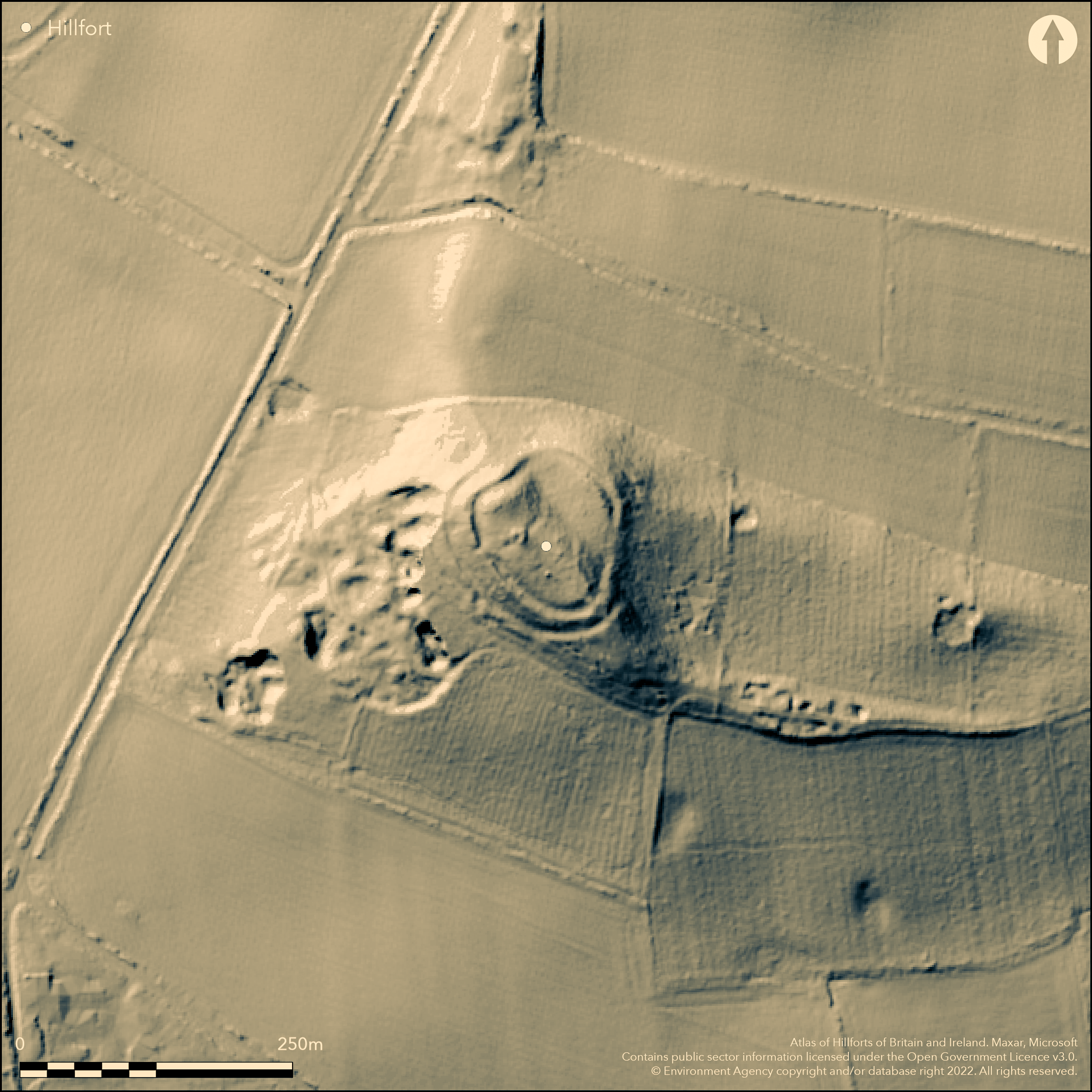
Lying at 183m OD within Redworth Woods on Shackleton Beacon Hill, a small, roughly oval multivallate hillfort liying on the west end of a prominent limestone ridge. Recorded in 1794 by W. Hutchinson, a local antiquarian. Measuring 60m NW to SE by 75m NE to SW it is naturally defended on the N and W sides by steep slopes. In the NE there are double banks of stone and earth 5m wide and up to 1m high, separated by a single ditch 5m wide and 1m deep. The S and W appears more strongly defended and the enclosing works follow the natural slope of the hill and comprise a sequence of four ditches and ramparts which vary in height from 2.5m to 0.2m and average 7m wide, and decrease in size and strength down slope. The ditches vary between 0.2m and 3m deep with an average width of 7m. A small, semi-circular extension of the two outer banks lies on the NE side. It is uncertain if the feature is contemporary with the hillfort. There is a simple causewayed entrance in the SE which later carried a track. No internal features are recorded. The interior is on two levels. In the W, a level platform measures 75m by 27m, in the E the ground falls steeply away to a lower area 60m by 20m. Some remodelling occurred in the 18th century when a windmill and later a folly occupied the interior, but the hillfort is otherwise in a good condition. It is uncertain if works carried out in the 18th century has destroyed or reduced the defences at certain points around the perimeter. The site is unexcavated and undated.
Citizen Science: ✗
Reliability of Data: Confirmed
Reliability of Interpretation: Confirmed
X: -183270 Y: 7285454 (EPSG: 3857)
Longitude: -1.646342166982635 Latitude: 54.60435003584734 (EPSG:4326)
Country: England
Current County or Unitary Authority: County Durham
Historic County: County Durham
Current Parish/Community/Council/Townland: Heighington
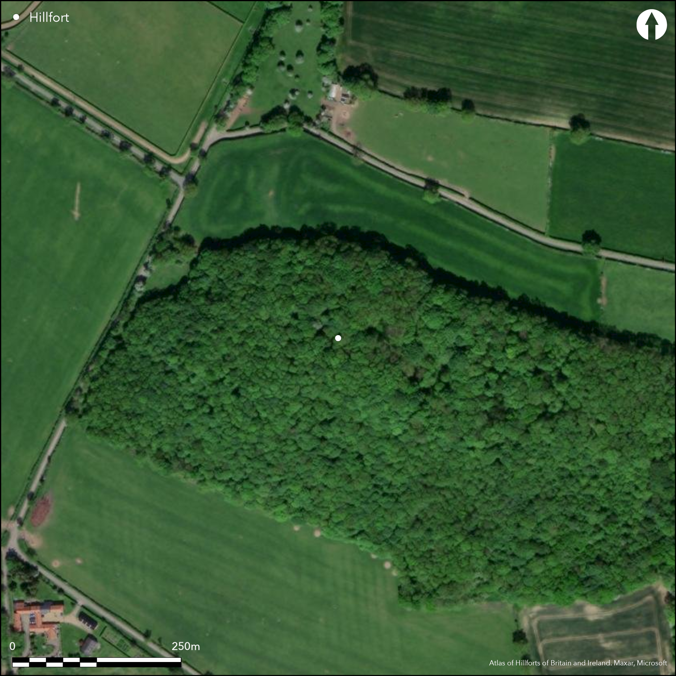
It currently lies within unmanaged woodland and is included in the Heritage at Risk Register 2015 as vulnerable from scrub and tree growth
| Extant | ✓ |
| Cropmark | ✗ |
| Likely Destroyed | ✗ |
None
| Woodland | ✓ |
| Commercial Forestry Plantation | ✗ |
| Parkland | ✗ |
| Pasture (Grazing) | ✗ |
| Arable | ✗ |
| Scrub/Bracken | ✓ |
| Bare Outcrop | ✗ |
| Heather/Moorland | ✗ |
| Heath | ✗ |
| Built-up | ✗ |
| Coastal Grassland | ✗ |
| Other | ✗ |
A multivallate contour fort sited on a prominent limestone ridge at 183m OD
| Contour Fort | ✓ |
| Partial Contour Fort | ✗ |
| Promontory Fort | ✗ |
| Hillslope Fort | ✗ |
| Level Terrain Fort | ✗ |
| Marsh Fort | ✗ |
| Multiple Enclosure Fort | ✗ |
| Hilltop | ✗ |
| Coastal Promontory | ✗ |
| Inland Promontory | ✓ |
| Valley Bottom | ✗ |
| Knoll/Hillock/Outcrop | ✗ |
| Ridge | ✗ |
| Cliff/Plateau-edge/Scarp | ✗ |
| Hillslope | ✗ |
| Lowland | ✗ |
| Spur | ✗ |
Dominant Topographic Feature: Prominent limestone ridge
| North | ✗ |
| Northeast | ✗ |
| East | ✗ |
| Southeast | ✗ |
| South | ✗ |
| Southwest | ✓ |
| West | ✗ |
| Northwest | ✗ |
| Level | ✗ |
Altitude: 183.0m
N/A
Undated presumed Iron Age
Reliability: D - None
| Pre 1200BC | ✗ |
| 1200BC - 800BC | ✗ |
| 800BC - 400BC | ✗ |
| 400BC - AD50 | ✗ |
| AD50 - AD400 | ✗ |
| AD400 - AD 800 | ✗ |
| Post AD800 | ✗ |
| Unknown | ✓ |
| Pre Hillfort: | None |
| Post Hillfort: | Windmill which was remodelled in the late 18th century to form a stone folly. The folly remains as a circular structure 6.5m in diameter with walls 0.8m thick and up to 3m high. |
The site was recorded in 1794 by local antiquary and topographer William Hutchinson. RCHME survey, ref. no. 621856. Field Investigators in 1953, 1962,1981, 1984, 1991. Scheduled.
| 1st Identified Written Reference (1794): | Hutchinson, W |
| Other (1953): | None |
| Other (1962): | None |
| Other (1981): | None |
| Other (1981): | Scheduled |
| Other (1984): | Durham Magnesian Limestone Survey: RCHME |
| Other (1991): | Durham SAMs Project: RCHME |
No internal features are recovered
None
| None | ✓ |
| Spring | ✗ |
| Stream | ✗ |
| Pool | ✗ |
| Flush | ✗ |
| Well | ✗ |
| Other | ✗ |
None
| No Known Features | ✓ |
| Round Stone Structures | ✗ |
| Rectangular Stone Structures | ✗ |
| Curvilinear Platforms | ✗ |
| Other Roundhouse Evidence | ✗ |
| Pits | ✗ |
| Quarry Hollows | ✗ |
| Other | ✗ |
None
| No Known Excavation | ✓ |
| Pits | ✗ |
| Postholes | ✗ |
| Roundhouses | ✗ |
| Rectangular Structures | ✗ |
| Roads/Tracks | ✗ |
| Quarry Hollows | ✗ |
| Other | ✗ |
| Nothing Found | ✗ |
None
| No Known Geophysics | ✓ |
| Pits | ✗ |
| Roundhouses | ✗ |
| Rectangular Structures | ✗ |
| Roads/Tracks | ✗ |
| Quarry Hollows | ✗ |
| Other | ✗ |
| Nothing Found | ✗ |
None
| No Known Finds | ✓ |
| Pottery | ✗ |
| Metal | ✗ |
| Metalworking | ✗ |
| Human Bones | ✗ |
| Animal Bones | ✗ |
| Lithics | ✗ |
| Environmental | ✗ |
| Other | ✗ |
Unknown, in dense woodland
| APs Not Checked | ✓ |
| None | ✗ |
| Roundhouses | ✗ |
| Rectangular Structures | ✗ |
| Pits | ✗ |
| Postholes | ✗ |
| Roads/Tracks | ✗ |
| Other | ✗ |
A simple causewayed entrance lies in the SE. Damage has a occurred through the construction of the road.
| None: | None |
| 2: | None |
Guard Chambers: ✗
Chevaux de Frise: ✗
| 1. Simple Gap (South east): | None |
Double banks of stone and earth 5m wide and up to 1m high in the NE, separated by a single ditch 5m wide and 1m deep. In the S and W the enclosing works follow the natural slope of the hill and comprise a sequence of four ditches and ramparts varying in height from 2.5m to 0.2m and average 7m wide, decreasing in size and strength down slope. The ditches vary between 0.2m and 3m deep with an average width of 7m.
| Area 1: | 0.35ha. |
| Total: | 0.35ha. |
Total Footprint Area: Noneha.
None
| ✗ | Estimated area from dimensions. |
| ✗ | None |
| NE Quadrant: | 2 |
| SE Quadrant: | 4 |
| SW Quadrant: | 4 |
| NW Quadrant: | None |
| Total: | 4 |
| Partial Univallate | ✗ |
| Univallate | ✗ |
| Partial Bivallate | ✓ |
| Bivallate | ✗ |
| Partial Multivallate | ✓ |
| Multivallate | ✗ |
| Unknown | ✗ |
| Partial Univallate | ✗ |
| Univallate | ✗ |
| Partial Bivallate | ✗ |
| Bivallate | ✗ |
| Partial Multivallate | ✗ |
| Multivallate | ✗ |
Outer bank is the NE is possibly a counterscarp
| None | ✗ |
| Earthen Bank | ✓ |
| Stone Wall | ✓ |
| Rubble | ✗ |
| Wall-walk | ✗ |
| Evidence of Timber | ✗ |
| Vitrification | ✗ |
| Other Burning | ✗ |
| Palisade | ✗ |
| Counter Scarp Bank | ✗ |
| Berm | ✗ |
| Unfinished | ✗ |
| Other | ✗ |
None
| None | ✗ |
| Earthen Bank | ✗ |
| Stone Wall | ✗ |
| Murus Duplex | ✗ |
| Timber-framed | ✗ |
| Timber-laced | ✗ |
| Vitrification | ✗ |
| Other Burning | ✗ |
| Palisade | ✗ |
| Counter Scarp Bank | ✗ |
| Berm | ✗ |
| Unfinished | ✗ |
| No Known Excavation | ✓ |
| Other | ✗ |
| ✗ | None |
| ✓ | Single ditch in N.E, 4 ditches in the S and W |
Number of Ditches: 4
| ✓ | The small, semi-circular extension on the NE side is possibly an annex. |
Archaeo-Environment Ltd 1983-4. Limestone Landscapes Historic Environment Audit And Action Plan; Durham Magnesian Limestone Survey. RCHME
Hutchinson, W. 1785-1794. The history and antiquities of the county palatine, of Durham. Volumes III, p 205
Page, W. (ed) 1905 The Victoria history of the county of Durham, Vol. I. 349-50
Atlas of Hillforts:
Wikidata:
This work is licensed under CC BY-SA 4.0![]()
![]()
![]() and should be cited as:
and should be cited as:
Lock, Gary and Ralston, Ian. 2024. Atlas of Hillforts of Britain and Ireland. Available at: https://hillforts.arch.ox.ac.uk
Document Version 1.1