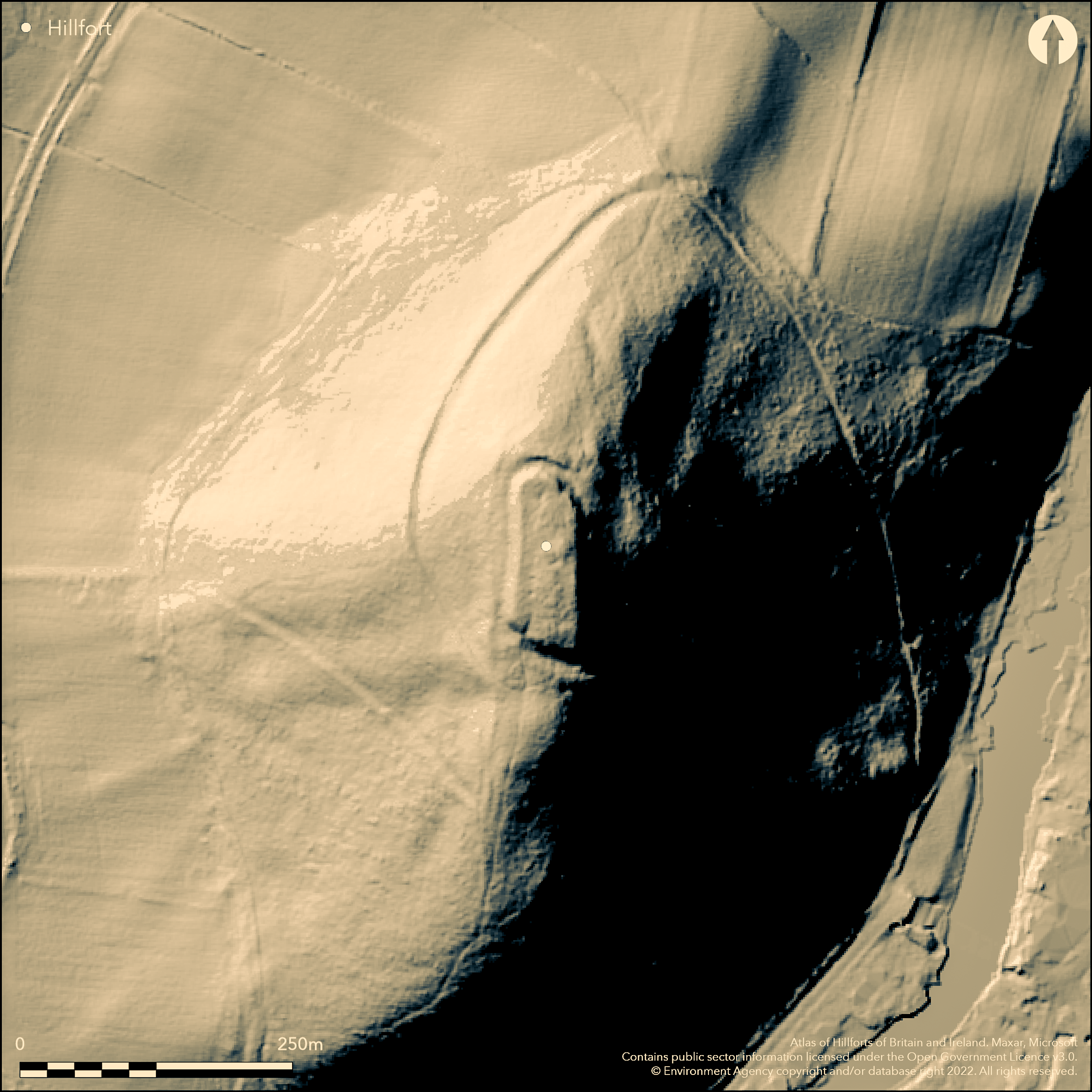
LiDAR 1m DTM Hillshade
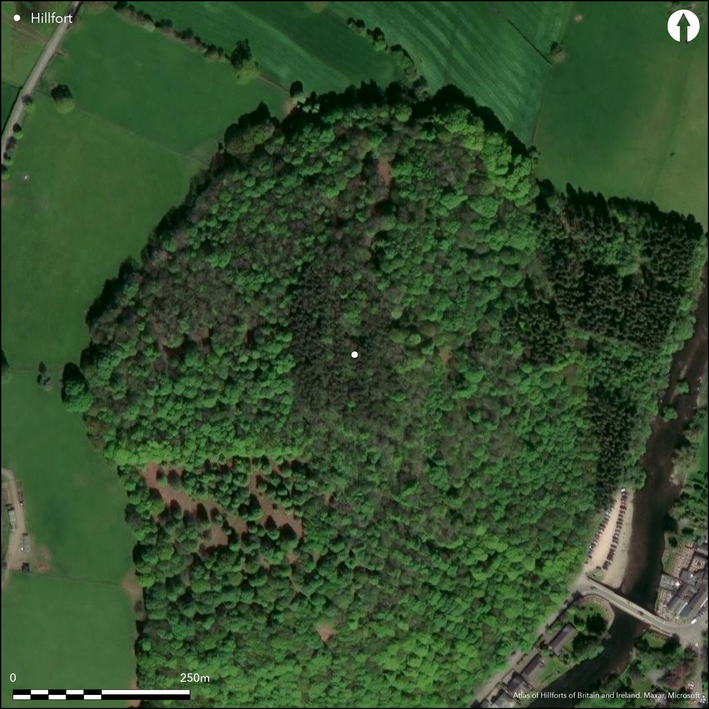
Satellite Imagery
LiDAR 1m DTM Hillshade
Satellite Imagery
Scroll left/right to view further images.
HER: Lake District National Park 1164 (None)
NMR: NY 42 SE 2 (11131)
SM: 1008264
NGR: NY 46770 24638
X: 346770 Y: 524638 (OSGB36)
Lying to the W of the River Eamont and overlooking the foot of Ullswater, a small, oval hillfort lying in woodland on the summit of Dunmallard Hill. The site is multivallate, measuring approximately 92m N-S by 39m E-W enclosing an area of a little under 0.4ha. A small earthen mound lies in the centre of the enclosed area. Univallate except in the N. The stone-revetted ramparts measure up to 9m wide and 3m high with an external ditch up to 9m wide and 1m deep. A further bank and ditch of slighter proportions lies at the northern end. Erosion has occurred in the central part of the eastern defences and they are now lost. A narrow gap in the SW corner forms the only entrance into the enclosure. The site is unexcavated and undated, possible post-Roman re-use.
Citizen Science: ✗
Reliability of Data: Confirmed
Reliability of Interpretation: Confirmed
X: -314561 Y: 7287327 (EPSG: 3857)
Longitude: -2.8257525169977584 Latitude: 54.61409340406012 (EPSG:4326)
Country: England
Current County or Unitary Authority: Cumbria
Historic County: Westmorland
Current Parish/Community/Council/Townland: Dacre
The central part of the rampart in the east has eroded downslope
| Extant | ✓ |
| Cropmark | ✗ |
| Likely Destroyed | ✗ |
None
| Woodland | ✓ |
| Commercial Forestry Plantation | ✗ |
| Parkland | ✗ |
| Pasture (Grazing) | ✗ |
| Arable | ✗ |
| Scrub/Bracken | ✗ |
| Bare Outcrop | ✗ |
| Heather/Moorland | ✗ |
| Heath | ✗ |
| Built-up | ✗ |
| Coastal Grassland | ✗ |
| Other | ✗ |
A multivallate contour fort on the summit of Dunmallard Hill at 240m OD
| Contour Fort | ✓ |
| Partial Contour Fort | ✗ |
| Promontory Fort | ✗ |
| Hillslope Fort | ✗ |
| Level Terrain Fort | ✗ |
| Marsh Fort | ✗ |
| Multiple Enclosure Fort | ✗ |
| Hilltop | ✓ |
| Coastal Promontory | ✗ |
| Inland Promontory | ✗ |
| Valley Bottom | ✗ |
| Knoll/Hillock/Outcrop | ✗ |
| Ridge | ✗ |
| Cliff/Plateau-edge/Scarp | ✗ |
| Hillslope | ✗ |
| Lowland | ✗ |
| Spur | ✗ |
Dominant Topographic Feature: Summit of Dunmallard Hill
| North | ✗ |
| Northeast | ✗ |
| East | ✗ |
| Southeast | ✗ |
| South | ✗ |
| Southwest | ✗ |
| West | ✗ |
| Northwest | ✗ |
| Level | ✓ |
Altitude: 240.0m
N/A
Undated, presumed Iron Age but Challis & Harding (1975) suggest possibly post-Roman
Reliability: D - None
| Pre 1200BC | ✗ |
| 1200BC - 800BC | ✗ |
| 800BC - 400BC | ✗ |
| 400BC - AD50 | ✗ |
| AD50 - AD400 | ✗ |
| AD400 - AD 800 | ✗ |
| Post AD800 | ✗ |
| Unknown | ✓ |
| Pre Hillfort: | None |
| Post Hillfort: | Possible post-Roman use |
On 1st Ed OS map (1885-1990). No excavation has taken place. Historically it was known as Dunmalloght (1307), Dunmallock (1329). Said to mean 'curse fort'. Institute for placename studies [www.nottingham.ac.uk/ins/index.aspx]. It was mis-identified as a Roman fort by Antiquarian Thomas West (1778). Field investigation in 1968. Scheduled
| 1st Identified Written Reference (1307): | Dunmalloght (curse fort) |
| Other (1926): | Scheduled |
| Other (1968): | Field Investigation |
| 1st Identified Map Depiction (None): | OS One-inch 1885-1900 - outline |
Uninvestigated earthen mound in the centre of the enclosed area
None
| None | ✓ |
| Spring | ✗ |
| Stream | ✗ |
| Pool | ✗ |
| Flush | ✗ |
| Well | ✗ |
| Other | ✗ |
Unidentified earthen mound
| No Known Features | ✗ |
| Round Stone Structures | ✗ |
| Rectangular Stone Structures | ✗ |
| Curvilinear Platforms | ✗ |
| Other Roundhouse Evidence | ✗ |
| Pits | ✗ |
| Quarry Hollows | ✗ |
| Other | ✓ |
None
| No Known Excavation | ✓ |
| Pits | ✗ |
| Postholes | ✗ |
| Roundhouses | ✗ |
| Rectangular Structures | ✗ |
| Roads/Tracks | ✗ |
| Quarry Hollows | ✗ |
| Other | ✗ |
| Nothing Found | ✗ |
None
| No Known Geophysics | ✓ |
| Pits | ✗ |
| Roundhouses | ✗ |
| Rectangular Structures | ✗ |
| Roads/Tracks | ✗ |
| Quarry Hollows | ✗ |
| Other | ✗ |
| Nothing Found | ✗ |
None
| No Known Finds | ✓ |
| Pottery | ✗ |
| Metal | ✗ |
| Metalworking | ✗ |
| Human Bones | ✗ |
| Animal Bones | ✗ |
| Lithics | ✗ |
| Environmental | ✗ |
| Other | ✗ |
None
| APs Not Checked | ✓ |
| None | ✗ |
| Roundhouses | ✗ |
| Rectangular Structures | ✗ |
| Pits | ✗ |
| Postholes | ✗ |
| Roads/Tracks | ✗ |
| Other | ✗ |
Narrow oblique gap in S-W corner
| None: | None |
| 2: | None |
Guard Chambers: ✗
Chevaux de Frise: ✗
| 1. Simple Gap (South west): | None |
Partly stone-revetted bank measuring up to 9m wide and 3m high and an external ditch measuring up to 9m wide and 1m deep. A second slighter bank and ditch lies in the N. Downslope erosion has occurred in the central part of the E side and the ramparts are now lost in this area.
| Area 1: | 0.4ha. |
| Total: | 0.4ha. |
Total Footprint Area: Noneha.
The enclosure is defended by a partly stone-revetted bank measuring up to 9m wide and 3m high and an external ditch measuring up to 9m wide and 1m deep. Downslope erosion has occurred in the central part of the east side and the ramparts are now lost in this area. A second bank and ditch of slighter proportions protects the northern apex of the site.
| ✗ | Slightly under 0.4ha |
| ✗ | Univallate except in the north where there is a second bank and ditch |
| NE Quadrant: | 2 |
| SE Quadrant: | 1 |
| SW Quadrant: | 1 |
| NW Quadrant: | 2 |
| Total: | 2 |
| Partial Univallate | ✓ |
| Univallate | ✗ |
| Partial Bivallate | ✓ |
| Bivallate | ✗ |
| Partial Multivallate | ✗ |
| Multivallate | ✗ |
| Unknown | ✗ |
| Partial Univallate | ✗ |
| Univallate | ✗ |
| Partial Bivallate | ✗ |
| Bivallate | ✗ |
| Partial Multivallate | ✗ |
| Multivallate | ✗ |
Traces of a dry-stone wall revetment
| None | ✗ |
| Earthen Bank | ✓ |
| Stone Wall | ✓ |
| Rubble | ✗ |
| Wall-walk | ✗ |
| Evidence of Timber | ✗ |
| Vitrification | ✗ |
| Other Burning | ✗ |
| Palisade | ✗ |
| Counter Scarp Bank | ✗ |
| Berm | ✗ |
| Unfinished | ✗ |
| Other | ✗ |
None
| None | ✗ |
| Earthen Bank | ✗ |
| Stone Wall | ✗ |
| Murus Duplex | ✗ |
| Timber-framed | ✗ |
| Timber-laced | ✗ |
| Vitrification | ✗ |
| Other Burning | ✗ |
| Palisade | ✗ |
| Counter Scarp Bank | ✗ |
| Berm | ✗ |
| Unfinished | ✗ |
| No Known Excavation | ✓ |
| Other | ✗ |
| ✗ | None |
| ✓ | Second ditch in the N |
Number of Ditches: 2
| ✗ | None |
Challis A.J. and Harding D.W. 1975. Later prehistory from the Trent to the Tyne; BAR British Series 1 (1974) - 20(i)
Wainwright, A. 1974. "Dunmallet". The Outlying Fells of Lakeland. Kendal. Westmorland Gazette. pp. 214-215.
West, T. 1778. A Guide to the Lakes. William Pennington, Kendal
Atlas of Hillforts:
Wikidata:
This work is licensed under CC BY-SA 4.0

 and should be cited as:
Lock, Gary and Ralston, Ian. 2024. Atlas of Hillforts of Britain and Ireland. Available at: https://hillforts.arch.ox.ac.uk
Document Version 1.1