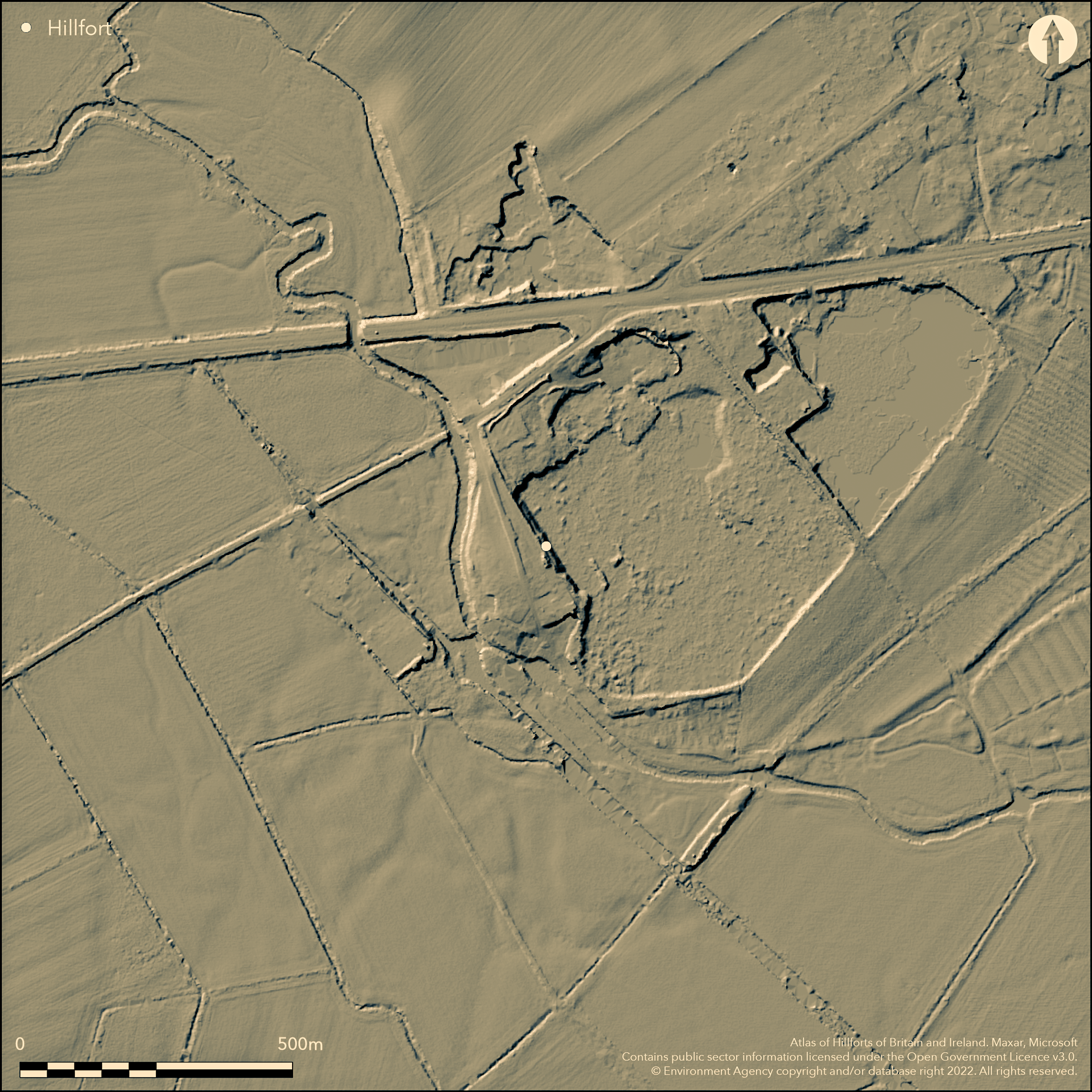
LiDAR 1m DTM Hillshade
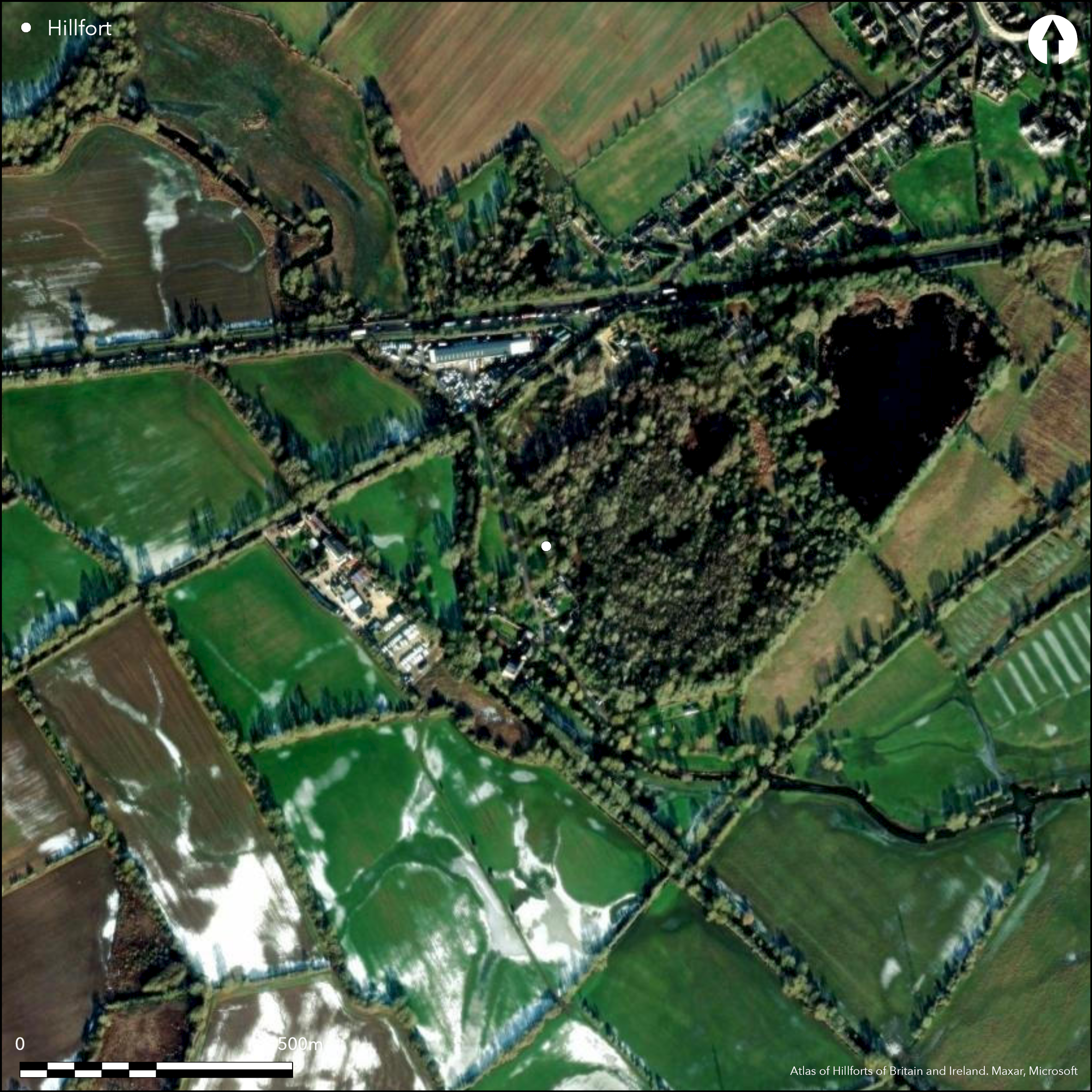
Satellite Imagery
LiDAR 1m DTM Hillshade
Satellite Imagery
Scroll left/right to view further images.
HER: Oxfordshire 15053 (MOX1064)
NMR: SP 41 SW 7 (336777)
SM: None
NGR: SP44891005
X: 444890 Y: 210050 (OSGB36)
Just S of Cassington situated on a gravel spur at the confluence of the Rivers Evenlode and Thames. Discovered by aerial photograph in 1933 at which time it was not extant, subsequently completely destroyed by gravel quarrying. A univallate roughly circular enclosure of c.5.2ha, the ditch is not visible on the W side close to the River Evenlode, not known whether it was originally a complete circuit. The aerial photographs show many features within and outside the enclosure including ring ditches. A series of small-scale excavations (Sutton 1966) have shown the ditch to be V-shaped and average 10m wide and 4m deep with a gravel bank on the inner side, original entrances are simple gaps to the NE and SE, the latter verified by excavation. Excavation at the SE entrance produced 1st century BC pottery, the site was re-used in the Romano-British period (1st to 3rd centuries AD). This may be an enclosed oppidum (Lambrick 2009, 362), there is also a suggestion that it was unfinished.
Citizen Science: ✗
Reliability of Data: Confirmed
Reliability of Interpretation: Unconfirmed
X: -150349 Y: 6761752 (EPSG: 3857)
Longitude: -1.350609384112304 Latitude: 51.78726934111524 (EPSG:4326)
Country: England
Current County or Unitary Authority: Oxfordshire
Historic County: Oxfordshire
Current Parish/Community/Council/Townland: Cassington
None
| Extant | ✗ |
| Cropmark | ✗ |
| Likely Destroyed | ✓ |
Destroyed by gravel quarrying
| Woodland | ✗ |
| Commercial Forestry Plantation | ✗ |
| Parkland | ✗ |
| Pasture (Grazing) | ✗ |
| Arable | ✗ |
| Scrub/Bracken | ✗ |
| Bare Outcrop | ✗ |
| Heather/Moorland | ✗ |
| Heath | ✗ |
| Built-up | ✗ |
| Coastal Grassland | ✗ |
| Other | ✓ |
On flat floodplain, a spur of gravel overlooking the River Evenlode at its confluence with the River Thames
| Contour Fort | ✗ |
| Partial Contour Fort | ✗ |
| Promontory Fort | ✗ |
| Hillslope Fort | ✗ |
| Level Terrain Fort | ✓ |
| Marsh Fort | ✗ |
| Multiple Enclosure Fort | ✗ |
| Hilltop | ✗ |
| Coastal Promontory | ✗ |
| Inland Promontory | ✗ |
| Valley Bottom | ✓ |
| Knoll/Hillock/Outcrop | ✗ |
| Ridge | ✗ |
| Cliff/Plateau-edge/Scarp | ✗ |
| Hillslope | ✗ |
| Lowland | ✗ |
| Spur | ✗ |
Dominant Topographic Feature: Dominates the confluence of the Rivers Evenlode and Thames
| North | ✗ |
| Northeast | ✗ |
| East | ✗ |
| Southeast | ✗ |
| South | ✗ |
| Southwest | ✗ |
| West | ✗ |
| Northwest | ✗ |
| Level | ✓ |
Altitude: 60.0m
N/A
1st century BC pottery from ditch at SE entrance
Reliability: C - Low
| Pre 1200BC | ✗ |
| 1200BC - 800BC | ✗ |
| 800BC - 400BC | ✗ |
| 400BC - AD50 | ✓ |
| AD50 - AD400 | ✓ |
| AD400 - AD 800 | ✗ |
| Post AD800 | ✗ |
| Unknown | ✗ |
| Pre Hillfort: | None |
| Post Hillfort: | None |
| Artefactual: | 1st century BC pottery from ditch at SE entrance |
Discovered by aerial photography in 1933. Several small scale excavations over a long period of time due to gravel extraction. Sections across the ditch dug but most of the excavation was of earlier or later features (see Sutton 1966)
| Other (1933): | Discovered by aerial photography |
| Excavation (None): | None |
Aerial photographs show earlier features (ring ditches) within the enclosure, perhaps some roundhouses and pits
very close to the confluence of the Rivers Evenlode and Thames
| None | ✓ |
| Spring | ✗ |
| Stream | ✗ |
| Pool | ✗ |
| Flush | ✗ |
| Well | ✗ |
| Other | ✗ |
Ploughed flat, now quarried away
| No Known Features | ✓ |
| Round Stone Structures | ✗ |
| Rectangular Stone Structures | ✗ |
| Curvilinear Platforms | ✗ |
| Other Roundhouse Evidence | ✗ |
| Pits | ✗ |
| Quarry Hollows | ✗ |
| Other | ✗ |
Limited excavation of Iron Age features, possible pits, postholes
| No Known Excavation | ✗ |
| Pits | ✓ |
| Postholes | ✓ |
| Roundhouses | ✗ |
| Rectangular Structures | ✗ |
| Roads/Tracks | ✗ |
| Quarry Hollows | ✗ |
| Other | ✗ |
| Nothing Found | ✗ |
None
| No Known Geophysics | ✓ |
| Pits | ✗ |
| Roundhouses | ✗ |
| Rectangular Structures | ✗ |
| Roads/Tracks | ✗ |
| Quarry Hollows | ✗ |
| Other | ✗ |
| Nothing Found | ✗ |
1st century BC/AD pottery
| No Known Finds | ✗ |
| Pottery | ✓ |
| Metal | ✗ |
| Metalworking | ✗ |
| Human Bones | ✗ |
| Animal Bones | ✗ |
| Lithics | ✗ |
| Environmental | ✗ |
| Other | ✗ |
Possible roundhouses and pits
| APs Not Checked | ✗ |
| None | ✗ |
| Roundhouses | ✓ |
| Rectangular Structures | ✗ |
| Pits | ✓ |
| Postholes | ✗ |
| Roads/Tracks | ✗ |
| Other | ✗ |
Two probable entrances both simple gaps, NE 5m wide on aerial photograph, SE 6.5m wide verified by excavation
| 3: | A simple gap to the S may be original, unknown |
| 2: | None |
Guard Chambers: ✗
Chevaux de Frise: ✗
| 1. Simple Gap (North east): | Simple gap, 5m wide on aerial photograph |
| 2. Simple Gap (South east): | Verified by excavation, simple gap, 6.5m wide |
Single ditch shown on aerial photograph, five sections excavated, averages 10m wide and 4m deep, V-profile, evidence of an internal rampart. Not a complete circuit, missing to the W near the river
| Area 1: | 5.3ha. |
| Total: | 5.3ha. |
Total Footprint Area: Noneha.
Single ditch shown on aerial photograph, five sections excavated, averages 10m wide and 4m deep, V-profile, evidence of an internal rampart.
| ✗ | None |
| ✗ | On aerial photograph the ditch not a complete circuit but has a section missing to the W next to the River Evenlode, this may not be original |
| NE Quadrant: | 1 |
| SE Quadrant: | 1 |
| SW Quadrant: | 1 |
| NW Quadrant: | 1 |
| Total: | 1 |
| Partial Univallate | ✗ |
| Univallate | ✓ |
| Partial Bivallate | ✗ |
| Bivallate | ✗ |
| Partial Multivallate | ✗ |
| Multivallate | ✗ |
| Unknown | ✗ |
| Partial Univallate | ✗ |
| Univallate | ✗ |
| Partial Bivallate | ✗ |
| Bivallate | ✗ |
| Partial Multivallate | ✗ |
| Multivallate | ✗ |
Heavily ploughed, now quarried away
| None | ✓ |
| Earthen Bank | ✗ |
| Stone Wall | ✗ |
| Rubble | ✗ |
| Wall-walk | ✗ |
| Evidence of Timber | ✗ |
| Vitrification | ✗ |
| Other Burning | ✗ |
| Palisade | ✗ |
| Counter Scarp Bank | ✗ |
| Berm | ✗ |
| Unfinished | ✗ |
| Other | ✗ |
Possible earthen bank
| None | ✗ |
| Earthen Bank | ✓ |
| Stone Wall | ✗ |
| Murus Duplex | ✗ |
| Timber-framed | ✗ |
| Timber-laced | ✗ |
| Vitrification | ✗ |
| Other Burning | ✗ |
| Palisade | ✗ |
| Counter Scarp Bank | ✗ |
| Berm | ✗ |
| Unfinished | ✓ |
| No Known Excavation | ✗ |
| Other | ✗ |
| ✗ | None |
| ✓ | Single ditch, V-profile, averages 10m wide and 4m deep |
Number of Ditches: 1
| ✗ | None |
Cunliffe, B. and Rowley, T. (eds) 1976. Oppida: the beginnings of urbanisation in Barbarian Europe, BAR Int Ser 11, 328.
Sutton, J.E.G. 1966. Iron-Age hill-forts and some other earthworks in Oxfordshire, Oxoniensia, 31, 28-42.
Benson, D. and Miles, D. 1974. The Upper Thames Valley, an archaeological survey of the river gravels. Oxford: OAU Survey 2, 84-87.
Lambrick, G. 2009. Thames Through Time. The archaeology of the gravel terraces of the upper and middle Thames. Late prehistory 1500 BC - AD 50. Oxford: Oxford Archaeology, Thames Valley Landscapes Monograph No. 29.
Atlas of Hillforts:
Wikidata:
This work is licensed under CC BY-SA 4.0

 and should be cited as:
Lock, Gary and Ralston, Ian. 2024. Atlas of Hillforts of Britain and Ireland. Available at: https://hillforts.arch.ox.ac.uk
Document Version 1.1