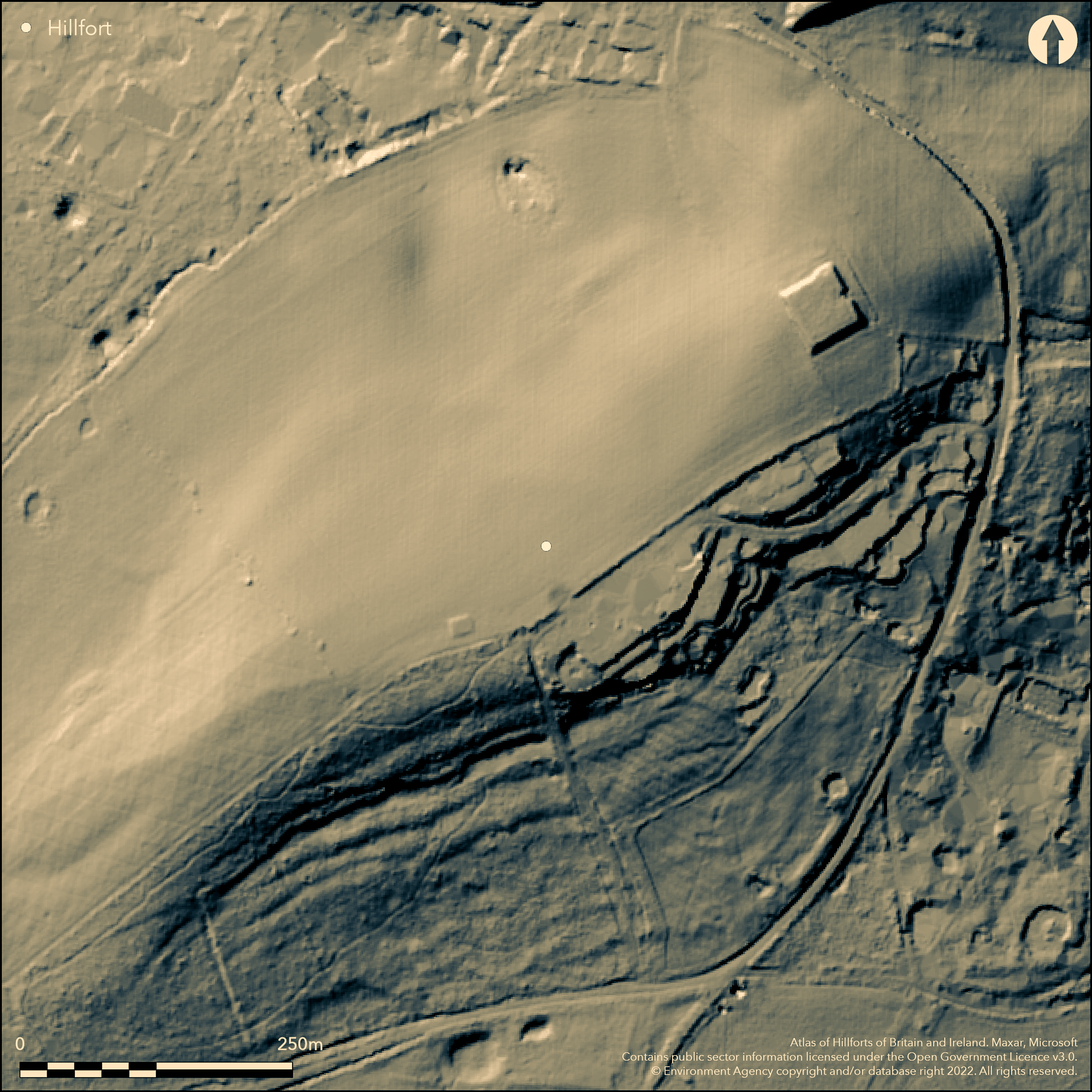
LiDAR 1m DTM Hillshade
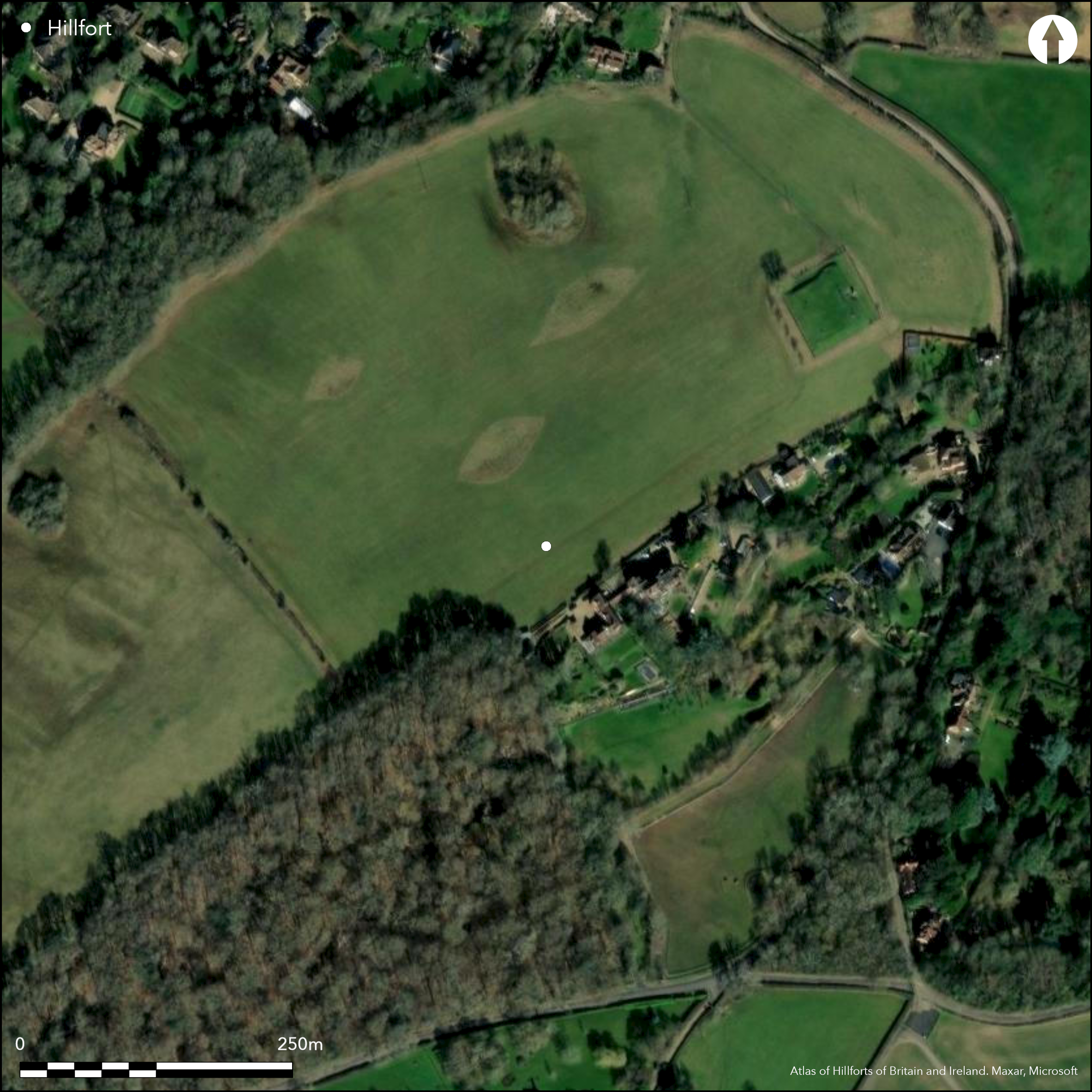
Satellite Imagery
LiDAR 1m DTM Hillshade
Satellite Imagery
Scroll left/right to view further images.
HER: Berkshire RW15748 (None)
NMR: None (None)
SM: None
NGR: SU 8680 8430
X: 486803 Y: 184330 (OSGB36)
A suggested hillfort on Mount Hill to the SE of Cookham. Now much destroyed although Darby (1909) records possible ramparts as two terraces which extend for a considerable distance into the wooded portion of the hill on the W. It is also suggested that Spring Lane to the E of the hill runs in the ditch between the banks. In the spring of 1907 when levelling the ground above the upper terrace, a possible Early Iron Age settlement was found. Two separate circles where the clay was black from intermingled charcoal and on and around them a number of fragments of very coarse pottery, including a decorated fragment from the neck of a jar suggest possible hut circles. A spindle whorl was also found. The pottery was dated to the Early Iron Age by Peake (1931). Over and Tyrell (1994) refer to this as a small Iron Age enclosure. Cookham Dean was spelt COC-DUN in 1220 and was the British COG-DUN 'our ancestors fort'. More recent excavation (Ford 1993) shows the terraces to be 20th century although lithics and prehistoric pottery were found. Terracing shown on OS 1:25,000 map (1937-61).
Citizen Science: ✗
Reliability of Data: Unconfirmed
Reliability of Interpretation: Unconfirmed
X: -83430 Y: 6719369 (EPSG: 3857)
Longitude: -0.7494632818158973 Latitude: 51.55114072493798 (EPSG:4326)
Country: England
Current County or Unitary Authority: Berkshire
Historic County: Berkshire
Current Parish/Community/Council/Townland: Cookham
None
| Extant | ✗ |
| Cropmark | ✗ |
| Likely Destroyed | ✓ |
None
| Woodland | ✓ |
| Commercial Forestry Plantation | ✗ |
| Parkland | ✗ |
| Pasture (Grazing) | ✓ |
| Arable | ✗ |
| Scrub/Bracken | ✗ |
| Bare Outcrop | ✗ |
| Heather/Moorland | ✗ |
| Heath | ✗ |
| Built-up | ✓ |
| Coastal Grassland | ✗ |
| Other | ✗ |
Possible contour fort lying on a high spur at 90m OD
| Contour Fort | ✓ |
| Partial Contour Fort | ✗ |
| Promontory Fort | ✗ |
| Hillslope Fort | ✗ |
| Level Terrain Fort | ✗ |
| Marsh Fort | ✗ |
| Multiple Enclosure Fort | ✗ |
| Hilltop | ✗ |
| Coastal Promontory | ✗ |
| Inland Promontory | ✗ |
| Valley Bottom | ✗ |
| Knoll/Hillock/Outcrop | ✗ |
| Ridge | ✗ |
| Cliff/Plateau-edge/Scarp | ✗ |
| Hillslope | ✗ |
| Lowland | ✗ |
| Spur | ✓ |
Dominant Topographic Feature: Spur
| North | ✗ |
| Northeast | ✗ |
| East | ✗ |
| Southeast | ✗ |
| South | ✗ |
| Southwest | ✗ |
| West | ✗ |
| Northwest | ✗ |
| Level | ✓ |
Altitude: 91.0m
N/A
Early Iron Age based on excavated pottery
Reliability: B - Medium
| Pre 1200BC | ✗ |
| 1200BC - 800BC | ✗ |
| 800BC - 400BC | ✓ |
| 400BC - AD50 | ✗ |
| AD50 - AD400 | ✗ |
| AD400 - AD 800 | ✗ |
| Post AD800 | ✗ |
| Unknown | ✗ |
| Pre Hillfort: | None |
| Post Hillfort: | None |
| Artefactual: | None |
On OS 1:25,000 map (1937-61). Excavation 1907 (Darby 1909; Peake 1931) and 1993 (TVAS).
| Excavation (1907): | None |
| Excavation (1993): | None |
| 1st Identified Map Depiction (None): | None |
Two possible round houses shown by excavation plus pottery and lithics.
None
| None | ✓ |
| Spring | ✗ |
| Stream | ✗ |
| Pool | ✗ |
| Flush | ✗ |
| Well | ✗ |
| Other | ✗ |
None
| No Known Features | ✓ |
| Round Stone Structures | ✗ |
| Rectangular Stone Structures | ✗ |
| Curvilinear Platforms | ✗ |
| Other Roundhouse Evidence | ✗ |
| Pits | ✗ |
| Quarry Hollows | ✗ |
| Other | ✗ |
None
| No Known Excavation | ✗ |
| Pits | ✗ |
| Postholes | ✗ |
| Roundhouses | ✓ |
| Rectangular Structures | ✗ |
| Roads/Tracks | ✗ |
| Quarry Hollows | ✗ |
| Other | ✗ |
| Nothing Found | ✗ |
None
| No Known Geophysics | ✓ |
| Pits | ✗ |
| Roundhouses | ✗ |
| Rectangular Structures | ✗ |
| Roads/Tracks | ✗ |
| Quarry Hollows | ✗ |
| Other | ✗ |
| Nothing Found | ✗ |
None
| No Known Finds | ✗ |
| Pottery | ✓ |
| Metal | ✗ |
| Metalworking | ✗ |
| Human Bones | ✗ |
| Animal Bones | ✗ |
| Lithics | ✓ |
| Environmental | ✗ |
| Other | ✗ |
None
| APs Not Checked | ✓ |
| None | ✗ |
| Roundhouses | ✗ |
| Rectangular Structures | ✗ |
| Pits | ✗ |
| Postholes | ✗ |
| Roads/Tracks | ✗ |
| Other | ✗ |
No evidence for entrances
| 0: | None |
| 2: | None |
Guard Chambers: ✗
Chevaux de Frise: ✗
Two possible ramparts/terraces on the E of the hill, suggested that Spring Lane runs in the ditch between them.
| Area 1: | Noneha. |
| Total: | Noneha. |
Total Footprint Area: Noneha.
None
| ✗ | Area unknown |
| ✗ | None |
| NE Quadrant: | None |
| SE Quadrant: | None |
| SW Quadrant: | None |
| NW Quadrant: | None |
| Total: | None |
| Partial Univallate | ✗ |
| Univallate | ✗ |
| Partial Bivallate | ✗ |
| Bivallate | ✗ |
| Partial Multivallate | ✗ |
| Multivallate | ✗ |
| Unknown | ✓ |
| Partial Univallate | ✗ |
| Univallate | ✗ |
| Partial Bivallate | ✗ |
| Bivallate | ✗ |
| Partial Multivallate | ✗ |
| Multivallate | ✗ |
None
| None | ✓ |
| Earthen Bank | ✗ |
| Stone Wall | ✗ |
| Rubble | ✗ |
| Wall-walk | ✗ |
| Evidence of Timber | ✗ |
| Vitrification | ✗ |
| Other Burning | ✗ |
| Palisade | ✗ |
| Counter Scarp Bank | ✗ |
| Berm | ✗ |
| Unfinished | ✗ |
| Other | ✗ |
Excavated terraces shown to be 20th century
| None | ✗ |
| Earthen Bank | ✗ |
| Stone Wall | ✗ |
| Murus Duplex | ✗ |
| Timber-framed | ✗ |
| Timber-laced | ✗ |
| Vitrification | ✗ |
| Other Burning | ✗ |
| Palisade | ✗ |
| Counter Scarp Bank | ✗ |
| Berm | ✗ |
| Unfinished | ✗ |
| No Known Excavation | ✗ |
| Other | ✓ |
| ✗ | None |
| ✗ | Unconfirmed report that Spring Lane to the E of the hill runs in the enclosure ditch between the banks. |
Number of Ditches: None
| ✗ | None |
Darby S. 1909. Chapters in the History of Cookham, 21-22.
Ford, S. 1993, Harwood House Nursing Home, Cookham Dean, Berkshire - An archaeological evaluation for Harwood House Nursing Home. Thames Valley Archaeological Services, Report 93/2. https://www.tvas.co.uk/reports/pdf/93-02ev.pdf. Accessed November 2015
Over L and Tyrrell C. 1994. The Royal Hundred of Cookham, 22.
Peake, H. 1931. The Archaeology of Berkshire, 66 and 190.
Atlas of Hillforts:
Wikidata:
This work is licensed under CC BY-SA 4.0

 and should be cited as:
Lock, Gary and Ralston, Ian. 2024. Atlas of Hillforts of Britain and Ireland. Available at: https://hillforts.arch.ox.ac.uk
Document Version 1.1