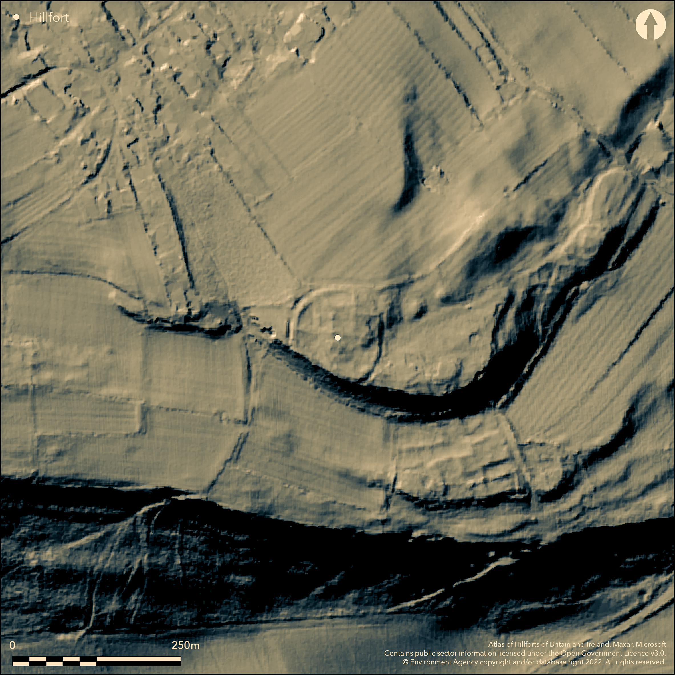
LiDAR 1m DTM Hillshade
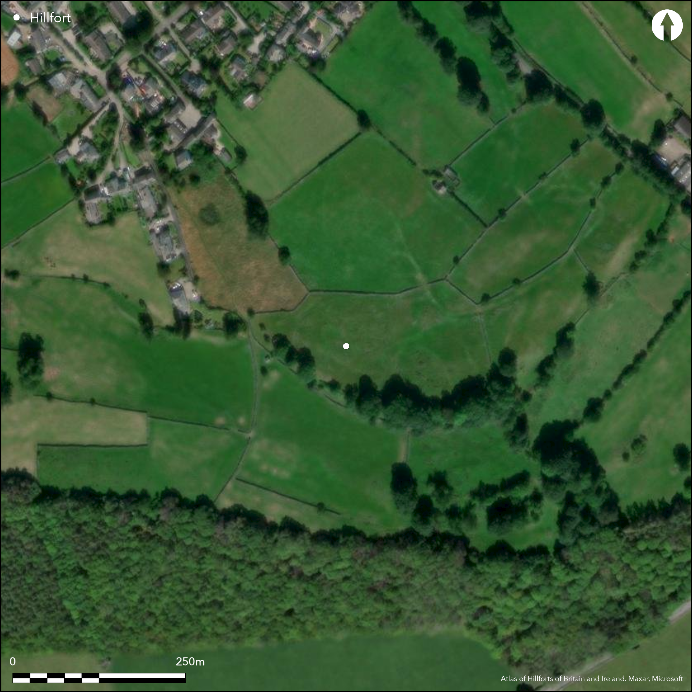
Satellite Imagery
LiDAR 1m DTM Hillshade
Satellite Imagery
Scroll left/right to view further images.
HER: Cumbria 1163 (None)
NMR: NY 42 NE 12 (11102)
SM: None
NGR: NY 48470 27500
X: 348470 Y: 527500 (OSGB36)
Lying to the S of Stainton, and overlooking Evening Bank Wood, a sub-circular enclosure, most probably a hillfort, but now almost destroyed. The enclosure is approximately 61m across with a single bank and ditch. It lies in a defensive position and utilises a precipitous natural slope on its southern side. The enclosure ditch was infilled in the past by a farmer and now almost level and part of the interior has been quarried, making it difficult to distinguish between the hillfort and quarrying activities. There is a local account of stirrups and buckles being found during the filling in of the ditch. There is no known historical account of the hillfort or record of the finds, and today the hillfort is mutilated and almost destroyed. Recorded on 1968-69 1:2,500 OS mapping.
Citizen Science: ✗
Reliability of Data: Unconfirmed
Reliability of Interpretation: Unconfirmed
X: -311687 Y: 7292306 (EPSG: 3857)
Longitude: -2.7999363092562253 Latitude: 54.639988038797206 (EPSG:4326)
Country: England
Current County or Unitary Authority: Cumbria
Historic County: Westmorland
Current Parish/Community/Council/Townland: Dacre
Almost destroyed, banks visible on aerial photographs
| Extant | ✗ |
| Cropmark | ✓ |
| Likely Destroyed | ✓ |
Quarried in the past, now appears to be under pasture, with some possible scrub (GoogleEarth)
| Woodland | ✗ |
| Commercial Forestry Plantation | ✗ |
| Parkland | ✗ |
| Pasture (Grazing) | ✓ |
| Arable | ✗ |
| Scrub/Bracken | ✓ |
| Bare Outcrop | ✗ |
| Heather/Moorland | ✗ |
| Heath | ✗ |
| Built-up | ✗ |
| Coastal Grassland | ✗ |
| Other | ✗ |
Probable contour fort at approximately 192m OD, now almost destroyed.
| Contour Fort | ✓ |
| Partial Contour Fort | ✗ |
| Promontory Fort | ✗ |
| Hillslope Fort | ✗ |
| Level Terrain Fort | ✗ |
| Marsh Fort | ✗ |
| Multiple Enclosure Fort | ✗ |
| Hilltop | ✓ |
| Coastal Promontory | ✗ |
| Inland Promontory | ✗ |
| Valley Bottom | ✗ |
| Knoll/Hillock/Outcrop | ✗ |
| Ridge | ✗ |
| Cliff/Plateau-edge/Scarp | ✓ |
| Hillslope | ✗ |
| Lowland | ✗ |
| Spur | ✗ |
Dominant Topographic Feature: Destroyed
| North | ✗ |
| Northeast | ✗ |
| East | ✗ |
| Southeast | ✗ |
| South | ✗ |
| Southwest | ✗ |
| West | ✗ |
| Northwest | ✗ |
| Level | ✓ |
Altitude: 192.0m
N/A
Undated, presumed Iron Age
Reliability: D - None
| Pre 1200BC | ✗ |
| 1200BC - 800BC | ✗ |
| 800BC - 400BC | ✗ |
| 400BC - AD50 | ✗ |
| AD50 - AD400 | ✗ |
| AD400 - AD 800 | ✗ |
| Post AD800 | ✗ |
| Unknown | ✓ |
| Pre Hillfort: | None recorded |
| Post Hillfort: | 1818-1903 OS map shows trig point in vicinity at 631ft (192m). Unrecorded on later maps. The reported stirrups and buckles (W Gill, Stainton, Penrith; HER ref Object Name Book 1923,11(Gill)) could potentially be of a later date. |
Recorded on 1968-69 1:2,500 OS mapping. Field investigation in 1966.1923, Recorded by Ordnance Survey Archaeology Division in 1923, Object Name Book reference 11.
| 1st Identified Written Reference (1923): | OS Object Name Book |
| Other (1966): | Field investigation |
| 1st Identified Map Depiction (None): | None |
No evidence as the interior has been disturbed by quarrying. Surface finds of stirrups and buckles reported by W. Gill of Stainton, but undated.
Overlooks the River Eamont
| None | ✓ |
| Spring | ✗ |
| Stream | ✗ |
| Pool | ✗ |
| Flush | ✗ |
| Well | ✗ |
| Other | ✗ |
None
| No Known Features | ✓ |
| Round Stone Structures | ✗ |
| Rectangular Stone Structures | ✗ |
| Curvilinear Platforms | ✗ |
| Other Roundhouse Evidence | ✗ |
| Pits | ✗ |
| Quarry Hollows | ✗ |
| Other | ✗ |
None
| No Known Excavation | ✓ |
| Pits | ✗ |
| Postholes | ✗ |
| Roundhouses | ✗ |
| Rectangular Structures | ✗ |
| Roads/Tracks | ✗ |
| Quarry Hollows | ✗ |
| Other | ✗ |
| Nothing Found | ✗ |
None
| No Known Geophysics | ✓ |
| Pits | ✗ |
| Roundhouses | ✗ |
| Rectangular Structures | ✗ |
| Roads/Tracks | ✗ |
| Quarry Hollows | ✗ |
| Other | ✗ |
| Nothing Found | ✗ |
Stirrups and buckles reported by W. Gill of Stainton, but undated.
| No Known Finds | ✗ |
| Pottery | ✗ |
| Metal | ✓ |
| Metalworking | ✗ |
| Human Bones | ✗ |
| Animal Bones | ✗ |
| Lithics | ✗ |
| Environmental | ✗ |
| Other | ✗ |
None
| APs Not Checked | ✗ |
| None | ✓ |
| Roundhouses | ✗ |
| Rectangular Structures | ✗ |
| Pits | ✗ |
| Postholes | ✗ |
| Roads/Tracks | ✗ |
| Other | ✗ |
No evidence
| None: | Unknown |
| 2: | None |
Guard Chambers: ✗
Chevaux de Frise: ✗
The single sub-circular outer bank and ditch approximately 61m across, visible on Cumbria County Council aerial photographs. It utilises a precipitous natural slope on its southern side. The enclosure ditch is infilled and now almost level.
| Area 1: | 0.3ha. |
| Total: | 0.3ha. |
Total Footprint Area: Noneha.
None
| ✗ | Enclosed area is approximate |
| ✗ | Utilises natural slope in the S |
| NE Quadrant: | 1 |
| SE Quadrant: | None |
| SW Quadrant: | None |
| NW Quadrant: | 1 |
| Total: | 1 |
| Partial Univallate | ✓ |
| Univallate | ✗ |
| Partial Bivallate | ✗ |
| Bivallate | ✗ |
| Partial Multivallate | ✗ |
| Multivallate | ✗ |
| Unknown | ✗ |
| Partial Univallate | ✗ |
| Univallate | ✗ |
| Partial Bivallate | ✗ |
| Bivallate | ✗ |
| Partial Multivallate | ✗ |
| Multivallate | ✗ |
Destroyed
| None | ✓ |
| Earthen Bank | ✗ |
| Stone Wall | ✗ |
| Rubble | ✗ |
| Wall-walk | ✗ |
| Evidence of Timber | ✗ |
| Vitrification | ✗ |
| Other Burning | ✗ |
| Palisade | ✗ |
| Counter Scarp Bank | ✗ |
| Berm | ✗ |
| Unfinished | ✗ |
| Other | ✗ |
None
| None | ✗ |
| Earthen Bank | ✗ |
| Stone Wall | ✗ |
| Murus Duplex | ✗ |
| Timber-framed | ✗ |
| Timber-laced | ✗ |
| Vitrification | ✗ |
| Other Burning | ✗ |
| Palisade | ✗ |
| Counter Scarp Bank | ✗ |
| Berm | ✗ |
| Unfinished | ✗ |
| No Known Excavation | ✓ |
| Other | ✗ |
| ✗ | None |
| ✓ | Single ditch, now infilled |
Number of Ditches: 1
| ✗ | None |
Challis A.J. and Harding D.W. 1975. Later prehistory from the Trent to the Tyne; BAR British series 1 (1974) - 20(i), 46
Higham, N,J. and Jones G D B 1975. Frontiers Forts and Farmers. Archaeol J . 32, 36
Hogg, A.H.A. 1979. British Hill-Forts. An Index. British Archaeological Reports, British Series 62.
Atlas of Hillforts:
Wikidata:
This work is licensed under CC BY-SA 4.0

 and should be cited as:
Lock, Gary and Ralston, Ian. 2024. Atlas of Hillforts of Britain and Ireland. Available at: https://hillforts.arch.ox.ac.uk
Document Version 1.1