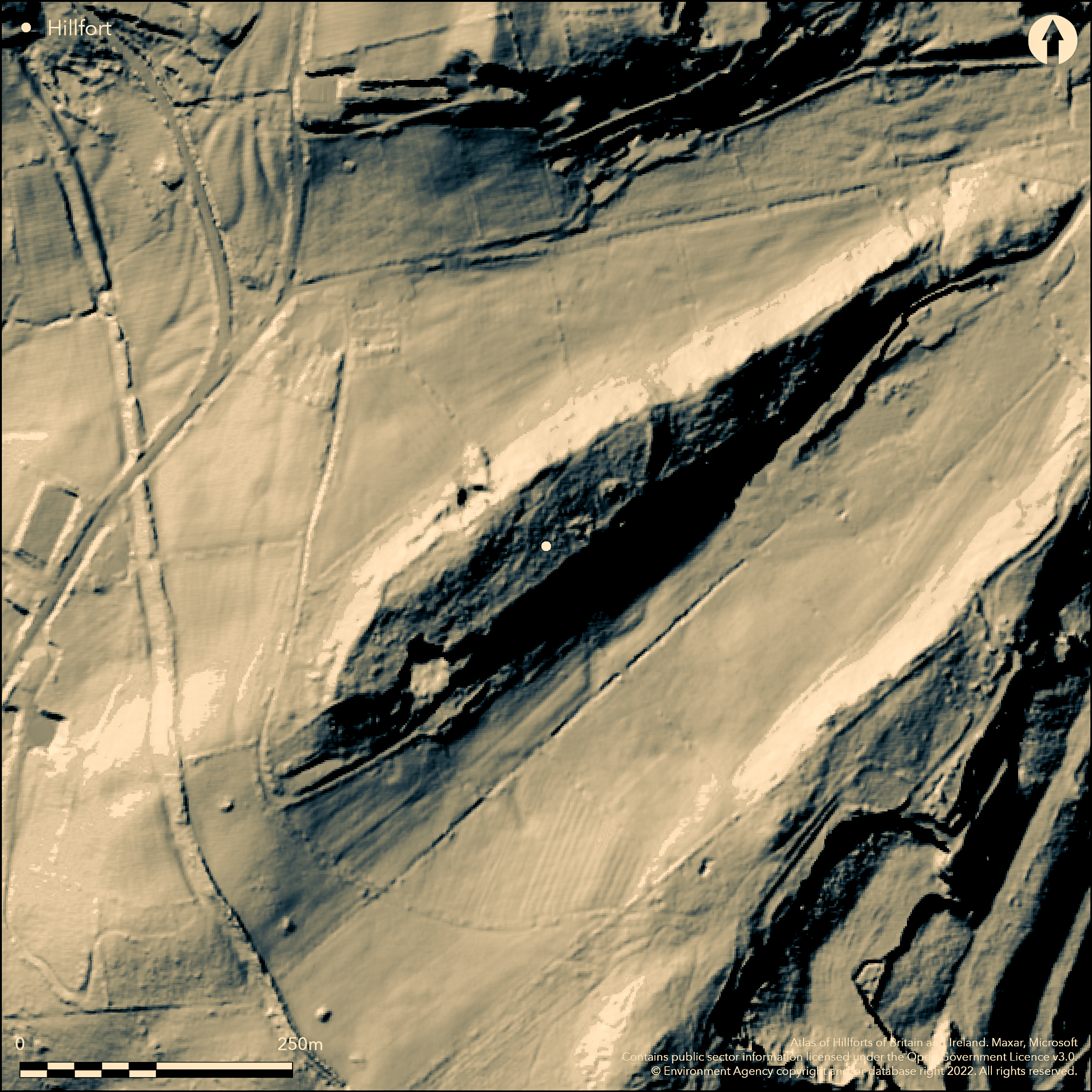
LiDAR 1m DTM Hillshade
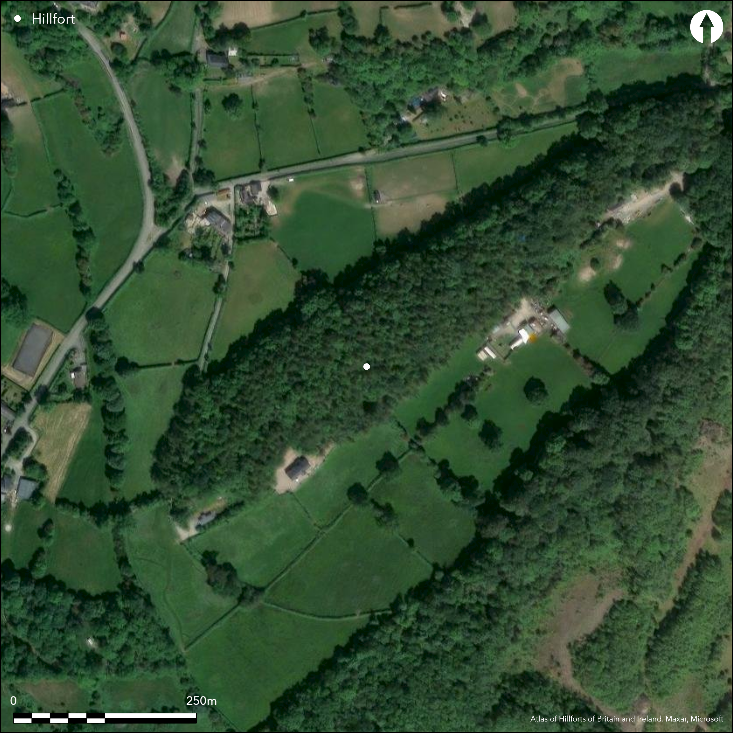
Satellite Imagery
LiDAR 1m DTM Hillshade
Satellite Imagery
Scroll left/right to view further images.
HER: Shropshire 1563 (None)
NMR: SJ 22 SE 1 (65999)
SM: None
NGR: SJ260246
X: 326093 Y: 324630 (OSGB36)
Possible, univallate, hillslope fort located on a narrow, NE-SW aligned, wooded ridge on Whitehaven hill, above the River Tanat. Internally the ground slopes gently from NW-SE. Area not defined. There are steep slopes to the NW and SE. A bank c. 3m high to the NE is the only substantial remains visible, there being none on the SW side. Traces of dry-stone walling to the interior of the bank may be a modern boundary. A terrace on the SE side has been suggested as an entrance ramp, but this is unclear. The dense vegetation mitigates against any determination of interior features, but inside the W corner there are indications of some, but it is not clear what they are. Rhodondendron and raspberry here suggest that these are modern features. Two small quarries cut into the S corner and NW side. Undated.
Citizen Science: ✗
Reliability of Data: Unconfirmed
Reliability of Interpretation: Unconfirmed
X: -344871 Y: 6948686 (EPSG: 3857)
Longitude: -3.098030896857461 Latitude: 52.814105359775056 (EPSG:4326)
Country: England
Current County or Unitary Authority: Shropshire
Historic County: Shropshire
Current Parish/Community/Council/Townland: Oswestry Rural
Only remains of the NE bank are visible. Two small quarries cut into the S corner and NW side.
| Extant | ✓ |
| Cropmark | ✗ |
| Likely Destroyed | ✗ |
Dense tree and scrub mitigates against any determination of interior features, but inside W corner indications of some, but not clear what they are. Rhodondendron and raspberry here suggest modern features. Tree uprooting damage to NE bank in past.
| Woodland | ✓ |
| Commercial Forestry Plantation | ✗ |
| Parkland | ✗ |
| Pasture (Grazing) | ✗ |
| Arable | ✗ |
| Scrub/Bracken | ✓ |
| Bare Outcrop | ✗ |
| Heather/Moorland | ✗ |
| Heath | ✗ |
| Built-up | ✗ |
| Coastal Grassland | ✗ |
| Other | ✗ |
Possible univallate hillslope fort located on a narrow, NE-SW aligned, wooded ridge on Whitehaven hill, above the River Tanat. Internally the ground slopes gently from NW-SE. Steep slopes to the NW and SE.
| Contour Fort | ✗ |
| Partial Contour Fort | ✗ |
| Promontory Fort | ✗ |
| Hillslope Fort | ✓ |
| Level Terrain Fort | ✗ |
| Marsh Fort | ✗ |
| Multiple Enclosure Fort | ✗ |
| Hilltop | ✗ |
| Coastal Promontory | ✗ |
| Inland Promontory | ✗ |
| Valley Bottom | ✗ |
| Knoll/Hillock/Outcrop | ✗ |
| Ridge | ✓ |
| Cliff/Plateau-edge/Scarp | ✗ |
| Hillslope | ✗ |
| Lowland | ✗ |
| Spur | ✗ |
Dominant Topographic Feature: Narrow, NE-SW aligned, ridge on Whitehaven hill.
| North | ✗ |
| Northeast | ✗ |
| East | ✗ |
| Southeast | ✗ |
| South | ✗ |
| Southwest | ✓ |
| West | ✗ |
| Northwest | ✗ |
| Level | ✗ |
Altitude: 220.0m
N/A
None
Reliability: D - None
| Pre 1200BC | ✗ |
| 1200BC - 800BC | ✗ |
| 800BC - 400BC | ✗ |
| 400BC - AD50 | ✗ |
| AD50 - AD400 | ✗ |
| AD400 - AD 800 | ✗ |
| Post AD800 | ✗ |
| Unknown | ✓ |
| Pre Hillfort: | None |
| Post Hillfort: | None |
Field observation Ordnance Survey 1972. Field observation Shropshire CC 1981.
| Other (1972): | Field observation OS. |
| Other (1981): | Field observation Shropshire CC. |
None
None visible.
| None | ✓ |
| Spring | ✗ |
| Stream | ✗ |
| Pool | ✗ |
| Flush | ✗ |
| Well | ✗ |
| Other | ✗ |
The dense vegetation mitigates against investigation of interior features. Inside the W corner there is are indications of features, but it is not clear what they are. Rhodondendron and raspberry here suggest that these may be modern. Two small, probably modern, quarries cut into the S corner and NW side.
| No Known Features | ✗ |
| Round Stone Structures | ✗ |
| Rectangular Stone Structures | ✗ |
| Curvilinear Platforms | ✗ |
| Other Roundhouse Evidence | ✗ |
| Pits | ✗ |
| Quarry Hollows | ✗ |
| Other | ✓ |
None
| No Known Excavation | ✓ |
| Pits | ✗ |
| Postholes | ✗ |
| Roundhouses | ✗ |
| Rectangular Structures | ✗ |
| Roads/Tracks | ✗ |
| Quarry Hollows | ✗ |
| Other | ✗ |
| Nothing Found | ✗ |
None
| No Known Geophysics | ✓ |
| Pits | ✗ |
| Roundhouses | ✗ |
| Rectangular Structures | ✗ |
| Roads/Tracks | ✗ |
| Quarry Hollows | ✗ |
| Other | ✗ |
| Nothing Found | ✗ |
None
| No Known Finds | ✓ |
| Pottery | ✗ |
| Metal | ✗ |
| Metalworking | ✗ |
| Human Bones | ✗ |
| Animal Bones | ✗ |
| Lithics | ✗ |
| Environmental | ✗ |
| Other | ✗ |
None
| APs Not Checked | ✓ |
| None | ✗ |
| Roundhouses | ✗ |
| Rectangular Structures | ✗ |
| Pits | ✗ |
| Postholes | ✗ |
| Roads/Tracks | ✗ |
| Other | ✗ |
A terrace on the SE side has been suggested as an entrance ramp, but this is unclear, and the dense vegetation mitigates against further investigation.
| 1: | The dense vegetation mitigates against investigation. |
| 2: | Possible entrance to the SE. |
Guard Chambers: ✗
Chevaux de Frise: ✗
| 1. Simple Gap (None): | A terrace on the SE side has been suggested as an entrance ramp, but this is unclear. Simple gap default. |
A bank c. 3m high to the NE is the only substantial remains visible, there being none on the SW side. Traces of dry-stone walling to the interior of the bank may be a modern boundary.
| Area 1: | Noneha. |
| Total: | Noneha. |
Total Footprint Area: Noneha.
None
| ✗ | The area of the site has not been determined. |
| ✗ | Only the NE bank is visible. |
| NE Quadrant: | 1 |
| SE Quadrant: | 0 |
| SW Quadrant: | 0 |
| NW Quadrant: | 0 |
| Total: | 1 |
| Partial Univallate | ✓ |
| Univallate | ✗ |
| Partial Bivallate | ✗ |
| Bivallate | ✗ |
| Partial Multivallate | ✗ |
| Multivallate | ✗ |
| Unknown | ✗ |
| Partial Univallate | ✗ |
| Univallate | ✗ |
| Partial Bivallate | ✗ |
| Bivallate | ✗ |
| Partial Multivallate | ✗ |
| Multivallate | ✗ |
Traces of dry-stone walling to the interior of the bank may be a modern boundary.
| None | ✗ |
| Earthen Bank | ✓ |
| Stone Wall | ✗ |
| Rubble | ✗ |
| Wall-walk | ✗ |
| Evidence of Timber | ✗ |
| Vitrification | ✗ |
| Other Burning | ✗ |
| Palisade | ✗ |
| Counter Scarp Bank | ✗ |
| Berm | ✗ |
| Unfinished | ✗ |
| Other | ✗ |
None
| None | ✗ |
| Earthen Bank | ✗ |
| Stone Wall | ✗ |
| Murus Duplex | ✗ |
| Timber-framed | ✗ |
| Timber-laced | ✗ |
| Vitrification | ✗ |
| Other Burning | ✗ |
| Palisade | ✗ |
| Counter Scarp Bank | ✗ |
| Berm | ✗ |
| Unfinished | ✗ |
| No Known Excavation | ✓ |
| Other | ✗ |
| ✗ | None |
| ✗ | None |
Number of Ditches: 0
| ✗ | None |
No related records
Atlas of Hillforts:
Wikidata:
This work is licensed under CC BY-SA 4.0

 and should be cited as:
Lock, Gary and Ralston, Ian. 2024. Atlas of Hillforts of Britain and Ireland. Available at: https://hillforts.arch.ox.ac.uk
Document Version 1.1