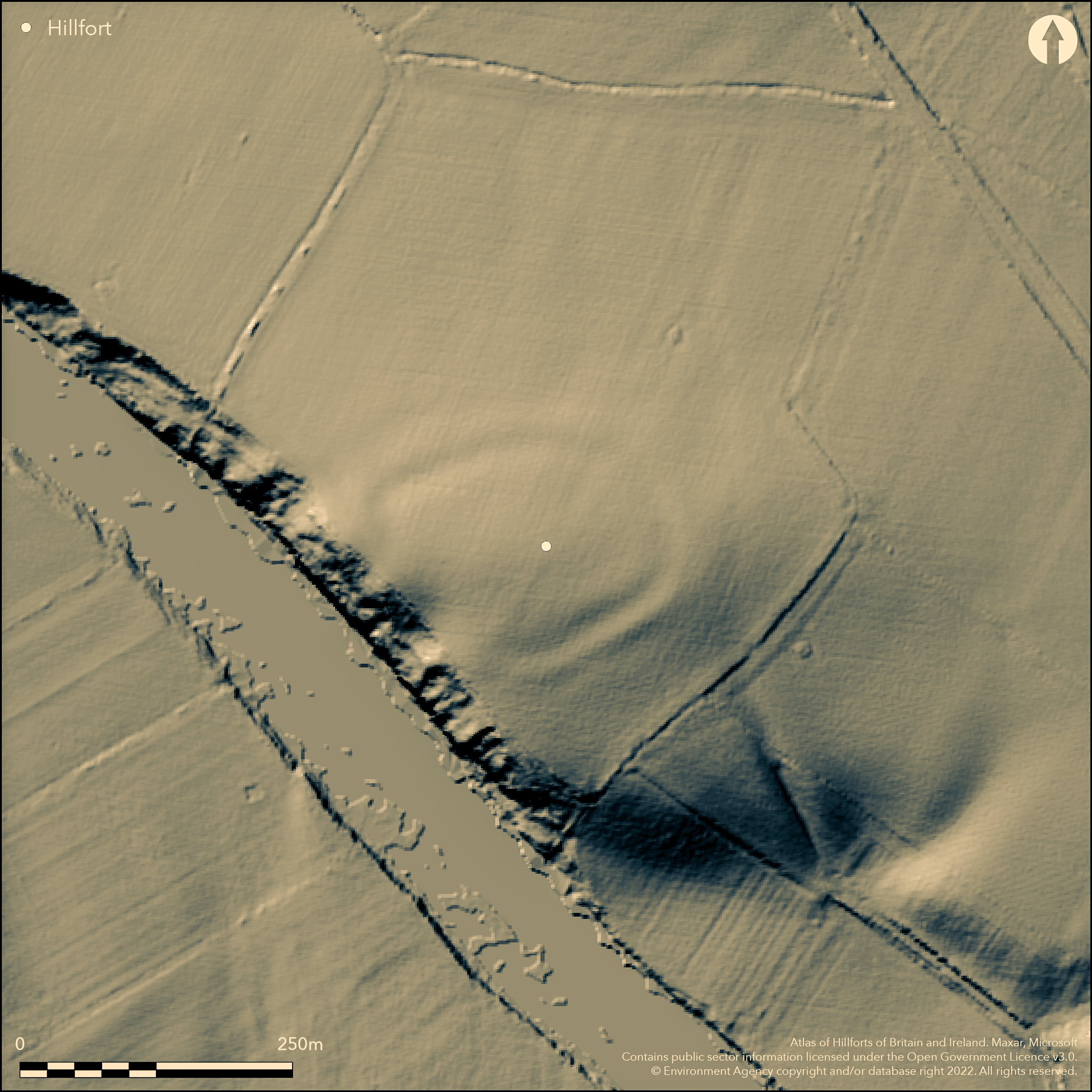
LiDAR 1m DTM Hillshade
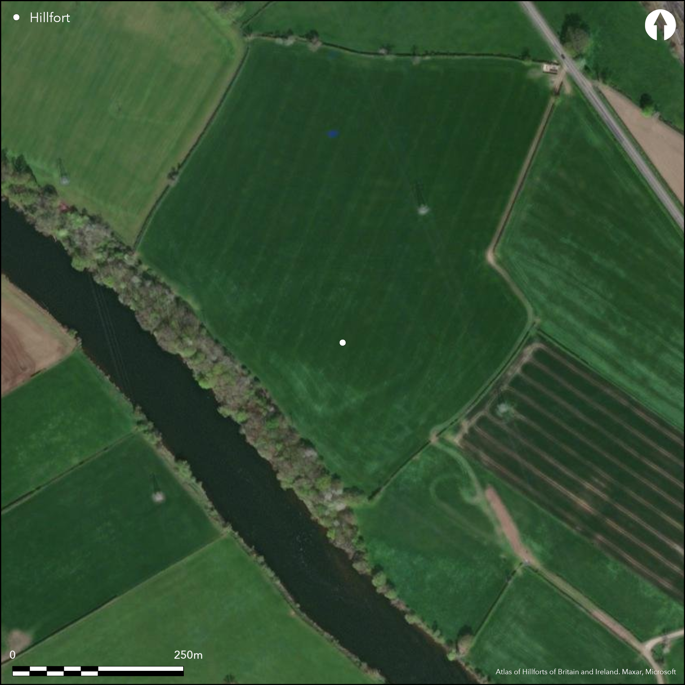
Satellite Imagery
LiDAR 1m DTM Hillshade
Satellite Imagery
Scroll left/right to view further images.
HER: Cumbria 399 (None)
NMR: NY 35 NE 6 (10572)
SM: None
NGR: NY 3756 5849
X: 337562 Y: 558490 (OSGB36)
To the W of Kingmoor, a multivallate D-shaped enclosure 170m by 150m enclosing an area of approximately 1ha. It occupies an elevated position on the E bank of the River Eden, giving views over the surrounding area and comprises at least one bank and two ditches with a more complex ditch system in the N and E, on a steep cliff edge to the W. An entrance lies in the SW which is approached by a track leading to the River Eden. It is now largely plough-levelled and survives only as a cropmark. The site is undated but is shown on the 1816 OS mapping as the alleged camp of Prince Charles in 1745 (Collingwood 1923, 232). It is unlikely to have been constructed at that time but was possibly used as a camp by his Army. Recorded on 1885-1903 1st edition OS mapping.
Citizen Science: ✗
Reliability of Data: Confirmed
Reliability of Interpretation: Unconfirmed
X: -331243 Y: 7345815 (EPSG: 3857)
Longitude: -2.9756021424418284 Latitude: 54.9172108640504 (EPSG:4326)
Country: England; None
Current County or Unitary Authority: Cumbria
Historic County: Cumberland
Current Parish/Community/Council/Townland: Kingmoor; Beaumont
None
| Extant | ✗ |
| Cropmark | ✓ |
| Likely Destroyed | ✗ |
None
| Woodland | ✗ |
| Commercial Forestry Plantation | ✗ |
| Parkland | ✗ |
| Pasture (Grazing) | ✗ |
| Arable | ✓ |
| Scrub/Bracken | ✗ |
| Bare Outcrop | ✗ |
| Heather/Moorland | ✗ |
| Heath | ✗ |
| Built-up | ✗ |
| Coastal Grassland | ✗ |
| Other | ✗ |
Lying at 34m OD in an elevated position on a cliff edge overlooking the River Eden
| Contour Fort | ✗ |
| Partial Contour Fort | ✓ |
| Promontory Fort | ✗ |
| Hillslope Fort | ✗ |
| Level Terrain Fort | ✗ |
| Marsh Fort | ✗ |
| Multiple Enclosure Fort | ✗ |
| Hilltop | ✗ |
| Coastal Promontory | ✗ |
| Inland Promontory | ✗ |
| Valley Bottom | ✗ |
| Knoll/Hillock/Outcrop | ✗ |
| Ridge | ✗ |
| Cliff/Plateau-edge/Scarp | ✓ |
| Hillslope | ✗ |
| Lowland | ✗ |
| Spur | ✗ |
Dominant Topographic Feature: Elevated position on the E bank of the River Eden
| North | ✗ |
| Northeast | ✗ |
| East | ✗ |
| Southeast | ✗ |
| South | ✗ |
| Southwest | ✗ |
| West | ✗ |
| Northwest | ✗ |
| Level | ✓ |
Altitude: 34.0m
Parish boundary between Kingmoor and Beaumont follows the course of the River Eden
Boundary Type: Parish/Townland
Undated, presumed Iron Age
Reliability: D - None
| Pre 1200BC | ✗ |
| 1200BC - 800BC | ✗ |
| 800BC - 400BC | ✗ |
| 400BC - AD50 | ✗ |
| AD50 - AD400 | ✗ |
| AD400 - AD 800 | ✗ |
| Post AD800 | ✗ |
| Unknown | ✓ |
| Pre Hillfort: | None |
| Post Hillfort: | Possibly used as a camp by the army of Charles I in 1741 |
| Morphology/Earthwork/Typology: | None |
Recorded on 1885-1903 1st edition OS mapping. General reference in MacLauchlan (1858). Field investigation in 1969. Located on English Heritage (Historic England) map of Hadrian's Wall 2010
| 1st Identified Written Reference (1858): | None |
| Other (1969): | Field investigation |
| Other (2010): | Map of Hadrian's Wall |
| 1st Identified Map Depiction (None): | OS One-inch |
No internal featueres
An entrance in the SW leads towards the River Eden
| None | ✓ |
| Spring | ✗ |
| Stream | ✗ |
| Pool | ✗ |
| Flush | ✗ |
| Well | ✗ |
| Other | ✗ |
None
| No Known Features | ✓ |
| Round Stone Structures | ✗ |
| Rectangular Stone Structures | ✗ |
| Curvilinear Platforms | ✗ |
| Other Roundhouse Evidence | ✗ |
| Pits | ✗ |
| Quarry Hollows | ✗ |
| Other | ✗ |
None
| No Known Excavation | ✓ |
| Pits | ✗ |
| Postholes | ✗ |
| Roundhouses | ✗ |
| Rectangular Structures | ✗ |
| Roads/Tracks | ✗ |
| Quarry Hollows | ✗ |
| Other | ✗ |
| Nothing Found | ✗ |
None
| No Known Geophysics | ✓ |
| Pits | ✗ |
| Roundhouses | ✗ |
| Rectangular Structures | ✗ |
| Roads/Tracks | ✗ |
| Quarry Hollows | ✗ |
| Other | ✗ |
| Nothing Found | ✗ |
None
| No Known Finds | ✓ |
| Pottery | ✗ |
| Metal | ✗ |
| Metalworking | ✗ |
| Human Bones | ✗ |
| Animal Bones | ✗ |
| Lithics | ✗ |
| Environmental | ✗ |
| Other | ✗ |
None
| APs Not Checked | ✗ |
| None | ✓ |
| Roundhouses | ✗ |
| Rectangular Structures | ✗ |
| Pits | ✗ |
| Postholes | ✗ |
| Roads/Tracks | ✗ |
| Other | ✗ |
A break in the SW is associated with a track leading to a river and possibly an original entrance
| 1: | None |
| 2: | None |
Guard Chambers: ✗
Chevaux de Frise: ✗
| 1. Simple Gap (South west): | None |
At least one bank between two ditches with a more complex ditch system in the N and E
| Area 1: | 1.0ha. |
| Total: | 1.0ha. |
Total Footprint Area: Noneha.
None
| ✗ | None |
| ✗ | None |
| NE Quadrant: | 1 |
| SE Quadrant: | 1 |
| SW Quadrant: | None |
| NW Quadrant: | 1 |
| Total: | 1 |
| Partial Univallate | ✓ |
| Univallate | ✗ |
| Partial Bivallate | ✗ |
| Bivallate | ✗ |
| Partial Multivallate | ✗ |
| Multivallate | ✗ |
| Unknown | ✗ |
| Partial Univallate | ✗ |
| Univallate | ✗ |
| Partial Bivallate | ✗ |
| Bivallate | ✗ |
| Partial Multivallate | ✗ |
| Multivallate | ✗ |
Photography in snowy conditions in 1985 show the ditch and bank circuits still survive as eroded earthworks. It is uncertain whether any earthworks can still be seen on the ground
| None | ✗ |
| Earthen Bank | ✗ |
| Stone Wall | ✗ |
| Rubble | ✗ |
| Wall-walk | ✗ |
| Evidence of Timber | ✗ |
| Vitrification | ✗ |
| Other Burning | ✗ |
| Palisade | ✗ |
| Counter Scarp Bank | ✗ |
| Berm | ✗ |
| Unfinished | ✗ |
| Other | ✓ |
None
| None | ✗ |
| Earthen Bank | ✗ |
| Stone Wall | ✗ |
| Murus Duplex | ✗ |
| Timber-framed | ✗ |
| Timber-laced | ✗ |
| Vitrification | ✗ |
| Other Burning | ✗ |
| Palisade | ✗ |
| Counter Scarp Bank | ✗ |
| Berm | ✗ |
| Unfinished | ✗ |
| No Known Excavation | ✓ |
| Other | ✗ |
| ✗ | None |
| ✓ | More complex system in the N and E, but no further information provided |
Number of Ditches: 2
| ✗ | None |
Collingwood G. 1923. An Inventory of the Ancient Monuments of Cumberland. Trans Cumberland Westmorland Antiq Archaeol Soc. 23, 232
MacLauchlan, H. 1858. Memoir written during a survey of the Roman wall, through the counties of Northumberland and Cumberland, in the years 1852-1854. Made by direction of His Grace the Duke of Northumberland. 79-80
Atlas of Hillforts:
Wikidata:
This work is licensed under CC BY-SA 4.0

 and should be cited as:
Lock, Gary and Ralston, Ian. 2024. Atlas of Hillforts of Britain and Ireland. Available at: https://hillforts.arch.ox.ac.uk
Document Version 1.1