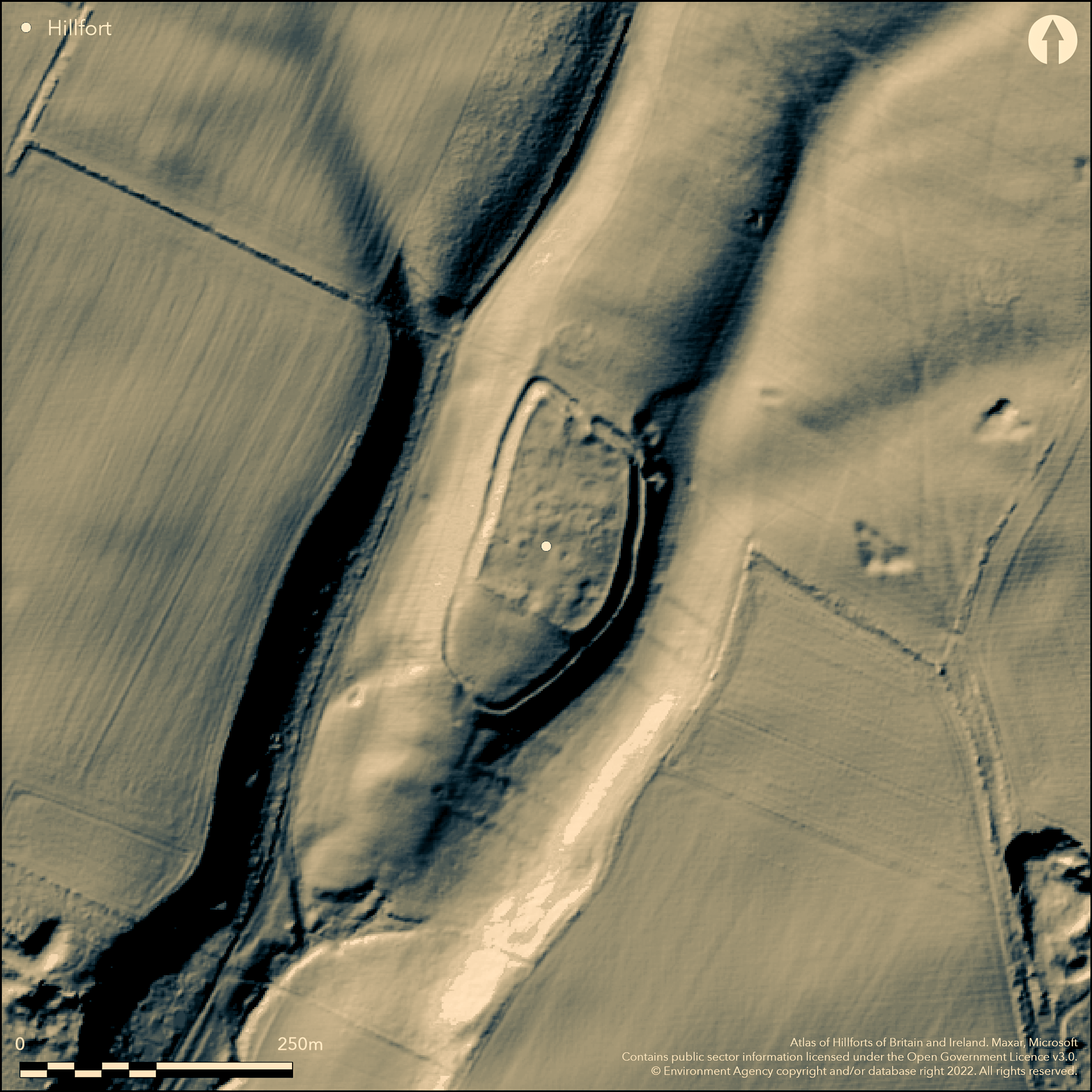
LiDAR 1m DTM Hillshade
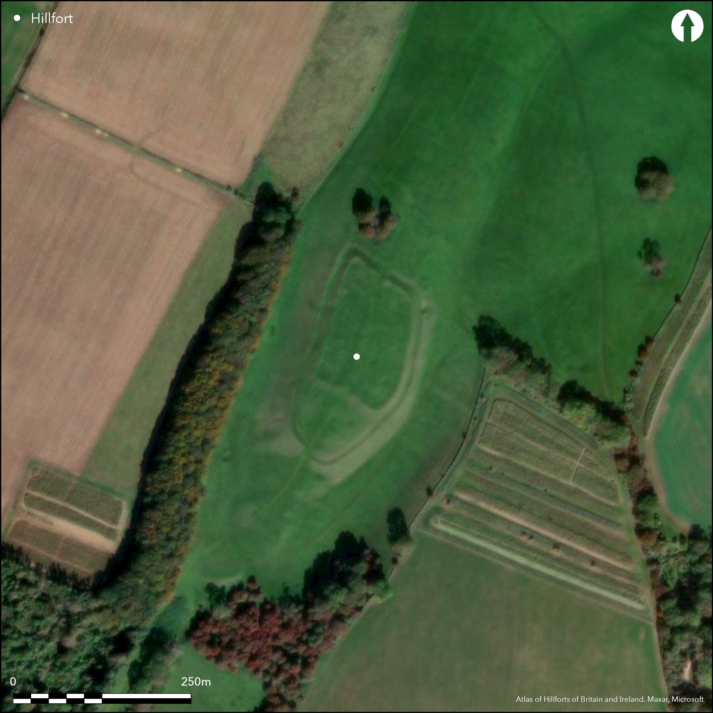
Satellite Imagery
LiDAR 1m DTM Hillshade
Satellite Imagery
Scroll left/right to view further images.
HER: Worcestershire MWR1257 (WSM02907)
NMR: SO 93 NE 1 (118000)
SM: 1005327
NGR: SO971383
X: 397158 Y: 238348 (OSGB36)
Excavated (Thomas 2005) small, middle Iron Age, partial contour hillfort located on a S-facing spur at the E end of Bredon Hill. Extensive views to the SW to the Severn Valley. The River Avon lies to the W. Very visible. On 1st Ed OS map (1885-1900). The site was built in two stages. The first a rampart, ditch and counterscarp of 1.95ha overall, with a 1ha interior. A simple gap centre N entrance with another simple gap entrance overlooking a spring to the S. In Phase II the S rampart was pulled back to form a smaller enclosure with of c. 0.71ha. A new stone-faced rampart with no ditch had a central, inturned, timber-framed gate. This new enclosure was crammed with huts, pits and other structures, on a planned basis with pits to the W and stone-built circular structures to the E. Circular platforms sited just inside the rampart. Possibly at the same time the N rampart was re-modelled with to form a new gate with inturns. In Phase III a dry-stone-faced rubble wall appears to have closed the N entrance. The earlier S part of the initial enclosure is free of structures and pits and could have acted as a stock enclosure. Much middle Iron Age pottery and a good suite of C14 dates (Horn Forthcoming). Lynchets and ridge and furrow outside the hillfort. Well preserved with pasture land use.
Citizen Science: ✓
Reliability of Data: Confirmed
Reliability of Interpretation: Confirmed
X: -227411 Y: 6807991 (EPSG: 3857)
Longitude: -2.042863933166145 Latitude: 52.04348238324865 (EPSG:4326)
Country: England
Current County or Unitary Authority: Worcestershire
Historic County: Gloucestershire
Current Parish/Community/Council/Townland: Conderton
Well-preserved.
| Extant | ✓ |
| Cropmark | ✗ |
| Likely Destroyed | ✗ |
Pasture.
| Woodland | ✗ |
| Commercial Forestry Plantation | ✗ |
| Parkland | ✗ |
| Pasture (Grazing) | ✓ |
| Arable | ✗ |
| Scrub/Bracken | ✗ |
| Bare Outcrop | ✗ |
| Heather/Moorland | ✗ |
| Heath | ✗ |
| Built-up | ✗ |
| Coastal Grassland | ✗ |
| Other | ✗ |
Partial contour hillfort located on a S-facing spur at the E end of Bredon Hill. Extensive views to the SW to the Severn Valley. The River Avon lies to the W.
| Contour Fort | ✗ |
| Partial Contour Fort | ✓ |
| Promontory Fort | ✗ |
| Hillslope Fort | ✗ |
| Level Terrain Fort | ✗ |
| Marsh Fort | ✗ |
| Multiple Enclosure Fort | ✗ |
| Hilltop | ✗ |
| Coastal Promontory | ✗ |
| Inland Promontory | ✗ |
| Valley Bottom | ✗ |
| Knoll/Hillock/Outcrop | ✗ |
| Ridge | ✗ |
| Cliff/Plateau-edge/Scarp | ✗ |
| Hillslope | ✗ |
| Lowland | ✗ |
| Spur | ✓ |
Dominant Topographic Feature: S-facing spur of Conderton Hill at the E end of Bredon Hill.
| North | ✗ |
| Northeast | ✗ |
| East | ✗ |
| Southeast | ✗ |
| South | ✗ |
| Southwest | ✓ |
| West | ✗ |
| Northwest | ✗ |
| Level | ✓ |
Altitude: 190.0m
N/A
24 C14 dates, much MIA pottery suggest hillfort start 520-400 BC, addition of cross rampart and inturned entrances 400-260 BC, hillfort end 200-125 BC (Horn Forthcoming).
Reliability: A - High
| Pre 1200BC | ✗ |
| 1200BC - 800BC | ✗ |
| 800BC - 400BC | ✓ |
| 400BC - AD50 | ✓ |
| AD50 - AD400 | ✗ |
| AD400 - AD 800 | ✗ |
| Post AD800 | ✗ |
| Unknown | ✗ |
| Pre Hillfort: | None |
| Post Hillfort: | None |
| Artefactual: | Early and middle Iron Age pottery. |
| C14: | None |
On 1st Ed OS map (1885-1900). Excavation 1958-59, Director N. Thomas. Geophysical surveys 1958 and 1996 (AML). Air photo interpretation English Heritage: Gloucestershire National Mapping Programme (North Cotswolds and Forest of Dean).
| Other (1970): | Visited by Hillfort Study Group |
| 1st Identified Map Depiction (None): | 1st Ed OS. |
| Excavation (None): | Director N. Thomas. |
| Geophysical Survey (None): | Surveys part of Thomas excavation project. |
| Other (None): | Air photo interpretation English Heritage: Gloucestershire National Mapping Programme (North Cotswolds and Forest of Dean). |
Geophysical surveys 1958 and 1996 found pits, infilled ditches, gullies, infilled quarry hollows and rampart details.Many finds of early and middle Iron Age and Roman pottery, VCP, loom weights, copper alloy rings, iron objects and implements, plough share tip, nails, bone items, spindle whorls, saddle querns, Roman coins of Trajan (AD 98-117) and Constantine (AD 306-37. Much animal bone. Many features excavated including pits and structures.
Spring just outside the S ramparts probably provided water supply.
| None | ✓ |
| Spring | ✗ |
| Stream | ✗ |
| Pool | ✗ |
| Flush | ✗ |
| Well | ✗ |
| Other | ✗ |
None
| No Known Features | ✓ |
| Round Stone Structures | ✗ |
| Rectangular Stone Structures | ✗ |
| Curvilinear Platforms | ✗ |
| Other Roundhouse Evidence | ✗ |
| Pits | ✗ |
| Quarry Hollows | ✗ |
| Other | ✗ |
Many features excavated including pits and structures.
| No Known Excavation | ✗ |
| Pits | ✓ |
| Postholes | ✓ |
| Roundhouses | ✓ |
| Rectangular Structures | ✗ |
| Roads/Tracks | ✗ |
| Quarry Hollows | ✓ |
| Other | ✓ |
| Nothing Found | ✗ |
Geophysical surveys 1958 and 1996 found pits, infilled ditches, gullies, infilled quarry hollows and rampart details.
| No Known Geophysics | ✗ |
| Pits | ✓ |
| Roundhouses | ✓ |
| Rectangular Structures | ✗ |
| Roads/Tracks | ✗ |
| Quarry Hollows | ✓ |
| Other | ✓ |
| Nothing Found | ✗ |
Many finds of early and middle Iron Age and Roman pottery, VCP, loom weights, copper alloy rings, iron objects and implements, plough share tip, nails, bone items, spindle whorls, saddle querns, Roman coins of Trajan (AD 98-117) and Constantine (AD 306-37. Much animal bone.
| No Known Finds | ✗ |
| Pottery | ✓ |
| Metal | ✓ |
| Metalworking | ✓ |
| Human Bones | ✓ |
| Animal Bones | ✓ |
| Lithics | ✓ |
| Environmental | ✓ |
| Other | ✓ |
Air photo interpretation English Heritage: Gloucestershire National Mapping Programme (North Cotswolds and Forest of Dean).
| APs Not Checked | ✓ |
| None | ✗ |
| Roundhouses | ✗ |
| Rectangular Structures | ✗ |
| Pits | ✗ |
| Postholes | ✗ |
| Roads/Tracks | ✗ |
| Other | ✗ |
N entrance is simple gap, 10m wide, with inturns and 15m passageway. S perimeter entrance is simple, slight offset gap, 10m wide, blocked. S central entrance in interior is simple gap 7m wide with inturns and 15m passageway.
| 3: | None |
| 2: | Two outer perimeter (N and S) and one internal central entrance, one blocked. |
Guard Chambers: ✗
Chevaux de Frise: ✗
| 1. In-turned (North): | Simple gap, 10m wide, with inturns and 15m passageway. |
| 1. In-turned (South): | S central entrance in interior simple gap 7m wide with inturns and 15m passageway. |
| 2. Blocked (South): | S perimeter simple, slight offset gap, 10m wide, blocked. |
In first phase a rampart, ditch and counterscarp of 1.95ha overall, with a 1ha interior. In Phase II the S rampart was pulled back to form a smaller enclosure with of c. 0.71ha. A new stone-faced rampart with no ditch had a central, inturned, timber-framed gate. This remained in Phase III.
| Area 1: | 0.71ha. |
| Total: | 0.71ha. |
Total Footprint Area: Noneha.
None
| ✗ | The whole site footprint of Phase I is 1.95ha with 1ha enclosed. The enclosed area of Phase III is 0.71. |
| ✓ | None |
| NE Quadrant: | 1 |
| SE Quadrant: | 1 |
| SW Quadrant: | 1 |
| NW Quadrant: | 1 |
| Total: | 1 |
| Partial Univallate | ✗ |
| Univallate | ✓ |
| Partial Bivallate | ✗ |
| Bivallate | ✗ |
| Partial Multivallate | ✗ |
| Multivallate | ✗ |
| Unknown | ✗ |
| Partial Univallate | ✗ |
| Univallate | ✗ |
| Partial Bivallate | ✗ |
| Bivallate | ✗ |
| Partial Multivallate | ✗ |
| Multivallate | ✗ |
None
| None | ✗ |
| Earthen Bank | ✓ |
| Stone Wall | ✓ |
| Rubble | ✗ |
| Wall-walk | ✗ |
| Evidence of Timber | ✗ |
| Vitrification | ✗ |
| Other Burning | ✗ |
| Palisade | ✗ |
| Counter Scarp Bank | ✓ |
| Berm | ✗ |
| Unfinished | ✗ |
| Other | ✗ |
Excavation report gives full details. Earth and rubble stone-faced ramparts. A dry-stone-faced rubble wall appears to have closed the N entrance.
| None | ✗ |
| Earthen Bank | ✓ |
| Stone Wall | ✓ |
| Murus Duplex | ✗ |
| Timber-framed | ✗ |
| Timber-laced | ✗ |
| Vitrification | ✗ |
| Other Burning | ✗ |
| Palisade | ✗ |
| Counter Scarp Bank | ✓ |
| Berm | ✗ |
| Unfinished | ✗ |
| No Known Excavation | ✗ |
| Other | ✗ |
| ✗ | None |
| ✓ | Outer ditch present around circuit. |
Number of Ditches: 1
| ✗ | None |
Horn, J. Forthcoming. The dating of hillforts in Britain and Ireland. Unpublished PhD thesis, University of Edinburgh.
Thomas, N. 2005. Conderton Camp Worcestershire. A small middle Iron Age hillfort on Bredon HIll, CBA Research Reort 143, York: CBA.
Windle, B.C.A. and Willis-Bund, J.W. (eds) 1901. Victoria History of the Counties of England: a history of the County of Worcestershire, 1, London: St Catherine Press.
Small, F. et al 2006. The Forest of Dean Mapping Project, Gloucestershire: a report for the National Mapping Programme, Report No 28-2006, Centre for Archaeology Report.
Stoertz, C. 2012. The North Cotswolds: a highlight report for the National Mapping Programme, Report No 17-2012,Centre for Archaeology Report.
Atlas of Hillforts:
Wikidata:
This work is licensed under CC BY-SA 4.0

 and should be cited as:
Lock, Gary and Ralston, Ian. 2024. Atlas of Hillforts of Britain and Ireland. Available at: https://hillforts.arch.ox.ac.uk
Document Version 1.1