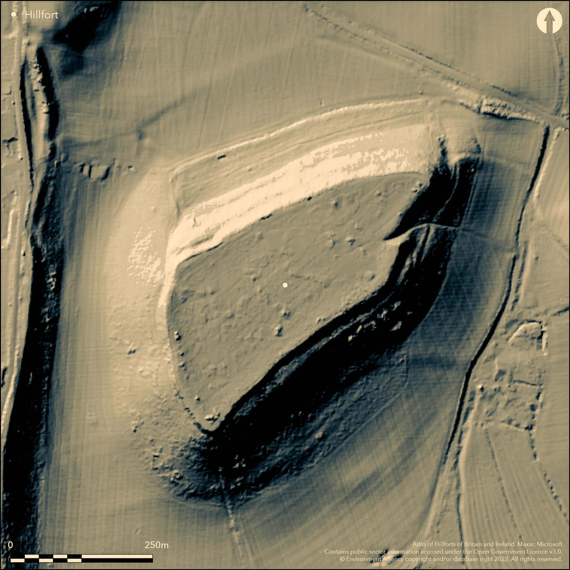
LiDAR 1m DTM Hillshade
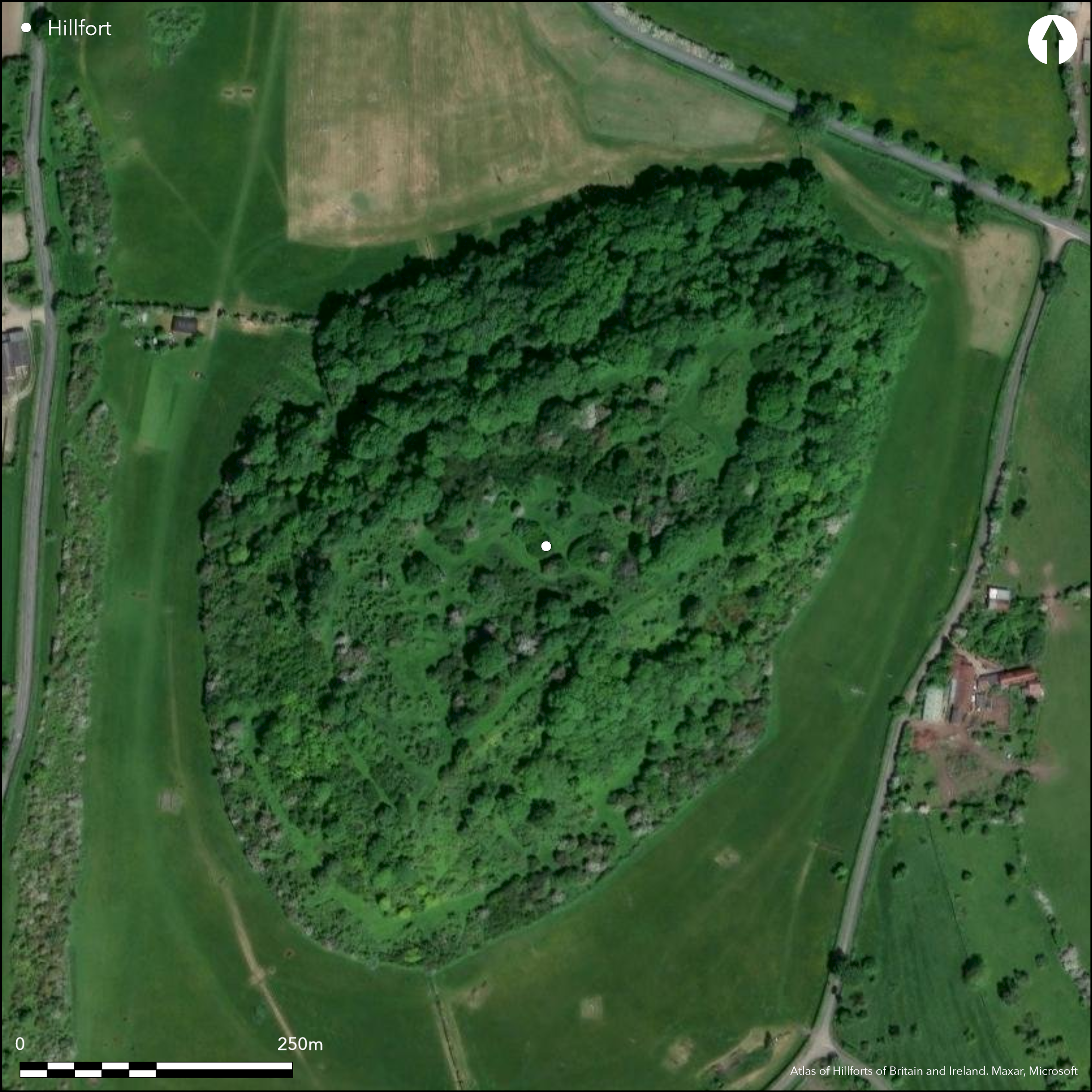
Satellite Imagery
LiDAR 1m DTM Hillshade
Satellite Imagery
Scroll left/right to view further images.
HER: Worcestershire MWR1496 (WSM03717)
NMR: SO 73 SE 1 (113577)
SM: 1005329
NGR: SO792317
X: 379238 Y: 231609 (OSGB36)
Gadbury Camp is a large, univallate, contour fort of irregular oval shape located on isolated low hill or knoll of Keuper Sandstone capping a red marl, at 50m O.D. above the headwaters of Glynch Brook and to E of the River Leadon. On 1st Ed OS map (1885-1900). Measures to 400m long by 100m at the widest point, with internal area c. 4ha. Steep slopes have been artificially scarped c. 1m-2.5m below the crest, making a massive rampart unnecessary. Well-defined re-entrant opening on E and slight gap, possibly modern, at NW angle. Chance finds of Roman coins, Iron Age sherds, possible 'Celtic' stone head (may be medieval), loom weights and bone. Investigated by RCHME Malvern Hills Archaeological Survey 2000-05. In tree covered Gadbury Coppice.
Citizen Science: ✓
Reliability of Data: Confirmed
Reliability of Interpretation: Confirmed
X: -256451 Y: 6796964 (EPSG: 3857)
Longitude: -2.3037342532966036 Latitude: 51.98250913926931 (EPSG:4326)
Country: England
Current County or Unitary Authority: Worcestershire
Historic County: Worcestershire
Current Parish/Community/Council/Townland: Eldersfield
No details on present condition.
| Extant | ✓ |
| Cropmark | ✗ |
| Likely Destroyed | ✗ |
In tree covered Gadbury Coppice.
| Woodland | ✓ |
| Commercial Forestry Plantation | ✗ |
| Parkland | ✗ |
| Pasture (Grazing) | ✗ |
| Arable | ✗ |
| Scrub/Bracken | ✗ |
| Bare Outcrop | ✗ |
| Heather/Moorland | ✗ |
| Heath | ✗ |
| Built-up | ✗ |
| Coastal Grassland | ✗ |
| Other | ✗ |
Contour hillfort of irregular oval shape located on a low hill or knoll of Keuper Sandstone over a red marl at 50m O.D. above the headwaters of Glynch Brook and to the E of the River Leadon.
| Contour Fort | ✓ |
| Partial Contour Fort | ✗ |
| Promontory Fort | ✗ |
| Hillslope Fort | ✗ |
| Level Terrain Fort | ✗ |
| Marsh Fort | ✗ |
| Multiple Enclosure Fort | ✗ |
| Hilltop | ✓ |
| Coastal Promontory | ✗ |
| Inland Promontory | ✗ |
| Valley Bottom | ✗ |
| Knoll/Hillock/Outcrop | ✗ |
| Ridge | ✗ |
| Cliff/Plateau-edge/Scarp | ✗ |
| Hillslope | ✗ |
| Lowland | ✓ |
| Spur | ✗ |
Dominant Topographic Feature: Low hill of 50m O.D. dominant in surrounding lowlands.
| North | ✗ |
| Northeast | ✗ |
| East | ✗ |
| Southeast | ✗ |
| South | ✗ |
| Southwest | ✗ |
| West | ✗ |
| Northwest | ✗ |
| Level | ✓ |
Altitude: 50.0m
N/A
None
Reliability: D - None
| Pre 1200BC | ✗ |
| 1200BC - 800BC | ✗ |
| 800BC - 400BC | ✗ |
| 400BC - AD50 | ✗ |
| AD50 - AD400 | ✗ |
| AD400 - AD 800 | ✗ |
| Post AD800 | ✗ |
| Unknown | ✓ |
| Pre Hillfort: | None |
| Post Hillfort: | None |
On 1st Ed OS map (1885-1900). Malvern Hills Archaeological Survey - lead RCHME/EH, including Aerial Survey of Malvern Hills defines form and nature of the enclosure. Published 2005.
| 1st Identified Map Depiction (None): | 1st Ed OS |
| Other (None): | Malvern Hills Archaeological Survey - lead RCHME/EH. |
Some chance finds of Roman coins, Iron Age sherds, possible 'Celtic' stone head (may be medieval), loom weights and bone.
None
| None | ✓ |
| Spring | ✗ |
| Stream | ✗ |
| Pool | ✗ |
| Flush | ✗ |
| Well | ✗ |
| Other | ✗ |
None
| No Known Features | ✓ |
| Round Stone Structures | ✗ |
| Rectangular Stone Structures | ✗ |
| Curvilinear Platforms | ✗ |
| Other Roundhouse Evidence | ✗ |
| Pits | ✗ |
| Quarry Hollows | ✗ |
| Other | ✗ |
None
| No Known Excavation | ✓ |
| Pits | ✗ |
| Postholes | ✗ |
| Roundhouses | ✗ |
| Rectangular Structures | ✗ |
| Roads/Tracks | ✗ |
| Quarry Hollows | ✗ |
| Other | ✗ |
| Nothing Found | ✗ |
None
| No Known Geophysics | ✓ |
| Pits | ✗ |
| Roundhouses | ✗ |
| Rectangular Structures | ✗ |
| Roads/Tracks | ✗ |
| Quarry Hollows | ✗ |
| Other | ✗ |
| Nothing Found | ✗ |
Some chance finds of Roman coins, Iron Age sherds, possible 'Celtic' stone head (may be medieval), loom weights and bone.
| No Known Finds | ✗ |
| Pottery | ✓ |
| Metal | ✗ |
| Metalworking | ✗ |
| Human Bones | ✗ |
| Animal Bones | ✓ |
| Lithics | ✓ |
| Environmental | ✗ |
| Other | ✓ |
Malvern Hills Archaeological Survey 2000-2001 - lead RCHME/EH, including Aerial Survey of Malvern Hills defines form and nature of enclosure.
| APs Not Checked | ✗ |
| None | ✗ |
| Roundhouses | ✗ |
| Rectangular Structures | ✗ |
| Pits | ✗ |
| Postholes | ✗ |
| Roads/Tracks | ✗ |
| Other | ✓ |
There is a well-defined re-entrant opening on the E, possibly the site of an original entrance, and a slight gap, possibly modern, at the NW angle.
| 2: | None |
| 2: | None |
Guard Chambers: ✗
Chevaux de Frise: ✗
| 1. Simple Gap (East): | Well-defined re-entrant opening. |
The steep slopes have been artificially scarped c. 1-2.5m below the crest, thus making a massive rampart unnecessary. Ditches not defined.
| Area 1: | 4.0ha. |
| Total: | 4.0ha. |
Total Footprint Area: Noneha.
None
| ✗ | None |
| ✓ | None |
| NE Quadrant: | 1 |
| SE Quadrant: | 1 |
| SW Quadrant: | 1 |
| NW Quadrant: | 1 |
| Total: | 1 |
| Partial Univallate | ✗ |
| Univallate | ✓ |
| Partial Bivallate | ✗ |
| Bivallate | ✗ |
| Partial Multivallate | ✗ |
| Multivallate | ✗ |
| Unknown | ✗ |
| Partial Univallate | ✗ |
| Univallate | ✗ |
| Partial Bivallate | ✗ |
| Bivallate | ✗ |
| Partial Multivallate | ✗ |
| Multivallate | ✗ |
None
| None | ✗ |
| Earthen Bank | ✓ |
| Stone Wall | ✗ |
| Rubble | ✗ |
| Wall-walk | ✗ |
| Evidence of Timber | ✗ |
| Vitrification | ✗ |
| Other Burning | ✗ |
| Palisade | ✗ |
| Counter Scarp Bank | ✗ |
| Berm | ✗ |
| Unfinished | ✗ |
| Other | ✗ |
None
| None | ✗ |
| Earthen Bank | ✗ |
| Stone Wall | ✗ |
| Murus Duplex | ✗ |
| Timber-framed | ✗ |
| Timber-laced | ✗ |
| Vitrification | ✗ |
| Other Burning | ✗ |
| Palisade | ✗ |
| Counter Scarp Bank | ✗ |
| Berm | ✗ |
| Unfinished | ✗ |
| No Known Excavation | ✓ |
| Other | ✗ |
| ✗ | None |
| ✗ | Ditches not defined. |
Number of Ditches: 0
| ✗ | None |
Windle, B.C.A. and Willis-Bund, J.W. (eds) 1901. Victoria History of the Counties of England: a history of the County of Worcestershire, 1. 188, London: St Catherine Press.
Bowden, M. 2005. The Malvern Hills: an ancient landscape: an archaeological landscape, London: English Heritage.
Atlas of Hillforts:
Wikidata:
This work is licensed under CC BY-SA 4.0

 and should be cited as:
Lock, Gary and Ralston, Ian. 2024. Atlas of Hillforts of Britain and Ireland. Available at: https://hillforts.arch.ox.ac.uk
Document Version 1.1