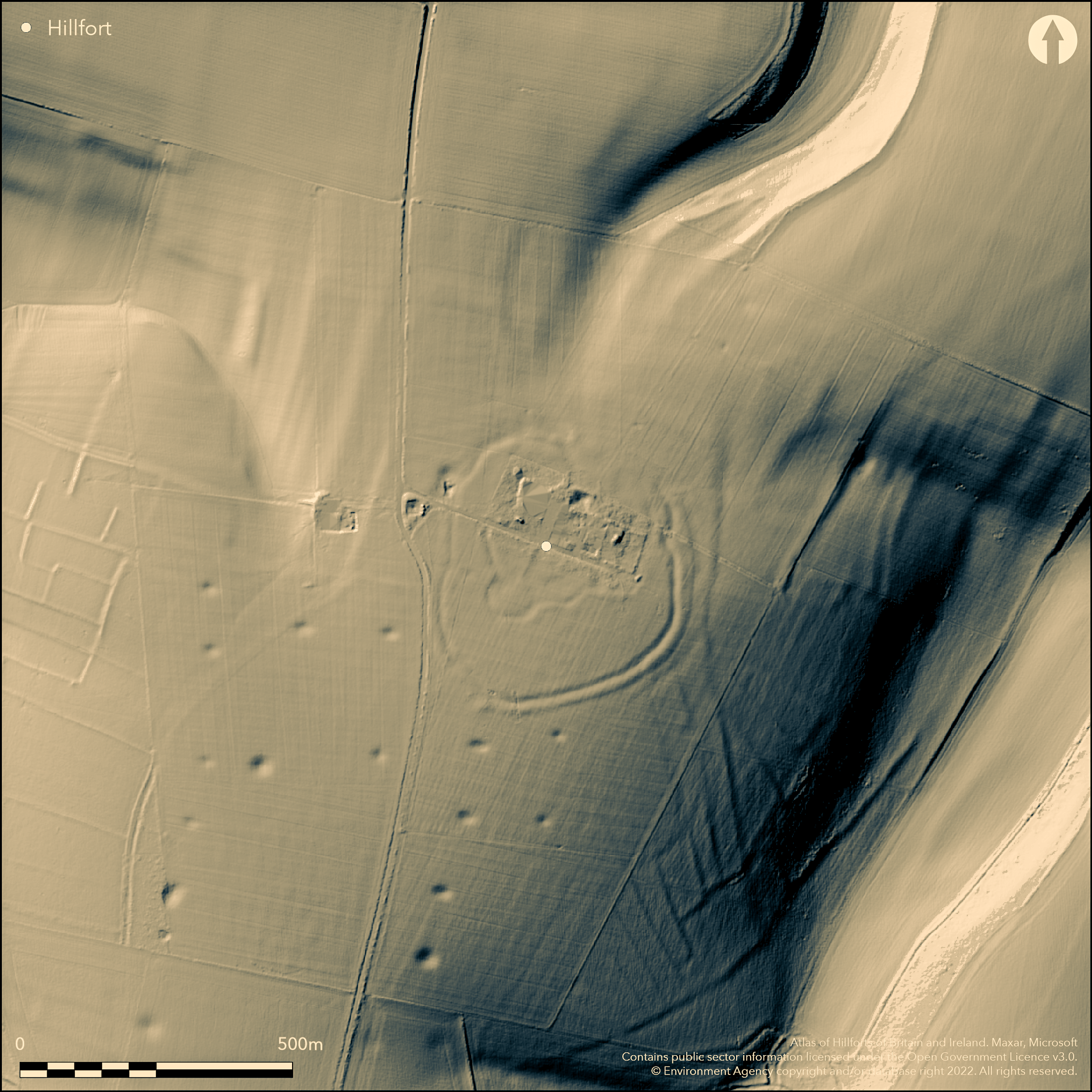
LiDAR 1m DTM Hillshade
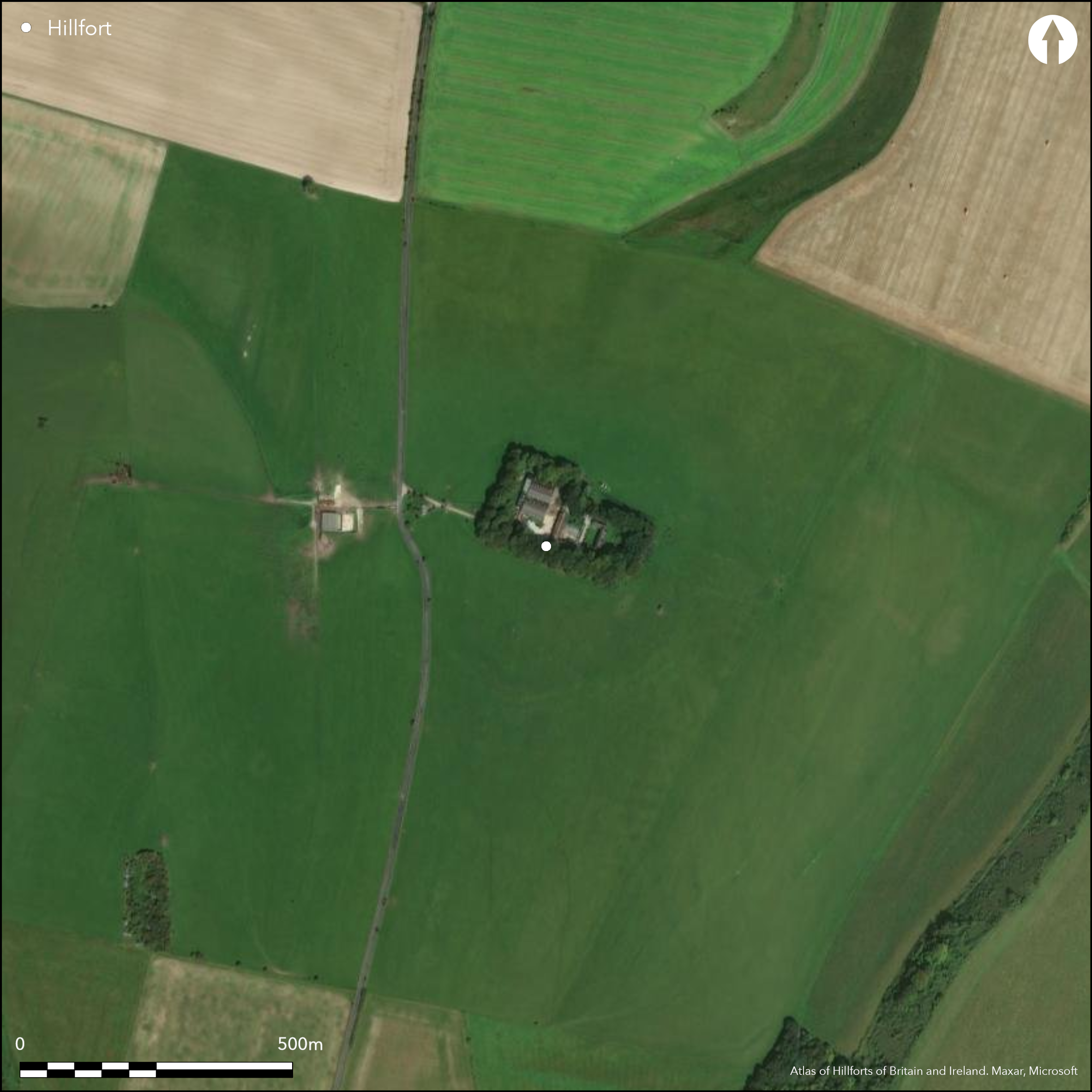
Satellite Imagery
LiDAR 1m DTM Hillshade
Satellite Imagery
Scroll left/right to view further images.
HER: Wiltshire and Swindon MWI6159 (None)
NMR: SU 03 NW 10 (214484)
SM: 1005601
NGR: SU010362
X: 401000 Y: 136242 (OSGB36)
Large, multivallate, irregular-shaped hillfort of 7ha situated on a prominent NE spur slope directly above the River Wylye valley. Excavated W. Cunnington 1800-10, R.S. Newall 1934 and by E.H. Steele in 1959-64. Colt Hoare's 1810 plan shows double ramparts with ditch and counterscarp on W. Main defences and inner enclosure much levelled by ploughing. N part of site interior location of Bilbury Farm buildings, rest pasture. Ditch now visible only as cropmark. Of main enclosure all that survives is ditch of inner rampart up to 0.7m deep, and the outer bank up to 0.8m high, with the overlapping entrance just traceable. Original entrance on N. Colt Hoare shows eight breaks in ramparts, including one with a track-way leading to the internal settlement. Two on 1980 OS map. Finds from Steele's excavation, including pre-Roman and New Forest pottery, and parts of 2 iron bow-fibulae in Salisbury Museum. On Ist Ed. OS map (1887).
Citizen Science: ✗
Reliability of Data: Confirmed
Reliability of Interpretation: Confirmed
X: -221204 Y: 6643506 (EPSG: 3857)
Longitude: -1.9871079936108336 Latitude: 51.12540133307142 (EPSG:4326)
Country: England
Current County or Unitary Authority: Wiltshire
Historic County: Wiltshire
Current Parish/Community/Council/Townland: Wylye
N part of site interior location of Bilbury Farm buildings. Much of site destroyed by agricultural activity and difficult to determine details.
| Extant | ✓ |
| Cropmark | ✓ |
| Likely Destroyed | ✓ |
Bilbury Farm with tree-lined boundary located in N part of enclosure. Pasture elsewhere.
| Woodland | ✗ |
| Commercial Forestry Plantation | ✗ |
| Parkland | ✗ |
| Pasture (Grazing) | ✓ |
| Arable | ✗ |
| Scrub/Bracken | ✓ |
| Bare Outcrop | ✗ |
| Heather/Moorland | ✗ |
| Heath | ✗ |
| Built-up | ✓ |
| Coastal Grassland | ✗ |
| Other | ✗ |
Large, multivallate, irregular-shaped hillfort situated on a prominent NE spur slope directly above the River Wylye valley.
| Contour Fort | ✗ |
| Partial Contour Fort | ✓ |
| Promontory Fort | ✗ |
| Hillslope Fort | ✗ |
| Level Terrain Fort | ✗ |
| Marsh Fort | ✗ |
| Multiple Enclosure Fort | ✗ |
Situated on a prominent north-eastern spur slope above the River Wylye valley.
| Hilltop | ✗ |
| Coastal Promontory | ✗ |
| Inland Promontory | ✗ |
| Valley Bottom | ✗ |
| Knoll/Hillock/Outcrop | ✗ |
| Ridge | ✗ |
| Cliff/Plateau-edge/Scarp | ✗ |
| Hillslope | ✗ |
| Lowland | ✗ |
| Spur | ✓ |
Dominant Topographic Feature: Gently sloping spur above River Wylye.
| North | ✗ |
| Northeast | ✓ |
| East | ✗ |
| Southeast | ✗ |
| South | ✗ |
| Southwest | ✗ |
| West | ✗ |
| Northwest | ✗ |
| Level | ✗ |
Altitude: 170.0m
N/A
Pottery found by Steele suggested by Hawkes as pre-Claudian date for original construction of inner enclosure to 4th century AD.
Reliability: C - Low
| Pre 1200BC | ✗ |
| 1200BC - 800BC | ✗ |
| 800BC - 400BC | ✗ |
| 400BC - AD50 | ✓ |
| AD50 - AD400 | ✓ |
| AD400 - AD 800 | ✗ |
| Post AD800 | ✗ |
| Unknown | ✗ |
| Pre Hillfort: | None |
| Post Hillfort: | None |
| Artefactual: | None |
In Aubrey's Monumenta Britannica (1665-1693). Planned by Colt Hoare 1810. On Ist Ed. OS map (1887). Excavation W. Cunnington Sen. 1800-10. Excavation R S Newall 1934. Excavation by Rev E.H. Steele, 1959-64. Measured Survey RCHME: South Wiltshire Project 1983-2005.
| 1st Identified Map Depiction (1810): | Planned by R.C. Colt Hoare. |
| Other (1887): | OS map |
| Other (1887): | OS map. |
| Excavation (1934): | R.S. Newall - no details. |
| Other (1984): | Visited by Hillfort Study Group |
| 1st Identified Written Reference (None): | Aubrey's Monumenta Britannica. |
| Excavation (None): | W. Cunnington Sen. |
| Excavation (None): | Excavation by Rev E.H. Steele. No excavation report - notes only. |
| Earthwork Survey (None): | RCHME |
Finds from Steel's excavation, including pre-Roman and New Forest pottery, and parts of two iron bow-fibulae in Salisbury Museum.
None
| None | ✓ |
| Spring | ✗ |
| Stream | ✗ |
| Pool | ✗ |
| Flush | ✗ |
| Well | ✗ |
| Other | ✗ |
None
| No Known Features | ✓ |
| Round Stone Structures | ✗ |
| Rectangular Stone Structures | ✗ |
| Curvilinear Platforms | ✗ |
| Other Roundhouse Evidence | ✗ |
| Pits | ✗ |
| Quarry Hollows | ✗ |
| Other | ✗ |
No details from excavations.
| No Known Excavation | ✗ |
| Pits | ✗ |
| Postholes | ✗ |
| Roundhouses | ✗ |
| Rectangular Structures | ✗ |
| Roads/Tracks | ✗ |
| Quarry Hollows | ✗ |
| Other | ✗ |
| Nothing Found | ✓ |
None
| No Known Geophysics | ✓ |
| Pits | ✗ |
| Roundhouses | ✗ |
| Rectangular Structures | ✗ |
| Roads/Tracks | ✗ |
| Quarry Hollows | ✗ |
| Other | ✗ |
| Nothing Found | ✗ |
Finds from Steel's excavation, including pre-Roman and New Forest pottery, and parts of two iron bow-fibulae in Salisbury Museum.
| No Known Finds | ✗ |
| Pottery | ✓ |
| Metal | ✓ |
| Metalworking | ✗ |
| Human Bones | ✗ |
| Animal Bones | ✗ |
| Lithics | ✗ |
| Environmental | ✗ |
| Other | ✗ |
None
| APs Not Checked | ✓ |
| None | ✗ |
| Roundhouses | ✗ |
| Rectangular Structures | ✗ |
| Pits | ✗ |
| Postholes | ✗ |
| Roads/Tracks | ✗ |
| Other | ✗ |
Overlapping entrance just traceable on N. Colt Hoare shows eight breaks in rampart, including one with a track-way leading to the internal settlement. Two on 1980 OS 2,500 map.
| 2: | Two on 1980 OS map. |
| 2: | None |
Guard Chambers: ✗
Chevaux de Frise: ✗
| 1. Over-lapping (North): | Just traceable. |
Colt Hoare's plan of 1810 shows double ramparts with ditch and counterscarp on W. Main defences and inner enclosure now much levelled and N part of site interior location of Bilbury Farm buildings, making interpretation difficult. Ditch now visible only as cropmark. Of main enclosure all that survives is ditch of inner rampart up to 0.7m deep, and the outer bank up to 0.8m high,
| Area 1: | 7.0ha. |
| Total: | 7.0ha. |
Total Footprint Area: Noneha.
None
| ✗ | None |
| ✗ | Ramparts much damaged and N part farm buildongs, making interpretation difficult. Colt Hoare's 1810 plan shows double ramparts with ditch and counterscarp on W. Main defences and inner enclosure much levelled by ploughing. |
| NE Quadrant: | 2 |
| SE Quadrant: | 2 |
| SW Quadrant: | 2 |
| NW Quadrant: | 2 |
| Total: | 2 |
| Partial Univallate | ✗ |
| Univallate | ✗ |
| Partial Bivallate | ✗ |
| Bivallate | ✓ |
| Partial Multivallate | ✗ |
| Multivallate | ✗ |
| Unknown | ✗ |
| Partial Univallate | ✗ |
| Univallate | ✗ |
| Partial Bivallate | ✗ |
| Bivallate | ✗ |
| Partial Multivallate | ✗ |
| Multivallate | ✗ |
None
| None | ✗ |
| Earthen Bank | ✗ |
| Stone Wall | ✗ |
| Rubble | ✗ |
| Wall-walk | ✗ |
| Evidence of Timber | ✗ |
| Vitrification | ✗ |
| Other Burning | ✗ |
| Palisade | ✗ |
| Counter Scarp Bank | ✓ |
| Berm | ✗ |
| Unfinished | ✗ |
| Other | ✗ |
None
| None | ✓ |
| Earthen Bank | ✗ |
| Stone Wall | ✗ |
| Murus Duplex | ✗ |
| Timber-framed | ✗ |
| Timber-laced | ✗ |
| Vitrification | ✗ |
| Other Burning | ✗ |
| Palisade | ✗ |
| Counter Scarp Bank | ✗ |
| Berm | ✗ |
| Unfinished | ✗ |
| No Known Excavation | ✗ |
| Other | ✗ |
| ✗ | None |
| ✓ | Ditch only survives as cropmark. |
Number of Ditches: 1
| ✗ | None |
Anon 1961-63. Excavation and fieldwork in Wiltshire 1960, Wiltshire Archaeol Natur Hist Mag, 58, 32-4.
Anon 1961-63. Excavation and fieldwork in Wiltshire 1961, Wiltshire Archaeol Natur Hist Mag, 58, 243-44..
Anon 1961-63. Excavation and fieldwork in Wiltshire 1962, Wiltshire Archaeol Natur Hist Mag, 58, 468-69.
Anon 1964. Excavation and fieldwork in Wiltshire 1963, Wiltshire Archaeol Natur Hist MagI, 59, 186-87.
Anon 1965. Excavation and fieldwork in Wiltshire 1964, Wiltshire Archaeol Natur Hist MagI, 60, 13.
Colt Hoare, R.C. 1810. The Ancient History of Wiltshire, 1, London: Miller, 108.
Crittall, E. ed 1973. A history of Wiltshire, 1.2, Victoria History of the Counties of England, 436, London: OUP.
Pugh, R.B. and Crittall, E. 1957. A history of Wiltshire, 1.1, The Victoria History of the Counties of England, London: OUP, 250.
Atlas of Hillforts:
Wikidata:
This work is licensed under CC BY-SA 4.0

 and should be cited as:
Lock, Gary and Ralston, Ian. 2024. Atlas of Hillforts of Britain and Ireland. Available at: https://hillforts.arch.ox.ac.uk
Document Version 1.1