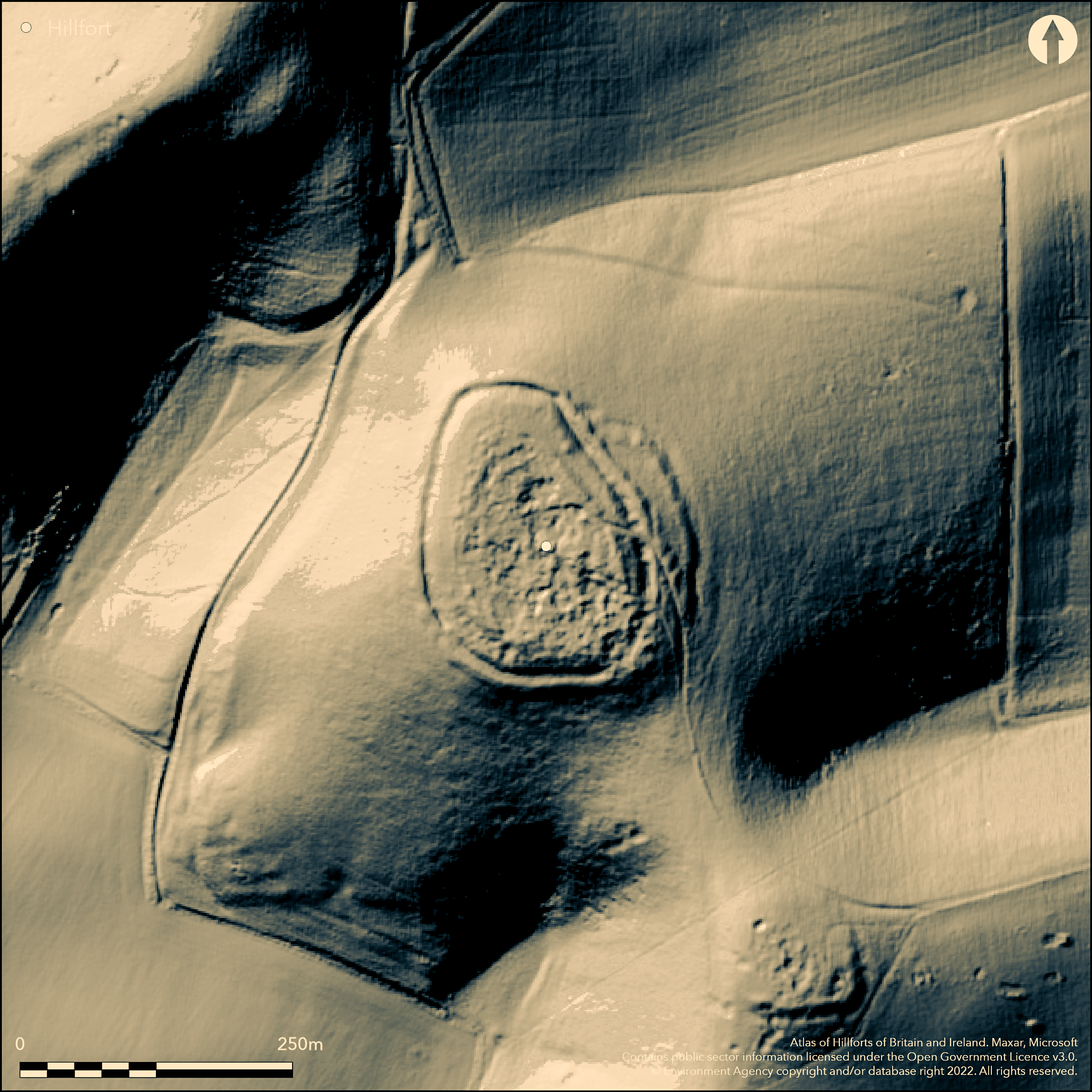
LiDAR 1m DTM Hillshade
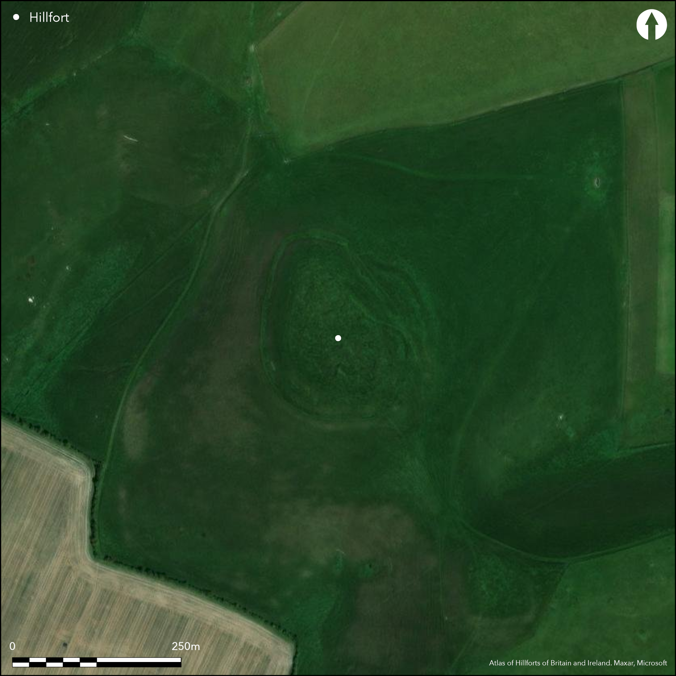
Satellite Imagery
LiDAR 1m DTM Hillshade
Satellite Imagery
Scroll left/right to view further images.
HER: Wiltshire and Swindon MWI8517 (None)
NMR: SU 06 SE 63 (1093452)
SM: 1005695
NGR: SU08336396
X: 408330 Y: 163965 (OSGB36)
Fine contour hillfort sited in Interesting location in archaeologically rich Marlborough Downs on spur summit of Rybury Hill, NW of sister summit of Cliffords Hill (separated from latter by col), overlooking the Vale of Pewsey and overlooked itself from NE. Wansdyke c. 1 km to N. Overlies Neolithic causewayed enclosure which can be clearly seen. Internal area 1.4ha. Very steep surrounding slopes on all sides with flattish col separating the two summits providing access to site. Surrounding bank with ditch, averages 1.5m deep, with outer counterscarp bank 1.1m above it. To the SE, although the bank is severely mutilated by modern quarrying, it and the ditch the ditch seem incomplete, with several gang-work type banks still crossing the latter. Trench was dug across ditch by Desmond Bonney in 1963 revealed it to be flat bottomed 2.1m deep. Silts contained over 600 flint flakes. Situated as it is on the downland edge, the fort is well suited to 'control' the resources of the Vale of Pewsey below as well as those of the downland above. Enclosure 190m long N-S by c. 150m overall, with a simple break to the S, probably indicating original entrance. . Presumed post-medieval chalk or flint extraction pits. Late Bronze Age or early Iron Age date probably correct. Good sheep- grazed upland pasture. On Ist Ed. OS map (1887).
Citizen Science: ✗
Reliability of Data: Confirmed
Reliability of Interpretation: Confirmed
X: -209473 Y: 6687831 (EPSG: 3857)
Longitude: -1.8817274891151223 Latitude: 51.3746285667851 (EPSG:4326)
Country: England
Current County or Unitary Authority: Wiltshire
Historic County: Wiltshire
Current Parish/Community/Council/Townland: All Cannings
Presumed post-medieval chalk or flint extraction pits, but site in good condition.
| Extant | ✓ |
| Cropmark | ✗ |
| Likely Destroyed | ✗ |
Good sheep grazed upland pasture.
| Woodland | ✗ |
| Commercial Forestry Plantation | ✗ |
| Parkland | ✗ |
| Pasture (Grazing) | ✓ |
| Arable | ✗ |
| Scrub/Bracken | ✗ |
| Bare Outcrop | ✗ |
| Heather/Moorland | ✗ |
| Heath | ✗ |
| Built-up | ✗ |
| Coastal Grassland | ✗ |
| Other | ✗ |
Bivallate contour hillfort sited in Interesting location in archaeologically rich Marlborough Downs on spur summit of Rybury Hill, NW of sister summit of Cliffords Hill (separated from latter by col), overlooking the Vale of Pewsey and overlooked itself from NE. Wansdyke c. 1 km to the N. Very steep surrounding slopes on all sides with flattish col separating the two summits providing access to site.
| Contour Fort | ✓ |
| Partial Contour Fort | ✗ |
| Promontory Fort | ✗ |
| Hillslope Fort | ✗ |
| Level Terrain Fort | ✗ |
| Marsh Fort | ✗ |
| Multiple Enclosure Fort | ✗ |
Interesting location in archaeologically rich downland on spur of Cliffords Hill overlooking the Vale of Pewsey and overlooked itself from the north-east. Wansdyke c. 1 km to the north.
| Hilltop | ✓ |
| Coastal Promontory | ✗ |
| Inland Promontory | ✗ |
| Valley Bottom | ✗ |
| Knoll/Hillock/Outcrop | ✗ |
| Ridge | ✗ |
| Cliff/Plateau-edge/Scarp | ✗ |
| Hillslope | ✗ |
| Lowland | ✗ |
| Spur | ✓ |
Dominant Topographic Feature: Downland spur.
| North | ✗ |
| Northeast | ✗ |
| East | ✗ |
| Southeast | ✗ |
| South | ✗ |
| Southwest | ✗ |
| West | ✗ |
| Northwest | ✗ |
| Level | ✓ |
Altitude: 240.0m
N/A
Late Bronze Age or early Iron Age date for hillfort probably correct.
Reliability: C - Low
| Pre 1200BC | ✗ |
| 1200BC - 800BC | ✗ |
| 800BC - 400BC | ✓ |
| 400BC - AD50 | ✓ |
| AD50 - AD400 | ✗ |
| AD400 - AD 800 | ✗ |
| Post AD800 | ✗ |
| Unknown | ✗ |
| Pre Hillfort: | None |
| Post Hillfort: | None |
| Morphology/Earthwork/Typology: | IWB interpretation. |
In Aubrey's Monumenta Britannica (1665-1693). On Ist Ed. OS map (1887). Site surveyed at 1:1250 scale in early 1960s by RCHME, prior to small scale excavation by Desmond Bonney 1963. RCHME analytical earthwork survey, ref. no. 888267 and 1086632, of causewayed enclosure as part of national project to record industry and enclosure in the Neolithic 1995. RCHME field survey as part of Avebury World Heritage Site Project 1997-98.
| 1st Identified Map Depiction (1887): | OS map. |
| Excavation (1963): | D. Bonney - no report. |
| Other (1995): | RCAHME analytical earthwork survey as part of national project to record industry and enclosure in the Neolithic. |
| 1st Identified Written Reference (None): | In Aubrey's Monumenta Britannica. |
| Other (None): | RCAHME survey prior to excavation. |
| Other (None): | RCHME field survey as part of Avebury World Heritage Site project. |
Presumed post-medieval chalk or flint extraction pits.
None
| None | ✓ |
| Spring | ✗ |
| Stream | ✗ |
| Pool | ✗ |
| Flush | ✗ |
| Well | ✗ |
| Other | ✗ |
Presumed post-medieval chalk or flint extraction pits.
| No Known Features | ✗ |
| Round Stone Structures | ✗ |
| Rectangular Stone Structures | ✗ |
| Curvilinear Platforms | ✗ |
| Other Roundhouse Evidence | ✗ |
| Pits | ✗ |
| Quarry Hollows | ✗ |
| Other | ✓ |
No details.
| No Known Excavation | ✗ |
| Pits | ✗ |
| Postholes | ✗ |
| Roundhouses | ✗ |
| Rectangular Structures | ✗ |
| Roads/Tracks | ✗ |
| Quarry Hollows | ✗ |
| Other | ✗ |
| Nothing Found | ✓ |
None
| No Known Geophysics | ✓ |
| Pits | ✗ |
| Roundhouses | ✗ |
| Rectangular Structures | ✗ |
| Roads/Tracks | ✗ |
| Quarry Hollows | ✗ |
| Other | ✗ |
| Nothing Found | ✗ |
None
| No Known Finds | ✓ |
| Pottery | ✗ |
| Metal | ✗ |
| Metalworking | ✗ |
| Human Bones | ✗ |
| Animal Bones | ✗ |
| Lithics | ✗ |
| Environmental | ✗ |
| Other | ✗ |
None
| APs Not Checked | ✓ |
| None | ✗ |
| Roundhouses | ✗ |
| Rectangular Structures | ✗ |
| Pits | ✗ |
| Postholes | ✗ |
| Roads/Tracks | ✗ |
| Other | ✗ |
Simple break to the S, probably indicating original entrance.
| 1: | None |
| 2: | None |
Guard Chambers: ✗
Chevaux de Frise: ✗
| 1. Simple Gap (South): | None |
Surrounding bank with ditch, averages 1.5m deep, with outer counterscarp bank 1.1m above it. To the SE, although the bank is severely mutilated by modern quarrying, it and the ditch the ditch seem incomplete, with several gang-work type banks still crossing the latter. Trench was dug across ditch by Desmond Bonney in 1963 revealed it to be flat bottomed 2.1m deep.
| Area 1: | 1.4ha. |
| Total: | 1.4ha. |
Total Footprint Area: Noneha.
None
| ✗ | None |
| ✓ | None |
| NE Quadrant: | 1 |
| SE Quadrant: | 1 |
| SW Quadrant: | 1 |
| NW Quadrant: | 1 |
| Total: | 1 |
| Partial Univallate | ✗ |
| Univallate | ✓ |
| Partial Bivallate | ✗ |
| Bivallate | ✗ |
| Partial Multivallate | ✗ |
| Multivallate | ✗ |
| Unknown | ✗ |
| Partial Univallate | ✗ |
| Univallate | ✗ |
| Partial Bivallate | ✗ |
| Bivallate | ✗ |
| Partial Multivallate | ✗ |
| Multivallate | ✗ |
None
| None | ✗ |
| Earthen Bank | ✓ |
| Stone Wall | ✗ |
| Rubble | ✗ |
| Wall-walk | ✗ |
| Evidence of Timber | ✗ |
| Vitrification | ✗ |
| Other Burning | ✗ |
| Palisade | ✗ |
| Counter Scarp Bank | ✓ |
| Berm | ✗ |
| Unfinished | ✗ |
| Other | ✗ |
No details.
| None | ✓ |
| Earthen Bank | ✗ |
| Stone Wall | ✗ |
| Murus Duplex | ✗ |
| Timber-framed | ✗ |
| Timber-laced | ✗ |
| Vitrification | ✗ |
| Other Burning | ✗ |
| Palisade | ✗ |
| Counter Scarp Bank | ✗ |
| Berm | ✗ |
| Unfinished | ✗ |
| No Known Excavation | ✗ |
| Other | ✗ |
| ✓ | To the SE, although the bank is severely mutilated by modern quarrying, it and the ditch the ditch seem incomplete, with several gang-work type banks still crossing the latter. |
| ✓ | Trench was dug across ditch by Desmond Bonney in 1963 revealed it to be flat bottomed 2.1 m deep. Surounding ditch seems incomplete on SE. |
Number of Ditches: 1
| ✗ | None |
Brown, G., Field, D. and McOmish, D. 2005. The Avebury landscape. Aspects of the field archaeology of the Marlborough Downs. Oxford: Oxbow Books.
Oswald, A, Dyer, C. and Barber, M. 2001. The creation of monuments: Neolithic causewayed enclosures in the British Isles. London: English Heritage.
Atlas of Hillforts:
Wikidata:
This work is licensed under CC BY-SA 4.0

 and should be cited as:
Lock, Gary and Ralston, Ian. 2024. Atlas of Hillforts of Britain and Ireland. Available at: https://hillforts.arch.ox.ac.uk
Document Version 1.1