LiDAR 1m DTM Hillshade
Satellite Imagery
LiDAR 1m DTM Hillshade
Satellite Imagery
Scroll left/right to view further images.
HER: Wiltshire and Swindon MWI14756 (None)
NMR: SU 16 SE 4 (220987)
SM: 1005696
NGR: SU16636324
X: 416635 Y: 163244 (OSGB36)
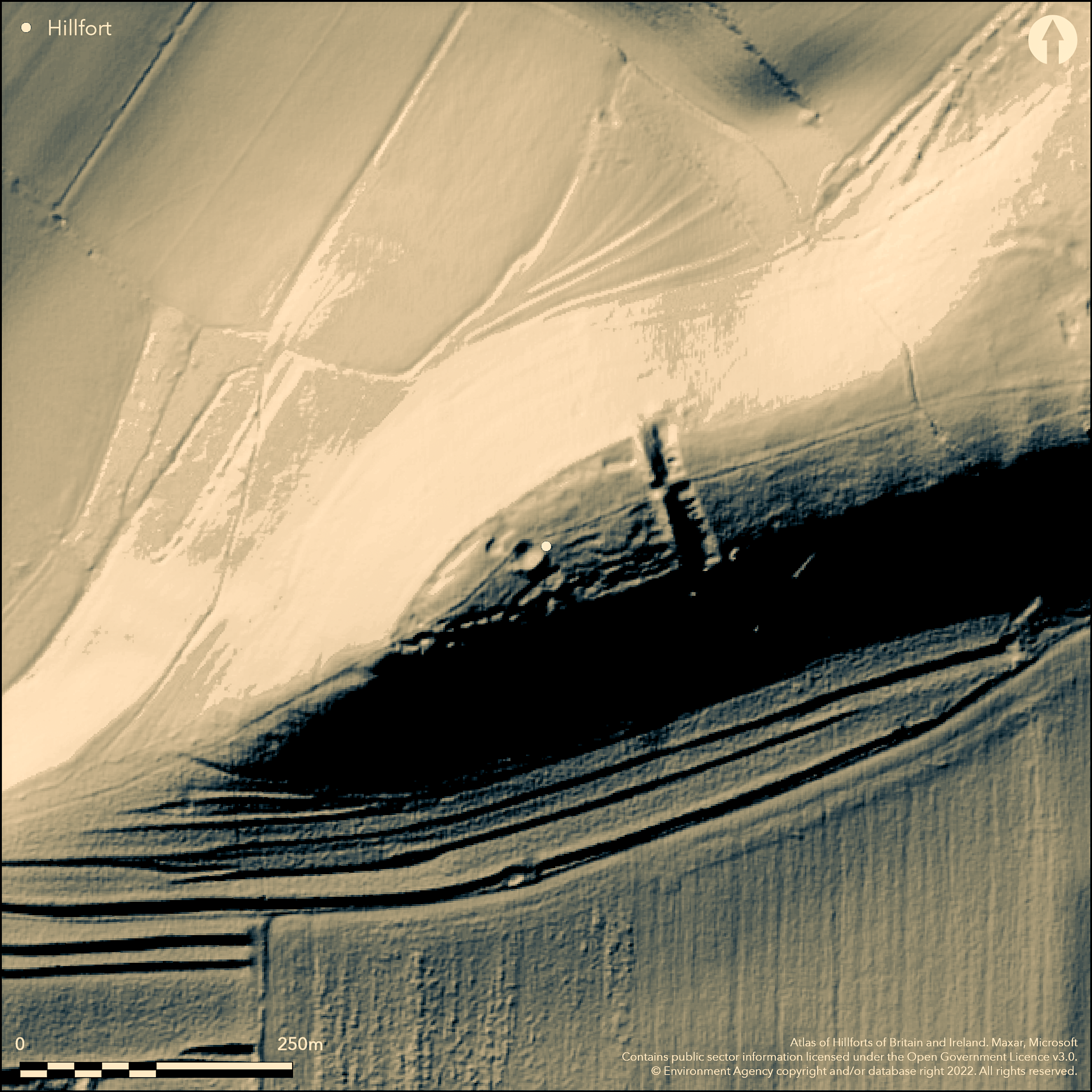
Possible inland promontory fort located on steep NW-facing spur above Vale of Pewsey. Usually thought of as a typical promontory fort, but challenged by Bowden (2005, 159), who suggests that the 'Grave' is in fact a massive cross-ridge dyke (one of a series of earthworks which divide up the ridge), restricting access from E, with no sign of rampart as such. However, slopes very steep and precipitous and also suggested that site protected by single bank and ditch running NW-SE across ridge, the bank averaging 3m high by 18m wide with ditch on E side 10m wide, enclosing 1ha. Ditch has unfinished appearance although rampart complete. Some disturbance by tracking and quarrying. Later track distorted original central entrance and causeway across ditch. Another straight bank and ditch to E, broken only by old chalk pit, also runs NW-SE across ridge for c. 94m. Uncertainty as to whether this is part of fort or an earlier attempt to cut off the promontory. Now shows as a broad scarp 2.2m high with ditch 0.6m deep on E side. Central portion disturbed by trackway and quarrying. Internally S half has large number of irregular scoops, not necessarily hut sites, since there has also been flint digging in the area. Minimal investigations, late Hallstatt-La Tene sherds (comparable with All Cannings ware) found by Hawkes and Meyrick in fort and nearby suggest Iron Age. On Ist Ed. OS map (1887).
Citizen Science: ✗
Reliability of Data: Confirmed
Reliability of Interpretation: Unconfirmed
X: -196194 Y: 6686642 (EPSG: 3857)
Longitude: -1.7624433448437378 Latitude: 51.36796432297782 (EPSG:4326)
Country: England
Current County or Unitary Authority: Wiltshire
Historic County: Wiltshire
Current Parish/Community/Council/Townland: Wilcot
Ploughing, quarrying and track damage.
| Extant | ✓ |
| Cropmark | ✗ |
| Likely Destroyed | ✗ |
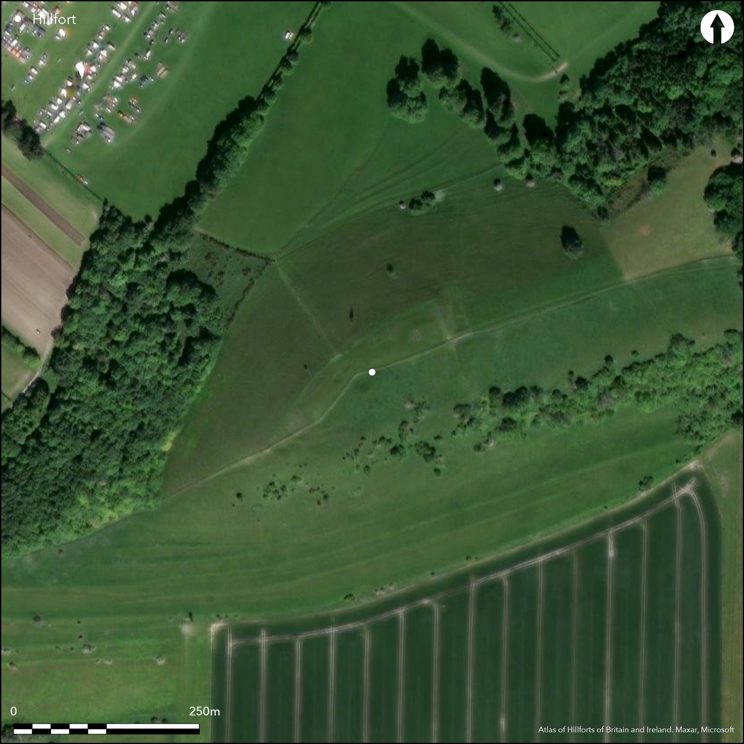
Downland pasture. Quarrying.
| Woodland | ✗ |
| Commercial Forestry Plantation | ✗ |
| Parkland | ✗ |
| Pasture (Grazing) | ✓ |
| Arable | ✗ |
| Scrub/Bracken | ✗ |
| Bare Outcrop | ✗ |
| Heather/Moorland | ✗ |
| Heath | ✗ |
| Built-up | ✗ |
| Coastal Grassland | ✗ |
| Other | ✓ |
Promontory fort located on steep NW-facing spur above Vale of Pewsey. Slopes very steep and precipitous
| Contour Fort | ✗ |
| Partial Contour Fort | ✗ |
| Promontory Fort | ✓ |
| Hillslope Fort | ✗ |
| Level Terrain Fort | ✗ |
| Marsh Fort | ✗ |
| Multiple Enclosure Fort | ✗ |
Located on a very steep and precipitous to the north, downland spur of Martinsell Hill and one of the string of enclosures overlooking the Vale of Pewsey
| Hilltop | ✗ |
| Coastal Promontory | ✗ |
| Inland Promontory | ✓ |
| Valley Bottom | ✗ |
| Knoll/Hillock/Outcrop | ✗ |
| Ridge | ✗ |
| Cliff/Plateau-edge/Scarp | ✗ |
| Hillslope | ✗ |
| Lowland | ✗ |
| Spur | ✓ |
Dominant Topographic Feature: Spur promontory.
| North | ✗ |
| Northeast | ✗ |
| East | ✗ |
| Southeast | ✗ |
| South | ✗ |
| Southwest | ✗ |
| West | ✗ |
| Northwest | ✗ |
| Level | ✓ |
Altitude: 250.0m
N/A
Late Hallstatt-La Tene sherds (comparable with All Cannings ware) found by Hawkes and Meyrick in fort and nearby.
Reliability: C - Low
| Pre 1200BC | ✗ |
| 1200BC - 800BC | ✗ |
| 800BC - 400BC | ✓ |
| 400BC - AD50 | ✗ |
| AD50 - AD400 | ✗ |
| AD400 - AD 800 | ✗ |
| Post AD800 | ✗ |
| Unknown | ✗ |
| Pre Hillfort: | None |
| Post Hillfort: | None |
| Artefactual: | Late Hallstatt-La Tene sherds. |
On Ist Ed. OS map (1887). Minimal investigations by Hawkes and Meyrick in fort and nearby.
| 1st Identified Map Depiction (1887): | OS map. |
| Other (None): | Minimal investigations by Hawkes and Meyrick in fort and nearby. |
Internally S half has large number of irregular scoops, not necessarily hut sites, since there has also been flint digging in the area. Late Hallstatt-La Tene sherds (comparable with All Cannings ware) found by Hawkes and Meyrick in fort and nearby.
None
| None | ✓ |
| Spring | ✗ |
| Stream | ✗ |
| Pool | ✗ |
| Flush | ✗ |
| Well | ✗ |
| Other | ✗ |
Internally S half has large number of irregular scoops, not necessarily hut sites, since there has also been flint digging in the area.
| No Known Features | ✗ |
| Round Stone Structures | ✗ |
| Rectangular Stone Structures | ✗ |
| Curvilinear Platforms | ✓ |
| Other Roundhouse Evidence | ✗ |
| Pits | ✗ |
| Quarry Hollows | ✗ |
| Other | ✓ |
Minimal investigations.
| No Known Excavation | ✓ |
| Pits | ✗ |
| Postholes | ✗ |
| Roundhouses | ✗ |
| Rectangular Structures | ✗ |
| Roads/Tracks | ✗ |
| Quarry Hollows | ✗ |
| Other | ✗ |
| Nothing Found | ✗ |
None
| No Known Geophysics | ✓ |
| Pits | ✗ |
| Roundhouses | ✗ |
| Rectangular Structures | ✗ |
| Roads/Tracks | ✗ |
| Quarry Hollows | ✗ |
| Other | ✗ |
| Nothing Found | ✗ |
Late Hallstatt- La Tene sherds comparable with All Cannings ware found by Hawkes and Meyrick in fort and nearby. Furrowed and cordoned haematite ware and sherd of black ware.
| No Known Finds | ✗ |
| Pottery | ✓ |
| Metal | ✗ |
| Metalworking | ✗ |
| Human Bones | ✗ |
| Animal Bones | ✗ |
| Lithics | ✗ |
| Environmental | ✗ |
| Other | ✗ |
None
| APs Not Checked | ✓ |
| None | ✗ |
| Roundhouses | ✗ |
| Rectangular Structures | ✗ |
| Pits | ✗ |
| Postholes | ✗ |
| Roads/Tracks | ✗ |
| Other | ✗ |
Later track distorted original central entrance and causeway across ditch, simple gap at NE.
| 1: | None |
| 2: | None |
Guard Chambers: ✗
Chevaux de Frise: ✗
| 1. Simple Gap (North east): | Causewayed. |
Site protected by single bank and ditch running NW-SE across ridge, the bank averaging 3.0m high by 18.0m wide with ditch on E side 10m wide. Ditch has unfinished appearance although rampart complete. Some disturbance by tracking and quarrying. Another straight bank and ditch to E, broken only by old chalk pit, also runs NW-SE across ridge for c. 94m. Uncertainty as to whether this is part of fort or an earlier attempt to cut off the promontory. Now shows as a broad scarp 2.2m high with ditch 0.6m deep on E side. Central portion disturbed by trackway and quarrying.
| Area 1: | 1.0ha. |
| Total: | 1.0ha. |
Total Footprint Area: Noneha.
None
| ✗ | None |
| ✗ | None |
| NE Quadrant: | 1 |
| SE Quadrant: | 1 |
| SW Quadrant: | 0 |
| NW Quadrant: | 0 |
| Total: | 1 |
| Partial Univallate | ✓ |
| Univallate | ✗ |
| Partial Bivallate | ✗ |
| Bivallate | ✗ |
| Partial Multivallate | ✗ |
| Multivallate | ✗ |
| Unknown | ✗ |
| Partial Univallate | ✗ |
| Univallate | ✗ |
| Partial Bivallate | ✗ |
| Bivallate | ✗ |
| Partial Multivallate | ✗ |
| Multivallate | ✗ |
Ditch has unfinished appearance although rampart complete.
| None | ✗ |
| Earthen Bank | ✓ |
| Stone Wall | ✗ |
| Rubble | ✗ |
| Wall-walk | ✗ |
| Evidence of Timber | ✗ |
| Vitrification | ✗ |
| Other Burning | ✗ |
| Palisade | ✗ |
| Counter Scarp Bank | ✗ |
| Berm | ✗ |
| Unfinished | ✓ |
| Other | ✗ |
None
| None | ✗ |
| Earthen Bank | ✗ |
| Stone Wall | ✗ |
| Murus Duplex | ✗ |
| Timber-framed | ✗ |
| Timber-laced | ✗ |
| Vitrification | ✗ |
| Other Burning | ✗ |
| Palisade | ✗ |
| Counter Scarp Bank | ✗ |
| Berm | ✗ |
| Unfinished | ✗ |
| No Known Excavation | ✓ |
| Other | ✗ |
| ✗ | None |
| ✓ | Ditch has unfinished appearance although rampart complete. Another straight ditch (with bank), broken only by old chalk pit, also runs NW-SE across ridge for c. 94m. Uncertainty as to whether this is part of fort. |
Number of Ditches: 2
| ✗ | None |
Bowden M. 2005. The middle Iron Age on the Marlborough Downs, in eds G. Brown, D. Field and D. McOmish, The Avebury landscape, Oxford: Oxbow Books, 156-63.
Pugh, R.B. and Crittall, E. eds 1957. A history of Wiltshire, 1.1, The Victoria history of the counties of England, Oxford: OUP, 121, 270.
Atlas of Hillforts:
Wikidata:
This work is licensed under CC BY-SA 4.0![]()
![]()
![]() and should be cited as:
and should be cited as:
Lock, Gary and Ralston, Ian. 2024. Atlas of Hillforts of Britain and Ireland. Available at: https://hillforts.arch.ox.ac.uk
Document Version 1.1