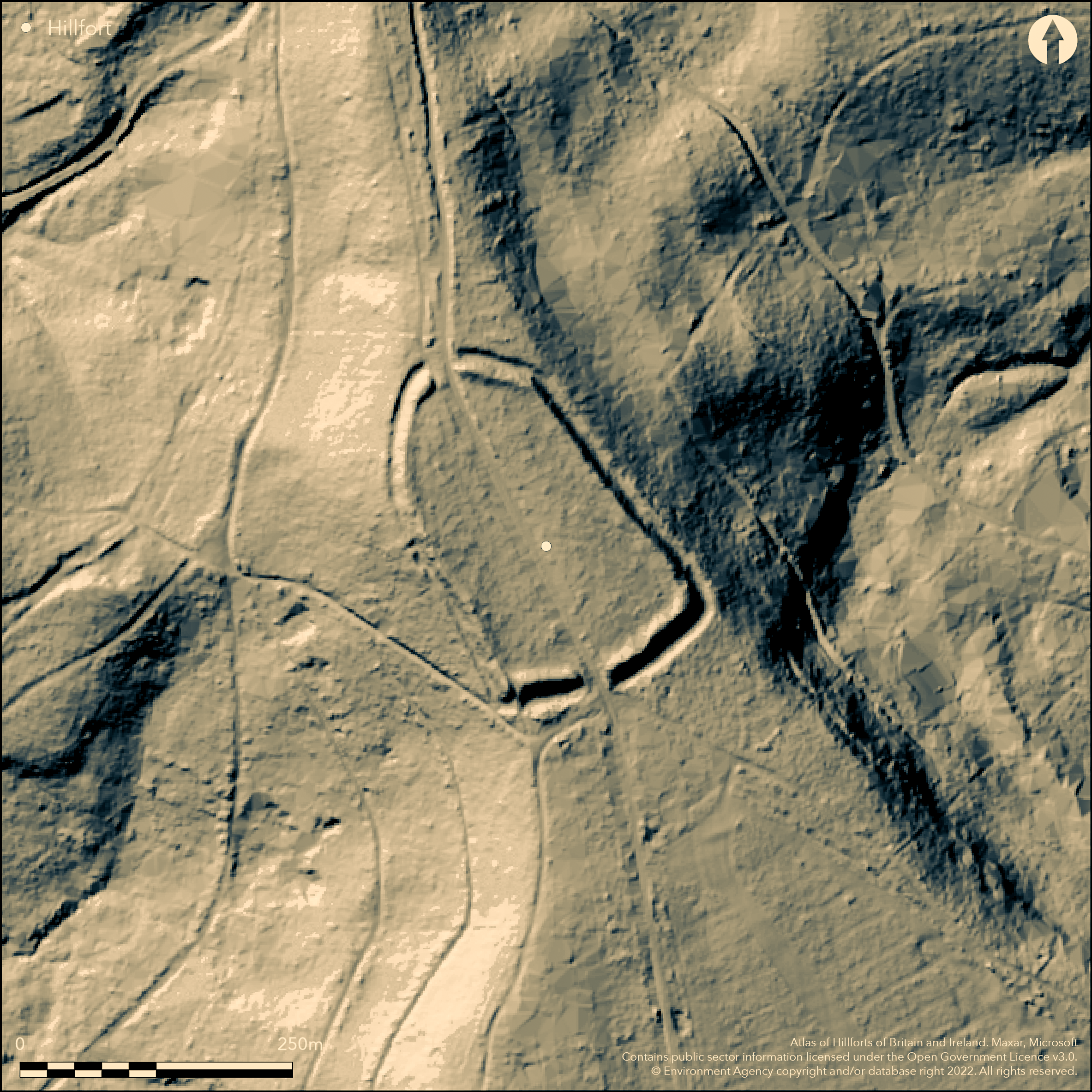
LiDAR 1m DTM Hillshade
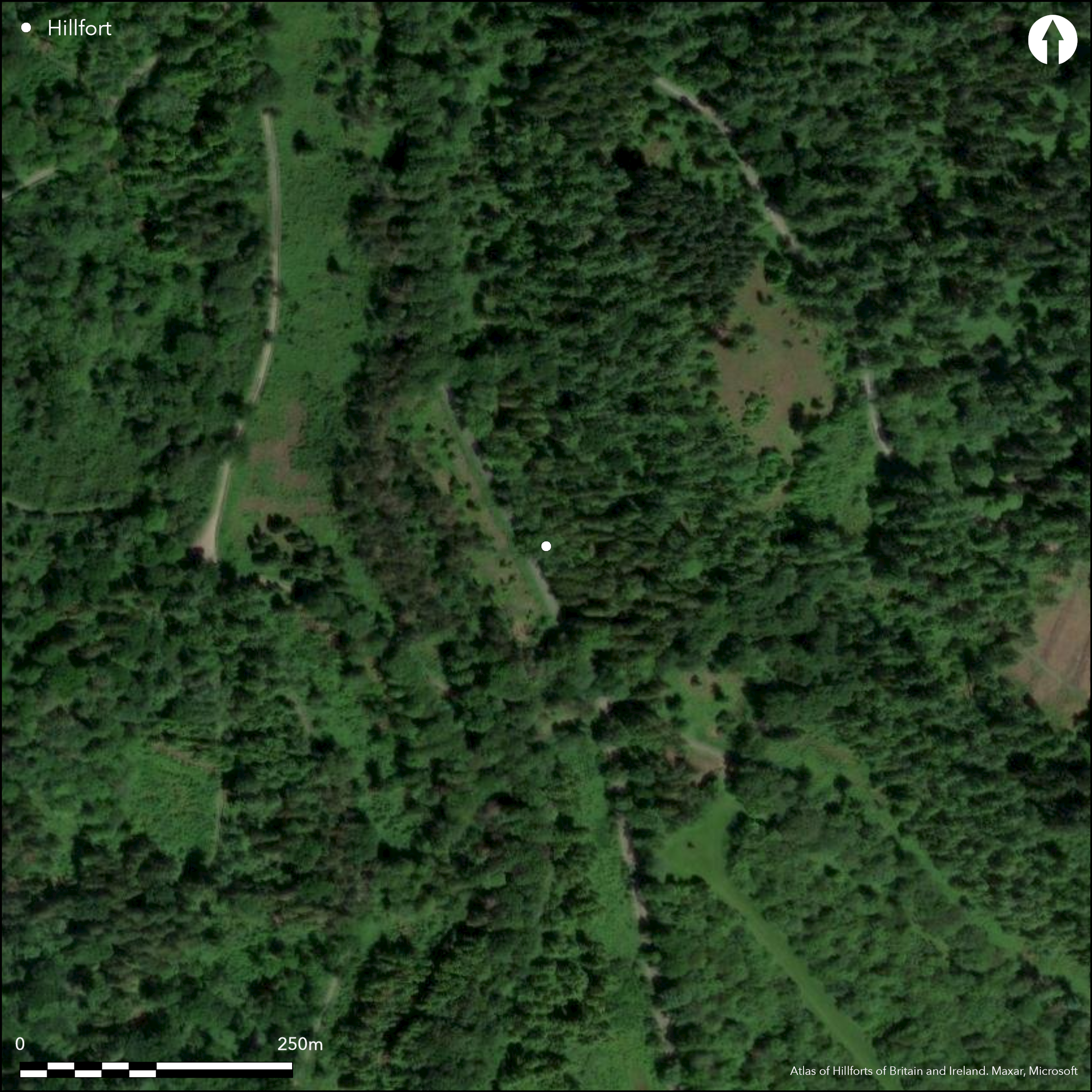
Satellite Imagery
LiDAR 1m DTM Hillshade
Satellite Imagery
Scroll left/right to view further images.
HER: Wiltshire and Swindon MWI103 (None)
NMR: ST 73 SW 6 (202653)
SM: 1008257
NGR: ST74773354
X: 374777 Y: 133542 (OSGB36)
Univallate, sub-rectangular, contour fort located at the N end of a ridge in the hills of the Somerset/Wiltshire border, enclosing 1.6ha. The, drawing to a point on N, a plan determined by the natural contours and consisting of a bank and external ditch or terrace. Most massive on S against rising ground, with bank up to 2m high and the outside ditch 2m deep. On N tip bank is 0.5m high with ditch 2m deep. The W and E sides make use of natural slopes forming a drop of 2m-3m from bank 0.5m high to ditch 0.5m deep. Along much of steep W side ditch is broad terrace 3m-4m wide. Original entrances possibly in centre of N and S sides, with minor road enclosed by banks now running through. Present gaps wider than road, suggesting former broader trackway along the ridge. Second gap on NNW adjacent to that through which the road runs, possibly the original entrance gap. An entrance in SW corner of the fort unlikely to be original and probably relating to track at some points running along slight terrace inside ramparts. Also small gap in the bank on SE. Suggested that SE side originally cross-ridge dyke. No internal features. Wooded and damaged. On Ist Ed. OS map (1887).
Citizen Science: ✗
Reliability of Data: Confirmed
Reliability of Interpretation: Confirmed
X: -262896 Y: 6639102 (EPSG: 3857)
Longitude: -2.361631206957383 Latitude: 51.10056376092296 (EPSG:4326)
Country: England; None
Current County or Unitary Authority: Wiltshire; Somerset
Historic County: Wiltshire; Somerset
Current Parish/Community/Council/Townland: Stourton with Gasper; Charlton Musgrove
Minor road runs through site entrances.
| Extant | ✓ |
| Cropmark | ✗ |
| Likely Destroyed | ✗ |
Wooded site. Road.
| Woodland | ✓ |
| Commercial Forestry Plantation | ✗ |
| Parkland | ✗ |
| Pasture (Grazing) | ✗ |
| Arable | ✗ |
| Scrub/Bracken | ✗ |
| Bare Outcrop | ✗ |
| Heather/Moorland | ✗ |
| Heath | ✗ |
| Built-up | ✗ |
| Coastal Grassland | ✗ |
| Other | ✓ |
Univallate, sub-rectangular, contour fort located at the N end of a ridge in the hills of the Somerset/Wiltshire border
| Contour Fort | ✓ |
| Partial Contour Fort | ✗ |
| Promontory Fort | ✗ |
| Hillslope Fort | ✗ |
| Level Terrain Fort | ✗ |
| Marsh Fort | ✗ |
| Multiple Enclosure Fort | ✗ |
| Hilltop | ✗ |
| Coastal Promontory | ✗ |
| Inland Promontory | ✗ |
| Valley Bottom | ✗ |
| Knoll/Hillock/Outcrop | ✗ |
| Ridge | ✓ |
| Cliff/Plateau-edge/Scarp | ✗ |
| Hillslope | ✗ |
| Lowland | ✗ |
| Spur | ✗ |
Dominant Topographic Feature: Ridge
| North | ✗ |
| Northeast | ✗ |
| East | ✗ |
| Southeast | ✗ |
| South | ✗ |
| Southwest | ✗ |
| West | ✗ |
| Northwest | ✗ |
| Level | ✓ |
Altitude: 242.0m
Boundary Type: County
None.
Reliability: D - None
| Pre 1200BC | ✗ |
| 1200BC - 800BC | ✗ |
| 800BC - 400BC | ✗ |
| 400BC - AD50 | ✗ |
| AD50 - AD400 | ✗ |
| AD400 - AD 800 | ✗ |
| Post AD800 | ✗ |
| Unknown | ✓ |
| Pre Hillfort: | None |
| Post Hillfort: | None |
In Aubrey's Monumenta Britannica (1665-1693). On Ist Ed. OS map (1887). RCHME measured survey: South Wiltshire Project, ref. no. 831573.
| 1st Identified Map Depiction (1887): | OS map. |
| 1st Identified Written Reference (None): | Aubrey's Monumenta Britannica. |
| Earthwork Survey (None): | RCHME measured survey: South Wiltshire. |
None.
None
| None | ✓ |
| Spring | ✗ |
| Stream | ✗ |
| Pool | ✗ |
| Flush | ✗ |
| Well | ✗ |
| Other | ✗ |
None
| No Known Features | ✓ |
| Round Stone Structures | ✗ |
| Rectangular Stone Structures | ✗ |
| Curvilinear Platforms | ✗ |
| Other Roundhouse Evidence | ✗ |
| Pits | ✗ |
| Quarry Hollows | ✗ |
| Other | ✗ |
None
| No Known Excavation | ✓ |
| Pits | ✗ |
| Postholes | ✗ |
| Roundhouses | ✗ |
| Rectangular Structures | ✗ |
| Roads/Tracks | ✗ |
| Quarry Hollows | ✗ |
| Other | ✗ |
| Nothing Found | ✗ |
None
| No Known Geophysics | ✓ |
| Pits | ✗ |
| Roundhouses | ✗ |
| Rectangular Structures | ✗ |
| Roads/Tracks | ✗ |
| Quarry Hollows | ✗ |
| Other | ✗ |
| Nothing Found | ✗ |
None
| No Known Finds | ✓ |
| Pottery | ✗ |
| Metal | ✗ |
| Metalworking | ✗ |
| Human Bones | ✗ |
| Animal Bones | ✗ |
| Lithics | ✗ |
| Environmental | ✗ |
| Other | ✗ |
None
| APs Not Checked | ✓ |
| None | ✗ |
| Roundhouses | ✗ |
| Rectangular Structures | ✗ |
| Pits | ✗ |
| Postholes | ✗ |
| Roads/Tracks | ✗ |
| Other | ✗ |
Original entrances possibly in centre of N and S sides, with minor road enclosed by banks now running through. Present gaps wider than road, suggesting former broader trackway along the ridge. Second gap on NNW adjacent to that through which the road runs, possibly the original entrance gap. An entrance in SW corner of the fort unlikely to be original and probably relating to track at some points running along slight terrace inside ramparts. Also small gap in the bank on SE. At N end both sets of bank and ditch terminals appear rounded and undamaged.
| 5: | None |
| 2: | None |
Guard Chambers: ✗
Chevaux de Frise: ✗
| 1. Simple Gap (North): | Minor road runs through gap. |
| 2. Simple Gap (South): | Minor road runs through gap. |
| 3. Simple Gap (North west): | Second gap on NNW adjacent to that through which the road runs, possibly the original entrance gap. |
The, drawing to a point on N, a plan determined by the natural contours and consisting of a bank and external ditch or terrace. Most massive on S against rising ground, with bank up to 2m high and the outside ditch 2m deep. On N tip bank is 0.5m high with ditch 2m deep. The W and E sides make use of natural slopes forming a drop of 2m-3m from bank 0.5m high to ditch 0.5m deep. Along much of steep W side ditch is broad terrace 3m-4m wide.
| Area 1: | 1.6ha. |
| Total: | 1.6ha. |
Total Footprint Area: Noneha.
None
| ✗ | None |
| ✓ | None |
| NE Quadrant: | 1 |
| SE Quadrant: | 1 |
| SW Quadrant: | 1 |
| NW Quadrant: | 1 |
| Total: | 1 |
| Partial Univallate | ✗ |
| Univallate | ✓ |
| Partial Bivallate | ✗ |
| Bivallate | ✗ |
| Partial Multivallate | ✗ |
| Multivallate | ✗ |
| Unknown | ✗ |
| Partial Univallate | ✗ |
| Univallate | ✗ |
| Partial Bivallate | ✗ |
| Bivallate | ✗ |
| Partial Multivallate | ✗ |
| Multivallate | ✗ |
Along much of steep W side ditch is broad terrace 3m-4m wide.
| None | ✗ |
| Earthen Bank | ✓ |
| Stone Wall | ✗ |
| Rubble | ✗ |
| Wall-walk | ✗ |
| Evidence of Timber | ✗ |
| Vitrification | ✗ |
| Other Burning | ✗ |
| Palisade | ✗ |
| Counter Scarp Bank | ✗ |
| Berm | ✗ |
| Unfinished | ✗ |
| Other | ✓ |
None
| None | ✗ |
| Earthen Bank | ✗ |
| Stone Wall | ✗ |
| Murus Duplex | ✗ |
| Timber-framed | ✗ |
| Timber-laced | ✗ |
| Vitrification | ✗ |
| Other Burning | ✗ |
| Palisade | ✗ |
| Counter Scarp Bank | ✗ |
| Berm | ✗ |
| Unfinished | ✗ |
| No Known Excavation | ✓ |
| Other | ✗ |
| ✗ | None |
| ✓ | External ditch now terrace in places. |
Number of Ditches: 1
| ✗ | None |
Burrow, E.J. 1924. Ancient earthworks and camps of Somerset, Cheltenham: E.J. Burrow, 112-113.
Burrow, I. 1981. Hillforts and hilltop settlement in Somerset, 239.
Pugh, R.B. and Crittall, E. eds 1957. A history of Wiltshire, 1.1, The Victoria history of the counties of England, Oxford: OUP, 210.
Atlas of Hillforts:
Wikidata:
This work is licensed under CC BY-SA 4.0

 and should be cited as:
Lock, Gary and Ralston, Ian. 2024. Atlas of Hillforts of Britain and Ireland. Available at: https://hillforts.arch.ox.ac.uk
Document Version 1.1