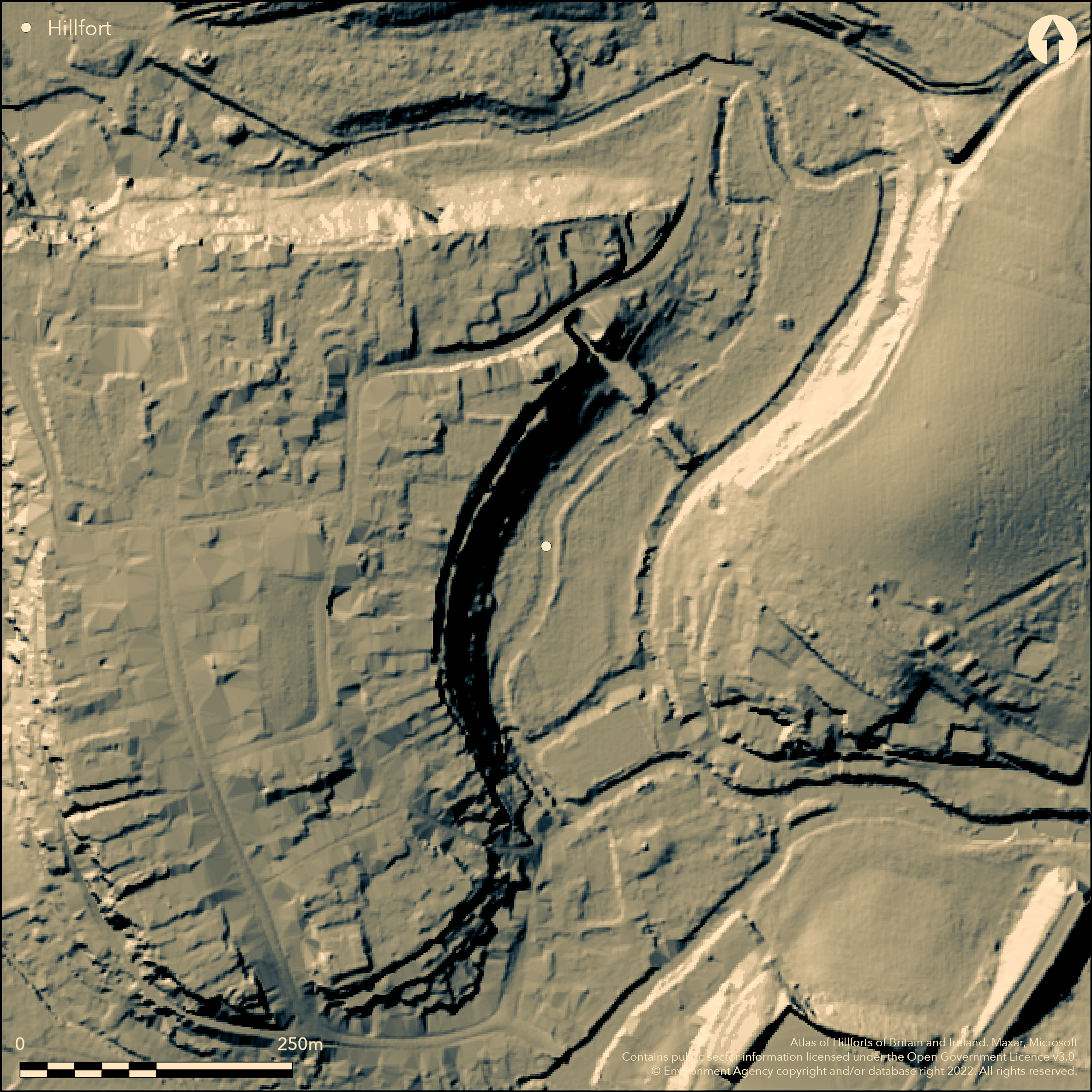
LiDAR 1m DTM Hillshade
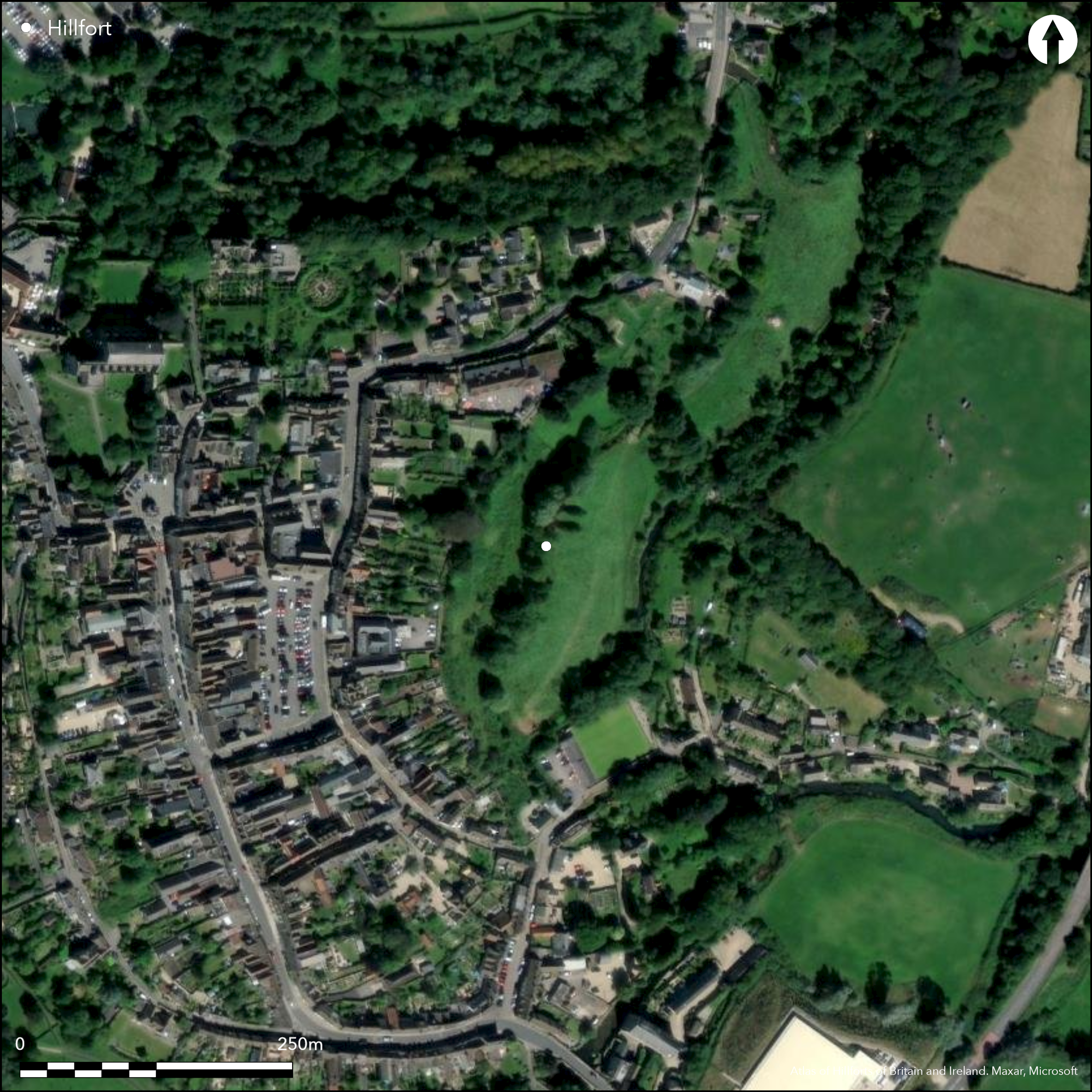
Satellite Imagery
LiDAR 1m DTM Hillshade
Satellite Imagery
Scroll left/right to view further images.
HER: Wiltshire and Swindon MWI5345 (None)
NMR: None (None)
SM: None
NGR: ST93528721
X: 393528 Y: 187213 (OSGB36)
Possible multivallate hillfort suggested (Haslam 1976). Located at Malmesbury on level terrain above bends on the River Avon to S. Measured survey (Corney 1998) indicated earthen bank c. 4m wide and 1m high could indicate such an enclosure. Located in the Nun's Walk area of Malmesbury measuring 123m by 272m. Geophysical survey of mound. Ramparts revealed during excavation of 10 trenches 1998 and 2000 with several constructional phases of ramparts and ditches. Original early Iron Age inner rampart probably clay bank, revetted in front with timber. Three postholes, possibly associated with the timber revetment, sealed beneath later layer of rampart material. Ditch, set in front of a berm less than 0.5m wide, probably contemporary with earliest rampart. Foundations of 3.72m limestone wall, originally to 7m-8m high, dated to the middle Iron Age, surmounted latest phase of inner earthen rampart. Outer defences a series of successive earth banks surmounted by timber and stone ramparts. Second outer ditch, excavated in front of outer bank contained large quantities of collapsed burnt masonry, some vitrified. Most of stonework of inner revetment wall robbed, including large pits backfilled with domestic rubbish. A surviving section of wall near St Joseph's School possibly Iron Age. Excavations 2005-6 by Cotswold Archaeology at Holloway revealed Iron Age defences coinciding with NE length of later town wall. C14 dating for first two phases of hillfort defences produced too broad dates to enable accurate dating, but small assemblage of pottery of Bronze Age to early Iron Age transition recovered from ramparts, suggested earliest phases of hillfort date. Definite evidence of Iron Age hillfort, possibly originating as univallate enclosure, with more complex defences later added around possible entrance located close to site adopted for the medieval East Gate.
Citizen Science: ✓
Reliability of Data: Confirmed
Reliability of Interpretation: Confirmed
X: -233194 Y: 6725198 (EPSG: 3857)
Longitude: -2.0948213725937257 Latitude: 51.58368857475345 (EPSG:4326)
Country: England
Current County or Unitary Authority: Wiltshire
Historic County: Wiltshire
Current Parish/Community/Council/Townland: Malmesbury
Complex damaged site.
| Extant | ✗ |
| Cropmark | ✗ |
| Likely Destroyed | ✓ |
None
| Woodland | ✗ |
| Commercial Forestry Plantation | ✗ |
| Parkland | ✗ |
| Pasture (Grazing) | ✓ |
| Arable | ✗ |
| Scrub/Bracken | ✗ |
| Bare Outcrop | ✗ |
| Heather/Moorland | ✗ |
| Heath | ✗ |
| Built-up | ✓ |
| Coastal Grassland | ✗ |
| Other | ✗ |
Located at Malmesbury on level terrain above bends on the River Avon to S.
| Contour Fort | ✗ |
| Partial Contour Fort | ✗ |
| Promontory Fort | ✗ |
| Hillslope Fort | ✗ |
| Level Terrain Fort | ✓ |
| Marsh Fort | ✗ |
| Multiple Enclosure Fort | ✗ |
| Hilltop | ✗ |
| Coastal Promontory | ✗ |
| Inland Promontory | ✗ |
| Valley Bottom | ✗ |
| Knoll/Hillock/Outcrop | ✗ |
| Ridge | ✗ |
| Cliff/Plateau-edge/Scarp | ✗ |
| Hillslope | ✗ |
| Lowland | ✓ |
| Spur | ✗ |
Dominant Topographic Feature: Level terrain above River Avon.
| North | ✗ |
| Northeast | ✗ |
| East | ✗ |
| Southeast | ✗ |
| South | ✗ |
| Southwest | ✗ |
| West | ✗ |
| Northwest | ✗ |
| Level | ✓ |
Altitude: 78.0m
N/A
C14 dating for first two phases of hillfort defences produced too broad dates to enable accurate dating, but small assemblage of pottery of Bronze Age to early Iron Age transition recovered from ramparts, suggested earliest phases of hillfort date.
Reliability: B - Medium
| Pre 1200BC | ✗ |
| 1200BC - 800BC | ✗ |
| 800BC - 400BC | ✓ |
| 400BC - AD50 | ✓ |
| AD50 - AD400 | ✗ |
| AD400 - AD 800 | ✗ |
| Post AD800 | ✗ |
| Unknown | ✗ |
| Pre Hillfort: | None |
| Post Hillfort: | None |
| Artefactual: | Small assemblage of pottery of Bronze Age to early Iron Age transition recovered from ramparts. |
| C14: | For first two phases of hillfort defences produced too broad dates to enable accurate dating. |
Survey 1998 Stratascan Geophysical & Specialist Survey Service. Excavation 1998-2000 T. Longman. Bristol & Region Archaeological Service. Excavation 2005-2006 Cotswold Archaeological Trust.
| Geophysical Survey (1998): | Survey Stratascan Geophysical & Specialist Survey Service. |
| Excavation (None): | T. Longman. Bristol & Region Archaeological Service. |
| Excavation (None): | Cotswold Archaeological Trust. |
Three postholes, possibly associated with the timber revetment, sealed beneath later layer of rampart material. Large pits backfilled with domestic rubbish.
None
| None | ✓ |
| Spring | ✗ |
| Stream | ✗ |
| Pool | ✗ |
| Flush | ✗ |
| Well | ✗ |
| Other | ✗ |
No longer visible.
| No Known Features | ✓ |
| Round Stone Structures | ✗ |
| Rectangular Stone Structures | ✗ |
| Curvilinear Platforms | ✗ |
| Other Roundhouse Evidence | ✗ |
| Pits | ✗ |
| Quarry Hollows | ✗ |
| Other | ✗ |
Three postholes, possibly associated with the timber revetment, sealed beneath later layer of rampart material. Large pits backfilled with domestic rubbish.
| No Known Excavation | ✗ |
| Pits | ✓ |
| Postholes | ✓ |
| Roundhouses | ✗ |
| Rectangular Structures | ✗ |
| Roads/Tracks | ✗ |
| Quarry Hollows | ✗ |
| Other | ✗ |
| Nothing Found | ✗ |
Geophysical survey of mound. No details.
| No Known Geophysics | ✗ |
| Pits | ✗ |
| Roundhouses | ✗ |
| Rectangular Structures | ✗ |
| Roads/Tracks | ✗ |
| Quarry Hollows | ✗ |
| Other | ✓ |
| Nothing Found | ✗ |
None
| No Known Finds | ✗ |
| Pottery | ✓ |
| Metal | ✗ |
| Metalworking | ✗ |
| Human Bones | ✗ |
| Animal Bones | ✗ |
| Lithics | ✗ |
| Environmental | ✗ |
| Other | ✗ |
None
| APs Not Checked | ✓ |
| None | ✗ |
| Roundhouses | ✗ |
| Rectangular Structures | ✗ |
| Pits | ✗ |
| Postholes | ✗ |
| Roads/Tracks | ✗ |
| Other | ✗ |
Possible E entrance of later multivallate site located close to site adopted for the medieval East Gate.
| 0: | No actual breaks specified. |
| 2: | One suggested. |
Guard Chambers: ✗
Chevaux de Frise: ✗
| 1. Simple Gap (East): | Possible E, but no entrance type specified and simple gap default. |
Original early Iron Age inner rampart probably clay bank, revetted in front with timber. Three postholes, possibly associated with the timber revetment, sealed beneath later layer of rampart material. Ditch, set in front of a berm less than 0.5m wide, probably contemporary with earliest rampart. Foundations of 3.72m limestone wall, originally to 7-8m high, dated to the middle Iron Age, surmounted latest phase of inner earthen rampart. Outer defences a series of successive earth banks surmounted by timber and stone ramparts. Second outer ditch, excavated in front of outer bank contained large quantities of collapsed burnt masonry, some vitrified.
| Area 1: | 3.0ha. |
| Total: | 3.0ha. |
Total Footprint Area: Noneha.
None
| ✓ | Enclosed area not defined; estimated from dimensions in summary. Possible phased construction, with original early Iron Age inner rampart probably clay bank, revetted in front with timber. |
| ✗ | Number of present ramparts not specified, but at least two as no longer visible. Formerly possibly firstly univallate? |
| NE Quadrant: | None |
| SE Quadrant: | None |
| SW Quadrant: | None |
| NW Quadrant: | None |
| Total: | None |
| Partial Univallate | ✗ |
| Univallate | ✗ |
| Partial Bivallate | ✗ |
| Bivallate | ✗ |
| Partial Multivallate | ✗ |
| Multivallate | ✗ |
| Unknown | ✓ |
| Partial Univallate | ✗ |
| Univallate | ✓ |
| Partial Bivallate | ✗ |
| Bivallate | ✗ |
| Partial Multivallate | ✓ |
| Multivallate | ✗ |
No longer visible.
| None | ✓ |
| Earthen Bank | ✗ |
| Stone Wall | ✗ |
| Rubble | ✗ |
| Wall-walk | ✗ |
| Evidence of Timber | ✗ |
| Vitrification | ✗ |
| Other Burning | ✗ |
| Palisade | ✗ |
| Counter Scarp Bank | ✗ |
| Berm | ✗ |
| Unfinished | ✗ |
| Other | ✗ |
Ramparts revealed during excavation of 10 trenches 1998 and 2000 with several constructional phases of ramparts and ditches. Original early Iron Age inner rampart probably clay bank, revetted in front with timber. Three postholes, possibly associated with the timber revetment, sealed beneath later layer of rampart material. Ditch, set in front of a berm less than 0.5m wide, probably contemporary with earliest rampart. Foundations of 3.72m limestone wall, originally to 7m-8m high, dated to the middle Iron Age, surmounted latest phase of inner earthen rampart. Outer defences a series of successive earth banks surmounted by timber and stone ramparts. Second outer ditch, excavated in front of outer bank contained large quantities of collapsed burnt masonry, some vitrified.
| None | ✗ |
| Earthen Bank | ✓ |
| Stone Wall | ✓ |
| Murus Duplex | ✗ |
| Timber-framed | ✓ |
| Timber-laced | ✗ |
| Vitrification | ✓ |
| Other Burning | ✓ |
| Palisade | ✗ |
| Counter Scarp Bank | ✗ |
| Berm | ✓ |
| Unfinished | ✗ |
| No Known Excavation | ✗ |
| Other | ✓ |
| ✗ | None |
| ✓ | At least two ditches. |
Number of Ditches: 2
| ✗ | None |
Cotswold Archaeological Trust 2010. The Prehistoric and Medieval Defences of Malmesbury: Archaeological Investigations at Holloway. 2005-2006, Cotswold Archaeological Trust,
Haslam, J. 1976. Wiltshire Towns: The Archaeological Potential.
Longman, T. 2003. Excavations at the Town Wall, Malmesbury 1998-2000, Bristol & Region Archaeological Serv. 2003.
Longman, T. 2006.The Prehistoric and Medieval Defences of Malmesbury: Archaeological Investigations at Holloway, 2005-2006, 104-64.
Stratascan Geophysical & specialist Survey Service 1998. Nun's Walk, Malmesbury, Accession Register: 2005. Devizes Museum - DZSWS 205.109.
Atlas of Hillforts:
Wikidata:
This work is licensed under CC BY-SA 4.0

 and should be cited as:
Lock, Gary and Ralston, Ian. 2024. Atlas of Hillforts of Britain and Ireland. Available at: https://hillforts.arch.ox.ac.uk
Document Version 1.1