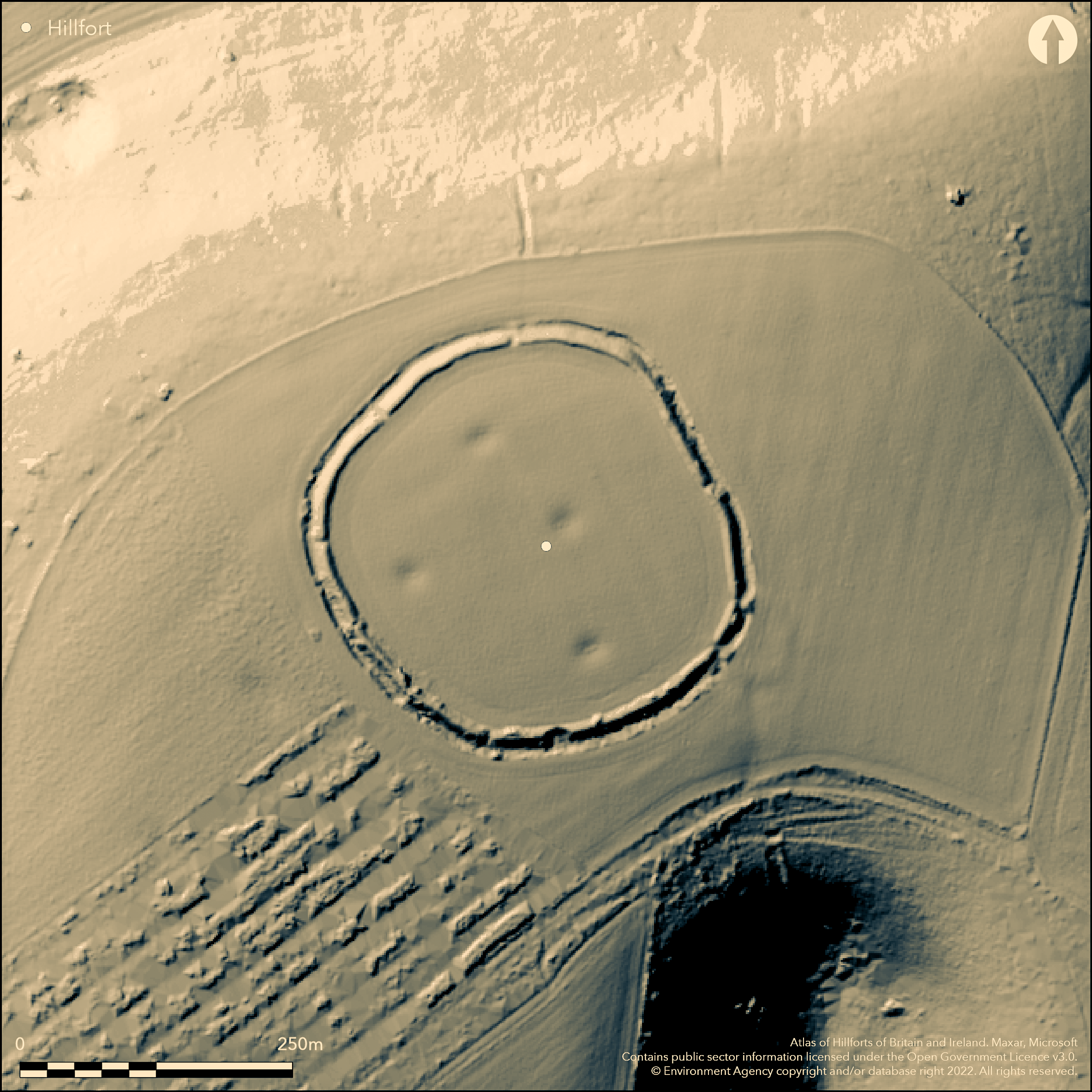
LiDAR 1m DTM Hillshade
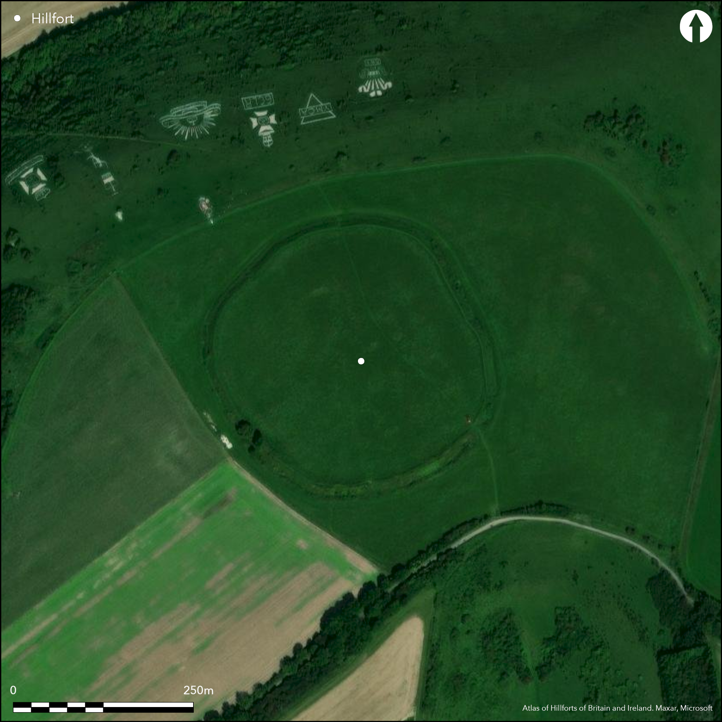
Satellite Imagery
LiDAR 1m DTM Hillshade
Satellite Imagery
Scroll left/right to view further images.
HER: Wiltshire and Swindon MWI5751 (None)
NMR: SU 62 NW 2 (213964)
SM: 1020262
NGR: SU01802812
X: 401809 Y: 128123 (OSGB36)
Univallate partial contour hillfort occupying a prominent position on N projecting spur of narrow part of Ebble-Nadder ridge. Ridge-top position strengthened by steep slopes falling to N and S. Interior area 4ha. On Andrews and Dury's Map of Wiltshire 1773. Access to site gained from W along main axis of ridge. Earthen rampart up to 3.6m high with external ditch to max. of 1.6m deep, well-preserved apart from some damage, constructed in series of straight or slightly curved sections suggesting possible gang working. At one point clear misalignment of two rampart sections. No internal quarry scoops suggest material for rampart from ditch. Small outwork, in poor condition, 60m long, lies against main rampart enclosing entrance on SE. Two linear earthworks, of two low banks and medial ditch, project from site. N linear, aligned roughly N-S, traced for c. 100m towards edge of escarpment. Much of its length N of enclosure obliterated by ploughing. S linear also aligned N-S, again been damaged by ploughing. Has total overall length of c. 155m and, unusually for cross-ridge dyke, course continues over edge of escarpment into bottom of steep combe that projects into the ridge from the S. These land boundary divisions possibly date from C. 500 BC. Eight narrow gaps, c. 2m-10m, gaps in bank, three having associated causeways across the ditch. At present that on SE thought original. Limited excavation by R.C.C. Clay 1923 found no evidence of occupation, but Iron Age pottery and spindle whorl or net sinker found outside. S cross dyke continues as buried feature beneath trackway which running along the ridge top. An Anglo Saxon charter refers to 'the ridgeway', suggesting the trackway used by, at least, early medieval period. During the medieval and post medieval periods, main route from Walton to Shaftesbury becoming turnpike by 18th century. Map of 1773 shows toll house immediately S of the road, visible today as series of earthworks of building platform with small enclosure to E. On Ist Ed. OS map (1887).
Citizen Science: ✗
Reliability of Data: Confirmed
Reliability of Interpretation: Confirmed
X: -219921 Y: 6630566 (EPSG: 3857)
Longitude: -1.9755861622508306 Latitude: 51.05239113121758 (EPSG:4326)
Country: England; None
Current County or Unitary Authority: Wiltshire
Historic County: Wiltshire
Current Parish/Community/Council/Townland: Fovant; Broad Chalke
Rampart and ditch well-preserved apart from some damage,
| Extant | ✓ |
| Cropmark | ✗ |
| Likely Destroyed | ✗ |
Has been arable in past.
| Woodland | ✗ |
| Commercial Forestry Plantation | ✗ |
| Parkland | ✗ |
| Pasture (Grazing) | ✓ |
| Arable | ✓ |
| Scrub/Bracken | ✗ |
| Bare Outcrop | ✗ |
| Heather/Moorland | ✗ |
| Heath | ✗ |
| Built-up | ✗ |
| Coastal Grassland | ✗ |
| Other | ✗ |
Univallate partial contour hillfort occupying a prominent position at 200m OD on N projecting spur of narrow part of Ebble-Nadder ridge.
| Contour Fort | ✗ |
| Partial Contour Fort | ✓ |
| Promontory Fort | ✗ |
| Hillslope Fort | ✗ |
| Level Terrain Fort | ✗ |
| Marsh Fort | ✗ |
| Multiple Enclosure Fort | ✗ |
Located on a north facing downland spur above the River Nadder and Vale of Wardour
| Hilltop | ✗ |
| Coastal Promontory | ✗ |
| Inland Promontory | ✗ |
| Valley Bottom | ✗ |
| Knoll/Hillock/Outcrop | ✗ |
| Ridge | ✓ |
| Cliff/Plateau-edge/Scarp | ✗ |
| Hillslope | ✗ |
| Lowland | ✗ |
| Spur | ✗ |
Dominant Topographic Feature: Projecting spur of narrow part of Ebble-Nadder ridge.
| North | ✗ |
| Northeast | ✓ |
| East | ✗ |
| Southeast | ✗ |
| South | ✗ |
| Southwest | ✗ |
| West | ✗ |
| Northwest | ✗ |
| Level | ✗ |
Altitude: 201.0m
Boundary Type: Parish/Townland
Chance finds of Iron Age pottery outside fort could suggest Iron Age use.
Reliability: C - Low
| Pre 1200BC | ✗ |
| 1200BC - 800BC | ✗ |
| 800BC - 400BC | ✗ |
| 400BC - AD50 | ✓ |
| AD50 - AD400 | ✗ |
| AD400 - AD 800 | ✗ |
| Post AD800 | ✗ |
| Unknown | ✗ |
| Pre Hillfort: | None |
| Post Hillfort: | None |
| Artefactual: | Chance finds of Iron Age pottery outside fort could suggest Iron Age use. |
In Aubrey's Monumenta Britannica (1665-1693). Andrews and Dury's Map of Wiltshire 1773. On Ist Ed. OS map (1887). Excavation W.Cunnington Sen. 1800-10. Excavation R.C.C. Clay 1923. Measured survey RCHME South Wiltshire, ref. no. 831573.
| 1st Identified Map Depiction (1773): | Andrews and Dury's Map of Wiltshire. |
| Other (1887): | OS map. |
| Excavation (1923): | R.C.C. Clay. |
| 1st Identified Written Reference (None): | Aubrey's Monumenta Britannica. |
| Excavation (None): | W. Cunnington Sen. |
| Earthwork Survey (None): | Measured survey RCHME. |
Excavation by R.C.C. Clay 1923 found no evidence of occupation. Iron Age pottery, spindle whorl or net sinker found outside hillfort. Coin of Constantine I found on site.
None
| None | ✓ |
| Spring | ✗ |
| Stream | ✗ |
| Pool | ✗ |
| Flush | ✗ |
| Well | ✗ |
| Other | ✗ |
None
| No Known Features | ✓ |
| Round Stone Structures | ✗ |
| Rectangular Stone Structures | ✗ |
| Curvilinear Platforms | ✗ |
| Other Roundhouse Evidence | ✗ |
| Pits | ✗ |
| Quarry Hollows | ✗ |
| Other | ✗ |
Excavation by R.C.C. Clay 1923 found no evidence of occupation.
| No Known Excavation | ✗ |
| Pits | ✗ |
| Postholes | ✗ |
| Roundhouses | ✗ |
| Rectangular Structures | ✗ |
| Roads/Tracks | ✗ |
| Quarry Hollows | ✗ |
| Other | ✗ |
| Nothing Found | ✓ |
None
| No Known Geophysics | ✓ |
| Pits | ✗ |
| Roundhouses | ✗ |
| Rectangular Structures | ✗ |
| Roads/Tracks | ✗ |
| Quarry Hollows | ✗ |
| Other | ✗ |
| Nothing Found | ✗ |
Iron Age pottery, spindle whorl or net sinker found outside hillfort. Coin of Constantine I found on site.
| No Known Finds | ✗ |
| Pottery | ✗ |
| Metal | ✗ |
| Metalworking | ✗ |
| Human Bones | ✗ |
| Animal Bones | ✗ |
| Lithics | ✗ |
| Environmental | ✗ |
| Other | ✓ |
None
| APs Not Checked | ✓ |
| None | ✗ |
| Roundhouses | ✗ |
| Rectangular Structures | ✗ |
| Pits | ✗ |
| Postholes | ✗ |
| Roads/Tracks | ✗ |
| Other | ✗ |
Eight narrow gaps, c. 2m-10m, gaps in bank, three having associated causeways across the ditch. That on SE could be thought original.
| 8: | None |
| 2: | SE entrance original. |
Guard Chambers: ✗
Chevaux de Frise: ✗
| 1. Simple Gap (South east): | Possibly original. Causewayed. |
Earthen rampart up to 3.6m high with external ditch to max. of 1.6m deep, well preserved apart from some damage, constructed in series of straight or slightly curved sections suggesting possible gang working. At one point clear misalignment of two rampart sections. No internal quarry scoops suggest material for rampart from ditch. Small outwork, in poor condition, 60m long, lies against main rampart enclosing entrance on SE.
| Area 1: | 4.0ha. |
| Total: | 4.0ha. |
Total Footprint Area: Noneha.
None
| ✗ | None |
| ✓ | None |
| NE Quadrant: | 1 |
| SE Quadrant: | 1 |
| SW Quadrant: | 1 |
| NW Quadrant: | 1 |
| Total: | 1 |
| Partial Univallate | ✗ |
| Univallate | ✓ |
| Partial Bivallate | ✗ |
| Bivallate | ✗ |
| Partial Multivallate | ✗ |
| Multivallate | ✗ |
| Unknown | ✗ |
| Partial Univallate | ✗ |
| Univallate | ✗ |
| Partial Bivallate | ✗ |
| Bivallate | ✗ |
| Partial Multivallate | ✗ |
| Multivallate | ✗ |
None
| None | ✗ |
| Earthen Bank | ✓ |
| Stone Wall | ✗ |
| Rubble | ✗ |
| Wall-walk | ✗ |
| Evidence of Timber | ✗ |
| Vitrification | ✗ |
| Other Burning | ✗ |
| Palisade | ✗ |
| Counter Scarp Bank | ✗ |
| Berm | ✗ |
| Unfinished | ✗ |
| Other | ✗ |
None
| None | ✗ |
| Earthen Bank | ✗ |
| Stone Wall | ✗ |
| Murus Duplex | ✗ |
| Timber-framed | ✗ |
| Timber-laced | ✗ |
| Vitrification | ✗ |
| Other Burning | ✗ |
| Palisade | ✗ |
| Counter Scarp Bank | ✗ |
| Berm | ✗ |
| Unfinished | ✗ |
| No Known Excavation | ✓ |
| Other | ✗ |
| ✓ | Site constructed in series of straight or slightly curved sections could indicate gang working. |
| ✓ | Generally well-preserved. |
Number of Ditches: 1
| ✗ | None |
Pugh, R.B. and Crittall, E. 1957. A history of Wiltshire, 1.1, The Victoria history of the counties of England, 113.
Atlas of Hillforts:
Wikidata:
This work is licensed under CC BY-SA 4.0

 and should be cited as:
Lock, Gary and Ralston, Ian. 2024. Atlas of Hillforts of Britain and Ireland. Available at: https://hillforts.arch.ox.ac.uk
Document Version 1.1