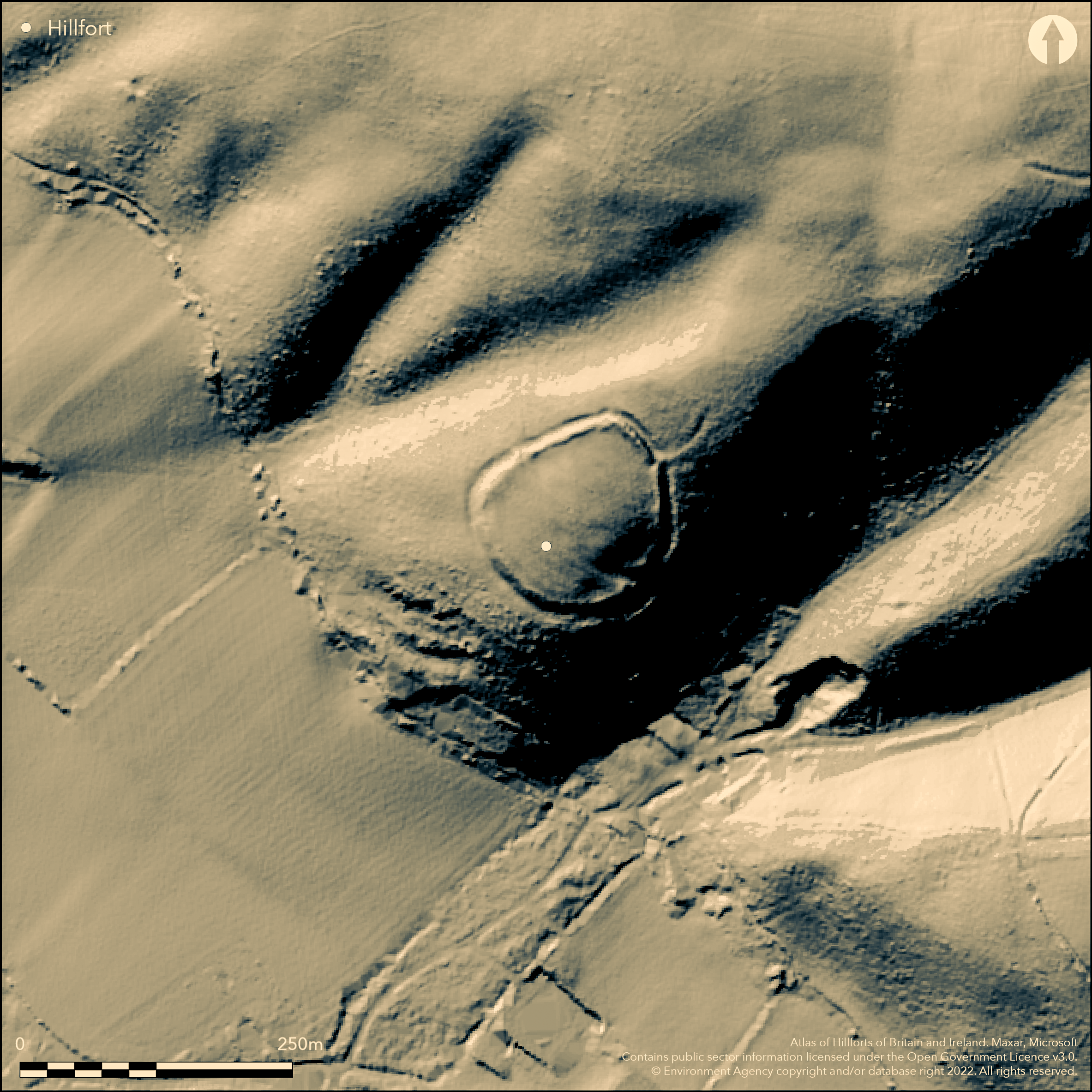
LiDAR 1m DTM Hillshade
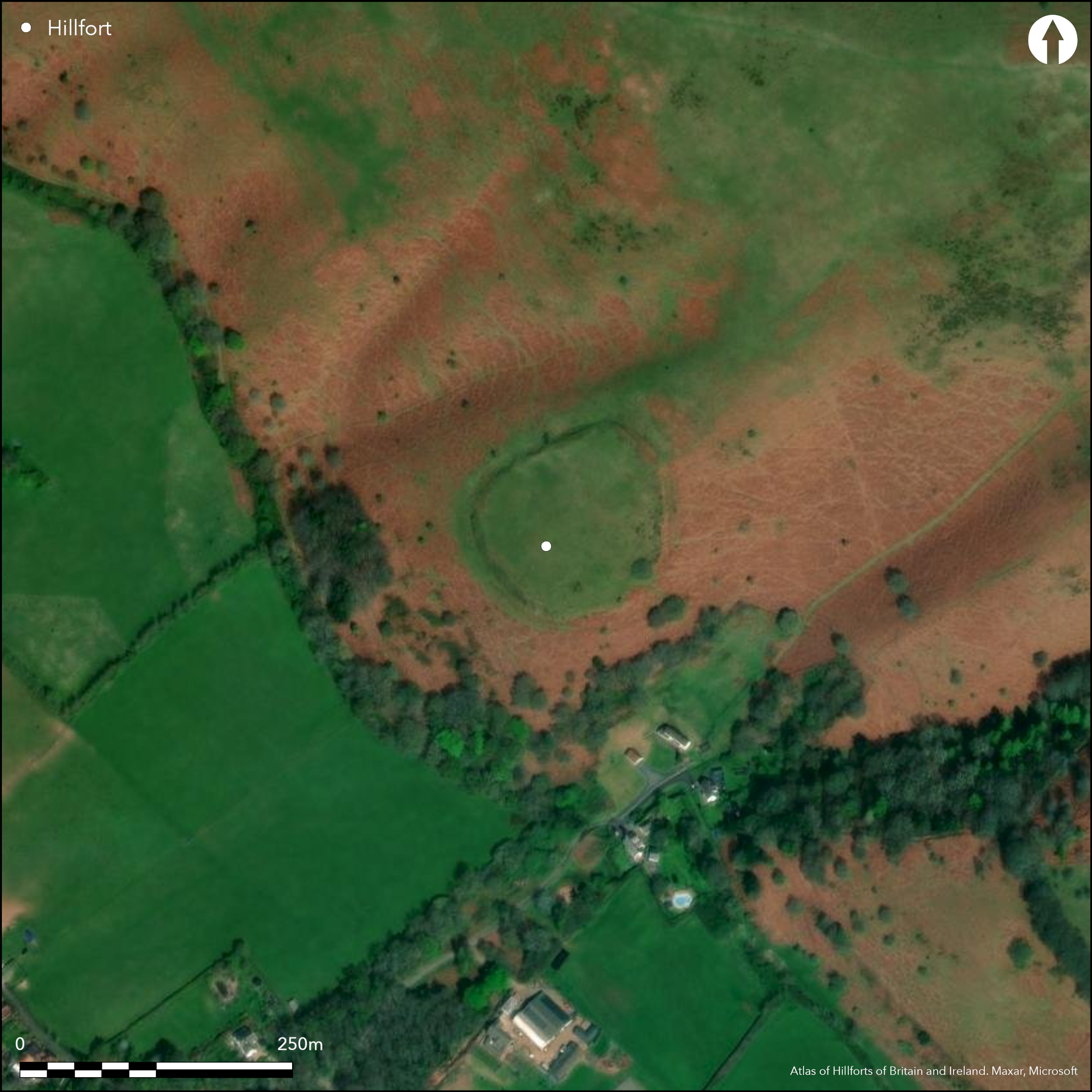
Satellite Imagery
LiDAR 1m DTM Hillshade
Satellite Imagery
Scroll left/right to view further images.
HER: Somerset 33201 (None)
NMR: ST 13 NW 3 (189562)
SM: 1008249
NGR: ST11813935
X: 311810 Y: 139350 (OSGB36)
Univallate hillslope fort, sited on steeply sloping narrow spur of Bicknoller Hill on the W flank of the Quantocks and overlooking narrow combe of the Doniford Stream flowing to the sea to the N. On 1st Ed OS map (1885-1900). Steeply sloping on all sides, but especially on the W. Sub-circular in plan, enclosed by stone bank with external ditch c. 0.5m deep. Uphill to the NE, banks massive up to 4m high with counterscarp c. 0.5 high; downhill to the W bank minimal and probably part-destroyed on the NW. To the SW bank appears to revert to a scarp up to 3.5m high with a terrace or berm at its foot some 3m wide. Quarry ditches inside the enclosure may indicate a former bank fallen into an outer ditch. Two original entrances - NE and SE. Former appears to lead to a cross ridge curving outwork of bank and ditch 450m to NE, which, in not crossing the entire ridge, seems to leave the approach to the fort open. Indeed fort not seen immediately, as E defences drop below the spur, possibly indicating its function as a look-out post or status embellishment. Not excavated and generally in good condition. The site similar in situation to Curdon Wood Camp located directly opposite on the W side of the Doniford Stream valley.
Citizen Science: ✗
Reliability of Data: Confirmed
Reliability of Interpretation: Confirmed
X: -363146 Y: 6647256 (EPSG: 3857)
Longitude: -3.262196700795016 Latitude: 51.14653947881124 (EPSG:4326)
Country: England
Current County or Unitary Authority: Somerset
Historic County: Somerset
Current Parish/Community/Council/Townland: Bicknoller
Monument in general good condition.
| Extant | ✓ |
| Cropmark | ✗ |
| Likely Destroyed | ✗ |
Open moorland/heath site with bracken.
| Woodland | ✗ |
| Commercial Forestry Plantation | ✗ |
| Parkland | ✗ |
| Pasture (Grazing) | ✗ |
| Arable | ✗ |
| Scrub/Bracken | ✓ |
| Bare Outcrop | ✗ |
| Heather/Moorland | ✓ |
| Heath | ✓ |
| Built-up | ✗ |
| Coastal Grassland | ✗ |
| Other | ✗ |
Univallate hillslope fort, sited on steeply sloping narrow spur of Bicknoller Hill on the western flank of the Quantocks and overlooking narrow combe of the Doniford Stream flowing to the sea to the N. Steeply sloping on all sides, but especially on the W.
| Contour Fort | ✗ |
| Partial Contour Fort | ✗ |
| Promontory Fort | ✗ |
| Hillslope Fort | ✓ |
| Level Terrain Fort | ✗ |
| Marsh Fort | ✗ |
| Multiple Enclosure Fort | ✗ |
| Hilltop | ✗ |
| Coastal Promontory | ✗ |
| Inland Promontory | ✗ |
| Valley Bottom | ✗ |
| Knoll/Hillock/Outcrop | ✗ |
| Ridge | ✗ |
| Cliff/Plateau-edge/Scarp | ✗ |
| Hillslope | ✓ |
| Lowland | ✗ |
| Spur | ✓ |
Dominant Topographic Feature: SW facing spur of the western Quantock Hills.
| North | ✗ |
| Northeast | ✗ |
| East | ✗ |
| Southeast | ✗ |
| South | ✗ |
| Southwest | ✓ |
| West | ✗ |
| Northwest | ✗ |
| Level | ✗ |
Altitude: 190.0m
N/A
None
Reliability: D - None
| Pre 1200BC | ✗ |
| 1200BC - 800BC | ✗ |
| 800BC - 400BC | ✗ |
| 400BC - AD50 | ✗ |
| AD50 - AD400 | ✗ |
| AD400 - AD 800 | ✗ |
| Post AD800 | ✗ |
| Unknown | ✓ |
| Pre Hillfort: | None |
| Post Hillfort: | None |
On 1st Ed OS map (1885-1900). Investigated as part of the Quantock Hills AONB National Mapping Programme of English Heritage.
| 1st Identified Map Depiction (None): | 1st Ed OS |
| Other (None): | Quantock Hills AONB National Mapping Programme of English Heritage. |
Quarry ditches inside the enclosure may indicate a former bank fallen into an outer ditch. AP investigation as part of English Heritage Quantocks AONB National Mapping Programme.
None
| None | ✓ |
| Spring | ✗ |
| Stream | ✗ |
| Pool | ✗ |
| Flush | ✗ |
| Well | ✗ |
| Other | ✗ |
Quarry ditches inside the enclosure may indicate a former bank fallen into an outer ditch.
| No Known Features | ✗ |
| Round Stone Structures | ✗ |
| Rectangular Stone Structures | ✗ |
| Curvilinear Platforms | ✗ |
| Other Roundhouse Evidence | ✗ |
| Pits | ✗ |
| Quarry Hollows | ✓ |
| Other | ✗ |
None
| No Known Excavation | ✓ |
| Pits | ✗ |
| Postholes | ✗ |
| Roundhouses | ✗ |
| Rectangular Structures | ✗ |
| Roads/Tracks | ✗ |
| Quarry Hollows | ✗ |
| Other | ✗ |
| Nothing Found | ✗ |
None
| No Known Geophysics | ✓ |
| Pits | ✗ |
| Roundhouses | ✗ |
| Rectangular Structures | ✗ |
| Roads/Tracks | ✗ |
| Quarry Hollows | ✗ |
| Other | ✗ |
| Nothing Found | ✗ |
None
| No Known Finds | ✓ |
| Pottery | ✗ |
| Metal | ✗ |
| Metalworking | ✗ |
| Human Bones | ✗ |
| Animal Bones | ✗ |
| Lithics | ✗ |
| Environmental | ✗ |
| Other | ✗ |
AP investigation as part of English Heritage Quantocks AONB National Mapping Programme.
| APs Not Checked | ✓ |
| None | ✗ |
| Roundhouses | ✗ |
| Rectangular Structures | ✗ |
| Pits | ✗ |
| Postholes | ✗ |
| Roads/Tracks | ✗ |
| Other | ✗ |
Two original entrances. To NE simple gap with causeway faces uphill in direction of the outwork 450m to the NE, with which it appears associated. To SE an askew entrance leads up from the combe below with a terraced track running up between staggered ramparts.
| 2: | None |
| 2: | Two good original entrances visible. |
Guard Chambers: ✗
Chevaux de Frise: ✗
| 1. Simple Gap (North east): | With causeway faces towards the outwork, |
| 1. Outworks (North east): | Outwork 450m to the NE, with which it appears associated. |
| 2. Oblique (South east): | Askew entrance leading up from combe below. |
| 2. Over-lapping (South east): | Terraced track running up between staggered ramparts. |
Steeply sloping on all sides, but especially on the W. Sub-circular in plan, enclosed by stone bank with external ditch c. 0.5m deep. Uphill to the NE, banks massive up to 4m high with counterscarp c. 0.5 high; downhill to the W bank minimal and probably part destroyed on the NW. To the SW bank appears to revert to a scarp up to 3.5m high with a terrace or berm at its foot some 3m wide. Quarry ditches inside the enclosure may indicate a former bank fallen into an outer ditch.
| Area 1: | 0.7ha. |
| Total: | 0.7ha. |
Total Footprint Area: Noneha.
None
| ✗ | None |
| ✓ | None |
| NE Quadrant: | 1 |
| SE Quadrant: | 1 |
| SW Quadrant: | 1 |
| NW Quadrant: | 1 |
| Total: | 1 |
| Partial Univallate | ✗ |
| Univallate | ✓ |
| Partial Bivallate | ✗ |
| Bivallate | ✗ |
| Partial Multivallate | ✗ |
| Multivallate | ✗ |
| Unknown | ✗ |
| Partial Univallate | ✗ |
| Univallate | ✗ |
| Partial Bivallate | ✗ |
| Bivallate | ✗ |
| Partial Multivallate | ✗ |
| Multivallate | ✗ |
Stone bank, berm or terrace and counterscarp in evidence.
| None | ✗ |
| Earthen Bank | ✓ |
| Stone Wall | ✗ |
| Rubble | ✓ |
| Wall-walk | ✗ |
| Evidence of Timber | ✗ |
| Vitrification | ✗ |
| Other Burning | ✗ |
| Palisade | ✗ |
| Counter Scarp Bank | ✓ |
| Berm | ✓ |
| Unfinished | ✗ |
| Other | ✗ |
None
| None | ✗ |
| Earthen Bank | ✗ |
| Stone Wall | ✗ |
| Murus Duplex | ✗ |
| Timber-framed | ✗ |
| Timber-laced | ✗ |
| Vitrification | ✗ |
| Other Burning | ✗ |
| Palisade | ✗ |
| Counter Scarp Bank | ✗ |
| Berm | ✗ |
| Unfinished | ✗ |
| No Known Excavation | ✓ |
| Other | ✗ |
| ✗ | None |
| ✓ | External ditch c. 0.5m deep. Outwork to the NE also has a ditch. |
Number of Ditches: 1
| ✗ | None |
Burrow, E.J. 1924. Ancient earthworks and camps of Somerset, Cheltenham: E.J. Burrow, 102-103.
Page, W. (ed) 1911. The Victoria County History of the County of Somerset, 2, 506, London: St Catherine Press.
Atlas of Hillforts:
Wikidata:
This work is licensed under CC BY-SA 4.0

 and should be cited as:
Lock, Gary and Ralston, Ian. 2024. Atlas of Hillforts of Britain and Ireland. Available at: https://hillforts.arch.ox.ac.uk
Document Version 1.1