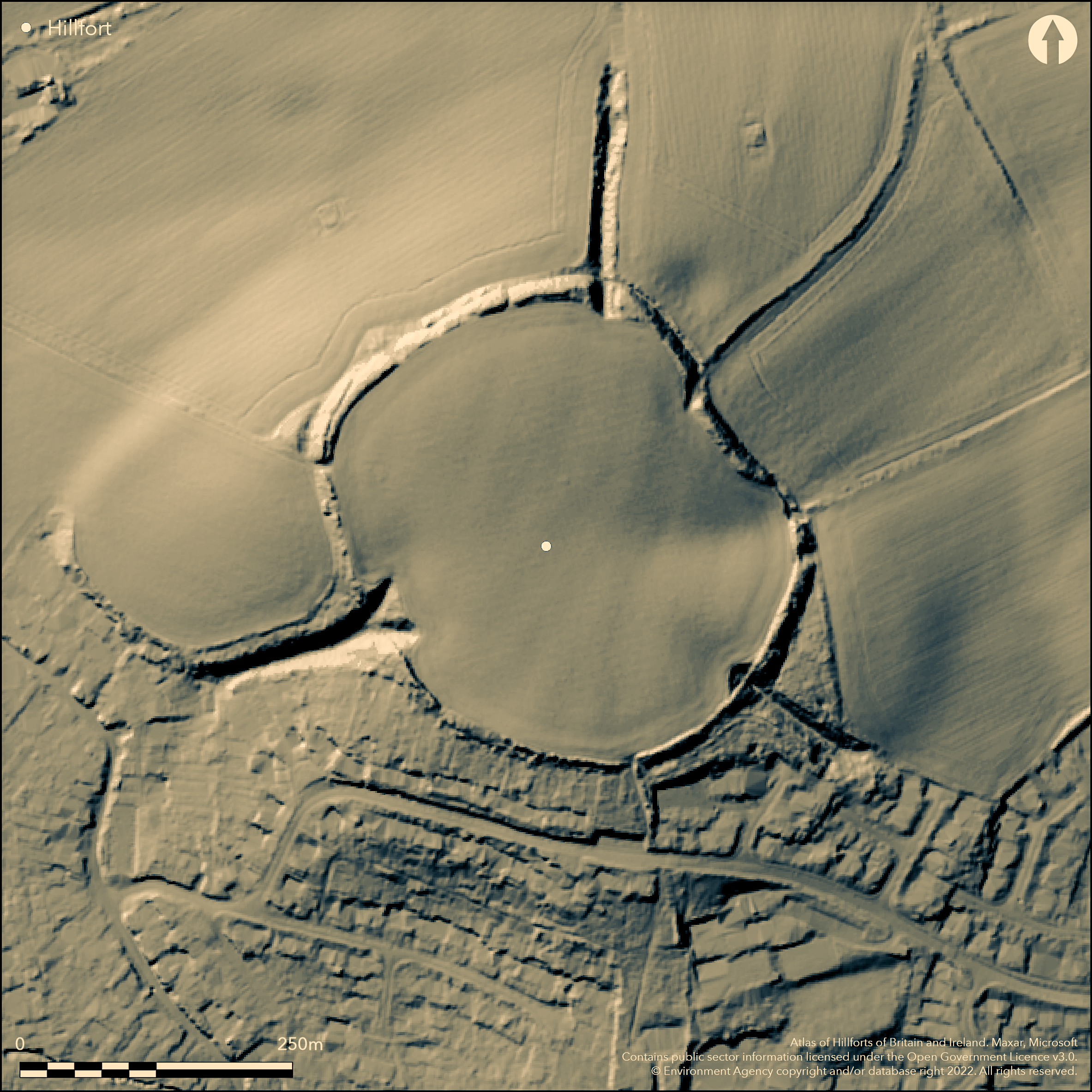
LiDAR 1m DTM Hillshade
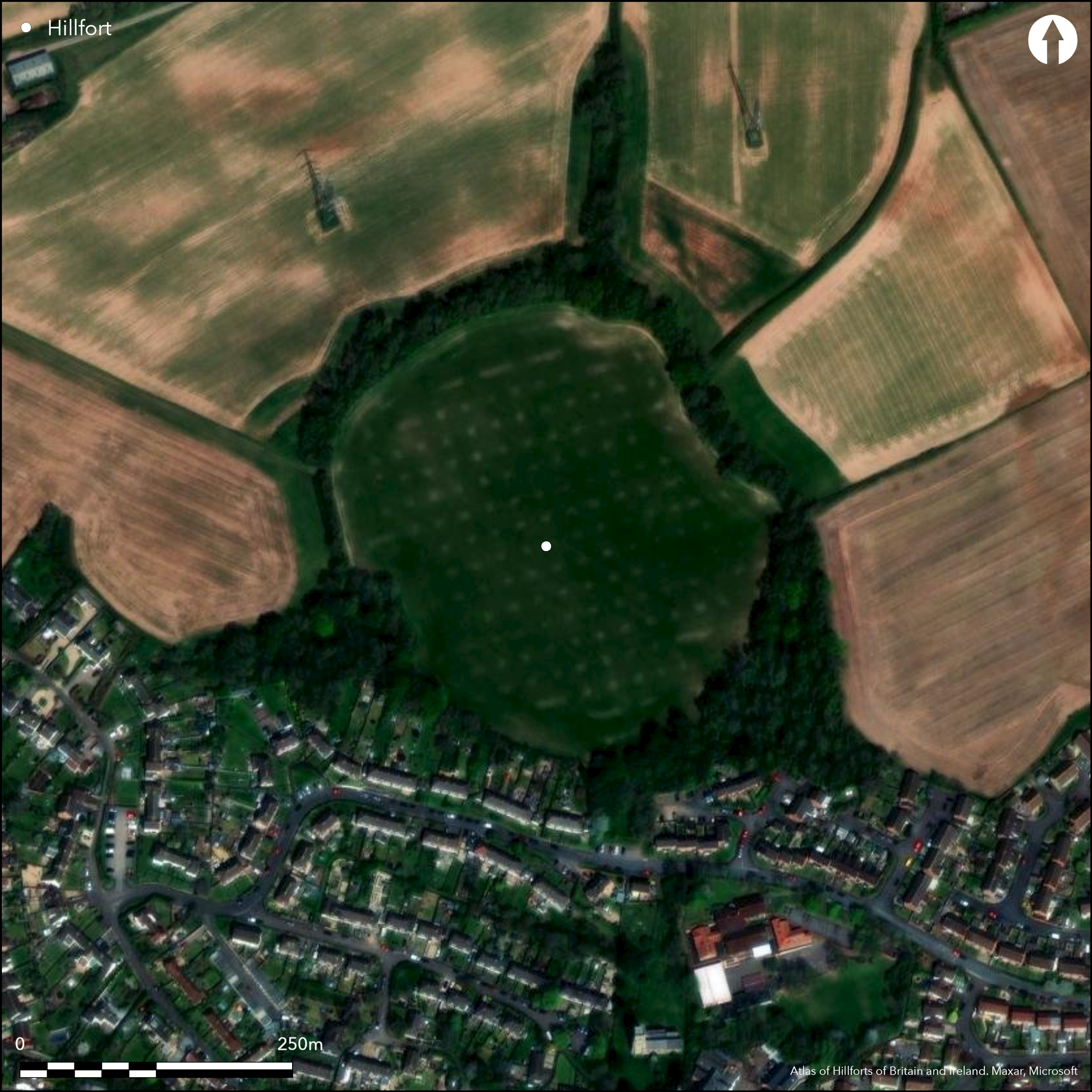
Satellite Imagery
LiDAR 1m DTM Hillshade
Satellite Imagery
Scroll left/right to view further images.
HER: Somerset 43399 (None)
NMR: ST 12 NE 1 (189007)
SM: 1008467
NGR: ST19622626
X: 319620 Y: 126260 (OSGB36)
Large contour hillfort located on a shallow knoll in undulating topography in a commanding position above the River Tone. On 1st Ed OS map (1885-1900). Hill top encircled by broad-topped bank up to 3m high. External ditch confirmed by excavation still just visible as a terrace or shallow depression. Later agricultural erosion and on SW side only a scarp remains. Later field banks pose problems. Short outer bank on W are remains of an earlier middle Bronze Age enclosure predating main site. Small valley to E possibly location of spring. Three deep entrance hollow ways up to 6m deep on the WSW, N and SE lead up to the hillfort, although now blocked by agriculture and collapse, formerly extended into the interior; former deepest and broadest. Small excavations in 1908 (Gray 1908) and between 1968 and 1971 (Langmaid 1968; Ellis 1989) found rampart detail, numerous finds and evidence of phased construction. Phase 1: Neolithic activity; Phase 2: Middle Bronze Age enclosure on NW part of hill; Phase 3: early to middle Iron Age (pits, jar pottery and slag found- possibly undefended at this stage); Phase 4: late Iron Age (pits and gullies with Glastonbury ware - main construction of site); Phase 5: final re-cutting of main ditch and use of wheel-made pottery - site possibly re-furbished; Phase 6: large quantities of simple Romano-Britsih pottery from pits suggest occupation to c. 3rd/4th centuries AD, but no Roman cons or Samian ware found.
Citizen Science: ✗
Reliability of Data: Confirmed
Reliability of Interpretation: Confirmed
X: -350395 Y: 6626603 (EPSG: 3857)
Longitude: -3.147650645031258 Latitude: 51.03000561971928 (EPSG:4326)
Country: England
Current County or Unitary Authority: Somerset
Historic County: Somerset
Current Parish/Community/Council/Townland: Norton Fitzwarren
The single rampart which circles the site has been mutilated by agriculture, but much remains. On Heritage at Risk Register (2015).
| Extant | ✓ |
| Cropmark | ✗ |
| Likely Destroyed | ✗ |
Pasture interior, part wooded ramparts.
| Woodland | ✓ |
| Commercial Forestry Plantation | ✗ |
| Parkland | ✗ |
| Pasture (Grazing) | ✓ |
| Arable | ✗ |
| Scrub/Bracken | ✗ |
| Bare Outcrop | ✗ |
| Heather/Moorland | ✗ |
| Heath | ✗ |
| Built-up | ✗ |
| Coastal Grassland | ✗ |
| Other | ✗ |
Large contour hillfort located on a shallow knoll in undulating topography in a commanding position above the River Tone.
| Contour Fort | ✓ |
| Partial Contour Fort | ✗ |
| Promontory Fort | ✗ |
| Hillslope Fort | ✗ |
| Level Terrain Fort | ✗ |
| Marsh Fort | ✗ |
| Multiple Enclosure Fort | ✗ |
| Hilltop | ✓ |
| Coastal Promontory | ✗ |
| Inland Promontory | ✗ |
| Valley Bottom | ✗ |
| Knoll/Hillock/Outcrop | ✗ |
| Ridge | ✗ |
| Cliff/Plateau-edge/Scarp | ✗ |
| Hillslope | ✗ |
| Lowland | ✗ |
| Spur | ✗ |
Dominant Topographic Feature: Shallow knoll in undulating topography
| North | ✗ |
| Northeast | ✗ |
| East | ✗ |
| Southeast | ✗ |
| South | ✗ |
| Southwest | ✗ |
| West | ✗ |
| Northwest | ✗ |
| Level | ✓ |
Altitude: 50.0m
N/A
Pre-hillfort activity proven in Neolithic finds and middle Bronze Age enclosure. Later early to middle Iron Age activity suggested with main construction in late Iron Age (Glastonbury ware). Occupation continues till c. 3rd/4th centuries AD at latest (quantities of simple Romano-British pottery found). No later activity found in small-scale excavations.
Reliability: B - Medium
| Pre 1200BC | ✗ |
| 1200BC - 800BC | ✓ |
| 800BC - 400BC | ✓ |
| 400BC - AD50 | ✓ |
| AD50 - AD400 | ✓ |
| AD400 - AD 800 | ✗ |
| Post AD800 | ✗ |
| Unknown | ✗ |
| Pre Hillfort: | None |
| Post Hillfort: | None |
| Artefactual: | Finds range from late Iron Age to Romano-British wares. |
| Morphology/Earthwork/Typology: | Earlier middle Bronze Age enclosure. |
On 1st Ed OS map (1885-1900). Small-scale excavations by H.St.G. Gray 1908 and Nancy and Philip Langmaid between 1968 and 1971. Aerial photograph investigation 1989 and 1991 found evidence of interior features.
| Excavation (1908): | Small-scale excavations by H.St.G. Gray. |
| 1st Identified Map Depiction (None): | 1st Ed OS |
| Excavation (None): | Small-scale excavations by Nancy and Philip Langmaid. |
Neolithic chipped flint axe, flakes and scrapers; hoard of Bronze Age bracelets, two palstaves and socketed axe from small V-shaped ditch under existing rampart; clay mould debris of late Bronze Age sword casting from pit at NE entrance; Iron Age and Roman-British pottery in quantity; iron slag suggests metalworking. Aerial photograph investigation 1989 and 1991 found evidence of interior features as cropmarks including at least five circular and sub-circular features c. 12-18m across - possible roundhouses; a sub-rectangular ditched enclosure just inside N rampart and numerous other linear and angled features. 100m to N field boundaries observed.
Small valley to E of hillfort possible location of a spring.
| None | ✓ |
| Spring | ✗ |
| Stream | ✗ |
| Pool | ✗ |
| Flush | ✗ |
| Well | ✗ |
| Other | ✗ |
None
| No Known Features | ✓ |
| Round Stone Structures | ✗ |
| Rectangular Stone Structures | ✗ |
| Curvilinear Platforms | ✗ |
| Other Roundhouse Evidence | ✗ |
| Pits | ✗ |
| Quarry Hollows | ✗ |
| Other | ✗ |
Pits excavated and detail of ramparts determined, with no evidence of possible outer bank.
| No Known Excavation | ✗ |
| Pits | ✓ |
| Postholes | ✗ |
| Roundhouses | ✗ |
| Rectangular Structures | ✗ |
| Roads/Tracks | ✗ |
| Quarry Hollows | ✗ |
| Other | ✓ |
| Nothing Found | ✗ |
None
| No Known Geophysics | ✓ |
| Pits | ✗ |
| Roundhouses | ✗ |
| Rectangular Structures | ✗ |
| Roads/Tracks | ✗ |
| Quarry Hollows | ✗ |
| Other | ✗ |
| Nothing Found | ✗ |
Neolithic chipped flint axe, flakes and scrapers; hoard of Bronze Age bracelets, two palstaves and socketed axe from small V-shaped ditch under existing rampart; clay mould debris of late Bronze Age sword casting from pit at NE entrance; Iron Age and Roman-British pottery in quantity; iron slag suggests metalworking.
| No Known Finds | ✗ |
| Pottery | ✓ |
| Metal | ✓ |
| Metalworking | ✓ |
| Human Bones | ✗ |
| Animal Bones | ✗ |
| Lithics | ✓ |
| Environmental | ✗ |
| Other | ✗ |
Aerial photograph investigation 1989 and 1991 found evidence of interior features as cropmarks including at least five circular and sub-circular features c. 12-18m across - possible roundhouses; a sub-rectangular ditched enclosure just inside N rampart and numerous other linear and angled features. 100m to N field boundaries observed.
| APs Not Checked | ✗ |
| None | ✗ |
| Roundhouses | ✓ |
| Rectangular Structures | ✗ |
| Pits | ✗ |
| Postholes | ✗ |
| Roads/Tracks | ✗ |
| Other | ✓ |
At least five breaks in the ramparts, but three original entrances accessed via hollow ways confirmed. Three deep entrance hollow ways up to 6m deep on the N, SE and SW lead up to the hillfort, although now blocked by agriculture and collapse, formerly extended into the interior; former deepest and broadest.
| 5: | At least five breaks. |
| 2: | Three original entrances accessed via hollow ways confirmed. |
Guard Chambers: ✗
Chevaux de Frise: ✗
| 1. Hollow Way (North): | Deepest and broadest. |
| 2. Hollow Way (South east): | None |
| 3. Hollow Way (South west): | None |
Hill top encircled by broad-topped bank up to 3m high. External ditch confirmed by excavation still just visible as a terrace or shallow depression. Later agricultural erosion and on SW side only a scarp remains. Later field banks pose problems. Short outer bank on W are remains of an earlier middle Bronze Age enclosure predating main site. Middle Bronze Age ditch of earlier enclosure found to underlie main rampart.
| Area 1: | 4.5ha. |
| Total: | 4.5ha. |
Total Footprint Area: Noneha.
None
| ✓ | Small excavations in 1908 (Gray 1908) and between 1968 and 1971 (Langmaid 1968; Ellis 1989) found rampart detail, numerous finds and evidence of phased construction. |
| ✓ | None |
| NE Quadrant: | 1 |
| SE Quadrant: | 1 |
| SW Quadrant: | 1 |
| NW Quadrant: | 1 |
| Total: | 1 |
| Partial Univallate | ✗ |
| Univallate | ✓ |
| Partial Bivallate | ✗ |
| Bivallate | ✗ |
| Partial Multivallate | ✗ |
| Multivallate | ✗ |
| Unknown | ✗ |
| Partial Univallate | ✗ |
| Univallate | ✗ |
| Partial Bivallate | ✗ |
| Bivallate | ✗ |
| Partial Multivallate | ✗ |
| Multivallate | ✗ |
None
| None | ✓ |
| Earthen Bank | ✗ |
| Stone Wall | ✗ |
| Rubble | ✗ |
| Wall-walk | ✗ |
| Evidence of Timber | ✗ |
| Vitrification | ✗ |
| Other Burning | ✗ |
| Palisade | ✗ |
| Counter Scarp Bank | ✗ |
| Berm | ✗ |
| Unfinished | ✗ |
| Other | ✗ |
Middle Bronze Age ditch of earlier enclosure found to underlie main rampart. A possible earlier palisade has been suggested. Evidence of phased construction.
| None | ✗ |
| Earthen Bank | ✓ |
| Stone Wall | ✗ |
| Murus Duplex | ✗ |
| Timber-framed | ✗ |
| Timber-laced | ✗ |
| Vitrification | ✗ |
| Other Burning | ✗ |
| Palisade | ✓ |
| Counter Scarp Bank | ✗ |
| Berm | ✗ |
| Unfinished | ✗ |
| No Known Excavation | ✗ |
| Other | ✗ |
| ✗ | None |
| ✓ | External ditch confirmed by excavation still just visible as a terrace or shallow depression. |
Number of Ditches: 1
| ✗ | None |
Ellis, P. 1989. Norton Fitzwarren Hillfort: a report on the excavations by Nancy and Philip Langmaid between 1968 and 1971, Proc Somerset Archaeol and Natur Hist Soc, 133, 1-74.
Gray, H.St.G., 1908. Excavations at Norton Camp, near Taunton, Proc Somerset Archaeol and Natur Hist Soc, 54, 131-43.
Langmaid, P. 1968. Norton Camp excavation, Proc Somerset Archaeol and Natur Hist Soc, 112, 107-08.
Atlas of Hillforts:
Wikidata:
This work is licensed under CC BY-SA 4.0

 and should be cited as:
Lock, Gary and Ralston, Ian. 2024. Atlas of Hillforts of Britain and Ireland. Available at: https://hillforts.arch.ox.ac.uk
Document Version 1.1