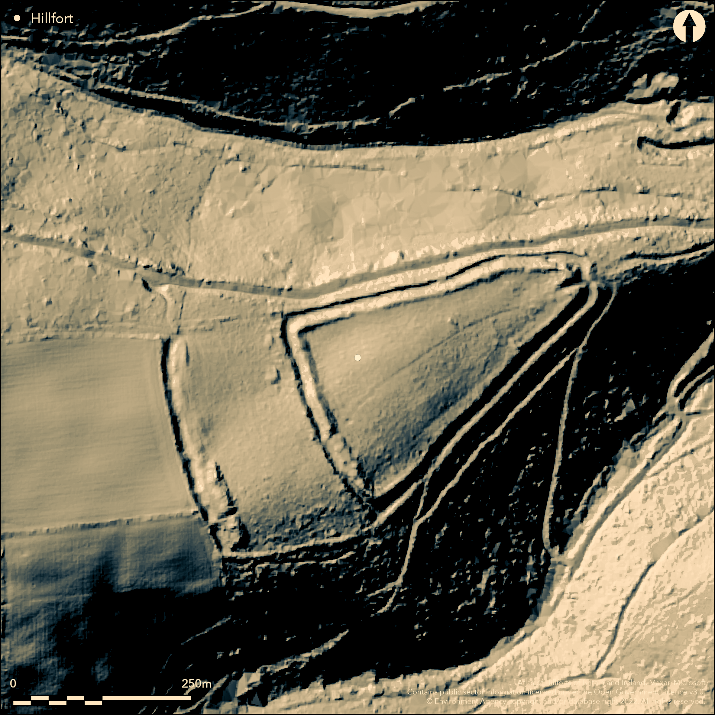
LiDAR 1m DTM Hillshade
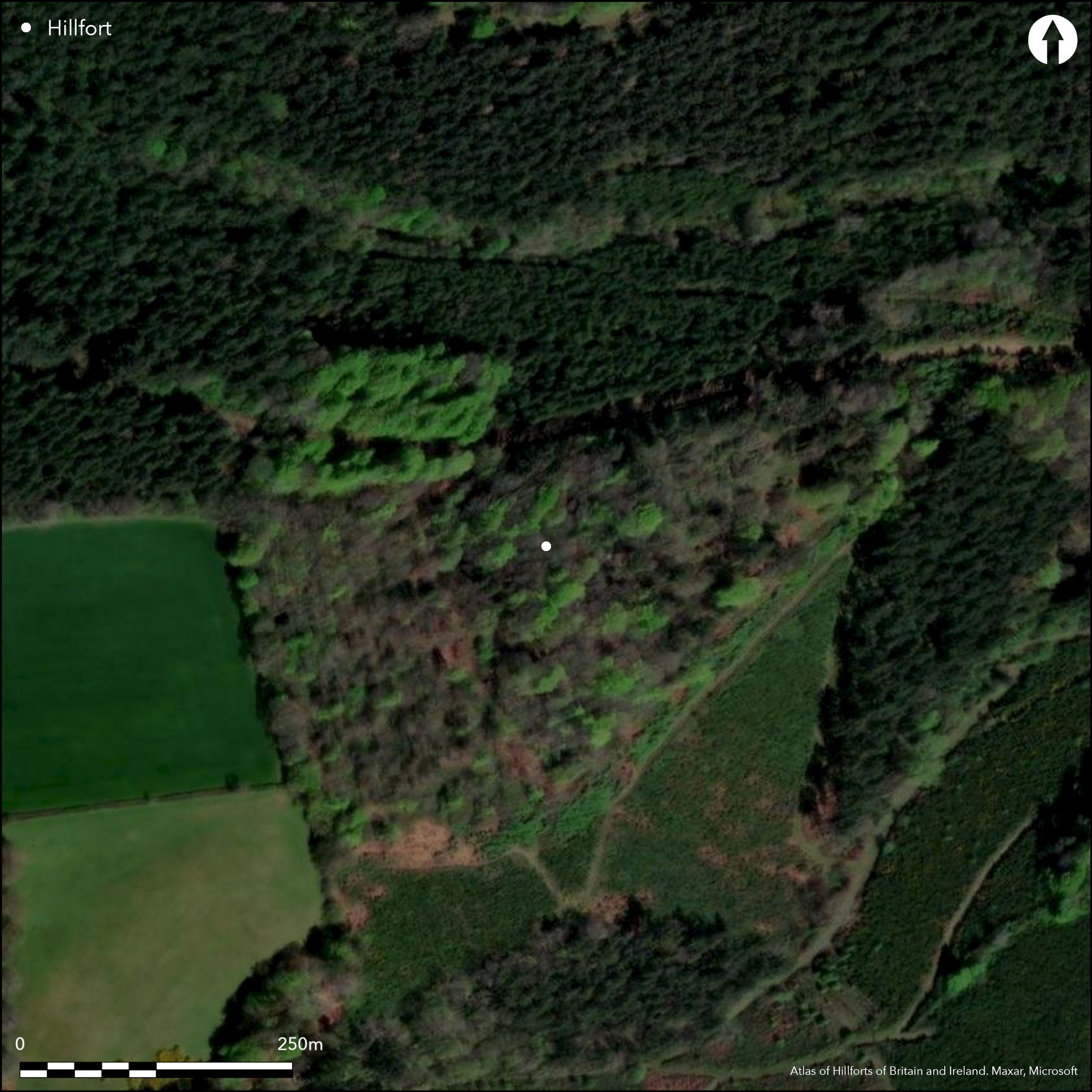
Satellite Imagery
LiDAR 1m DTM Hillshade
Satellite Imagery
Scroll left/right to view further images.
HER: Somerset 10228 (None)
NMR: ST 23 SW 1 (191142)
SM: 1007670
NGR: ST 2270 3350
X: 322747 Y: 133562 (OSGB36)
Large and complex, triangular-shaped, partial contour fort located on a promontory in E Quantock Hills. Unusual in having cross-ridge outworks on the W possibly defining a second, but unfinished, phase of construction. On 1st Ed OS map (1885-1900). Shape determined by natural contours. Earthworks enclose 1.8ha to the E, with a further 1.8ha defined on W uphill side by an outer bank. In main enclosure a rampart with outer ditch and counterscarp bank, with 6m drop to the ditch. This rampart is most massive to 3.4 high on uphill W, but absent on steep SE. Main entrance faces down hill on E tip of the promontory where a hollow way runs up spine of the hill going through a short inturned passageway. A mounding to the S rampart is possible guard chamber/tower. Second entrance gap on W through uphill rampart with slight causeway across ditch. Extension on W defined by cross-ridge bank with an incomplete rampart separated by berm from outer ditch. To S, this outwork linked to main fort by extension of counterscarp and on N by later hedge-line possibly reusing a similar feature. The ditch also extends to only 15m and, as a result of these features, the addition may be unfinished. Across the S of the outwork ditch are three causeways, one of which might be an original entrance. Site generally well preserved, but barn constructed in ditch as part of Ruborough Farm. Minimal investigations, undated.
Citizen Science: ✗
Reliability of Data: Confirmed
Reliability of Interpretation: Confirmed
X: -345606 Y: 6638308 (EPSG: 3857)
Longitude: -3.104628655208373 Latitude: 51.09608474384731 (EPSG:4326)
Country: England
Current County or Unitary Authority: Somerset
Historic County: Somerset
Current Parish/Community/Council/Townland: Broomfield
The site generally well preserved, but barn constructed in ditch as part of Ruborough Farm. On Heritage at Risk Register (2015).
| Extant | ✓ |
| Cropmark | ✗ |
| Likely Destroyed | ✗ |
Farm development.
| Woodland | ✓ |
| Commercial Forestry Plantation | ✗ |
| Parkland | ✗ |
| Pasture (Grazing) | ✗ |
| Arable | ✗ |
| Scrub/Bracken | ✗ |
| Bare Outcrop | ✗ |
| Heather/Moorland | ✗ |
| Heath | ✗ |
| Built-up | ✗ |
| Coastal Grassland | ✗ |
| Other | ✓ |
Large triangular-shaped partial contour fort located on a NE-facing promontory in E Quantock Hills.
| Contour Fort | ✗ |
| Partial Contour Fort | ✓ |
| Promontory Fort | ✗ |
| Hillslope Fort | ✗ |
| Level Terrain Fort | ✗ |
| Marsh Fort | ✗ |
| Multiple Enclosure Fort | ✗ |
| Hilltop | ✗ |
| Coastal Promontory | ✗ |
| Inland Promontory | ✓ |
| Valley Bottom | ✗ |
| Knoll/Hillock/Outcrop | ✗ |
| Ridge | ✗ |
| Cliff/Plateau-edge/Scarp | ✗ |
| Hillslope | ✗ |
| Lowland | ✗ |
| Spur | ✗ |
Dominant Topographic Feature: Inland promontory.
| North | ✗ |
| Northeast | ✓ |
| East | ✗ |
| Southeast | ✗ |
| South | ✗ |
| Southwest | ✗ |
| West | ✗ |
| Northwest | ✗ |
| Level | ✗ |
Altitude: 205.0m
N/A
None
Reliability: D - None
| Pre 1200BC | ✗ |
| 1200BC - 800BC | ✗ |
| 800BC - 400BC | ✗ |
| 400BC - AD50 | ✗ |
| AD50 - AD400 | ✗ |
| AD400 - AD 800 | ✗ |
| Post AD800 | ✗ |
| Unknown | ✓ |
| Pre Hillfort: | None |
| Post Hillfort: | None |
On 1st Ed OS map (1885-1900). Archaeological survey of the Quantock Hills AONB, carried out by the Exeter Office of English Heritage. Not dated.
| 1st Identified Map Depiction (None): | 1st Ed OS map |
| Other (None): | English Heritage survey. |
None
Possible spring located on side of hill.
| None | ✓ |
| Spring | ✗ |
| Stream | ✗ |
| Pool | ✗ |
| Flush | ✗ |
| Well | ✗ |
| Other | ✗ |
None
| No Known Features | ✓ |
| Round Stone Structures | ✗ |
| Rectangular Stone Structures | ✗ |
| Curvilinear Platforms | ✗ |
| Other Roundhouse Evidence | ✗ |
| Pits | ✗ |
| Quarry Hollows | ✗ |
| Other | ✗ |
None
| No Known Excavation | ✓ |
| Pits | ✗ |
| Postholes | ✗ |
| Roundhouses | ✗ |
| Rectangular Structures | ✗ |
| Roads/Tracks | ✗ |
| Quarry Hollows | ✗ |
| Other | ✗ |
| Nothing Found | ✗ |
None
| No Known Geophysics | ✓ |
| Pits | ✗ |
| Roundhouses | ✗ |
| Rectangular Structures | ✗ |
| Roads/Tracks | ✗ |
| Quarry Hollows | ✗ |
| Other | ✗ |
| Nothing Found | ✗ |
None
| No Known Finds | ✓ |
| Pottery | ✗ |
| Metal | ✗ |
| Metalworking | ✗ |
| Human Bones | ✗ |
| Animal Bones | ✗ |
| Lithics | ✗ |
| Environmental | ✗ |
| Other | ✗ |
None
| APs Not Checked | ✓ |
| None | ✗ |
| Roundhouses | ✗ |
| Rectangular Structures | ✗ |
| Pits | ✗ |
| Postholes | ✗ |
| Roads/Tracks | ✗ |
| Other | ✗ |
The main entrance faces downhill on the E tip of the promontory where a hollow way runs up the spine of the hill going through a short inturned passageway. A mounding to the S rampart is a possible guard chamber/tower. There is a second entrance gap on the W through the uphill rampart with slight causeway across the ditch. Across the S of the outwork ditch are three causeways, one of which might be an original.
| 5: | Two modern gaps. |
| 2: | None |
Guard Chambers: ✓
Chevaux de Frise: ✗
| 1. Hollow Way (East): | Short inturned passageway. |
| 1. In-turned (East): | Short inturned passageway. |
| 1. Passage-way/Corridor (East): | Short inturned passageway. |
| 1. Recesses/Guard Chambers (East): | A mounding to the S rampart of main E entrance is a possible guard chamber tower. |
| 2. Simple Gap (West): | Slight causeway across the ditch. |
| 3. Outworks (South): | Possible. Causeway across outwork ditch. |
Main enclosure defences comprise rampart with outer ditch and counterscarp bank, with 6m drop to the ditch. This rampart is most massive to 3.4 high on uphill W, but absent on steep SE. The extension on the W is defined by a cross-ridge bank with an incomplete rampart separated by a berm from the outer ditch. To S, this outwork linked to main fort by extension of counterscarp and on N by a later hedge-line possibly reusing a similar feature. The ditch also extends to only 15m and, as a result of these features, the addition may be unfinished.
| Area 1: | 3.6ha. |
| Total: | 3.6ha. |
Total Footprint Area: Noneha.
None
| ✗ | None |
| ✗ | None |
| NE Quadrant: | 1 |
| SE Quadrant: | 0 |
| SW Quadrant: | 1 |
| NW Quadrant: | 1 |
| Total: | 1 |
| Partial Univallate | ✓ |
| Univallate | ✗ |
| Partial Bivallate | ✗ |
| Bivallate | ✗ |
| Partial Multivallate | ✗ |
| Multivallate | ✗ |
| Unknown | ✗ |
| Partial Univallate | ✗ |
| Univallate | ✗ |
| Partial Bivallate | ✗ |
| Bivallate | ✗ |
| Partial Multivallate | ✗ |
| Multivallate | ✗ |
Extension on W defined by cross-ridge bank with an incomplete rampart separated by berm from outer ditch. To S, this outwork linked to main fort by extension of counterscarp and on N by later hedge-line possibly reusing a similar feature. The ditch also extends to only 15m and, as a result of these features, the addition may be unfinished.
| None | ✗ |
| Earthen Bank | ✓ |
| Stone Wall | ✗ |
| Rubble | ✗ |
| Wall-walk | ✗ |
| Evidence of Timber | ✗ |
| Vitrification | ✗ |
| Other Burning | ✗ |
| Palisade | ✗ |
| Counter Scarp Bank | ✓ |
| Berm | ✓ |
| Unfinished | ✓ |
| Other | ✗ |
None
| None | ✗ |
| Earthen Bank | ✗ |
| Stone Wall | ✗ |
| Murus Duplex | ✗ |
| Timber-framed | ✗ |
| Timber-laced | ✗ |
| Vitrification | ✗ |
| Other Burning | ✗ |
| Palisade | ✗ |
| Counter Scarp Bank | ✗ |
| Berm | ✗ |
| Unfinished | ✗ |
| No Known Excavation | ✓ |
| Other | ✗ |
| ✗ | None |
| ✓ | None |
Number of Ditches: 1
| ✗ | None |
Burrow, E.J. 1924. Ancient earthworks and camps of Somerset, Cheltenham: E.J. Burrow, 68-69.
Gray, H.St.G. 1903. Ruborough Camp, in the parish of Broomfield, Somerset, Proc Somerset Archaeol Natur Hist Soc 49, 173-82.
Page, W. (ed) 1911. The Victoria County History of the County of Somerset, 2, 483, London: St Catherine Press.
Waite, V. 1964. Portrait of the Quantocks. London: Robert Hale.
Atlas of Hillforts:
Wikidata:
This work is licensed under CC BY-SA 4.0

 and should be cited as:
Lock, Gary and Ralston, Ian. 2024. Atlas of Hillforts of Britain and Ireland. Available at: https://hillforts.arch.ox.ac.uk
Document Version 1.1