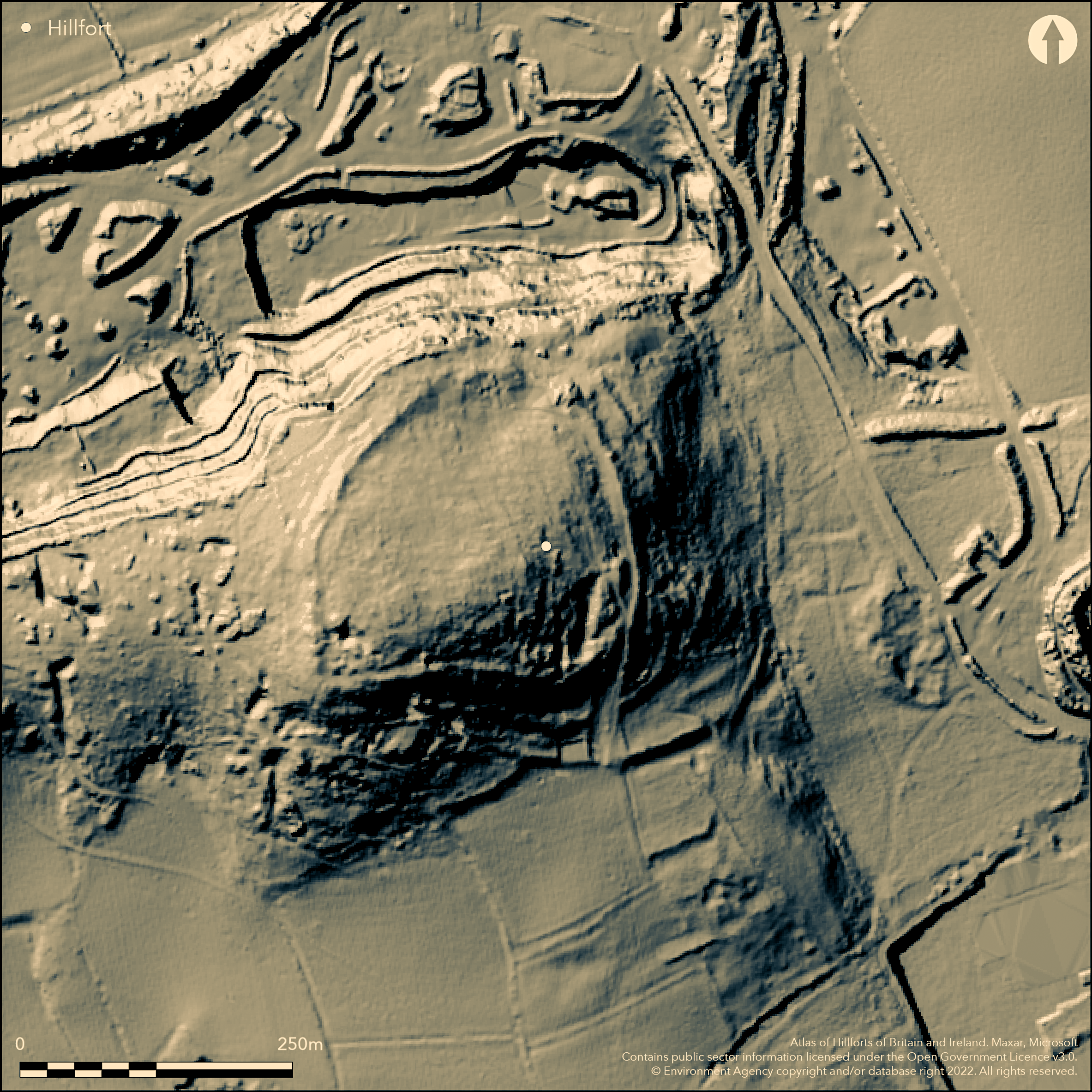
LiDAR 1m DTM Hillshade
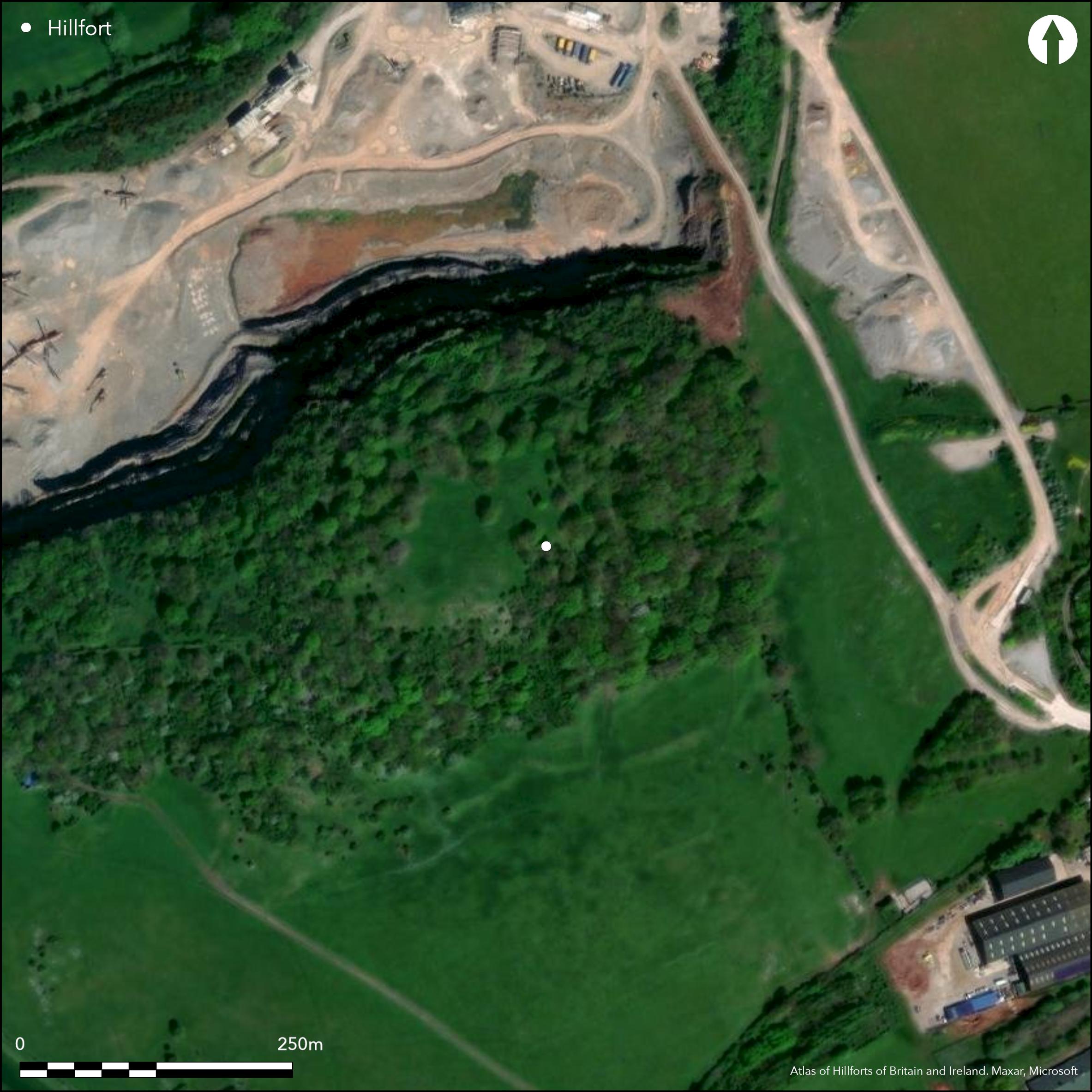
Satellite Imagery
LiDAR 1m DTM Hillshade
Satellite Imagery
Scroll left/right to view further images.
HER: Somerset 10439 (None)
NMR: ST 24 SW 6 (191244)
SM: 1006225
NGR: ST247405
X: 324700 Y: 140500 (OSGB36)
Contour fort located on isolated small hill above Wild Moor Middle Rhyne on Sedgemoor to NW of Cannington. On 1st Ed OS map (1885-1900). Originally enclosed by stone wall, now robbed, above scarp. In 1913 trench dug at SW corner showed this wall with possible additional defences as scarps below. Main entrance at SE, where there is third scarp at foot of the hill. E of the entrance bank and outer ditch are possible later adaptations of this original scarp. Various small excavations undertaken since 1905, but notably by P. Rahtz in 1963 who, because of Roman pottery as well as Iron Age finds and nearby cemetery, indicated later Roman reoccupation of the site. Earlier Neolithic and Brone Age pottery also found suggesting pre-enclosure interest. No definite hut sites in interior, but possible suitable rock terraces visible. Large enclosure identified N of hillfort from which sherds of Glastonbury-type ware recovered. With Castle HIll, Beaford in Devon, Cannington Park has been suggested as the site of the Battle of Cynuit in 878 AD between Viking forces led by Ubhe Ragnarson and the Anglo Saxons under Ealdorman Odda who were victorious.
Citizen Science: ✗
Reliability of Data: Confirmed
Reliability of Interpretation: Confirmed
X: -342663 Y: 6649418 (EPSG: 3857)
Longitude: -3.078195150356422 Latitude: 51.15872190321935 (EPSG:4326)
Country: England
Current County or Unitary Authority: Somerset
Historic County: Somerset
Current Parish/Community/Council/Townland: Cannington
Quarry immediately to N of site. Its effects not recorded.
| Extant | ✓ |
| Cropmark | ✗ |
| Likely Destroyed | ✗ |
Wooded.
| Woodland | ✓ |
| Commercial Forestry Plantation | ✗ |
| Parkland | ✗ |
| Pasture (Grazing) | ✗ |
| Arable | ✗ |
| Scrub/Bracken | ✓ |
| Bare Outcrop | ✗ |
| Heather/Moorland | ✗ |
| Heath | ✗ |
| Built-up | ✗ |
| Coastal Grassland | ✗ |
| Other | ✗ |
Originally a stone walled contour fort located on isolated small hill above Wild Moor Middle Rhyne on Sedgemoor to NW of Cannington.
| Contour Fort | ✓ |
| Partial Contour Fort | ✗ |
| Promontory Fort | ✗ |
| Hillslope Fort | ✗ |
| Level Terrain Fort | ✗ |
| Marsh Fort | ✗ |
| Multiple Enclosure Fort | ✗ |
Located on limestone summit
| Hilltop | ✓ |
| Coastal Promontory | ✗ |
| Inland Promontory | ✗ |
| Valley Bottom | ✗ |
| Knoll/Hillock/Outcrop | ✗ |
| Ridge | ✗ |
| Cliff/Plateau-edge/Scarp | ✗ |
| Hillslope | ✗ |
| Lowland | ✗ |
| Spur | ✗ |
Dominant Topographic Feature: Small hill above Sedgemoor.
| North | ✗ |
| Northeast | ✗ |
| East | ✗ |
| Southeast | ✗ |
| South | ✗ |
| Southwest | ✗ |
| West | ✗ |
| Northwest | ✗ |
| Level | ✓ |
Altitude: 80.0m
N/A
P. Rahtz (1969) suggested, because of late Roman pottery as well as Iron Age finds and nearby cemetery (400 late Roman or later graves), a later Roman reoccupation of the site. Earlier Neolithic and Bronze Age pottery also found suggesting pre-enclosure interest.
Reliability: C - Low
| Pre 1200BC | ✗ |
| 1200BC - 800BC | ✗ |
| 800BC - 400BC | ✗ |
| 400BC - AD50 | ✓ |
| AD50 - AD400 | ✗ |
| AD400 - AD 800 | ✗ |
| Post AD800 | ✗ |
| Unknown | ✗ |
| Pre Hillfort: | None |
| Post Hillfort: | None |
| Artefactual: | Neolithic, Bronze Age, Iron Age and Roman pottery finds. |
On 1st Ed OS map (1885-1900). Various small excavations undertaken since 1905, but notably by P. Rahtz in 1962-63.
| Excavation (1905): | Rev C.W. Whistler |
| Excavation (1913): | C. Bazell |
| Other (1980): | Visit by Hillfort Study Group |
| 1st Identified Map Depiction (None): | 1st Ed OS |
| Excavation (None): | P. Rahtz |
Neolithic, Bronze Age, Iron Age and Roman pottery finds. Iron Age brooch. Finds in Taunton Museum.
None
| None | ✓ |
| Spring | ✗ |
| Stream | ✗ |
| Pool | ✗ |
| Flush | ✗ |
| Well | ✗ |
| Other | ✗ |
No definite hut sites in interior, but possible suitable rock terraces visible.
| No Known Features | ✗ |
| Round Stone Structures | ✗ |
| Rectangular Stone Structures | ✗ |
| Curvilinear Platforms | ✗ |
| Other Roundhouse Evidence | ✗ |
| Pits | ✗ |
| Quarry Hollows | ✗ |
| Other | ✓ |
Various small excavations undertaken since 1905, but notably by P. Rahtz in 1963 who, because of Roman pottery as well as Iron Age finds and nearby cemetery, indicated later Roman reoccupation of the site.
| No Known Excavation | ✗ |
| Pits | ✗ |
| Postholes | ✗ |
| Roundhouses | ✗ |
| Rectangular Structures | ✗ |
| Roads/Tracks | ✗ |
| Quarry Hollows | ✗ |
| Other | ✓ |
| Nothing Found | ✗ |
None
| No Known Geophysics | ✓ |
| Pits | ✗ |
| Roundhouses | ✗ |
| Rectangular Structures | ✗ |
| Roads/Tracks | ✗ |
| Quarry Hollows | ✗ |
| Other | ✗ |
| Nothing Found | ✗ |
Neolithic, Bronze Age, Iron Age and late Roman pottery finds. Iron Age brooch. Wheel turned pottery. Finds in Taunton Museum.
| No Known Finds | ✗ |
| Pottery | ✓ |
| Metal | ✓ |
| Metalworking | ✗ |
| Human Bones | ✗ |
| Animal Bones | ✗ |
| Lithics | ✗ |
| Environmental | ✗ |
| Other | ✗ |
None
| APs Not Checked | ✓ |
| None | ✗ |
| Roundhouses | ✗ |
| Rectangular Structures | ✗ |
| Pits | ✗ |
| Postholes | ✗ |
| Roads/Tracks | ✗ |
| Other | ✗ |
Main entrance at SE where thought to be simple gap. Possible rampart and ditch additions.
| 1: | None |
| 2: | None |
Guard Chambers: ✗
Chevaux de Frise: ✗
| 1. Simple Gap (South east): | Thought to be simple gap. |
Originally enclosed by stone wall, now robbed, above scarp. In 1913 trench dug at SW corner showed this wall with possible additional defences as scarps below. Main entrance at SE, where there is a third scarp at the foot of the hill. E of the entrance a bank and outer ditch are possible later adaptations of this original scarp.
| Area 1: | 3.1ha. |
| Total: | 3.1ha. |
Total Footprint Area: Noneha.
None
| ✗ | None |
| ✓ | None |
| NE Quadrant: | 1 |
| SE Quadrant: | 1 |
| SW Quadrant: | 1 |
| NW Quadrant: | 1 |
| Total: | 1 |
| Partial Univallate | ✗ |
| Univallate | ✓ |
| Partial Bivallate | ✗ |
| Bivallate | ✗ |
| Partial Multivallate | ✗ |
| Multivallate | ✗ |
| Unknown | ✗ |
| Partial Univallate | ✗ |
| Univallate | ✗ |
| Partial Bivallate | ✗ |
| Bivallate | ✗ |
| Partial Multivallate | ✗ |
| Multivallate | ✗ |
Evidence of additional scarps downslope.
| None | ✗ |
| Earthen Bank | ✗ |
| Stone Wall | ✗ |
| Rubble | ✗ |
| Wall-walk | ✗ |
| Evidence of Timber | ✗ |
| Vitrification | ✗ |
| Other Burning | ✗ |
| Palisade | ✗ |
| Counter Scarp Bank | ✗ |
| Berm | ✗ |
| Unfinished | ✗ |
| Other | ✓ |
In 1913 trench dug at SW corner showed robbed stone encircling wall with possible additional defences as scarps below.
| None | ✗ |
| Earthen Bank | ✗ |
| Stone Wall | ✓ |
| Murus Duplex | ✗ |
| Timber-framed | ✗ |
| Timber-laced | ✗ |
| Vitrification | ✗ |
| Other Burning | ✗ |
| Palisade | ✗ |
| Counter Scarp Bank | ✗ |
| Berm | ✗ |
| Unfinished | ✗ |
| No Known Excavation | ✗ |
| Other | ✗ |
| ✗ | None |
| ✓ | E of the entrance a bank and outer ditch are possible later adaptations of the original scarp. |
Number of Ditches: 1
| ✗ | None |
Anon 1906. Note, Saga Book of the Viking Club 5, 47-8.
Page, W. (ed) 1911. The Victoria County History of the County of Somerset, 2, 474-75, London: St Catherine Press.
Rahtz, P. 1969. Cannington Hillfort 1963, Proc Somerset Archaeol Nat Hist Soc, 113, 56-68.
Atlas of Hillforts:
Wikidata:
This work is licensed under CC BY-SA 4.0

 and should be cited as:
Lock, Gary and Ralston, Ian. 2024. Atlas of Hillforts of Britain and Ireland. Available at: https://hillforts.arch.ox.ac.uk
Document Version 1.1