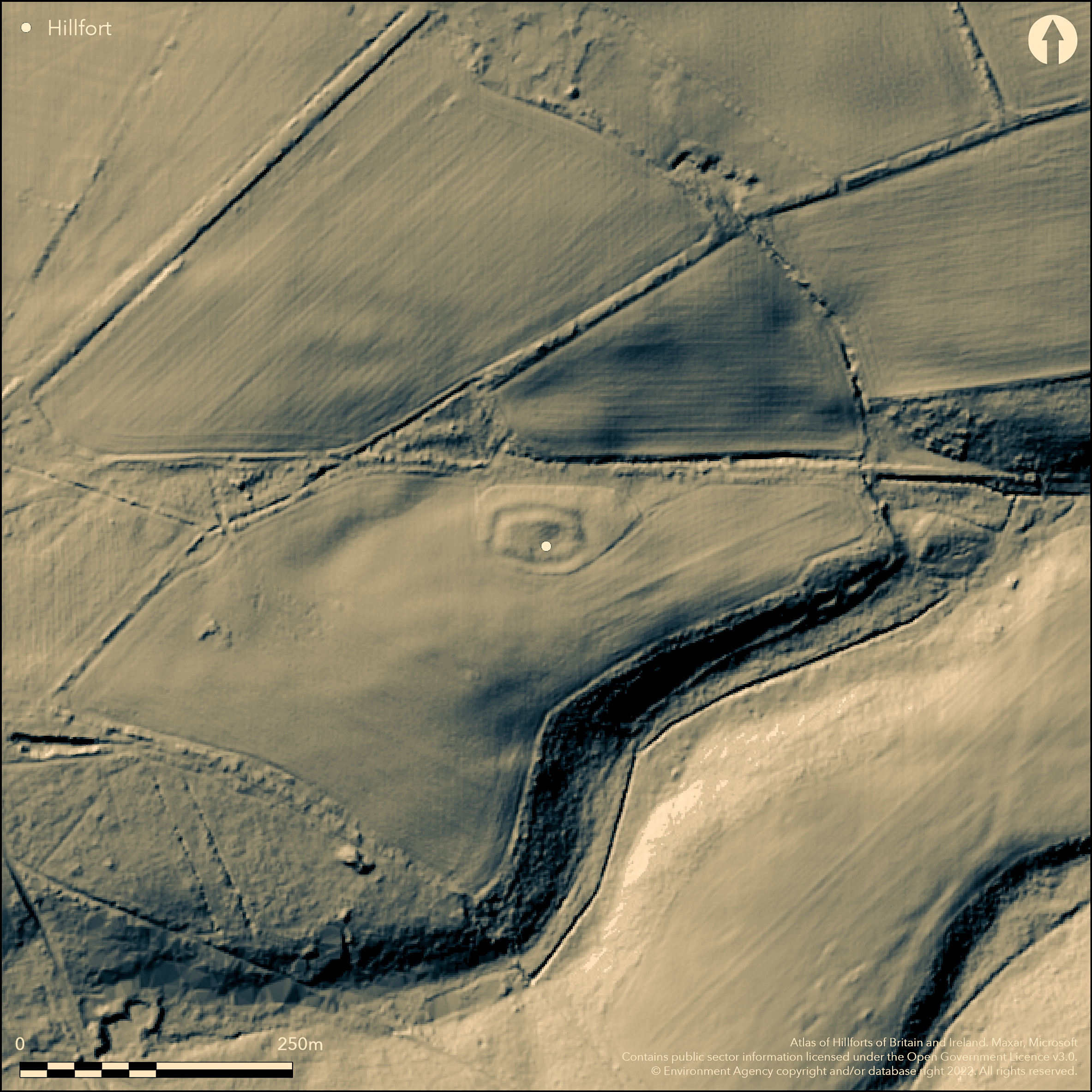
LiDAR 1m DTM Hillshade
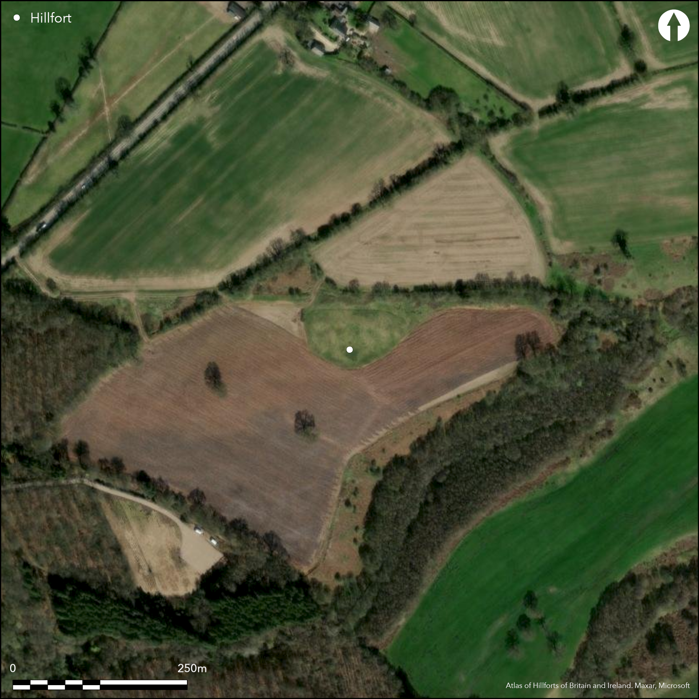
Satellite Imagery
LiDAR 1m DTM Hillshade
Satellite Imagery
Scroll left/right to view further images.
HER: Somerset 23428 (None)
NMR: ST 64 NE 2 (200178)
SM: 1006169
NGR: ST67674583
X: 367670 Y: 145830 (OSGB36)
Hillslope fort located high in Mendip Hills, in sheltered position at top of a steepening of N side of spur, dropping to a stream, where a slight re-entrant visible. Enclosure measures 68m by 50m. and shows continuous ditch with intermittent counterscarp and inner bank. On N side survives as bank 8m wide and 0.75m above interior and 1.5m above outer ditch bottom. Ditch 4m wide and 0.5m deep with slight counterscarp. Exploratory section across NE bank near entrance in 1961 (Overend 1962) revealed silted V-shaped ditch 2m deep cutting into bedrock. Beneath the bank was a silted-up U-shaped ditch and that this ditch itself cut into an earlier bank. Charcoal fragments scattered through silt of both these ditches. Three test pits dug in centre of interior found Mendip type flint tools, but no other signs of occupation. An earthwork survey in 1997 (Powlesland 1998) showed a complex site, but no phasing determined. Interior divided into two areas, E and W. E side shows a low-circular area with the substantial bank to the N. To S bank lower. The W side has traces of the bank on the three external sides. Simple gap and causeway entrance on E side. Medieval ridge and furrow visible on 1940's aerial photographs, with one fragment in interior and another adjacent to N edge of site. Site originally recorded in early 19th century by Colt-Hoare and Skinner, but later re-discovered by AP's in 1961, but was also mentioned in the 1515 survey of Glastonbury Abbey as 'Warehanenbergh'. Substantially eroded by cultivation. Undated.
Citizen Science: ✗
Reliability of Data: Confirmed
Reliability of Interpretation: Confirmed
X: -274318 Y: 6658649 (EPSG: 3857)
Longitude: -2.4642375297010877 Latitude: 51.21069810613688 (EPSG:4326)
Country: England
Current County or Unitary Authority: Somerset
Historic County: Somerset
Current Parish/Community/Council/Townland: Downhead
Substantially eroded by cultivation and bank and counterscarp intermittent.
| Extant | ✓ |
| Cropmark | ✗ |
| Likely Destroyed | ✗ |
Upland pasture.
| Woodland | ✗ |
| Commercial Forestry Plantation | ✗ |
| Parkland | ✗ |
| Pasture (Grazing) | ✓ |
| Arable | ✗ |
| Scrub/Bracken | ✗ |
| Bare Outcrop | ✗ |
| Heather/Moorland | ✗ |
| Heath | ✗ |
| Built-up | ✗ |
| Coastal Grassland | ✗ |
| Other | ✗ |
Probable hillslope fort located high in Mendip Hills, in sheltered position at top of a steepening of N side of spur, dropping to a stream, where a slight re-entrant visible.
| Contour Fort | ✗ |
| Partial Contour Fort | ✗ |
| Promontory Fort | ✗ |
| Hillslope Fort | ✓ |
| Level Terrain Fort | ✗ |
| Marsh Fort | ✗ |
| Multiple Enclosure Fort | ✗ |
| Hilltop | ✗ |
| Coastal Promontory | ✗ |
| Inland Promontory | ✗ |
| Valley Bottom | ✗ |
| Knoll/Hillock/Outcrop | ✗ |
| Ridge | ✗ |
| Cliff/Plateau-edge/Scarp | ✗ |
| Hillslope | ✓ |
| Lowland | ✗ |
| Spur | ✗ |
Dominant Topographic Feature: Slight N-facing slope high in Mendip Hills.
| North | ✓ |
| Northeast | ✗ |
| East | ✗ |
| Southeast | ✗ |
| South | ✗ |
| Southwest | ✗ |
| West | ✗ |
| Northwest | ✗ |
| Level | ✗ |
Altitude: 245.0m
N/A
None
Reliability: D - None
| Pre 1200BC | ✗ |
| 1200BC - 800BC | ✗ |
| 800BC - 400BC | ✗ |
| 400BC - AD50 | ✗ |
| AD50 - AD400 | ✗ |
| AD400 - AD 800 | ✗ |
| Post AD800 | ✗ |
| Unknown | ✓ |
| Pre Hillfort: | None |
| Post Hillfort: | None |
Excavation trench by E.D. Overend, Frome Society for Local Study 1961. Measures survey I. Powlesland 1998, University of Bristol dissertation.
| Excavation (1961): | E.D. Overend. |
| Other (1998): | Measured survey I. Powlesland. |
Site re-discovered by AP in 1961. Charcoal fragments were scattered through silt of both ditches found under the rampart. Three test pits dug in centre of interior found Mendip type flint tools, but no sign of occupation.
None
| None | ✓ |
| Spring | ✗ |
| Stream | ✗ |
| Pool | ✗ |
| Flush | ✗ |
| Well | ✗ |
| Other | ✗ |
None
| No Known Features | ✓ |
| Round Stone Structures | ✗ |
| Rectangular Stone Structures | ✗ |
| Curvilinear Platforms | ✗ |
| Other Roundhouse Evidence | ✗ |
| Pits | ✗ |
| Quarry Hollows | ✗ |
| Other | ✗ |
Trial pits dug in interior showed no sign of occupation.
| No Known Excavation | ✗ |
| Pits | ✗ |
| Postholes | ✗ |
| Roundhouses | ✗ |
| Rectangular Structures | ✗ |
| Roads/Tracks | ✗ |
| Quarry Hollows | ✗ |
| Other | ✓ |
| Nothing Found | ✗ |
None
| No Known Geophysics | ✓ |
| Pits | ✗ |
| Roundhouses | ✗ |
| Rectangular Structures | ✗ |
| Roads/Tracks | ✗ |
| Quarry Hollows | ✗ |
| Other | ✗ |
| Nothing Found | ✗ |
Charcoal fragments were scattered through silt of both ditches found under the rampart. Three test pits dug in centre of interior found Mendip type flint tools, but no sign of occupation.
| No Known Finds | ✗ |
| Pottery | ✗ |
| Metal | ✗ |
| Metalworking | ✗ |
| Human Bones | ✗ |
| Animal Bones | ✗ |
| Lithics | ✓ |
| Environmental | ✓ |
| Other | ✗ |
Site re-discovered by AP in 1961.
| APs Not Checked | ✗ |
| None | ✗ |
| Roundhouses | ✗ |
| Rectangular Structures | ✗ |
| Pits | ✗ |
| Postholes | ✗ |
| Roads/Tracks | ✗ |
| Other | ✓ |
Simple gap with causeway entrance on E. It is possible that there is another gap to the W, but not determined.
| 2: | As well as an original entrance on the E it is possible that there is another gap to the W, but not determined. |
| 2: | None |
Guard Chambers: ✗
Chevaux de Frise: ✗
| 1. Simple Gap (East): | Simple gap with causeway. |
Continuous ditch with intermittent counterscarp and inner bank. On N side survives as bank 8m wide and 0.75m above interior and 1.5m above outer ditch bottom. Ditch 4m wide and 0.5m deep with slight counterscarp. Exploratory section across NE bank near entrance in 1961 revealed silted V-shaped ditch 2m deep cutting into bedrock. Beneath the bank was a silted-up U-shaped ditch and that this ditch itself cut into an earlier bank.
| Area 1: | 0.33ha. |
| Total: | 0.33ha. |
Total Footprint Area: Noneha.
None
| ✗ | None |
| ✓ | Continuous ditch with intermittent counterscarp and inner bank. |
| NE Quadrant: | 1 |
| SE Quadrant: | 1 |
| SW Quadrant: | 1 |
| NW Quadrant: | 1 |
| Total: | 1 |
| Partial Univallate | ✗ |
| Univallate | ✓ |
| Partial Bivallate | ✗ |
| Bivallate | ✗ |
| Partial Multivallate | ✗ |
| Multivallate | ✗ |
| Unknown | ✗ |
| Partial Univallate | ✗ |
| Univallate | ✗ |
| Partial Bivallate | ✗ |
| Bivallate | ✗ |
| Partial Multivallate | ✗ |
| Multivallate | ✗ |
Intermittent counterscarp.
| None | ✗ |
| Earthen Bank | ✓ |
| Stone Wall | ✗ |
| Rubble | ✗ |
| Wall-walk | ✗ |
| Evidence of Timber | ✗ |
| Vitrification | ✗ |
| Other Burning | ✗ |
| Palisade | ✗ |
| Counter Scarp Bank | ✓ |
| Berm | ✗ |
| Unfinished | ✗ |
| Other | ✗ |
Exploratory section across NE bank near entrance in 1961 revealed silted V-shaped ditch 2m deep cutting into bedrock. Beneath the bank was a silted-up U-shaped ditch and that this ditch itself cut into an earlier bank.
| None | ✗ |
| Earthen Bank | ✓ |
| Stone Wall | ✗ |
| Murus Duplex | ✗ |
| Timber-framed | ✗ |
| Timber-laced | ✗ |
| Vitrification | ✗ |
| Other Burning | ✗ |
| Palisade | ✗ |
| Counter Scarp Bank | ✗ |
| Berm | ✗ |
| Unfinished | ✗ |
| No Known Excavation | ✗ |
| Other | ✗ |
| ✗ | None |
| ✓ | Ditch continuous. V and U-shaped. |
Number of Ditches: 1
| ✗ | None |
Council for British Archaeology : Group 12 (Wessex) & Group 13 (South West). Note, Archaeological review 2/1967/12.
Overend, E.D. 1962. Aerial photographs of the Frome area, Proc Somerset Archaeol Natur Hist Soc, 106, 77-80.
Powlesland, I. 1998. Field survey of Dinies Camp, Downhead, Somerset. Bristol: University of Bristol, unpublished dissertation.
Atlas of Hillforts:
Wikidata:
This work is licensed under CC BY-SA 4.0

 and should be cited as:
Lock, Gary and Ralston, Ian. 2024. Atlas of Hillforts of Britain and Ireland. Available at: https://hillforts.arch.ox.ac.uk
Document Version 1.1