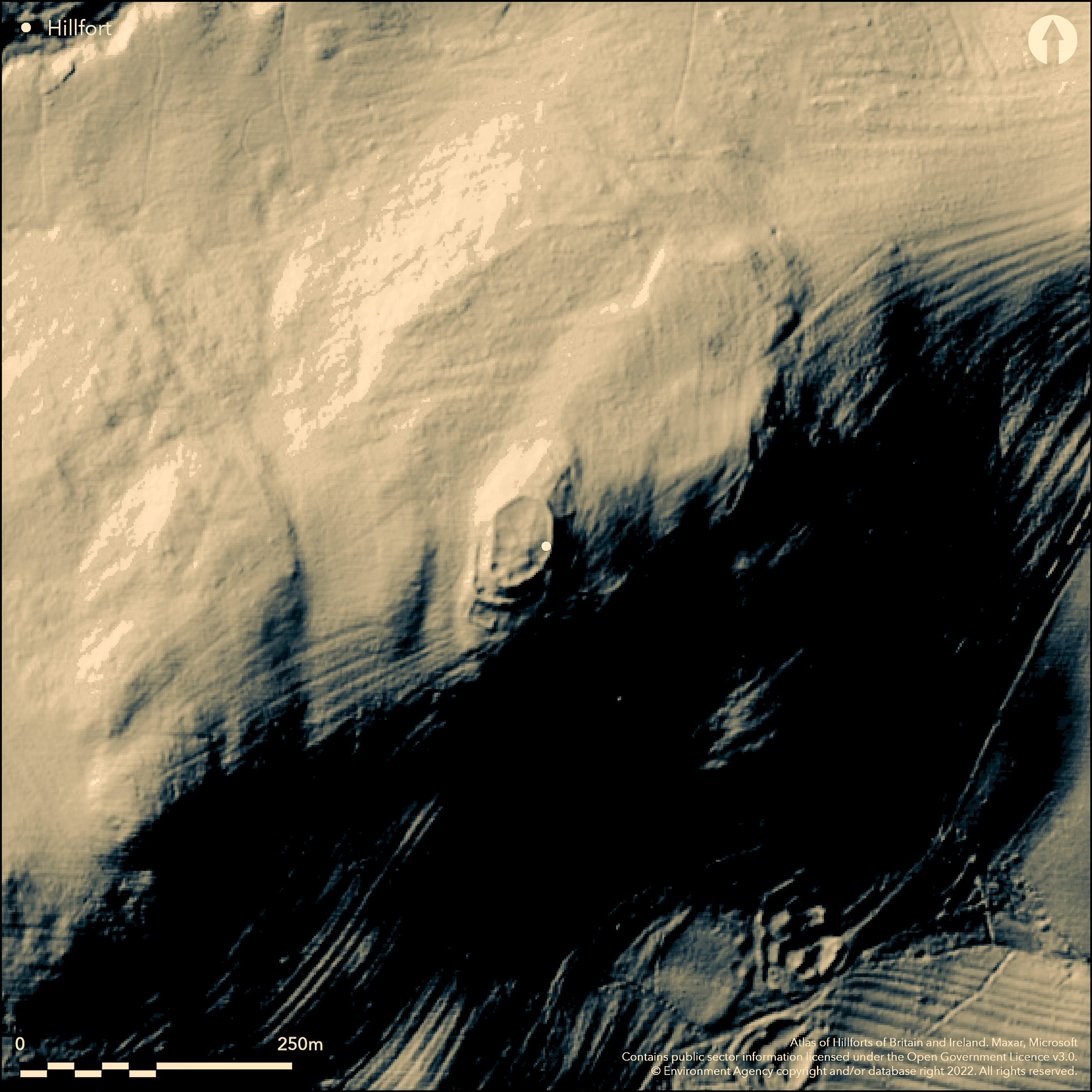
LiDAR 1m DTM Hillshade
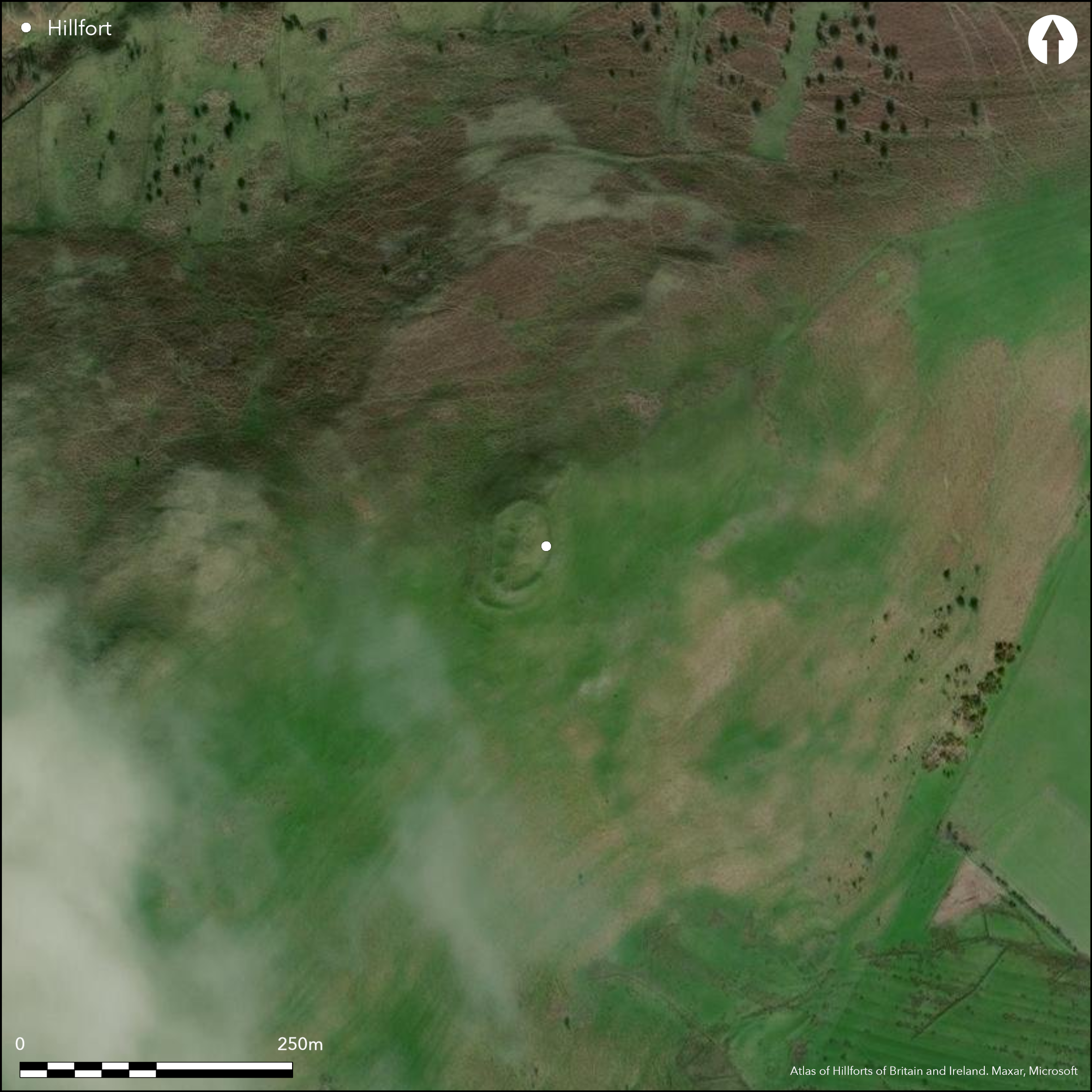
Satellite Imagery
LiDAR 1m DTM Hillshade
Satellite Imagery
Scroll left/right to view further images.
HER: Northumberland 852 (None)
NMR: NT 83 SE 7 (1188)
SM: 1008218
NGR: NT 88436 30103
X: 388463 Y: 630103 (OSGB36)
Sited 3km to the W of Kirknewton in the Northumberland National Park and 520m to the NE of Mid Hill (Atlas No. 0568), a small oval hillfort occupying the flattened crest of a ridge. An earth and stone bank 2m high and up to 7.5m wide encloses an area of 0.13ha. This is univallate for the most part except in the S and W where the enclosure is strengthened by a further bank with a maximum width of 9.6m, possibly a later Iron Age addition (Ainsworth et al. 2002) The double banks form an annex which is divided radially around its circuit. There is no evidence for ditches. A single gap entrance 3m wide lies in the SE, defined on its northern side by a large upright stone. House platforms and stone-founded hut circles 5-11m in diameter within the interior are believed to represent Iron Age and Romano-British occupation respectively. The site is unexcavated and was originally scheduled as a defended settlement but was reinterpreted as a hillfort following a field investigation by English Heritage in 2001 (Ainsworth et al. 2002).
Citizen Science: ✗
Reliability of Data: Confirmed
Reliability of Interpretation: Confirmed
X: -243175 Y: 7472204 (EPSG: 3857)
Longitude: -2.1844807990685897 Latitude: 55.56450051175103 (EPSG:4326)
Country: England
Current County or Unitary Authority: Northumberland
Historic County: Northumberland
Current Parish/Community/Council/Townland: Kirknewton
Well preserved
| Extant | ✓ |
| Cropmark | ✗ |
| Likely Destroyed | ✗ |
Rough grassland, possibly grazed
| Woodland | ✗ |
| Commercial Forestry Plantation | ✗ |
| Parkland | ✗ |
| Pasture (Grazing) | ✓ |
| Arable | ✗ |
| Scrub/Bracken | ✗ |
| Bare Outcrop | ✗ |
| Heather/Moorland | ✗ |
| Heath | ✗ |
| Built-up | ✗ |
| Coastal Grassland | ✗ |
| Other | ✗ |
A contour fort lying on level ground on the flattened crest of a ridge at 255m OD overlooked by higher ground in the W.
| Contour Fort | ✓ |
| Partial Contour Fort | ✗ |
| Promontory Fort | ✗ |
| Hillslope Fort | ✗ |
| Level Terrain Fort | ✗ |
| Marsh Fort | ✗ |
| Multiple Enclosure Fort | ✗ |
| Hilltop | ✓ |
| Coastal Promontory | ✗ |
| Inland Promontory | ✗ |
| Valley Bottom | ✗ |
| Knoll/Hillock/Outcrop | ✗ |
| Ridge | ✓ |
| Cliff/Plateau-edge/Scarp | ✗ |
| Hillslope | ✗ |
| Lowland | ✗ |
| Spur | ✗ |
Dominant Topographic Feature: Flattened crest of a ridge
| North | ✗ |
| Northeast | ✗ |
| East | ✗ |
| Southeast | ✗ |
| South | ✗ |
| Southwest | ✗ |
| West | ✗ |
| Northwest | ✗ |
| Level | ✓ |
Altitude: 255.0m
N/A
The site is unexcavated but is believed to have been constructed in the Iron Age. Stone founded hut circles are considered to represent later Romano-British settlement
Reliability: D - None
| Pre 1200BC | ✗ |
| 1200BC - 800BC | ✗ |
| 800BC - 400BC | ✗ |
| 400BC - AD50 | ✗ |
| AD50 - AD400 | ✗ |
| AD400 - AD 800 | ✗ |
| Post AD800 | ✗ |
| Unknown | ✓ |
| Pre Hillfort: | None |
| Post Hillfort: | Late Iron Age or Romano-British settlement, three medieval shielings, associated paddocks and the remains of cultivation. A possible stock enclosure is attached to the outer rampart |
General reference in MacLauchlan 1867. The site went unnoticed by Ordnance Survey until the 20th century. Included in the field survey by Jobey (c. 1965). Field investigation in 1966. Field survey in 2001 by English Heritage following a request from the Northumberland National Park (Ainsworth et al. 2002) as part of the 'Discovering our Hillfort Heritage' Project. Scheduled
| 1st Identified Written Reference (1867): | None |
| Other (1935): | Scheduled |
| Other (1965): | Field survey (G. Jobey) |
| Other (1966): | Field investigation |
| Earthwork Survey (2001): | Analytical survey 'Discovering our Hillfort Heritage' project |
| 1st Identified Map Depiction (None): | One-inch |
House platforms and stone-founded hut circles 5-11m in diameter within the interior are believed to represent Iron Age and Romano-British occupation respectively.
None
| None | ✓ |
| Spring | ✗ |
| Stream | ✗ |
| Pool | ✗ |
| Flush | ✗ |
| Well | ✗ |
| Other | ✗ |
Stone round-houses are probably Late Iron Age or Romano-British
| No Known Features | ✗ |
| Round Stone Structures | ✓ |
| Rectangular Stone Structures | ✗ |
| Curvilinear Platforms | ✓ |
| Other Roundhouse Evidence | ✗ |
| Pits | ✗ |
| Quarry Hollows | ✗ |
| Other | ✗ |
None
| No Known Excavation | ✓ |
| Pits | ✗ |
| Postholes | ✗ |
| Roundhouses | ✗ |
| Rectangular Structures | ✗ |
| Roads/Tracks | ✗ |
| Quarry Hollows | ✗ |
| Other | ✗ |
| Nothing Found | ✗ |
None
| No Known Geophysics | ✓ |
| Pits | ✗ |
| Roundhouses | ✗ |
| Rectangular Structures | ✗ |
| Roads/Tracks | ✗ |
| Quarry Hollows | ✗ |
| Other | ✗ |
| Nothing Found | ✗ |
None
| No Known Finds | ✓ |
| Pottery | ✗ |
| Metal | ✗ |
| Metalworking | ✗ |
| Human Bones | ✗ |
| Animal Bones | ✗ |
| Lithics | ✗ |
| Environmental | ✗ |
| Other | ✗ |
None
| APs Not Checked | ✗ |
| None | ✗ |
| Roundhouses | ✓ |
| Rectangular Structures | ✗ |
| Pits | ✗ |
| Postholes | ✗ |
| Roads/Tracks | ✗ |
| Other | ✗ |
A simple gap entrance lies in the SE marked by a large upright stone on its northern side
| None: | None |
| 2: | None |
Guard Chambers: ✗
Chevaux de Frise: ✗
| 1. Simple Gap (South east): | None |
An earth and stone bank 2m high and up to 7.5m wide encloses an area of 0.13ha which is univallate for the most part except in the S and SW where the enclosure is strengthened by a further bank with a maximum width of 9.6m. The double banks form an annex which is divided radially around its circuit. There is no evidence for ditches.
| Area 1: | 0.13ha. |
| Total: | 0.13ha. |
Total Footprint Area: 0.2ha.
None
| ✓ | Second outer rampart in S and W approximately 4m wide by 1m high possibly added later. |
| ✓ | None |
| NE Quadrant: | 1 |
| SE Quadrant: | 1 |
| SW Quadrant: | 2 |
| NW Quadrant: | 1 |
| Total: | 2 |
| Partial Univallate | ✓ |
| Univallate | ✗ |
| Partial Bivallate | ✓ |
| Bivallate | ✗ |
| Partial Multivallate | ✗ |
| Multivallate | ✗ |
| Unknown | ✗ |
| Partial Univallate | ✗ |
| Univallate | ✗ |
| Partial Bivallate | ✗ |
| Bivallate | ✗ |
| Partial Multivallate | ✗ |
| Multivallate | ✗ |
Large revetting boulders in the W
| None | ✗ |
| Earthen Bank | ✓ |
| Stone Wall | ✓ |
| Rubble | ✓ |
| Wall-walk | ✗ |
| Evidence of Timber | ✗ |
| Vitrification | ✗ |
| Other Burning | ✗ |
| Palisade | ✗ |
| Counter Scarp Bank | ✗ |
| Berm | ✗ |
| Unfinished | ✗ |
| Other | ✗ |
None
| None | ✗ |
| Earthen Bank | ✗ |
| Stone Wall | ✗ |
| Murus Duplex | ✗ |
| Timber-framed | ✗ |
| Timber-laced | ✗ |
| Vitrification | ✗ |
| Other Burning | ✗ |
| Palisade | ✗ |
| Counter Scarp Bank | ✗ |
| Berm | ✗ |
| Unfinished | ✗ |
| No Known Excavation | ✓ |
| Other | ✗ |
| ✗ | None |
| ✗ | None |
Number of Ditches: None
| ✓ | An annex is formed by the double ramparts in the S and SW reaching a maximum width of 9.6m in the NW. The area between the ramparts is divided by several slight earth and stone banks which run radially between the ramparts. |
Ainsworth, S. Oswald, A and Pearson, T. 2002. An Iron Age Hillfort on Staw Hill. English Heritage Archaeological Investigation Report Series AI/17/2002. Unpublished.
Jobey, G .1965. Hillforts and Settlements in Northumberland. Archaeol Aeliana (4th Series) 43, 61
MacLauchlan, H. 1867. Additional Notes to Roman Roads in Northumberland . 36
Oswald, A. Ainsworth, S. and Pearson, T 2006 Hillforts: Prehistoric Strongholds of Northumberland National Park. English Heritage
Atlas of Hillforts:
Wikidata:
This work is licensed under CC BY-SA 4.0

 and should be cited as:
Lock, Gary and Ralston, Ian. 2024. Atlas of Hillforts of Britain and Ireland. Available at: https://hillforts.arch.ox.ac.uk
Document Version 1.1