LiDAR 1m DTM Hillshade
Satellite Imagery
LiDAR 1m DTM Hillshade
Satellite Imagery
Scroll left/right to view further images.
HER: Northumberland 1544 (None)
NMR: NT 92 NE 56 (2661)
SM: 1016714
NGR: NT 9669 2826
X: 396692 Y: 628262 (OSGB36)
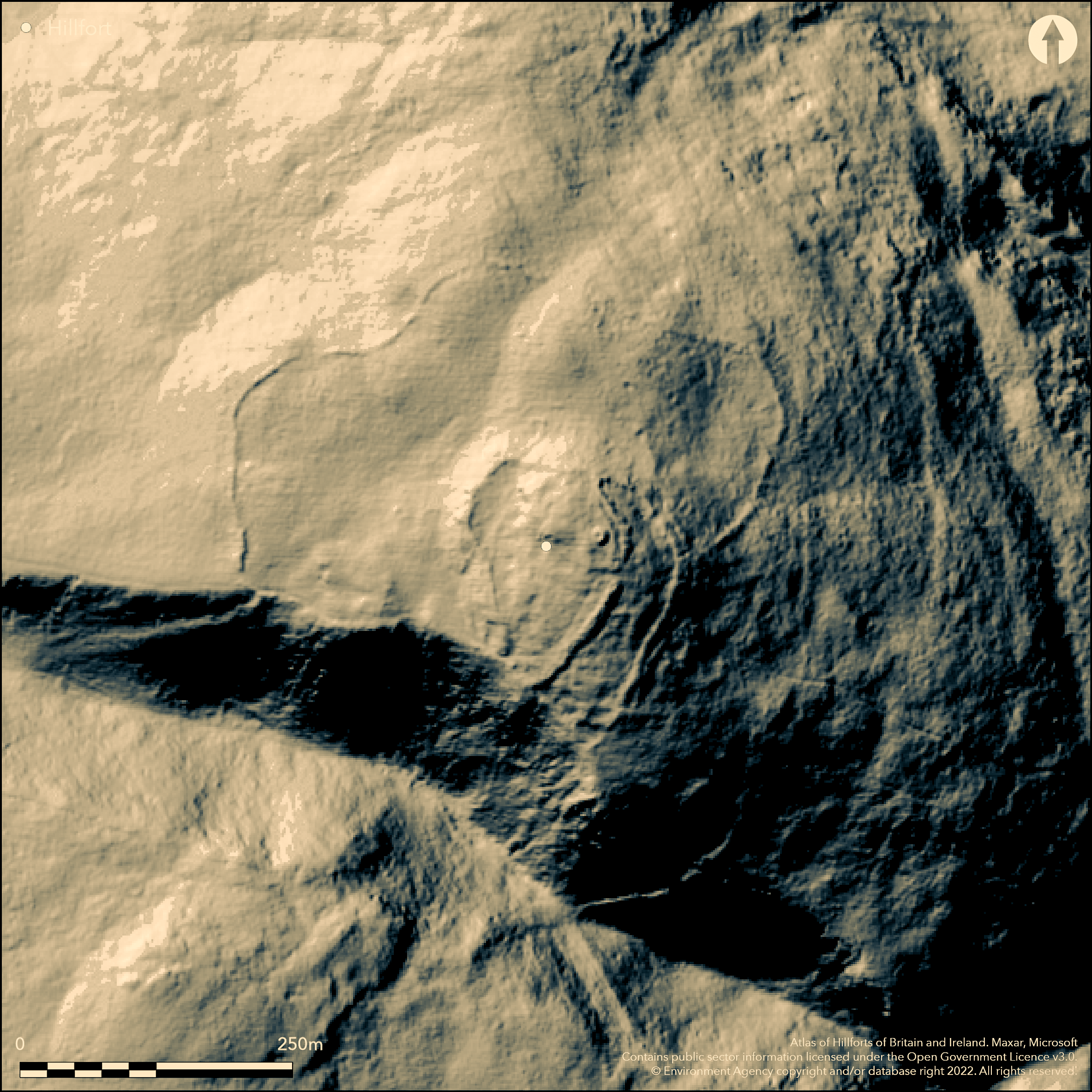
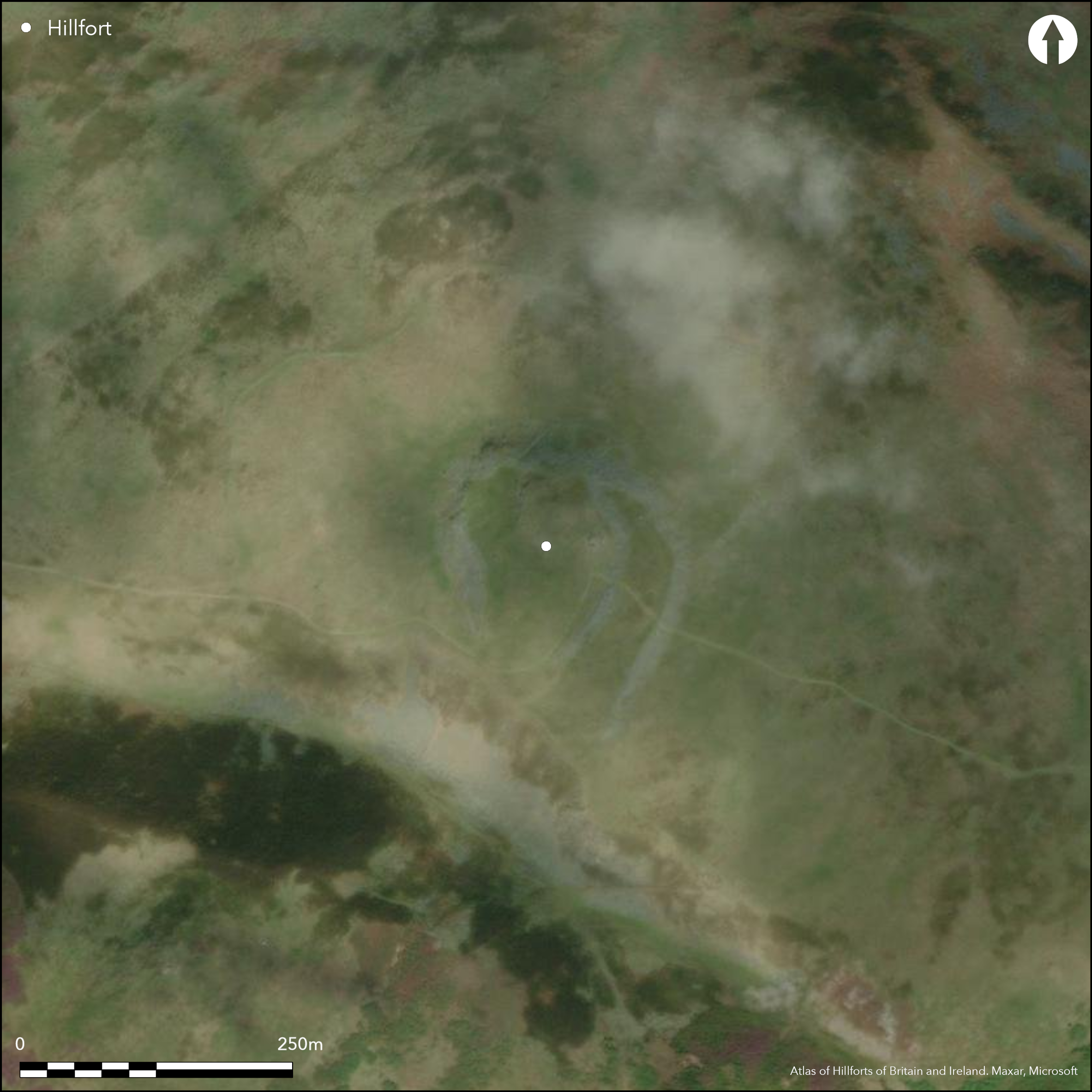
To the W of the village of Wooler, an Iron Age hillfort set within a larger, possibly Neolithic or Bronze Age enclosure. The site lies on the crest of Humbleton Hill at 282m OD, offering views in all directions, particularly to the N and S. It is naturally defended in the S by a steep ravine. The hillfort component measures 110m both E-W and N-S enclosing 0.29ha and is open in the S above the ravine, giving it a U-shaped ground plan. It originally comprised two closely-spaced walls, more massive than the earlier outer enclosure. Of these the outer rampart survives as a 10m wide bank of stones, the inner rampart present only in the N and E side, elsewhere naturally protected by the scarp and rock outcrops. Small quarry scoops behind this rampart might be the source of the building stone. A slightly staggered entrance 1.5m wide lies in the SE side, marked by large granite boulders. A second entrance in the SW corner is possibly later. In a possibly later phase, an inner hillfort rampart was constructed which survives as a bank of loose stones running N-SW, averaging 9.5m wide and up to 1m high, and is best preserved in the N where both the inner and outer faces are intact. Within this an entrance lies approximately midway along its length where an alignment of stones define two sides of a possible guard chamber approximately 2m square within the northern terminal (Oswald et al. 2006, 54). Up to eight circular house platforms lie between the inner and outer ramparts in the E with a further 20 within the inner rampart. They vary in size between 4m and 8m in diameter and are often terraced into the hillslope. The outer, possibly pre-hillfort enclosure is irregular in form, measuring up to 290m E-W by 210m N-S, enclosing 4.3ha, following the natural break of slope for much of its course. It is constructed from earth and stone and averages 5m wide by 0.7m high. A number of in-situ facing stones indicate an original width of between 2.5m and 3.5m at the base. In the E the bank curves uphill towards the outer rampart of the Iron Age hillfort. A 4m wide entrance is considered to lie at the SW corner defined by a series of large stones set on edge. A possible continuation of the enclosure wall runs up to the edge of Homilheugh ravine and is of similar construction to the hillfort and possibly a later addition. No excavation has been recorded although trenches which cut across the outer bank to expose the core have been identified in the N of this enclosure. Small stone-built enclosures, interpreted as medieval or later shielings, abut the inner and outer sides of the hillfort rampart and larger enclosure. The site was surveyed by RCHME in 1997 and Waddington (1998). It is shown on Armstrong's map of 1769 and 1866 1:10,560 OS mapping.
Citizen Science: ✗
Reliability of Data: Confirmed
Reliability of Interpretation: Confirmed
X: -228648 Y: 7468973 (EPSG: 3857)
Longitude: -2.0539797242211044 Latitude: 55.54808510081928 (EPSG:4326)
Country: England
Current County or Unitary Authority: Northumberland
Historic County: Northumberland
Current Parish/Community/Council/Townland: Akeld
None
| Extant | ✓ |
| Cropmark | ✗ |
| Likely Destroyed | ✗ |
Rough pasture
| Woodland | ✗ |
| Commercial Forestry Plantation | ✗ |
| Parkland | ✗ |
| Pasture (Grazing) | ✓ |
| Arable | ✗ |
| Scrub/Bracken | ✗ |
| Bare Outcrop | ✗ |
| Heather/Moorland | ✗ |
| Heath | ✗ |
| Built-up | ✗ |
| Coastal Grassland | ✗ |
| Other | ✗ |
Lying on the crest of Humbleton Hill at 282m with the land sloping to the SW a muliple enclosure fort sited on the edge of a ravine
| Contour Fort | ✗ |
| Partial Contour Fort | ✓ |
| Promontory Fort | ✗ |
| Hillslope Fort | ✗ |
| Level Terrain Fort | ✗ |
| Marsh Fort | ✗ |
| Multiple Enclosure Fort | ✓ |
| Hilltop | ✓ |
| Coastal Promontory | ✗ |
| Inland Promontory | ✗ |
| Valley Bottom | ✗ |
| Knoll/Hillock/Outcrop | ✗ |
| Ridge | ✗ |
| Cliff/Plateau-edge/Scarp | ✗ |
| Hillslope | ✗ |
| Lowland | ✗ |
| Spur | ✗ |
Dominant Topographic Feature: Crest of Humbleton Hill
| North | ✗ |
| Northeast | ✗ |
| East | ✗ |
| Southeast | ✗ |
| South | ✗ |
| Southwest | ✓ |
| West | ✗ |
| Northwest | ✗ |
| Level | ✗ |
Altitude: 282.0m
N/A
Undated, presumed Iron Age
Reliability: D - None
| Pre 1200BC | ✗ |
| 1200BC - 800BC | ✗ |
| 800BC - 400BC | ✗ |
| 400BC - AD50 | ✗ |
| AD50 - AD400 | ✗ |
| AD400 - AD 800 | ✗ |
| Post AD800 | ✗ |
| Unknown | ✓ |
| Pre Hillfort: | Possible Neolithic or Bronze age outer enclosure |
| Post Hillfort: | Medieval shielings and stock pens. Traces of later prehistoric cord rig cultivation has been identified in the N of the enclosure. An undated cairn built from stone robbed from the rampart stands on the summit of the hill within the inner rampart. Site of the Battle of Homildon (sic) Hill, 14 September 1402. Trig point |
| Morphology/Earthwork/Typology: | None |
Armstrong's map of Northumberland shows Humbledon Hillfort in relation to other hillforts in the region. Described as '...a chain of forts. Recorded on 1866 1:10,560 OS mapping. Archaeological recording in 2000 of fire-damaged areas on behalf of the National Park Authority. Mapped from the air as part of the Milfield Geoarchaeoloy Project - archive object MD000292. Field investigations in 1955, 1969, 1976. RCHME survey 1997, ref. no. 1092909. Excavation trenches have been observed, although unrecorded. Scheduled
| 1st Identified Map Depiction (1769): | Armstrong's map of Northumberland |
| 1st Identified Map Depiction (1866): | OS |
| Other (1934): | Scheduled |
| Other (1955): | Field investigation |
| Other (1969): | Visit by Hillfort Study Group |
| Other (1969): | Field investigation |
| Other (1976): | Field investigation |
| Earthwork Survey (1997): | RCHME |
| Other (2000): | Archaeological recording |
Up to eight circular house platforms lie between the inner and outer ramparts with a further 20 within the inner rampart. They vary in size between 4m and 8m in diameter and are often terraced into the hillslope. Oblique aerial photographs also reveal traces of ring-ditch or ring-groove houses in the large outer enclosure (SH)
None
| None | ✓ |
| Spring | ✗ |
| Stream | ✗ |
| Pool | ✗ |
| Flush | ✗ |
| Well | ✗ |
| Other | ✗ |
Ring-groove or ring-ditch houses
| No Known Features | ✗ |
| Round Stone Structures | ✗ |
| Rectangular Stone Structures | ✗ |
| Curvilinear Platforms | ✓ |
| Other Roundhouse Evidence | ✓ |
| Pits | ✗ |
| Quarry Hollows | ✓ |
| Other | ✗ |
None
| No Known Excavation | ✓ |
| Pits | ✗ |
| Postholes | ✗ |
| Roundhouses | ✗ |
| Rectangular Structures | ✗ |
| Roads/Tracks | ✗ |
| Quarry Hollows | ✗ |
| Other | ✗ |
| Nothing Found | ✗ |
None
| No Known Geophysics | ✓ |
| Pits | ✗ |
| Roundhouses | ✗ |
| Rectangular Structures | ✗ |
| Roads/Tracks | ✗ |
| Quarry Hollows | ✗ |
| Other | ✗ |
| Nothing Found | ✗ |
None
| No Known Finds | ✓ |
| Pottery | ✗ |
| Metal | ✗ |
| Metalworking | ✗ |
| Human Bones | ✗ |
| Animal Bones | ✗ |
| Lithics | ✗ |
| Environmental | ✗ |
| Other | ✗ |
Ring-ditch or ring-groove houses visible
| APs Not Checked | ✗ |
| None | ✗ |
| Roundhouses | ✓ |
| Rectangular Structures | ✗ |
| Pits | ✗ |
| Postholes | ✗ |
| Roads/Tracks | ✗ |
| Other | ✗ |
An entrance 1.5m wide lies in the SE side of the outer hillfort rampart, marked by large granite boulders. A second entrance in the SW corner is possibly later. A further entrance lies approximately midway along the length of the inner rampart in the E. An alignment of stones define two sides of a possible guard chamber approximately 2m square within its northern terminal (shown on plan in Oswald et al. 2006, 54). The earlier outer enclosure has a 4m wide entrance at the SW corner defined by a series of large stones set on edge.
| 4: | None |
| 2: | None |
Guard Chambers: ✓
Chevaux de Frise: ✗
| 1. Oblique (South east): | Both walls of outer rampart |
| 2. Recesses/Guard Chambers (East): | Inner rampart, possible guard chamber within its northern terminal |
| 3. Simple Gap (South west): | Earlier, possibly pre-hillfort enclosure |
The hillfort component measures 110m both E-W and N-S enclosing 0.29ha and is open in the S above the ravine, giving it a U-shaped ground plan. It originally comprised two closely-spaced walls, more massive than the earlier outer enclosure. Of these the outer rampart survives as a 10m wide bank of stones, the inner rampart present only in the N and E side, elsewhere naturally protected by the scarp and rock outcrops. In a possibly later phase, an inner hillfort rampart was constructed which survives as a bank of loose stones running N-SW, averaging 9.5m wide and up to 1m high, and is best preserved in the N where both the inner and outer faces are intact.
| Area 1: | 4.3ha. |
| Area 2: | 0.29ha. |
| Area 3: | 1ha. |
| Total: | 4.3ha. |
Total Footprint Area: 4.3ha.
None
| ✓ | Measured from satellite imagery. Whole site footprint includes earlier enclosure |
| ✗ | Open to the ravine in the S |
| NE Quadrant: | 3 |
| SE Quadrant: | 3 |
| SW Quadrant: | 1 |
| NW Quadrant: | 1 |
| Total: | 3 |
| Partial Univallate | ✓ |
| Univallate | ✗ |
| Partial Bivallate | ✗ |
| Bivallate | ✗ |
| Partial Multivallate | ✓ |
| Multivallate | ✗ |
| Unknown | ✗ |
| Partial Univallate | ✗ |
| Univallate | ✗ |
| Partial Bivallate | ✓ |
| Bivallate | ✗ |
| Partial Multivallate | ✗ |
| Multivallate | ✗ |
None
| None | ✗ |
| Earthen Bank | ✗ |
| Stone Wall | ✓ |
| Rubble | ✓ |
| Wall-walk | ✗ |
| Evidence of Timber | ✗ |
| Vitrification | ✗ |
| Other Burning | ✗ |
| Palisade | ✗ |
| Counter Scarp Bank | ✗ |
| Berm | ✗ |
| Unfinished | ✗ |
| Other | ✗ |
None
| None | ✗ |
| Earthen Bank | ✗ |
| Stone Wall | ✗ |
| Murus Duplex | ✗ |
| Timber-framed | ✗ |
| Timber-laced | ✗ |
| Vitrification | ✗ |
| Other Burning | ✗ |
| Palisade | ✗ |
| Counter Scarp Bank | ✗ |
| Berm | ✗ |
| Unfinished | ✗ |
| No Known Excavation | ✓ |
| Other | ✗ |
| ✗ | None |
| ✗ | None |
Number of Ditches: None
| ✗ | None |
Northern Archaeological Associates, 2000. Humbleton Hill Hillfort, Wooler: archaeological recording of fire damaged area. Northern Counties Archaeological Services [assessment & evaluation reports]. Unpublished
Oswald, A. Ainsworth, S. and Pearson, T 2006 Hillforts: Prehistoric Strongholds of Northumberland National Park. English Heritage
RCHME 1997 Humbleton Hill, Northumberland. Field Survey Report. Unpublished
Waddington C. 1998, Humbleton Hill Hillfort Survey, Northern Archaeol Vol.15/16; 71-81
Atlas of Hillforts:
Wikidata:
This work is licensed under CC BY-SA 4.0![]()
![]()
![]() and should be cited as:
and should be cited as:
Lock, Gary and Ralston, Ian. 2024. Atlas of Hillforts of Britain and Ireland. Available at: https://hillforts.arch.ox.ac.uk
Document Version 1.1