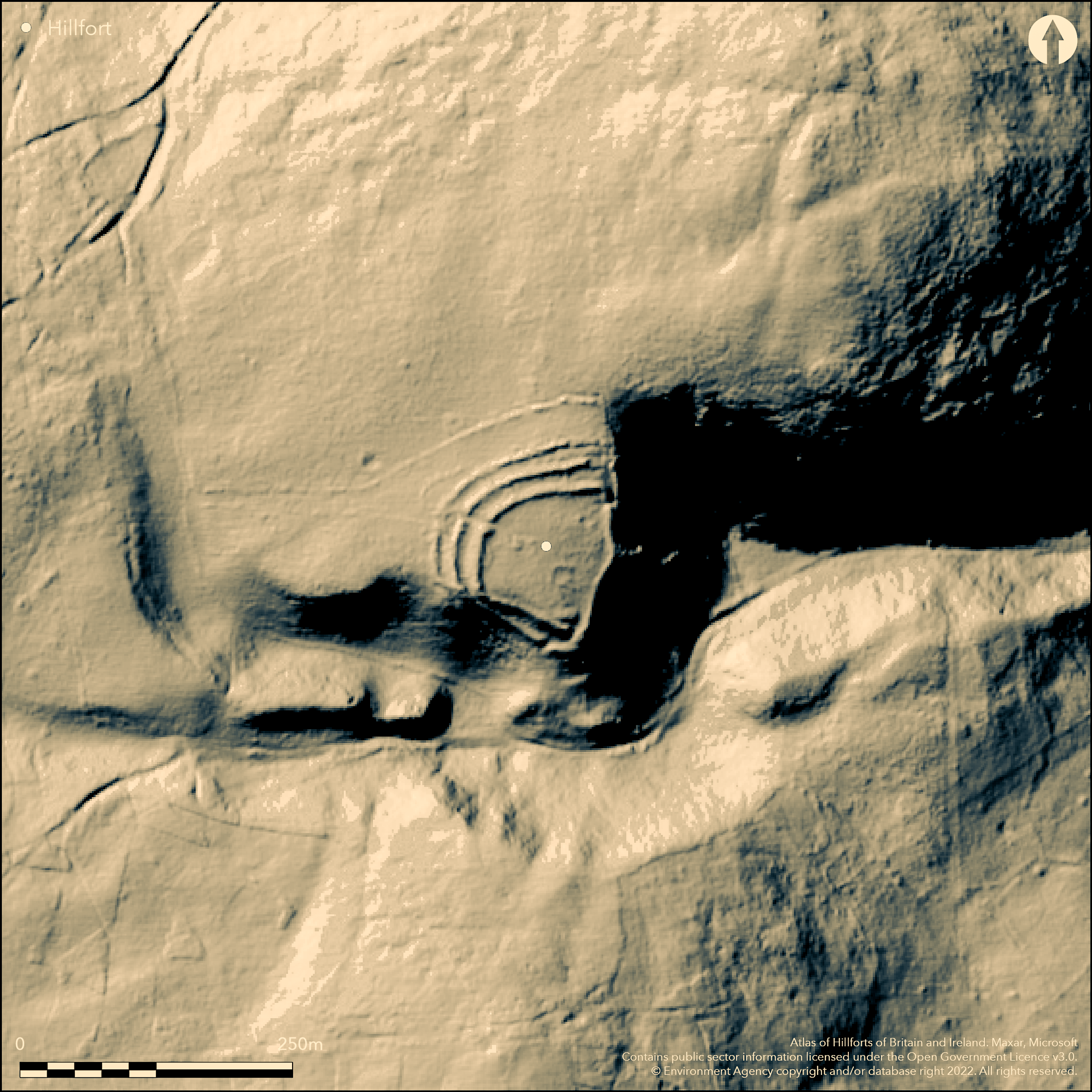
LiDAR 1m DTM Hillshade
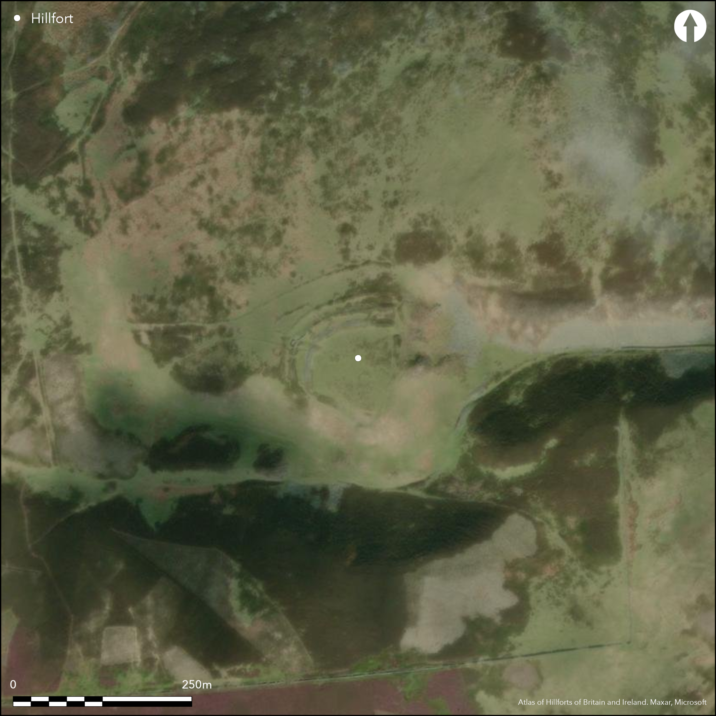
Satellite Imagery
LiDAR 1m DTM Hillshade
Satellite Imagery
Scroll left/right to view further images.
HER: Northumberland 1527 (None)
NMR: NT 92 NE 39 (2588)
SM: 1015639
NGR: NT 9561 2849
X: 395611 Y: 628494 (OSGB36)
To the W of Wooler on the SW and W slopes of Harehope Hill, a multivallate hillfort of 0.2ha. Measuring 138m N-S by 101m E-W, the hillfort is approximately semi-circular, enclosed by three earth and stone banks in the N and W, and two scarped banks in the S arranged concentrically. A single bank aligns on the steep crags of Monday Cleugh in the E. It is overlooked by Gains Law to the S and the hillfort of Harehope Hill (Atlas No. 0497) to the NE, but commands extensive views to the E, N and W. The innermost, and more substantial rampart, particularly in the S and W, has a maximum height of 1.5m and measures 5m wide, the middle rampart 1.2m high and 5m wide and the outer rampart 1m and 3m wide. Kerbstones are visible along the outer edges of the outer and middle ramparts. The ramparts are separated by a 4-5m wide level berm. No ditches are recorded. Two main entrances cut through the enclosure. A small 3m wide entrance lies in the SE which is overlapped by the outer rampart and which gives access to a nearby stream and springs. In the W a 3m wide gap is now overlain by a modern sheepfold A possible further entrance can be seen as a break through the NE corner of the inner rampart which gives access to the area between the inner and middle rampart. The remains of three Romano-British turf covered hut circles between 7m and 8m in diameter internally with walls standing up to 0.2m high lie within the interior. Entrances, approximately 2m wide can be determined in the N and NE in two of the huts. The site lacks evidence for any timber houses contemporary with the construction of the hillfort. A large rectangular foundation 6m by 19m and up to 0.1m high lies near the entrance in the W and two sub-rectangular foundations, 3m by 6m, are attached to the outer rampart on the north side of the enclosure. A later enclosure overlies the ramparts in the W. Damage has occurred to the outer rampart although the middle and inner rampart have survived better especially in the N. The hillfort is approached from the west via a trackway 138m long and 9-11m wide, bounded each side by an earth and stone bank 3m wide and 0.75m high. The southern bank of the trackway runs to the entrance in the W and the northern bank runs around the northern side of the hillfort to the crag edge where it lies 24m from the outer rampart. Undated, presumed Iron Age based on morphology. On 1st edition OS mapping (1856-65).
Citizen Science: ✗
Reliability of Data: Confirmed
Reliability of Interpretation: Confirmed
X: -230556 Y: 7469382 (EPSG: 3857)
Longitude: -2.071116592943756 Latitude: 55.55016099813459 (EPSG:4326)
Country: England; None
Current County or Unitary Authority: Northumberland
Historic County: Northumberland
Current Parish/Community/Council/Townland: Akeld
None
| Extant | ✓ |
| Cropmark | ✗ |
| Likely Destroyed | ✗ |
Rough grassland and heather
| Woodland | ✗ |
| Commercial Forestry Plantation | ✗ |
| Parkland | ✗ |
| Pasture (Grazing) | ✗ |
| Arable | ✗ |
| Scrub/Bracken | ✗ |
| Bare Outcrop | ✗ |
| Heather/Moorland | ✓ |
| Heath | ✗ |
| Built-up | ✗ |
| Coastal Grassland | ✗ |
| Other | ✗ |
Lying on gently sloping ground between at 262-257m OD trending eastwards towards Monday Cleugh
| Contour Fort | ✗ |
| Partial Contour Fort | ✓ |
| Promontory Fort | ✗ |
| Hillslope Fort | ✓ |
| Level Terrain Fort | ✗ |
| Marsh Fort | ✗ |
| Multiple Enclosure Fort | ✗ |
| Hilltop | ✗ |
| Coastal Promontory | ✗ |
| Inland Promontory | ✗ |
| Valley Bottom | ✗ |
| Knoll/Hillock/Outcrop | ✗ |
| Ridge | ✗ |
| Cliff/Plateau-edge/Scarp | ✓ |
| Hillslope | ✓ |
| Lowland | ✗ |
| Spur | ✗ |
Dominant Topographic Feature: Situated at the head of a deep crag-sided hollow known as Monday Cleugh
| North | ✗ |
| Northeast | ✗ |
| East | ✓ |
| Southeast | ✗ |
| South | ✗ |
| Southwest | ✗ |
| West | ✗ |
| Northwest | ✗ |
| Level | ✗ |
Altitude: 262.0m
Boundary Type: None
Undated, presumed Iron Age based on morphology
Reliability: D - None
| Pre 1200BC | ✗ |
| 1200BC - 800BC | ✗ |
| 800BC - 400BC | ✗ |
| 400BC - AD50 | ✗ |
| AD50 - AD400 | ✗ |
| AD400 - AD 800 | ✗ |
| Post AD800 | ✗ |
| Unknown | ✓ |
| Pre Hillfort: | None |
| Post Hillfort: | Late Iron Age or Romano-British roundhouses; medieval-modern sheepfolds |
| Morphology/Earthwork/Typology: | None |
General reference in MacLauchlan 1919-22, recorded on the 1856-65 OS mapping much as it appears today. Field investigations in 1955, 1976. Scheduled.
| Other (1932): | Scheduled |
| Other (1955): | Field investigation |
| Other (1976): | Field investigation |
| 1st Identified Map Depiction (None): | None |
| 1st Identified Written Reference (None): | None |
The remains of three turf covered hut circles between 7m and 8m in diameter internally with walls standing up to 0.2m high. Two have entrances approximately 2m wide on the N and NE sides. A rectangular building 6m by 19m and up to 0.1m high lies near the entrance in the W.
The entrance to the SE gives access to a small valley which leads to a spring and small stream to the E.
| None | ✓ |
| Spring | ✗ |
| Stream | ✗ |
| Pool | ✗ |
| Flush | ✗ |
| Well | ✗ |
| Other | ✗ |
Stone round-houses are probably Late Iron Age or Romano-British. Rectangular structures are probably later
| No Known Features | ✗ |
| Round Stone Structures | ✓ |
| Rectangular Stone Structures | ✓ |
| Curvilinear Platforms | ✗ |
| Other Roundhouse Evidence | ✗ |
| Pits | ✗ |
| Quarry Hollows | ✗ |
| Other | ✗ |
None
| No Known Excavation | ✓ |
| Pits | ✗ |
| Postholes | ✗ |
| Roundhouses | ✗ |
| Rectangular Structures | ✗ |
| Roads/Tracks | ✗ |
| Quarry Hollows | ✗ |
| Other | ✗ |
| Nothing Found | ✗ |
None
| No Known Geophysics | ✓ |
| Pits | ✗ |
| Roundhouses | ✗ |
| Rectangular Structures | ✗ |
| Roads/Tracks | ✗ |
| Quarry Hollows | ✗ |
| Other | ✗ |
| Nothing Found | ✗ |
None
| No Known Finds | ✓ |
| Pottery | ✗ |
| Metal | ✗ |
| Metalworking | ✗ |
| Human Bones | ✗ |
| Animal Bones | ✗ |
| Lithics | ✗ |
| Environmental | ✗ |
| Other | ✗ |
None
| APs Not Checked | ✓ |
| None | ✗ |
| Roundhouses | ✗ |
| Rectangular Structures | ✗ |
| Pits | ✗ |
| Postholes | ✗ |
| Roads/Tracks | ✗ |
| Other | ✗ |
Two main entrances into the enclosure; in the SE corner an opening 3m wide protected by the outer rampart which overlaps it, in the W a 3m wide entrance now overlain by a modern sheepfold. A possible third entrance lies in the NE corner where there is a gap in the inner rampart.
| 3: | None |
| 2: | None |
Guard Chambers: ✗
Chevaux de Frise: ✗
| 1. Simple Gap (South east): | Corner, overlapped by outer rampart |
| 2. Simple Gap (West): | inner rampart |
| 3. Simple Gap (North east): | inner rampart, possible entrance |
Three earth and stone banks in the N and W, two scarped banks in S. A single bank aligns on the gorge in the E where the crags render defences unnecessary. The banks have a 4-5m separation but some damage has occurred and the material has spread in places, in particular that of the outer rampart. The inner bank has a maximum height of 1.5m and is 5m wide, the middle bank 1.2m and 5m wide and the outer bank 1m. wide by 3m high. Kerb stones are visible along the outer edges of the outer and middle ramparts. The ramparts are separated by a 4-5m wide level berm. No ditches.
| Area 1: | 0.2ha. |
| Total: | 0.2ha. |
Total Footprint Area: 0.77ha.
None
| ✗ | Estimated from satellite imagery |
| ✗ | Single bank in E |
| NE Quadrant: | 3 |
| SE Quadrant: | 2 |
| SW Quadrant: | 2 |
| NW Quadrant: | 3 |
| Total: | 3 |
| Partial Univallate | ✗ |
| Univallate | ✗ |
| Partial Bivallate | ✓ |
| Bivallate | ✗ |
| Partial Multivallate | ✓ |
| Multivallate | ✗ |
| Unknown | ✗ |
| Partial Univallate | ✗ |
| Univallate | ✗ |
| Partial Bivallate | ✗ |
| Bivallate | ✗ |
| Partial Multivallate | ✗ |
| Multivallate | ✗ |
None
| None | ✗ |
| Earthen Bank | ✓ |
| Stone Wall | ✗ |
| Rubble | ✓ |
| Wall-walk | ✗ |
| Evidence of Timber | ✗ |
| Vitrification | ✗ |
| Other Burning | ✗ |
| Palisade | ✗ |
| Counter Scarp Bank | ✗ |
| Berm | ✓ |
| Unfinished | ✗ |
| Other | ✗ |
None
| None | ✗ |
| Earthen Bank | ✗ |
| Stone Wall | ✗ |
| Murus Duplex | ✗ |
| Timber-framed | ✗ |
| Timber-laced | ✗ |
| Vitrification | ✗ |
| Other Burning | ✗ |
| Palisade | ✗ |
| Counter Scarp Bank | ✗ |
| Berm | ✗ |
| Unfinished | ✗ |
| No Known Excavation | ✓ |
| Other | ✗ |
| ✗ | None |
| ✗ | None |
Number of Ditches: None
| ✗ | None |
Hogg, A.H.A.1979. British Hill-Forts. An Index. British Archaeological Reports, British Series 62. 122
MacLauchlan, H. 1919-22. Notes on camps in the parishes of Branxton, Carham, Ford, Kirknewton and Wooler in Northumberland. Hist Berwickshire Natur Club 24, 454-5
Atlas of Hillforts:
Wikidata:
This work is licensed under CC BY-SA 4.0

 and should be cited as:
Lock, Gary and Ralston, Ian. 2024. Atlas of Hillforts of Britain and Ireland. Available at: https://hillforts.arch.ox.ac.uk
Document Version 1.1