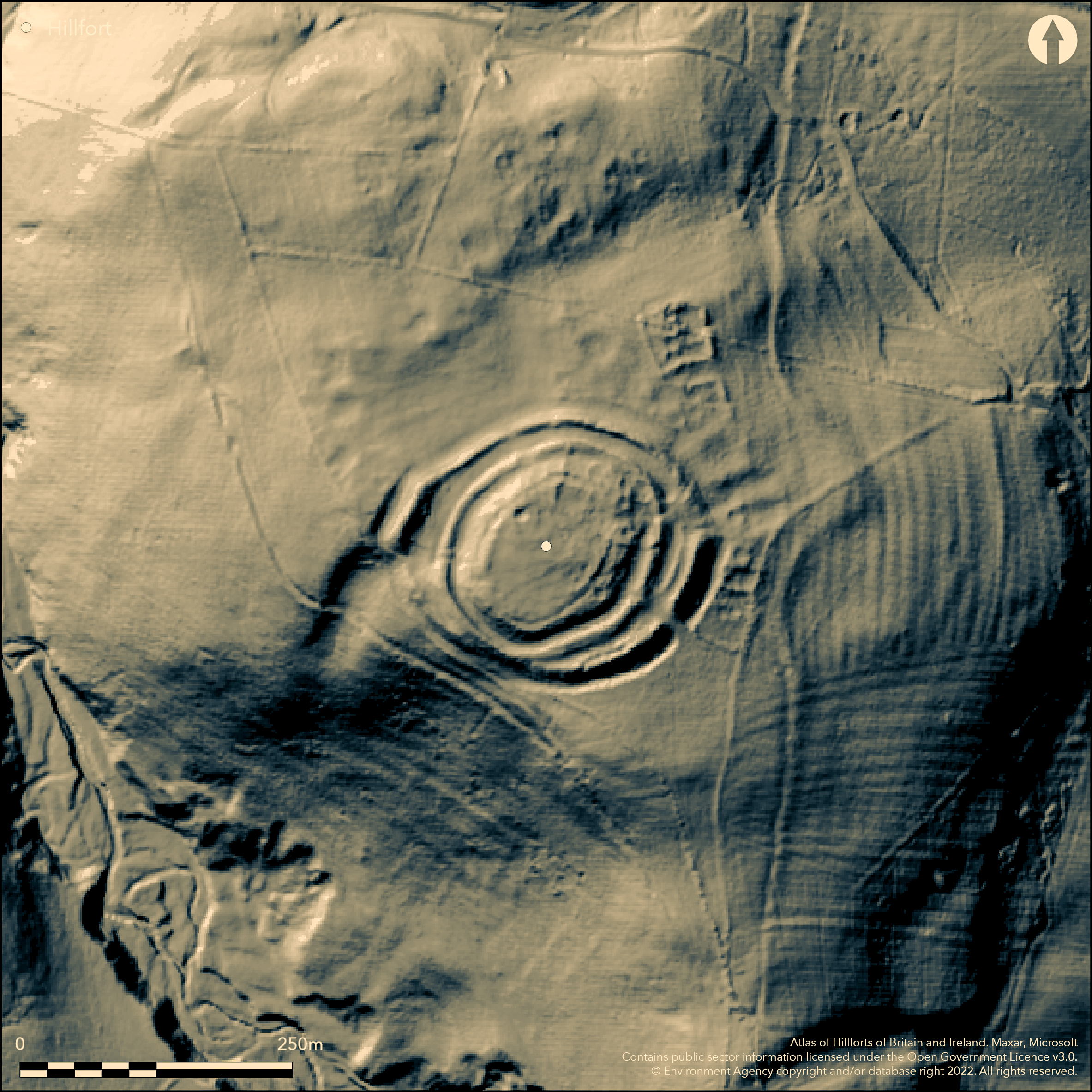
LiDAR 1m DTM Hillshade
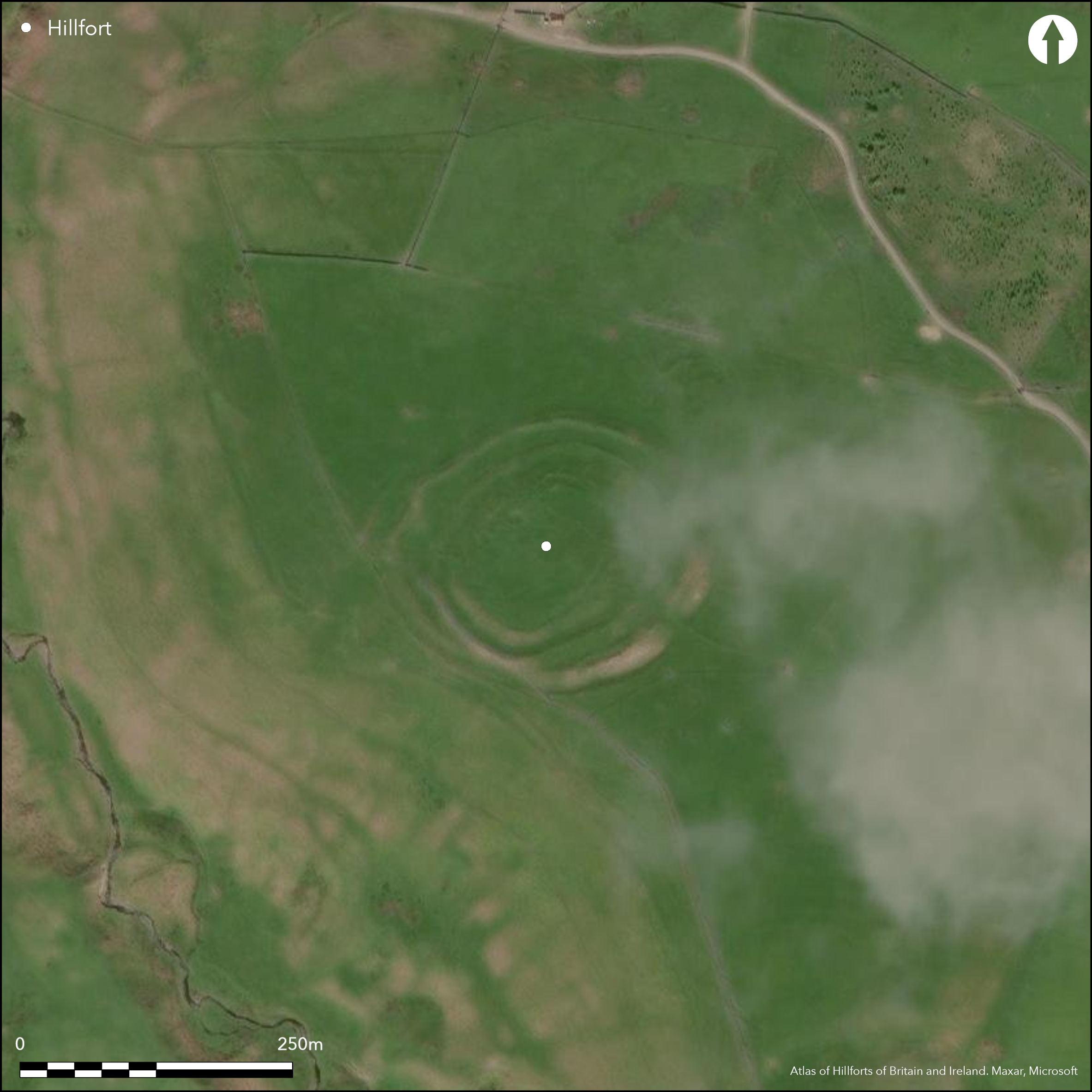
Satellite Imagery
LiDAR 1m DTM Hillshade
Satellite Imagery
Scroll left/right to view further images.
HER: Northumberland 1338 (None)
NMR: NT 91 SE 9 (2260)
SM: 1006609
NGR: NT 9799 1094
X: 397993 Y: 610940 (OSGB36)
To the SE of Alnham, overlooking Spartley Burn, a well-preserved multivallate hillfort, presumed Iron Age but with Romano-British activity within the interior. It is oval in plan enclosing 0.4ha with the innermost rampart considered to possibly be an earlier enclosure (Jobey 1965), which now survives as slight traces of a low, intermittent earthen bank. In the second phase it was enclosed by two substantial concentric banks and an outer ditch, the ditch being absent where the ground is steepest in the SW. In the third phase, a third rampart, not quite concentric, was added to the exterior, the outer and middle ramparts amalgamated in the SW due to the steepness of the slope. In a final phase the areas of the outer bank that flank the entrances were heightened and the entrances narrowed (Oswald et al. 2006). Definite entrances in the E are offset obliquely through the three rampart banks, with those of a possible further original entrance in the SE aligned. A further break in the outer rampart in the W carries a Romano-British track. The remains of at least three circular Iron Age stone-founded huts lie within the interior. Further Romano-British roundhouses and stock enclosures lie within and overlie the ramparts in the NE with further outside the hillfort in the NE, E and NW. The site is unexcavated but was surveyed during the 'Discovering our Hillfort Heritage' Project in 2000. It is recorded on 1856-65 OS mapping.
Citizen Science: ✗
Reliability of Data: Confirmed
Reliability of Interpretation: Confirmed
X: -226338 Y: 7438407 (EPSG: 3857)
Longitude: -2.0332285881573147 Latitude: 55.39244315117115 (EPSG:4326)
Country: England
Current County or Unitary Authority: Northumberland
Historic County: Northumberland
Current Parish/Community/Council/Townland: Alnham
None
| Extant | ✓ |
| Cropmark | ✗ |
| Likely Destroyed | ✗ |
None
| Woodland | ✗ |
| Commercial Forestry Plantation | ✗ |
| Parkland | ✗ |
| Pasture (Grazing) | ✓ |
| Arable | ✗ |
| Scrub/Bracken | ✗ |
| Bare Outcrop | ✗ |
| Heather/Moorland | ✗ |
| Heath | ✗ |
| Built-up | ✗ |
| Coastal Grassland | ✗ |
| Other | ✗ |
A partial contour fort overlooking Spartley Burn on the level summit of a spur at 290m OD
| Contour Fort | ✓ |
| Partial Contour Fort | ✗ |
| Promontory Fort | ✗ |
| Hillslope Fort | ✗ |
| Level Terrain Fort | ✓ |
| Marsh Fort | ✗ |
| Multiple Enclosure Fort | ✗ |
| Hilltop | ✓ |
| Coastal Promontory | ✗ |
| Inland Promontory | ✗ |
| Valley Bottom | ✗ |
| Knoll/Hillock/Outcrop | ✗ |
| Ridge | ✗ |
| Cliff/Plateau-edge/Scarp | ✗ |
| Hillslope | ✗ |
| Lowland | ✗ |
| Spur | ✓ |
Dominant Topographic Feature: Summit of a spur
| North | ✗ |
| Northeast | ✗ |
| East | ✗ |
| Southeast | ✗ |
| South | ✗ |
| Southwest | ✗ |
| West | ✗ |
| Northwest | ✗ |
| Level | ✓ |
Altitude: 290.0m
N/A
Enclosure undated, presumed Iron Age
Reliability: D - None
| Pre 1200BC | ✗ |
| 1200BC - 800BC | ✗ |
| 800BC - 400BC | ✗ |
| 400BC - AD50 | ✗ |
| AD50 - AD400 | ✗ |
| AD400 - AD 800 | ✗ |
| Post AD800 | ✗ |
| Unknown | ✓ |
| Pre Hillfort: | None |
| Post Hillfort: | Overlying Late Iron Age or Romano-British settlement enclosure |
| Morphology/Earthwork/Typology: | None |
Recorded on 1856-65 OS mapping. Field investigations in 1957, 1976. Included in SE Cheviots Project 1989. The site underwent a detailed analytical survey and reinterpretation in 2000 at the request of the Northumberland National Park Authority. Scheduled
| Other (1932): | Scheduled |
| Other (1958): | Field investigation |
| Other (1969): | Visit by Hillfort Study Group |
| Other (1976): | Field investigation |
| Other (1989): | SE Cheviots Project |
| Earthwork Survey (2000): | Analytical Survey 'Discovering our Hillfort Heritage' Project |
| 1st Identified Map Depiction (None): | None |
Three circular stone huts are possibly contemporary with the hillfort. An enclosed settlement within the hillfort considered to be Romano-British in date, survives as at least four small enclosures, one with evidence for two definite and two possible circular building platforms. The other is possibly a stock enclosure
None
| None | ✓ |
| Spring | ✗ |
| Stream | ✗ |
| Pool | ✗ |
| Flush | ✗ |
| Well | ✗ |
| Other | ✗ |
Stone round-houses are probably Late Iron Age or Romano-British
| No Known Features | ✗ |
| Round Stone Structures | ✓ |
| Rectangular Stone Structures | ✗ |
| Curvilinear Platforms | ✗ |
| Other Roundhouse Evidence | ✗ |
| Pits | ✗ |
| Quarry Hollows | ✗ |
| Other | ✗ |
None
| No Known Excavation | ✓ |
| Pits | ✗ |
| Postholes | ✗ |
| Roundhouses | ✗ |
| Rectangular Structures | ✗ |
| Roads/Tracks | ✗ |
| Quarry Hollows | ✗ |
| Other | ✗ |
| Nothing Found | ✗ |
None
| No Known Geophysics | ✓ |
| Pits | ✗ |
| Roundhouses | ✗ |
| Rectangular Structures | ✗ |
| Roads/Tracks | ✗ |
| Quarry Hollows | ✗ |
| Other | ✗ |
| Nothing Found | ✗ |
Black bead, possibly jet, found on Castle Hill. Undated
| No Known Finds | ✓ |
| Pottery | ✗ |
| Metal | ✗ |
| Metalworking | ✗ |
| Human Bones | ✗ |
| Animal Bones | ✗ |
| Lithics | ✗ |
| Environmental | ✗ |
| Other | ✓ |
None
| APs Not Checked | ✓ |
| None | ✗ |
| Roundhouses | ✗ |
| Rectangular Structures | ✗ |
| Pits | ✗ |
| Postholes | ✗ |
| Roads/Tracks | ✗ |
| Other | ✗ |
Definite entrances in the E are offset obliquely through the three rampart banks, with those of a possible further original entrance in the SE aligned. A further break in the outer rampart in the W carries a Romano-British track. In a final phase the areas of the outer bank that flank the entrances were heightened and the entrances narrowed (Oswald et al. 2006).
| 3: | None |
| 2: | None |
Guard Chambers: ✗
Chevaux de Frise: ✗
| 1. Oblique (East): | Inner rampart |
| 1. Oblique (East): | Middle rampart |
| 1. Oblique (East): | Outer rampart |
| 2. Simple Gap (South east): | Inner rampart |
| 2. Simple Gap (South east): | Middle rampart |
| 2. Simple Gap (South east): | Outer rampart |
Multivallate, comprising three turf-covered ramparts and an outer ditch which is absent in the SW. The innermost bank is 3m high, the middle 0.4-1.8m high internally and 1.0-2.2m externally. The outer and most substantial bank is 2.6m high internally and 4m externally. The outer ditch is 1.5m deep in the S and E and 2m deep in the W. Slight traces of an internal low, intermittent earthen bank probably represents and earlier phase
| Area 1: | 0.4ha. |
| Total: | 0.4ha. |
Total Footprint Area: 1.9ha.
None
| ✓ | None |
| ✓ | The ditch is not present in the SW |
| NE Quadrant: | 3 |
| SE Quadrant: | 3 |
| SW Quadrant: | 3 |
| NW Quadrant: | 3 |
| Total: | 3 |
| Partial Univallate | ✗ |
| Univallate | ✗ |
| Partial Bivallate | ✗ |
| Bivallate | ✗ |
| Partial Multivallate | ✗ |
| Multivallate | ✓ |
| Unknown | ✗ |
| Partial Univallate | ✗ |
| Univallate | ✓ |
| Partial Bivallate | ✗ |
| Bivallate | ✓ |
| Partial Multivallate | ✗ |
| Multivallate | ✗ |
None
| None | ✗ |
| Earthen Bank | ✓ |
| Stone Wall | ✗ |
| Rubble | ✗ |
| Wall-walk | ✗ |
| Evidence of Timber | ✗ |
| Vitrification | ✗ |
| Other Burning | ✗ |
| Palisade | ✗ |
| Counter Scarp Bank | ✗ |
| Berm | ✗ |
| Unfinished | ✗ |
| Other | ✗ |
None
| None | ✗ |
| Earthen Bank | ✗ |
| Stone Wall | ✗ |
| Murus Duplex | ✗ |
| Timber-framed | ✗ |
| Timber-laced | ✗ |
| Vitrification | ✗ |
| Other Burning | ✗ |
| Palisade | ✗ |
| Counter Scarp Bank | ✗ |
| Berm | ✗ |
| Unfinished | ✗ |
| No Known Excavation | ✓ |
| Other | ✗ |
| ✗ | None |
| ✓ | None |
Number of Ditches: 1
| ✗ | None |
Jobey G. 1965. Hillforts and Settlements in Northumberland. Archaeol Aeliana 43, 61
Oswald, A. Ainsworth, S. and Pearson, T, 2006 Hillforts: Prehistoric Strongholds of Northumberland National Park. English Heritage
Pearson, T., Lax, A. and Ainsworth, S. 2001. An Iron Age Hillfort and its Environs on Castle Hill, Alnham, Northumberland. English Heritage. York. Unpublished
Atlas of Hillforts:
Wikidata:
This work is licensed under CC BY-SA 4.0

 and should be cited as:
Lock, Gary and Ralston, Ian. 2024. Atlas of Hillforts of Britain and Ireland. Available at: https://hillforts.arch.ox.ac.uk
Document Version 1.1