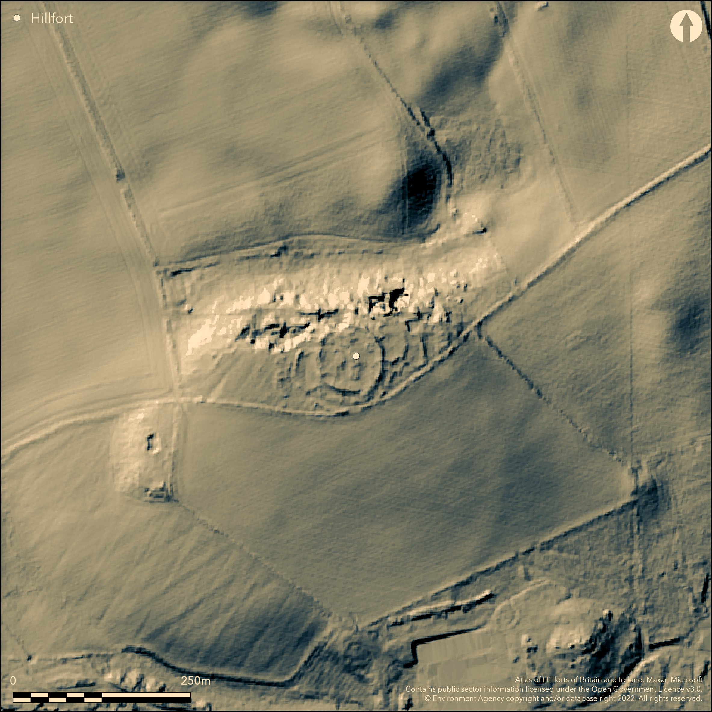
LiDAR 1m DTM Hillshade
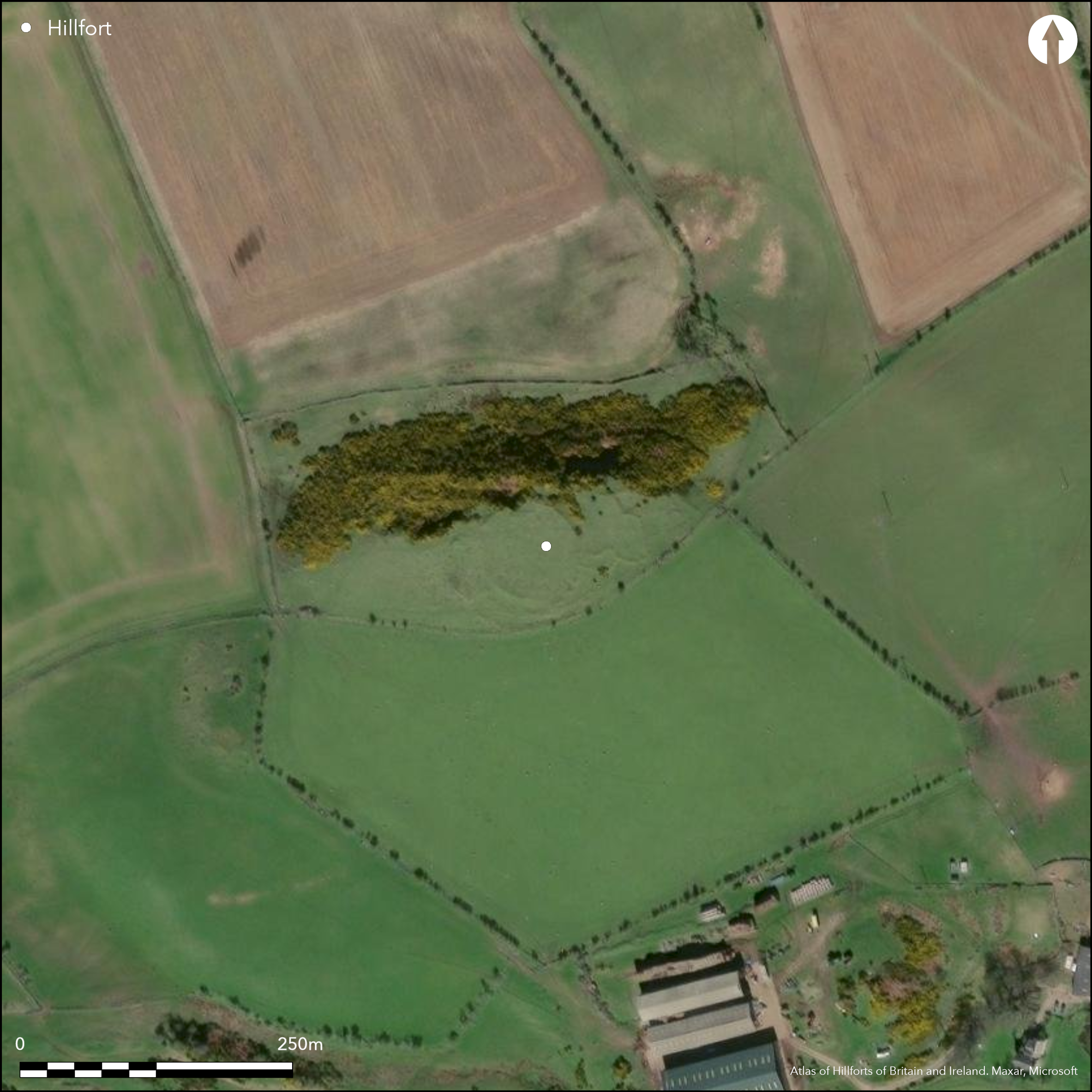
Satellite Imagery
LiDAR 1m DTM Hillshade
Satellite Imagery
Scroll left/right to view further images.
HER: Northumberland 4915 (None)
NMR: NU 12 NW 18 (7393)
SM: 1006472
NGR: NU 1337 2757
X: 413370 Y: 627570 (OSGB36)
To the NW of Rayheugh a small, oval multivallate hillfort with annexes and evidence for secondary occupation. The site occupies a slight rise at 141m OD. It measures 53m N-S by 50m E-W and was enclosed by up to three ramparts, only the innermost of which is still continuous. This survives to a height of between 0.3-0.8m and 3-4m wide. The remnants of two parallel outer banks have been recorded in the S. Four annexes lie on the E of the main enclosure and are of similar construction. Internally two hut circles lie at the E and W extremities of the site 4.0m and 7.0m in diameter respectively. The enclosure and its annexes have been extensively robbed for the later earth and stone dwellings and now survive only as low, turf-covered walls. Quarrying has occurred on the N side. The site is undated, but the hut circles are thought to represent a later phase of occupation. The site is shown on 1856-1865 OS mapping
Citizen Science: ✗
Reliability of Data: Unconfirmed
Reliability of Interpretation: Confirmed
X: -199226 Y: 7467717 (EPSG: 3857)
Longitude: -1.7896786374092648 Latitude: 55.54169851902441 (EPSG:4326)
Country: England
Current County or Unitary Authority: Northumberland
Historic County: Northumberland
Current Parish/Community/Council/Townland: Adderstone with Lucker
Survives in poor condition
| Extant | ✓ |
| Cropmark | ✗ |
| Likely Destroyed | ✗ |
Grassland with possible encroaching woodland in the N.
| Woodland | ✗ |
| Commercial Forestry Plantation | ✗ |
| Parkland | ✗ |
| Pasture (Grazing) | ✓ |
| Arable | ✗ |
| Scrub/Bracken | ✗ |
| Bare Outcrop | ✗ |
| Heather/Moorland | ✗ |
| Heath | ✗ |
| Built-up | ✗ |
| Coastal Grassland | ✗ |
| Other | ✗ |
A contour fort lying at 141m OD on a slight rise in otherwise fairly level ground
| Contour Fort | ✓ |
| Partial Contour Fort | ✗ |
| Promontory Fort | ✗ |
| Hillslope Fort | ✗ |
| Level Terrain Fort | ✗ |
| Marsh Fort | ✗ |
| Multiple Enclosure Fort | ✗ |
| Hilltop | ✗ |
| Coastal Promontory | ✗ |
| Inland Promontory | ✗ |
| Valley Bottom | ✗ |
| Knoll/Hillock/Outcrop | ✓ |
| Ridge | ✗ |
| Cliff/Plateau-edge/Scarp | ✗ |
| Hillslope | ✗ |
| Lowland | ✗ |
| Spur | ✗ |
Dominant Topographic Feature: Slight rise
| North | ✗ |
| Northeast | ✗ |
| East | ✗ |
| Southeast | ✗ |
| South | ✗ |
| Southwest | ✗ |
| West | ✗ |
| Northwest | ✗ |
| Level | ✓ |
Altitude: 141.0m
N/A
Undated but presumed Iron Age with later, possibly Roman period occupation
Reliability: D - None
| Pre 1200BC | ✗ |
| 1200BC - 800BC | ✗ |
| 800BC - 400BC | ✗ |
| 400BC - AD50 | ✗ |
| AD50 - AD400 | ✗ |
| AD400 - AD 800 | ✗ |
| Post AD800 | ✗ |
| Unknown | ✓ |
| Pre Hillfort: | None |
| Post Hillfort: | Secondary occupation; probably overlain by late Iron Age or Romano-British settlement |
| Morphology/Earthwork/Typology: | None |
General reference in MacLauchlan (1867); recorded on 1856-65 OS mapping. Field investigation 1955, 1969. Scheduled
| 1st Identified Written Reference (1867): | None |
| Other (1955): | Field investigation |
| Other (1969): | Field investigation |
| 1st Identified Map Depiction (None): | None |
| Other (None): | Scheduled |
Two hut circles lie at the E and W extremities of the site 4.0m and 7.0m in diameter respectively.
Spring 400m to the NE
| None | ✓ |
| Spring | ✗ |
| Stream | ✗ |
| Pool | ✗ |
| Flush | ✗ |
| Well | ✗ |
| Other | ✗ |
Stone round-houses are probably Late Iron Age or Romano-British
| No Known Features | ✗ |
| Round Stone Structures | ✓ |
| Rectangular Stone Structures | ✗ |
| Curvilinear Platforms | ✗ |
| Other Roundhouse Evidence | ✗ |
| Pits | ✗ |
| Quarry Hollows | ✗ |
| Other | ✗ |
None
| No Known Excavation | ✓ |
| Pits | ✗ |
| Postholes | ✗ |
| Roundhouses | ✗ |
| Rectangular Structures | ✗ |
| Roads/Tracks | ✗ |
| Quarry Hollows | ✗ |
| Other | ✗ |
| Nothing Found | ✗ |
None
| No Known Geophysics | ✓ |
| Pits | ✗ |
| Roundhouses | ✗ |
| Rectangular Structures | ✗ |
| Roads/Tracks | ✗ |
| Quarry Hollows | ✗ |
| Other | ✗ |
| Nothing Found | ✗ |
None
| No Known Finds | ✓ |
| Pottery | ✗ |
| Metal | ✗ |
| Metalworking | ✗ |
| Human Bones | ✗ |
| Animal Bones | ✗ |
| Lithics | ✗ |
| Environmental | ✗ |
| Other | ✗ |
None
| APs Not Checked | ✓ |
| None | ✗ |
| Roundhouses | ✗ |
| Rectangular Structures | ✗ |
| Pits | ✗ |
| Postholes | ✗ |
| Roads/Tracks | ✗ |
| Other | ✗ |
The ramparts are damaged and no original entrances are recorded
| None: | None |
| 2: | None |
Guard Chambers: ✗
Chevaux de Frise: ✗
Small, oval multivallate hillfort. It measures 53m N-S by 50m E-W and was enclosed by up to three ramparts, only the innermost of which is still continuous. This survives to a height of between 0.3-0.8m and 3-4m wide. The remnants of two parallel outer banks have been recorded in the S
| Area 1: | 0.2ha. |
| Total: | 0.2ha. |
Total Footprint Area: Noneha.
None
| ✗ | None |
| ✗ | Uncertain - now damaged. Two further bank survive in the S |
| NE Quadrant: | 1 |
| SE Quadrant: | 3 |
| SW Quadrant: | 3 |
| NW Quadrant: | 1 |
| Total: | 3 |
| Partial Univallate | ✓ |
| Univallate | ✗ |
| Partial Bivallate | ✗ |
| Bivallate | ✗ |
| Partial Multivallate | ✓ |
| Multivallate | ✗ |
| Unknown | ✗ |
| Partial Univallate | ✗ |
| Univallate | ✗ |
| Partial Bivallate | ✗ |
| Bivallate | ✗ |
| Partial Multivallate | ✗ |
| Multivallate | ✗ |
A section through a quarried part of the ramparts consisted of small stones and earth with larger stones on top
| None | ✗ |
| Earthen Bank | ✗ |
| Stone Wall | ✗ |
| Rubble | ✓ |
| Wall-walk | ✗ |
| Evidence of Timber | ✗ |
| Vitrification | ✗ |
| Other Burning | ✗ |
| Palisade | ✗ |
| Counter Scarp Bank | ✗ |
| Berm | ✗ |
| Unfinished | ✗ |
| Other | ✗ |
None
| None | ✗ |
| Earthen Bank | ✗ |
| Stone Wall | ✗ |
| Murus Duplex | ✗ |
| Timber-framed | ✗ |
| Timber-laced | ✗ |
| Vitrification | ✗ |
| Other Burning | ✗ |
| Palisade | ✗ |
| Counter Scarp Bank | ✗ |
| Berm | ✗ |
| Unfinished | ✗ |
| No Known Excavation | ✓ |
| Other | ✗ |
| ✗ | None |
| ✗ | None |
Number of Ditches: None
| ✓ | Four annexes lie on the E side of the enclosure. Their construction is similar to that of the main enclosure with banks surviving to a height of between 0.3-0.8m and approximately 4m wide. |
Hogg, A.H.A. 1979. British Hill-Forts. An Index. British Archaeological Reports, British Series 62.
MacLauchlan, H. 1867. Notes not included in the memoirs already published on Roman roads in Northumberland. (London), 11.
Atlas of Hillforts:
Wikidata:
This work is licensed under CC BY-SA 4.0

 and should be cited as:
Lock, Gary and Ralston, Ian. 2024. Atlas of Hillforts of Britain and Ireland. Available at: https://hillforts.arch.ox.ac.uk
Document Version 1.1