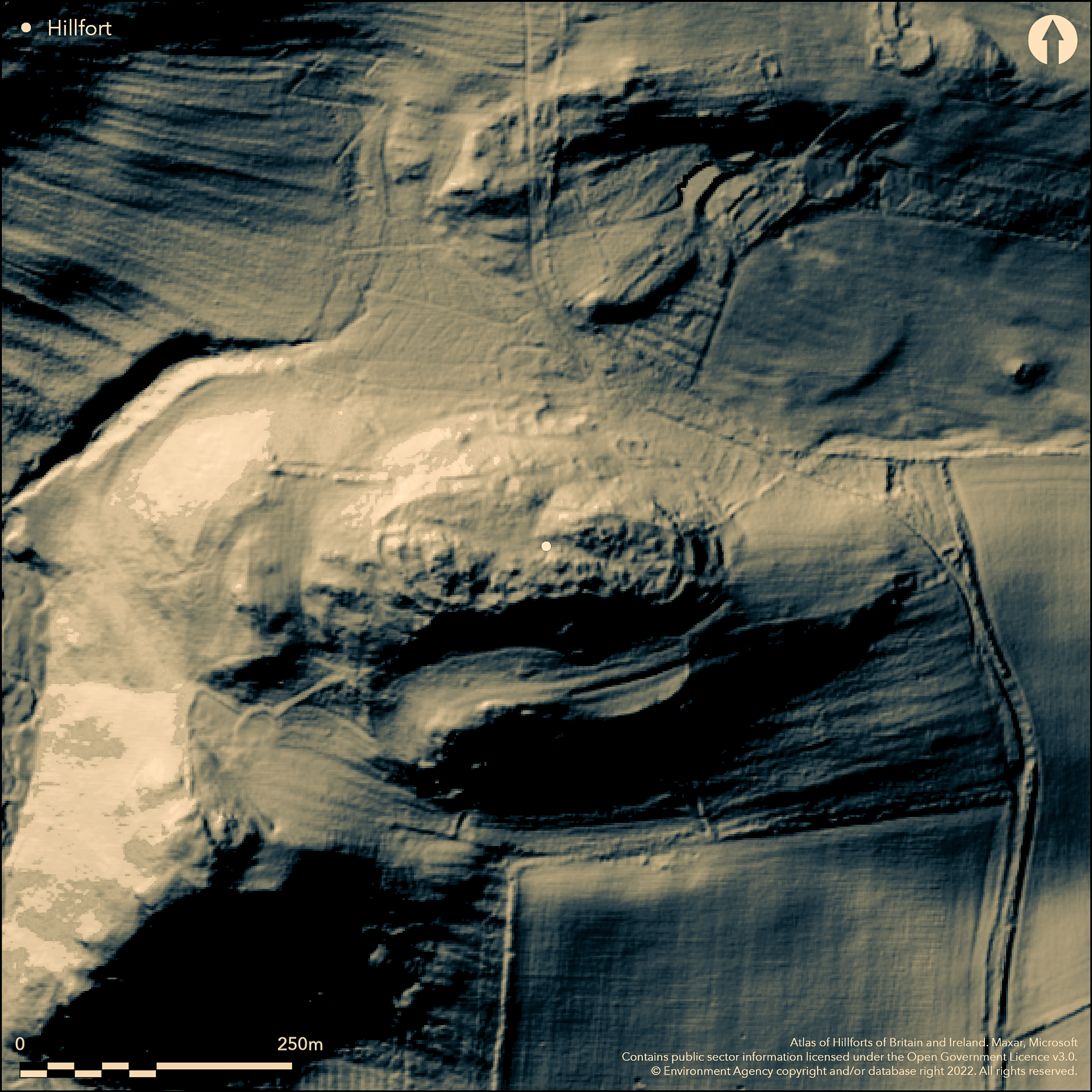
LiDAR 1m DTM Hillshade
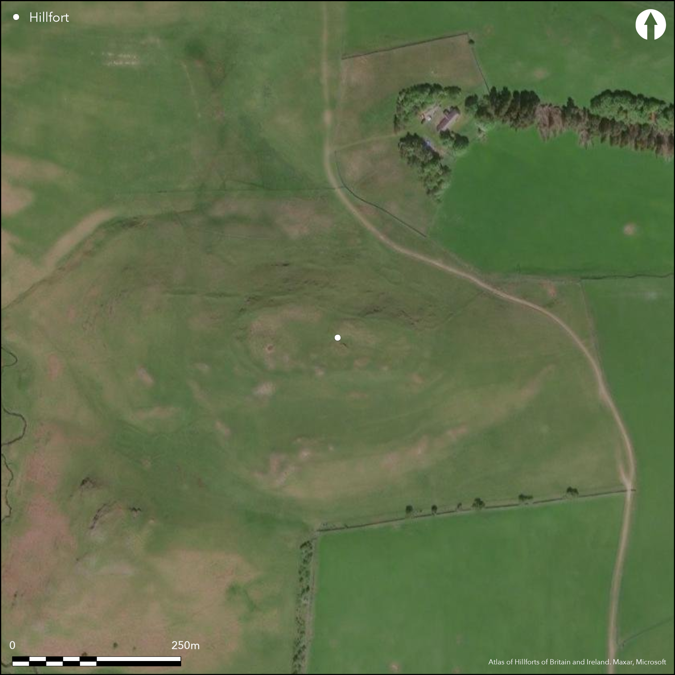
Satellite Imagery
LiDAR 1m DTM Hillshade
Satellite Imagery
Scroll left/right to view further images.
HER: Northumberland 1053 (None)
NMR: NT 90 NW 16 (1603)
SM: 1008271
NGR: NT 9204 0709
X: 392040 Y: 607090 (OSGB36)
Occupying a natural, strongly defended position on the summit of the western brow of Gallow Law, and overlooking Camp Knowe (Atlas No. 492), a bivallate hillfort of 1.2ha. The defences of Gallow Law follow the natural shape of the hilltop forming an irregular oval, orientated along the longer E-W axis. The site is further bounded in the N and S by steep crags. Two turf covered earth and stone ramparts which still retain traces of facing stone, encircle the hilltop, merging on the N and S sides to form broad banks between 3-6m wide and 0.3-2m high, the inner wall enclosing an area 140m E-W by 50m N-S and the outer wall an area of 170m E-W and 60m N-S. No ditch. An entrance lies in the E where the slopes on either side have been steeply scarped to produce an almost vertical face 1.5 high. A further possible entrance lies in the W, but is damaged and difficult to discern. There is no above ground evidence of occupation within the enclosure other than a rectangular hut foundation 6m by 4m which probably post-dates the construction and use of the hillfort. There is an unconfirmed report of hut circles 3m in diameter either side of the entrance in the E served as guard chambers. A 70m length of stone walling, 5m wide and 1.5m high runs from the outside wall the hillfort to isolate a plateau in the W which was possibly used as an annex. The sites survives in poor condition and the rampart is fragmentary. No excavation has been carried out and the site is undated. Shown on 1856-65 OS mapping.
Citizen Science: ✗
Reliability of Data: Confirmed
Reliability of Interpretation: Confirmed
X: -236787 Y: 7431617 (EPSG: 3857)
Longitude: -2.1270975290367473 Latitude: 55.35778632398027 (EPSG:4326)
Country: England; None
Current County or Unitary Authority: Northumberland
Historic County: Northumberland
Current Parish/Community/Council/Townland: Alwinton; Biddlestone
None
| Extant | ✓ |
| Cropmark | ✗ |
| Likely Destroyed | ✗ |
Pasture with rocky outcrops
| Woodland | ✗ |
| Commercial Forestry Plantation | ✗ |
| Parkland | ✗ |
| Pasture (Grazing) | ✓ |
| Arable | ✗ |
| Scrub/Bracken | ✗ |
| Bare Outcrop | ✗ |
| Heather/Moorland | ✗ |
| Heath | ✗ |
| Built-up | ✗ |
| Coastal Grassland | ✗ |
| Other | ✗ |
A partial contour fort lying at 270m OD on the summit of Gallow Law
| Contour Fort | ✗ |
| Partial Contour Fort | ✓ |
| Promontory Fort | ✗ |
| Hillslope Fort | ✗ |
| Level Terrain Fort | ✗ |
| Marsh Fort | ✗ |
| Multiple Enclosure Fort | ✗ |
| Hilltop | ✓ |
| Coastal Promontory | ✗ |
| Inland Promontory | ✗ |
| Valley Bottom | ✗ |
| Knoll/Hillock/Outcrop | ✗ |
| Ridge | ✗ |
| Cliff/Plateau-edge/Scarp | ✗ |
| Hillslope | ✗ |
| Lowland | ✗ |
| Spur | ✗ |
Dominant Topographic Feature: Summit of Gallow Law
| North | ✗ |
| Northeast | ✗ |
| East | ✗ |
| Southeast | ✗ |
| South | ✗ |
| Southwest | ✗ |
| West | ✗ |
| Northwest | ✗ |
| Level | ✓ |
Altitude: 270.0m
Parish boundary between Alwinton and Biddlestone lies approximately 190m to the NE
Boundary Type: Parish/Townland
Undated, presumed Iron Age. Rectangular hut foundation 6m by 4m which probably post-dates the construction and use of the hillfort.
Reliability: D - None
| Pre 1200BC | ✗ |
| 1200BC - 800BC | ✗ |
| 800BC - 400BC | ✗ |
| 400BC - AD50 | ✗ |
| AD50 - AD400 | ✗ |
| AD400 - AD 800 | ✗ |
| Post AD800 | ✗ |
| Unknown | ✓ |
| Pre Hillfort: | None |
| Post Hillfort: | None |
| Morphology/Earthwork/Typology: | None |
Shown on 1856-65 OS mapping, general reference in Hogg (1946-50). Field investigation in 1957. Scheduled
| Other (1957): | Field investigation |
| Other (1994): | Scheduled |
| 1st Identified Map Depiction (None): | None |
| 1st Identified Written Reference (None): | None |
No evidence for occupation contemporary with the hillfort. The foundations of a rectangular structure in the centre of the enclosure is possibly later. Unconfirmed report of 'guard posts' near to the entrance in the E
None
| None | ✓ |
| Spring | ✗ |
| Stream | ✗ |
| Pool | ✗ |
| Flush | ✗ |
| Well | ✗ |
| Other | ✗ |
Rectangular enclosure probably post-dates the hillfort
| No Known Features | ✗ |
| Round Stone Structures | ✗ |
| Rectangular Stone Structures | ✓ |
| Curvilinear Platforms | ✗ |
| Other Roundhouse Evidence | ✗ |
| Pits | ✗ |
| Quarry Hollows | ✗ |
| Other | ✗ |
None
| No Known Excavation | ✓ |
| Pits | ✗ |
| Postholes | ✗ |
| Roundhouses | ✗ |
| Rectangular Structures | ✗ |
| Roads/Tracks | ✗ |
| Quarry Hollows | ✗ |
| Other | ✗ |
| Nothing Found | ✗ |
None
| No Known Geophysics | ✓ |
| Pits | ✗ |
| Roundhouses | ✗ |
| Rectangular Structures | ✗ |
| Roads/Tracks | ✗ |
| Quarry Hollows | ✗ |
| Other | ✗ |
| Nothing Found | ✗ |
None
| No Known Finds | ✓ |
| Pottery | ✗ |
| Metal | ✗ |
| Metalworking | ✗ |
| Human Bones | ✗ |
| Animal Bones | ✗ |
| Lithics | ✗ |
| Environmental | ✗ |
| Other | ✗ |
None
| APs Not Checked | ✓ |
| None | ✗ |
| Roundhouses | ✗ |
| Rectangular Structures | ✗ |
| Pits | ✗ |
| Postholes | ✗ |
| Roads/Tracks | ✗ |
| Other | ✗ |
Entrance centrally placed through the eastern rampart with a further possible entrance in the W. Unconfirmed report of hut circles 3m in diameter either side of the entrance which in the E served as guard chambers.
| 3: | None |
| 2: | None |
Guard Chambers: ✓
Chevaux de Frise: ✗
| 1. Simple Gap (East): | inner rampart |
| 2. Simple Gap (East): | outer rampart |
| 3. Simple Gap (West): | Possible entrance |
Two turf-covered earth and stone walls with occasional facing stones. The inner wall encloses an area of 140m E-W by 50m N-S and the outer wall an area of 170m E-W and 60m N-S. No ditch.
| Area 1: | 0.6ha. |
| Total: | 0.6ha. |
Total Footprint Area: 1.21ha.
None
| ✗ | Estimated from satellite imagery |
| ✓ | Ramparts merge in the N and S to form a single large bank |
| NE Quadrant: | 2 |
| SE Quadrant: | 2 |
| SW Quadrant: | 2 |
| NW Quadrant: | 2 |
| Total: | 2 |
| Partial Univallate | ✗ |
| Univallate | ✗ |
| Partial Bivallate | ✗ |
| Bivallate | ✓ |
| Partial Multivallate | ✗ |
| Multivallate | ✗ |
| Unknown | ✗ |
| Partial Univallate | ✗ |
| Univallate | ✗ |
| Partial Bivallate | ✗ |
| Bivallate | ✗ |
| Partial Multivallate | ✗ |
| Multivallate | ✗ |
None
| None | ✗ |
| Earthen Bank | ✓ |
| Stone Wall | ✓ |
| Rubble | ✓ |
| Wall-walk | ✗ |
| Evidence of Timber | ✗ |
| Vitrification | ✗ |
| Other Burning | ✗ |
| Palisade | ✗ |
| Counter Scarp Bank | ✗ |
| Berm | ✗ |
| Unfinished | ✗ |
| Other | ✗ |
None
| None | ✗ |
| Earthen Bank | ✗ |
| Stone Wall | ✗ |
| Murus Duplex | ✗ |
| Timber-framed | ✗ |
| Timber-laced | ✗ |
| Vitrification | ✗ |
| Other Burning | ✗ |
| Palisade | ✗ |
| Counter Scarp Bank | ✗ |
| Berm | ✗ |
| Unfinished | ✗ |
| No Known Excavation | ✓ |
| Other | ✗ |
| ✗ | None |
| ✗ | None |
Number of Ditches: None
| ✓ | An unconfirmed annex lies in the W where a 70m length of stone walling cuts off the plateau. |
Hogg, A.H.A. 1946-50. Proc Soc Antiq Newcastle (4th Series) 11, 165
Atlas of Hillforts:
Wikidata:
This work is licensed under CC BY-SA 4.0

 and should be cited as:
Lock, Gary and Ralston, Ian. 2024. Atlas of Hillforts of Britain and Ireland. Available at: https://hillforts.arch.ox.ac.uk
Document Version 1.1