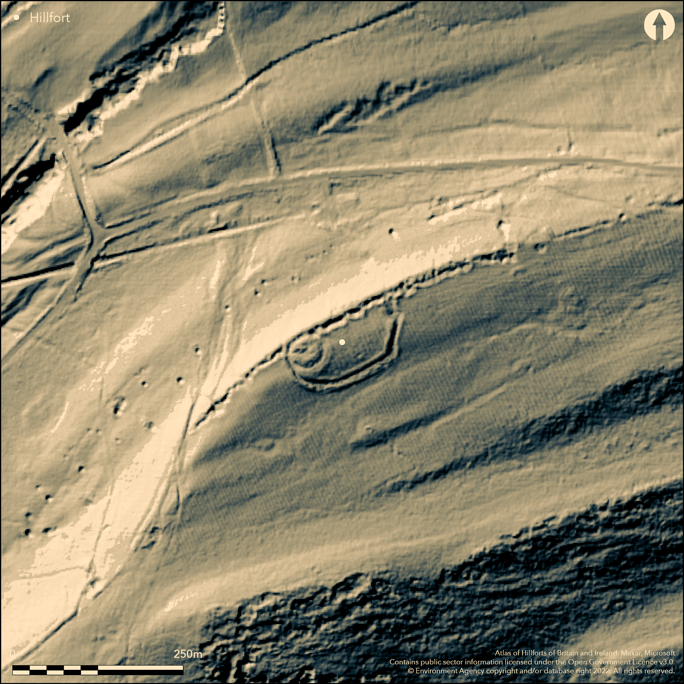
LiDAR 1m DTM Hillshade
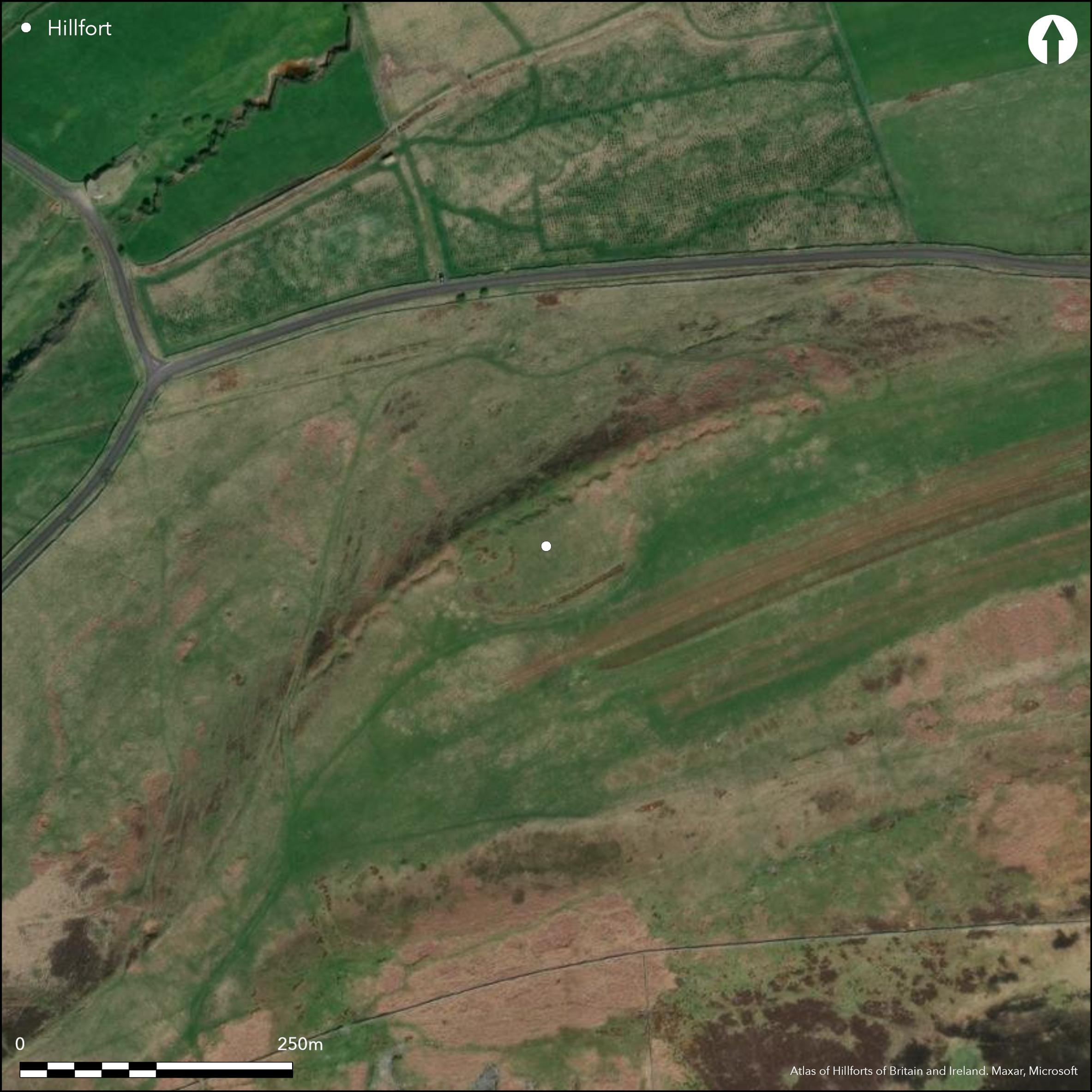
Satellite Imagery
LiDAR 1m DTM Hillshade
Satellite Imagery
Scroll left/right to view further images.
HER: Northumberland 6569 (None)
NMR: NY 76 NE 19 (15186)
SM: 1018536
NGR: NY 7830 6682
X: 378300 Y: 566820 (OSGB36)
Lying to the NE of Vindolanda on the northern edge of Barcombe Hill at 259m OD, a bivallate hillfort, later occupied by a Roman signal station. Approximately oval in form, measuring 95m NE-SW by 42m transversely enclosing 0.4ha. It is situated on level ground which slopes away steeply beyond the rampart in the NE. The ramparts are constructed of earth and stone, the inner rampart measuring up to 2m wide and the outer rampart 3m wide and 0.6 high separated by a ditch 6m wide and 1m deep. Today these are best preserved in the S and SE. Elsewhere they have been disturbed by Roman quarrying attributed to the construction of Hadrian's Wall but probably more widely exploited in the medieval and post medieval period. Quarry pits extend along the northern ditch and to the E and W for 450m. No entrance has been identified. In the NW corner of the hillfort are the remains of the turf-built signal station which survive up to a maximum of 0.8m and measure 17m E-W by 13m N-S surrounded by a 3m wide ditch. No other internal features are visible although excavations by Aitchison in 1939 and Crawford in 1950, primarily concerned with investigation of the signal station, exposed a limestone flagged base to the turf rampart 4.2m wide, which was cut into the hillfort rampart (Jobey 1969; Woodfield 1966). The 1950 excavation also revealed a small oven in the NE of the hillfort and large amounts of 1st century Roman pottery and charcoal. The signal station is thought to have pre-dated the construction of Hadrian's Wall and to have been short lived. Traces of ridge and furrow overlie the interior. The site is recorded on 1856-65 OS mapping. It is scheduled as a defended settlement and a Roman signal station.
Citizen Science: ✗
Reliability of Data: Confirmed
Reliability of Interpretation: Confirmed
X: -260568 Y: 7360994 (EPSG: 3857)
Longitude: -2.340717824373528 Latitude: 54.995505955004525 (EPSG:4326)
Country: England
Current County or Unitary Authority: Northumberland
Historic County: Northumberland
Current Parish/Community/Council/Townland: Bardon Mill
Extant but quarry pits extend for 450m along the northern ditch and to the E and W.
| Extant | ✓ |
| Cropmark | ✗ |
| Likely Destroyed | ✓ |
None
| Woodland | ✗ |
| Commercial Forestry Plantation | ✗ |
| Parkland | ✗ |
| Pasture (Grazing) | ✗ |
| Arable | ✗ |
| Scrub/Bracken | ✓ |
| Bare Outcrop | ✗ |
| Heather/Moorland | ✗ |
| Heath | ✗ |
| Built-up | ✗ |
| Coastal Grassland | ✗ |
| Other | ✗ |
A contour fort situated on the northern edge of Barcombe HIll at 259m OD. It lies on level ground which slopes away steeply beyond the rampart in the NE
| Contour Fort | ✓ |
| Partial Contour Fort | ✗ |
| Promontory Fort | ✗ |
| Hillslope Fort | ✗ |
| Level Terrain Fort | ✗ |
| Marsh Fort | ✗ |
| Multiple Enclosure Fort | ✗ |
| Hilltop | ✗ |
| Coastal Promontory | ✗ |
| Inland Promontory | ✗ |
| Valley Bottom | ✗ |
| Knoll/Hillock/Outcrop | ✗ |
| Ridge | ✗ |
| Cliff/Plateau-edge/Scarp | ✓ |
| Hillslope | ✓ |
| Lowland | ✗ |
| Spur | ✗ |
Dominant Topographic Feature: Northern edge of Barcombe HIll
| North | ✗ |
| Northeast | ✓ |
| East | ✗ |
| Southeast | ✗ |
| South | ✗ |
| Southwest | ✗ |
| West | ✗ |
| Northwest | ✗ |
| Level | ✗ |
Altitude: 259.0m
N/A
Undated, presumed Iron Age with overlying Roman activity. Excavations concerned with the Roman signal station revealed evidence only for Roman activity.
Reliability: D - None
| Pre 1200BC | ✗ |
| 1200BC - 800BC | ✗ |
| 800BC - 400BC | ✗ |
| 400BC - AD50 | ✗ |
| AD50 - AD400 | ✗ |
| AD400 - AD 800 | ✗ |
| Post AD800 | ✗ |
| Unknown | ✓ |
| Pre Hillfort: | None |
| Post Hillfort: | Roman signal station; possible settlement; medieval ridge and furrow; trig point. |
| Artefactual: | Charcoal, 1st century AD pottery |
Recorded on 1856-65 OS mapping. Field investigations 1966 and 1999. Excavated in 1939 and 1950. Scheduled
| Excavation (1939): | None |
| Excavation (1950): | Roman pottery and charcoal recovered |
| Other (1960): | Scheduled |
| Other (1966): | Field investigation |
| Other (1999): | Field investigation |
| 1st Identified Map Depiction (None): | OS one-inch |
A Roman signal station is located in the NW corner. No features contemporary with the hillfort are recorded
None
| None | ✓ |
| Spring | ✗ |
| Stream | ✗ |
| Pool | ✗ |
| Flush | ✗ |
| Well | ✗ |
| Other | ✗ |
Roman signal station and quarrying
| No Known Features | ✗ |
| Round Stone Structures | ✗ |
| Rectangular Stone Structures | ✗ |
| Curvilinear Platforms | ✗ |
| Other Roundhouse Evidence | ✗ |
| Pits | ✗ |
| Quarry Hollows | ✓ |
| Other | ✓ |
Oven, probably Roman
| No Known Excavation | ✗ |
| Pits | ✗ |
| Postholes | ✗ |
| Roundhouses | ✗ |
| Rectangular Structures | ✗ |
| Roads/Tracks | ✗ |
| Quarry Hollows | ✗ |
| Other | ✓ |
| Nothing Found | ✗ |
None
| No Known Geophysics | ✓ |
| Pits | ✗ |
| Roundhouses | ✗ |
| Rectangular Structures | ✗ |
| Roads/Tracks | ✗ |
| Quarry Hollows | ✗ |
| Other | ✗ |
| Nothing Found | ✗ |
Pottery and charcoal relate to later reuse of the hillfort
| No Known Finds | ✗ |
| Pottery | ✓ |
| Metal | ✗ |
| Metalworking | ✗ |
| Human Bones | ✗ |
| Animal Bones | ✗ |
| Lithics | ✗ |
| Environmental | ✓ |
| Other | ✗ |
None
| APs Not Checked | ✗ |
| None | ✓ |
| Roundhouses | ✗ |
| Rectangular Structures | ✗ |
| Pits | ✗ |
| Postholes | ✗ |
| Roads/Tracks | ✗ |
| Other | ✗ |
No entrances can be identified in the surviving earthworks
| None: | None |
| 2: | None |
Guard Chambers: ✗
Chevaux de Frise: ✗
Earth and stone ramparts. The inner rampart measures up to 2m wide and the outer rampart 3m wide and 0.6 high. A ditch 6m wide and 1m deep lies between.
| Area 1: | 0.4ha. |
| Total: | 0.4ha. |
Total Footprint Area: Noneha.
None
| ✗ | None |
| ✓ | None |
| NE Quadrant: | 2 |
| SE Quadrant: | 2 |
| SW Quadrant: | 2 |
| NW Quadrant: | 2 |
| Total: | 2 |
| Partial Univallate | ✗ |
| Univallate | ✗ |
| Partial Bivallate | ✗ |
| Bivallate | ✓ |
| Partial Multivallate | ✗ |
| Multivallate | ✗ |
| Unknown | ✗ |
| Partial Univallate | ✗ |
| Univallate | ✗ |
| Partial Bivallate | ✗ |
| Bivallate | ✗ |
| Partial Multivallate | ✗ |
| Multivallate | ✗ |
None
| None | ✗ |
| Earthen Bank | ✓ |
| Stone Wall | ✗ |
| Rubble | ✓ |
| Wall-walk | ✗ |
| Evidence of Timber | ✗ |
| Vitrification | ✗ |
| Other Burning | ✗ |
| Palisade | ✗ |
| Counter Scarp Bank | ✗ |
| Berm | ✗ |
| Unfinished | ✗ |
| Other | ✗ |
Limestone flagged base to the turf rampart
| None | ✗ |
| Earthen Bank | ✗ |
| Stone Wall | ✗ |
| Murus Duplex | ✗ |
| Timber-framed | ✗ |
| Timber-laced | ✗ |
| Vitrification | ✗ |
| Other Burning | ✗ |
| Palisade | ✗ |
| Counter Scarp Bank | ✗ |
| Berm | ✗ |
| Unfinished | ✗ |
| No Known Excavation | ✗ |
| Other | ✓ |
| ✗ | None |
| ✓ | None |
Number of Ditches: 1
| ✗ | None |
Jobey, G.1969. Barcombe Hill Signal Station, Thorngrafton. Archaeol Aeliana (4th Series)183-185
Jobey, G. 1965. Hill Forts and Settlements in Northumberland. 21-64 Archaeol Aeliana (4th Series) 43, 26
Woodfield, P. 1966. Barcombe Hill, Thorngrafton. Archaeol Aeliana (4th Series) 44, 71-7
Atlas of Hillforts:
Wikidata:
This work is licensed under CC BY-SA 4.0

 and should be cited as:
Lock, Gary and Ralston, Ian. 2024. Atlas of Hillforts of Britain and Ireland. Available at: https://hillforts.arch.ox.ac.uk
Document Version 1.1