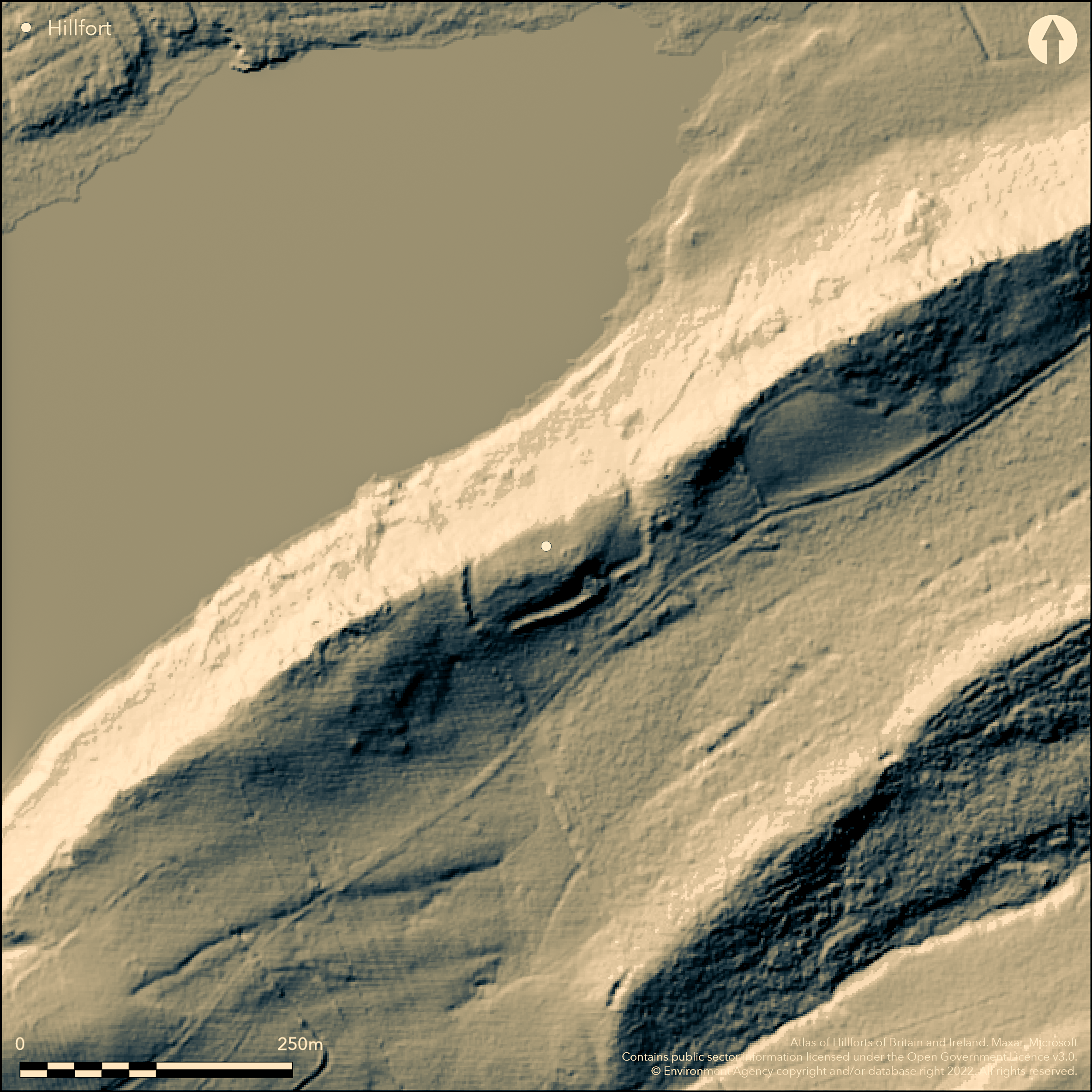
LiDAR 1m DTM Hillshade
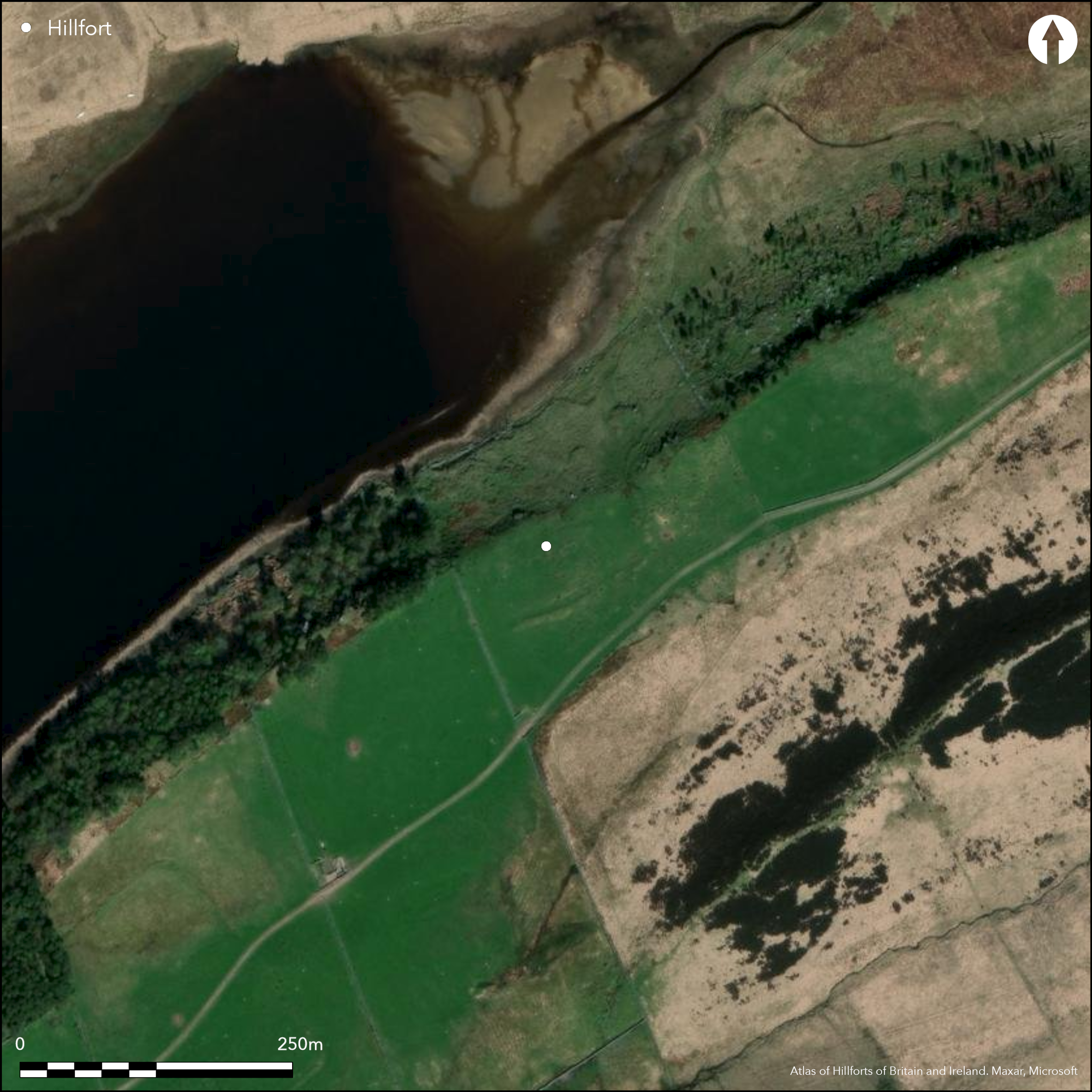
Satellite Imagery
LiDAR 1m DTM Hillshade
Satellite Imagery
Scroll left/right to view further images.
HER: Northumberland 6593 (None)
NMR: NY 76 NE 43 (15266)
SM: 1017961
NGR: NY 7767 6979
X: 377670 Y: 569790 (OSGB36)
Lying at the eastern end of Greenlee Lough at 241m OD. The site was described as a promontory fort by Challis and Harding (1975), but was scheduled in 1998 as a defended settlement. Probably best described as a cliff-edge fort, constructed against the northern edge of the cliff. The enclosure is approximately rectilinear, 48m E-W by 38m N-S, enclosing c.0.46ha, surrounded on three sides by an internal ditch 4m wide and 1m deep with a well preserved outer rampart between 4-6m wide. The terminals of the ramparts face on to the crest of a steep cliff face which forms the northern perimeter of the enclosure. Satellite imagery suggests a possible entrance lies centrally in the SE side with slightly overlapping terminals, with the one in the W turning inwards and the one in the E turning outwards. A further break lies in the SW corner. Its position at 241m OD on the crestline in the N, with the ground rising to 246m OD in the S, would make it unsuitable for defence as would the internal ditch. Between 11-15 rectangular stone huts (NY76NE 80) probably medieval shielings, can be made out within the interior, one of which crosses the rampart but there is no visible evidence for internal occupation contemporary with the construction of the hilllfort. A Roman Camp lies 205m to the SW and a stone circle of at least 14 stones lies 20m to the SE of the southern rampart. The site has not been excavated and is undated. Not recorded on OS mapping until the 1970's
Citizen Science: ✗
Reliability of Data: Confirmed
Reliability of Interpretation: Confirmed
X: -261690 Y: 7366169 (EPSG: 3857)
Longitude: -2.3507978974317294 Latitude: 55.022166874130825 (EPSG:4326)
Country: England; None
Current County or Unitary Authority: Northumberland
Historic County: Northumberland
Current Parish/Community/Council/Townland: Bardon Mill; Simonburn
None
| Extant | ✓ |
| Cropmark | ✗ |
| Likely Destroyed | ✗ |
None
| Woodland | ✗ |
| Commercial Forestry Plantation | ✗ |
| Parkland | ✗ |
| Pasture (Grazing) | ✓ |
| Arable | ✗ |
| Scrub/Bracken | ✗ |
| Bare Outcrop | ✗ |
| Heather/Moorland | ✗ |
| Heath | ✗ |
| Built-up | ✗ |
| Coastal Grassland | ✗ |
| Other | ✗ |
A cliff edge fort lying at 241m OD on land sloping to the NW
| Contour Fort | ✗ |
| Partial Contour Fort | ✓ |
| Promontory Fort | ✗ |
| Hillslope Fort | ✗ |
| Level Terrain Fort | ✗ |
| Marsh Fort | ✗ |
| Multiple Enclosure Fort | ✗ |
| Hilltop | ✗ |
| Coastal Promontory | ✗ |
| Inland Promontory | ✗ |
| Valley Bottom | ✗ |
| Knoll/Hillock/Outcrop | ✗ |
| Ridge | ✗ |
| Cliff/Plateau-edge/Scarp | ✓ |
| Hillslope | ✓ |
| Lowland | ✗ |
| Spur | ✗ |
Dominant Topographic Feature: Cliff edge
| North | ✗ |
| Northeast | ✗ |
| East | ✗ |
| Southeast | ✗ |
| South | ✗ |
| Southwest | ✗ |
| West | ✗ |
| Northwest | ✓ |
| Level | ✗ |
Altitude: 241.0m
Parish boundary between Bardon Mill and Simonburn lies lies 140m to the NW
Boundary Type: Parish/Townland
Undated
Reliability: D - None
| Pre 1200BC | ✗ |
| 1200BC - 800BC | ✗ |
| 800BC - 400BC | ✗ |
| 400BC - AD50 | ✗ |
| AD50 - AD400 | ✗ |
| AD400 - AD 800 | ✗ |
| Post AD800 | ✗ |
| Unknown | ✓ |
| Pre Hillfort: | None |
| Post Hillfort: | Medieval shielings |
Field investigation in 1966. Surveyed at 1:1000 scale in November 1984 as part of RCHME's Roman Camps in England Project and transcribed from aerial photographs as part of the Hadrian's Wall National Mapping project (event record: 1360986) in 2005. Field investigation in 1966. Scheduled
| Other (1966): | Field investigation |
| Earthwork Survey (1984): | Surveyed at 1:000 |
| Other (1998): | Scheduled |
| Other (2005): | NMP |
| 1st Identified Map Depiction (None): | None |
No evidence for internal occupation contemporary with the construction of the hillfort
Overlooks Greenlee Lough
| None | ✓ |
| Spring | ✗ |
| Stream | ✗ |
| Pool | ✗ |
| Flush | ✗ |
| Well | ✗ |
| Other | ✗ |
Rectangular structures are probably medieval shielings
| No Known Features | ✗ |
| Round Stone Structures | ✗ |
| Rectangular Stone Structures | ✓ |
| Curvilinear Platforms | ✗ |
| Other Roundhouse Evidence | ✗ |
| Pits | ✗ |
| Quarry Hollows | ✗ |
| Other | ✗ |
None
| No Known Excavation | ✓ |
| Pits | ✗ |
| Postholes | ✗ |
| Roundhouses | ✗ |
| Rectangular Structures | ✗ |
| Roads/Tracks | ✗ |
| Quarry Hollows | ✗ |
| Other | ✗ |
| Nothing Found | ✗ |
None
| No Known Geophysics | ✓ |
| Pits | ✗ |
| Roundhouses | ✗ |
| Rectangular Structures | ✗ |
| Roads/Tracks | ✗ |
| Quarry Hollows | ✗ |
| Other | ✗ |
| Nothing Found | ✗ |
None
| No Known Finds | ✓ |
| Pottery | ✗ |
| Metal | ✗ |
| Metalworking | ✗ |
| Human Bones | ✗ |
| Animal Bones | ✗ |
| Lithics | ✗ |
| Environmental | ✗ |
| Other | ✗ |
None
| APs Not Checked | ✓ |
| None | ✗ |
| Roundhouses | ✗ |
| Rectangular Structures | ✗ |
| Pits | ✗ |
| Postholes | ✗ |
| Roads/Tracks | ✗ |
| Other | ✗ |
Satellite imagery suggest a possible entrance lies centrally in the SE side with slightly overlapping terminals with the one in the W turning inwards and the one in the E turning outwards. A further break lies in the SW corner.
| 2: | None |
| 2: | None |
Guard Chambers: ✗
Chevaux de Frise: ✗
| 1. Over-lapping (South east): | None |
| 1. In-turned (South east): | Western terminal |
| 1. Out-turned (South east): | Eastern terminal |
The enclosure is approximately rectilinear, 107m E-W by 54m N-S surrounded on three sides by an internal ditch 4m wide and 1m deep and a well preserved outer rampart between 4-6m wide. The terminals of the ramparts face on to the crest of a steep cliff face which forms the northern perimeter of the enclosure
| Area 1: | 0.46ha. |
| Total: | 0.46ha. |
Total Footprint Area: 0.57ha.
None
| ✗ | Measurements approximate, taken from satellite imagery |
| ✗ | None |
| NE Quadrant: | 1 |
| SE Quadrant: | 1 |
| SW Quadrant: | 1 |
| NW Quadrant: | None |
| Total: | 1 |
| Partial Univallate | ✓ |
| Univallate | ✗ |
| Partial Bivallate | ✗ |
| Bivallate | ✗ |
| Partial Multivallate | ✗ |
| Multivallate | ✗ |
| Unknown | ✗ |
| Partial Univallate | ✗ |
| Univallate | ✗ |
| Partial Bivallate | ✗ |
| Bivallate | ✗ |
| Partial Multivallate | ✗ |
| Multivallate | ✗ |
None
| None | ✗ |
| Earthen Bank | ✓ |
| Stone Wall | ✗ |
| Rubble | ✗ |
| Wall-walk | ✗ |
| Evidence of Timber | ✗ |
| Vitrification | ✗ |
| Other Burning | ✗ |
| Palisade | ✗ |
| Counter Scarp Bank | ✗ |
| Berm | ✗ |
| Unfinished | ✗ |
| Other | ✗ |
None
| None | ✗ |
| Earthen Bank | ✗ |
| Stone Wall | ✗ |
| Murus Duplex | ✗ |
| Timber-framed | ✗ |
| Timber-laced | ✗ |
| Vitrification | ✗ |
| Other Burning | ✗ |
| Palisade | ✗ |
| Counter Scarp Bank | ✗ |
| Berm | ✗ |
| Unfinished | ✗ |
| No Known Excavation | ✓ |
| Other | ✗ |
| ✗ | None |
| ✓ | Internal |
Number of Ditches: 1
| ✗ | None |
Challis, A.J. and Harding, D.W., 1975. Later Prehistory Trent to Tyne, British Archaeological Report 200 (ii) (Oxford), 48.
Atlas of Hillforts:
Wikidata:
This work is licensed under CC BY-SA 4.0

 and should be cited as:
Lock, Gary and Ralston, Ian. 2024. Atlas of Hillforts of Britain and Ireland. Available at: https://hillforts.arch.ox.ac.uk
Document Version 1.1