LiDAR 1m DTM Hillshade
Satellite Imagery
LiDAR 1m DTM Hillshade
Satellite Imagery
Scroll left/right to view further images.
HER: Northumberland 3242 (None)
NMR: NU 01 SE 13 (5266)
SM: 1011094
NGR: NU 0522 1045
X: 405220 Y: 610450 (OSGB36)
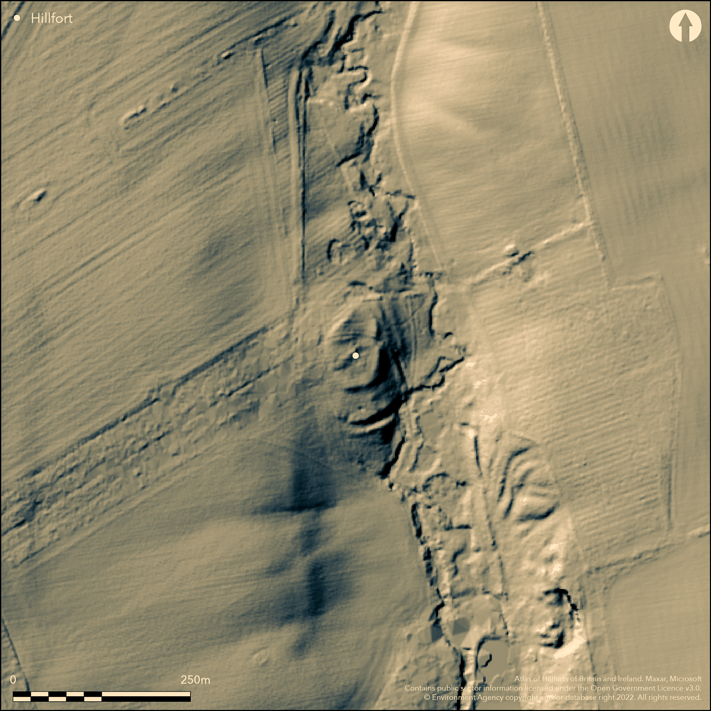
On low lying ground 550m to the NW of Castle Hill Callaly (Atlas No. 0504), a multivallate hillfort with an enclosed area of approximately 0.19ha. The small, roughly oval enclosure measures 60m by 40m and lies on relatively level ground at 95m OD, falling eastwards towards the Callaly Burn in the E and SE, with higher ground in the W. The enclosed area is surrounded by scarped banks 1.2m high and 5m wide with traces of a further inner bank in the E. Twenty-five metres to the S of the enclosure are outer works which run concentrically to the enclosure and comprise a bank 5m wide and 0.1m high which merges into the sloping ground towards the Callaly Burn. Beyond this is a ditch 10m wide by 2m deep, outside of which is a further bank 5m wide by 0.5m high. A simple gap entrance 10m wide lies in the E. A further gap in the W is probably not contemporary with the construction of the ramparts. The interior has been disturbed by old tree planting and no internal features are known. It survives in poor condition and was recorded as nearly destroyed by MacLauchlan in 1864. The site is recorded on 1856-65 OS mapping and was scheduled in 1949. It has seen no further investigation and is undated.
Citizen Science: ✗
Reliability of Data: Confirmed
Reliability of Interpretation: Confirmed
X: -213638 Y: 7437540 (EPSG: 3857)
Longitude: -1.9191449114399624 Latitude: 55.38801791291319 (EPSG:4326)
Country: England
Current County or Unitary Authority: Northumberland
Historic County: Northumberland
Current Parish/Community/Council/Townland: Callaly
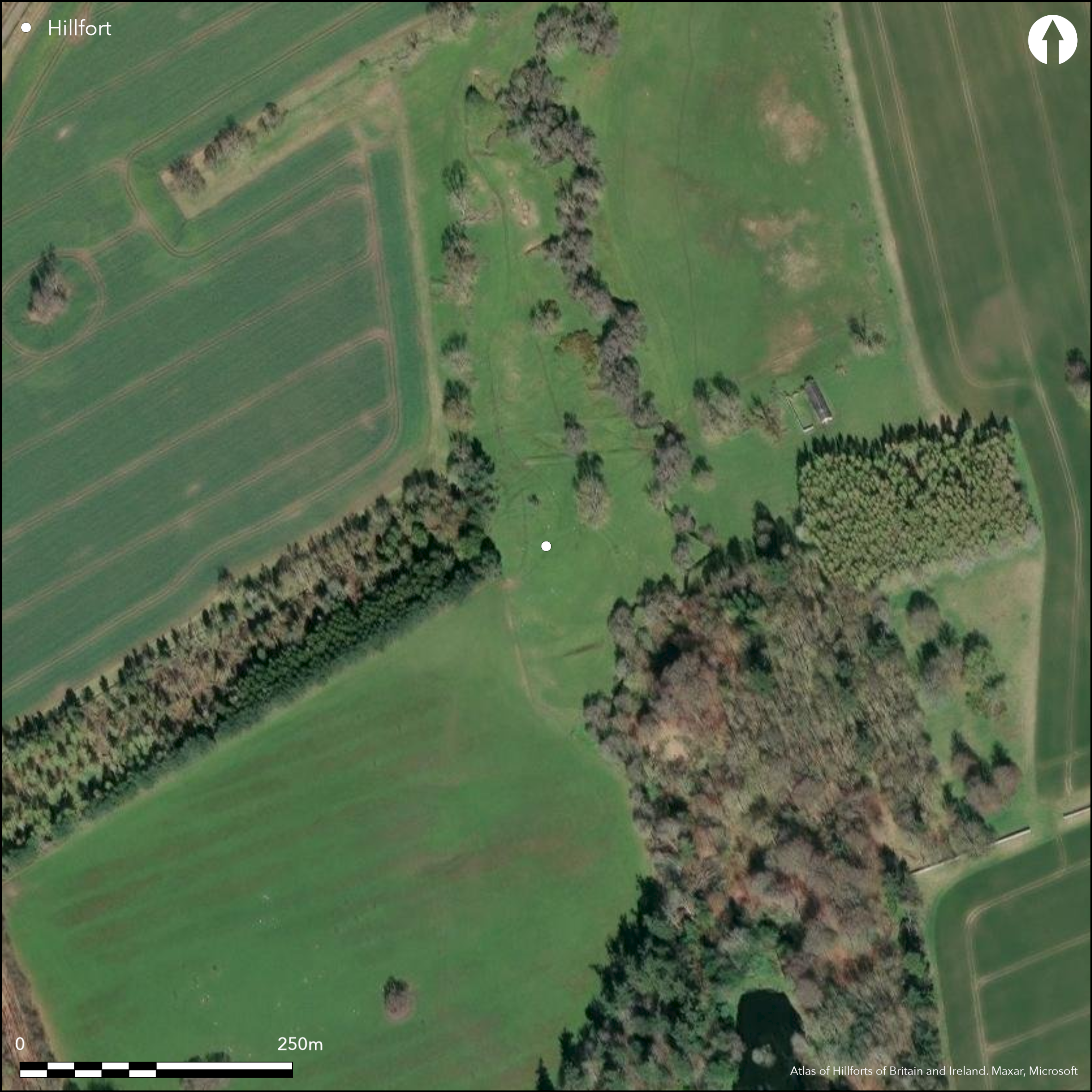
In poor condition
| Extant | ✓ |
| Cropmark | ✗ |
| Likely Destroyed | ✗ |
None
| Woodland | ✗ |
| Commercial Forestry Plantation | ✗ |
| Parkland | ✗ |
| Pasture (Grazing) | ✓ |
| Arable | ✗ |
| Scrub/Bracken | ✗ |
| Bare Outcrop | ✗ |
| Heather/Moorland | ✗ |
| Heath | ✗ |
| Built-up | ✗ |
| Coastal Grassland | ✗ |
| Other | ✗ |
A partial contour fort occupying relatively level ground at 95m OD
| Contour Fort | ✗ |
| Partial Contour Fort | ✓ |
| Promontory Fort | ✗ |
| Hillslope Fort | ✗ |
| Level Terrain Fort | ✗ |
| Marsh Fort | ✗ |
| Multiple Enclosure Fort | ✗ |
| Hilltop | ✗ |
| Coastal Promontory | ✗ |
| Inland Promontory | ✗ |
| Valley Bottom | ✗ |
| Knoll/Hillock/Outcrop | ✗ |
| Ridge | ✗ |
| Cliff/Plateau-edge/Scarp | ✗ |
| Hillslope | ✗ |
| Lowland | ✓ |
| Spur | ✗ |
Dominant Topographic Feature: Low lying ground
| North | ✗ |
| Northeast | ✗ |
| East | ✗ |
| Southeast | ✗ |
| South | ✗ |
| Southwest | ✗ |
| West | ✗ |
| Northwest | ✗ |
| Level | ✓ |
Altitude: 95.0m
N/A
Undated, presumed Iron Age
Reliability: D - None
| Pre 1200BC | ✗ |
| 1200BC - 800BC | ✗ |
| 800BC - 400BC | ✗ |
| 400BC - AD50 | ✗ |
| AD50 - AD400 | ✗ |
| AD400 - AD 800 | ✗ |
| Post AD800 | ✗ |
| Unknown | ✓ |
| Pre Hillfort: | None |
| Post Hillfort: | None |
| Morphology/Earthwork/Typology: | None |
The site was visited in MacLauchlan 1864; recorded on 1856-65 OS mapping and scheduled in 1949. Field investigations in 1957 and 1970
| 1st Identified Written Reference (1864): | MacLauchlan |
| Other (1949): | Scheduled |
| Other (1957): | Field investigation |
| Other (1970): | Field investigation |
| 1st Identified Map Depiction (None): | OS |
Interior damaged by tree planting and no internal features are known
Borders Callaly burn in the E
| None | ✓ |
| Spring | ✗ |
| Stream | ✗ |
| Pool | ✗ |
| Flush | ✗ |
| Well | ✗ |
| Other | ✗ |
None
| No Known Features | ✓ |
| Round Stone Structures | ✗ |
| Rectangular Stone Structures | ✗ |
| Curvilinear Platforms | ✗ |
| Other Roundhouse Evidence | ✗ |
| Pits | ✗ |
| Quarry Hollows | ✗ |
| Other | ✗ |
None
| No Known Excavation | ✓ |
| Pits | ✗ |
| Postholes | ✗ |
| Roundhouses | ✗ |
| Rectangular Structures | ✗ |
| Roads/Tracks | ✗ |
| Quarry Hollows | ✗ |
| Other | ✗ |
| Nothing Found | ✗ |
None
| No Known Geophysics | ✓ |
| Pits | ✗ |
| Roundhouses | ✗ |
| Rectangular Structures | ✗ |
| Roads/Tracks | ✗ |
| Quarry Hollows | ✗ |
| Other | ✗ |
| Nothing Found | ✗ |
None
| No Known Finds | ✓ |
| Pottery | ✗ |
| Metal | ✗ |
| Metalworking | ✗ |
| Human Bones | ✗ |
| Animal Bones | ✗ |
| Lithics | ✗ |
| Environmental | ✗ |
| Other | ✗ |
None
| APs Not Checked | ✓ |
| None | ✗ |
| Roundhouses | ✗ |
| Rectangular Structures | ✗ |
| Pits | ✗ |
| Postholes | ✗ |
| Roads/Tracks | ✗ |
| Other | ✗ |
Simple gap entrance 10m wide in the E. A further gap in the W is probably not original
| 2: | None |
| 2: | None |
Guard Chambers: ✗
Chevaux de Frise: ✗
| 1. Simple Gap (East): | None |
Small, roughly oval enclosure 60m by 40m. Enclosed area surrounded by scarped banks 1.2m high and 5m wide with traces of a further inner bank in the E. Twenty-five metres to the S of the enclosure are outer works comprising a bank 5m wide and 0.1m high which merges into the sloping ground towards the Callaly Burn. Beyond this is a ditch 10m wide by 2m deep, outside of which is a further bank 5m wide by 0.5m high, possibly a counterscarp.
| Area 1: | 0.19ha. |
| Total: | 0.19ha. |
Total Footprint Area: Noneha.
None
| ✗ | None |
| ✓ | Only oval enclosure has a complete circuit, outworks lie concentrically in the S. |
| NE Quadrant: | 2 |
| SE Quadrant: | 2 |
| SW Quadrant: | 2 |
| NW Quadrant: | 1 |
| Total: | 2 |
| Partial Univallate | ✓ |
| Univallate | ✗ |
| Partial Bivallate | ✓ |
| Bivallate | ✗ |
| Partial Multivallate | ✗ |
| Multivallate | ✗ |
| Unknown | ✗ |
| Partial Univallate | ✗ |
| Univallate | ✗ |
| Partial Bivallate | ✗ |
| Bivallate | ✗ |
| Partial Multivallate | ✗ |
| Multivallate | ✗ |
None
| None | ✗ |
| Earthen Bank | ✓ |
| Stone Wall | ✗ |
| Rubble | ✗ |
| Wall-walk | ✗ |
| Evidence of Timber | ✗ |
| Vitrification | ✗ |
| Other Burning | ✗ |
| Palisade | ✗ |
| Counter Scarp Bank | ✓ |
| Berm | ✗ |
| Unfinished | ✗ |
| Other | ✗ |
None
| None | ✗ |
| Earthen Bank | ✗ |
| Stone Wall | ✗ |
| Murus Duplex | ✗ |
| Timber-framed | ✗ |
| Timber-laced | ✗ |
| Vitrification | ✗ |
| Other Burning | ✗ |
| Palisade | ✗ |
| Counter Scarp Bank | ✗ |
| Berm | ✗ |
| Unfinished | ✗ |
| No Known Excavation | ✓ |
| Other | ✗ |
| ✗ | None |
| ✓ | Ditch in the S |
Number of Ditches: 1
| ✗ | None |
Hogg, A.H.A., 1946-50. Proceedings of the Society of Antiquaries of Newcastle (4th Series) 11, 165.
MacLauchlan, H., 1864. Memoir written during a survey of the eastern branch of the Watling Street (London), 54.
Atlas of Hillforts:
Wikidata:
This work is licensed under CC BY-SA 4.0![]()
![]()
![]() and should be cited as:
and should be cited as:
Lock, Gary and Ralston, Ian. 2024. Atlas of Hillforts of Britain and Ireland. Available at: https://hillforts.arch.ox.ac.uk
Document Version 1.1