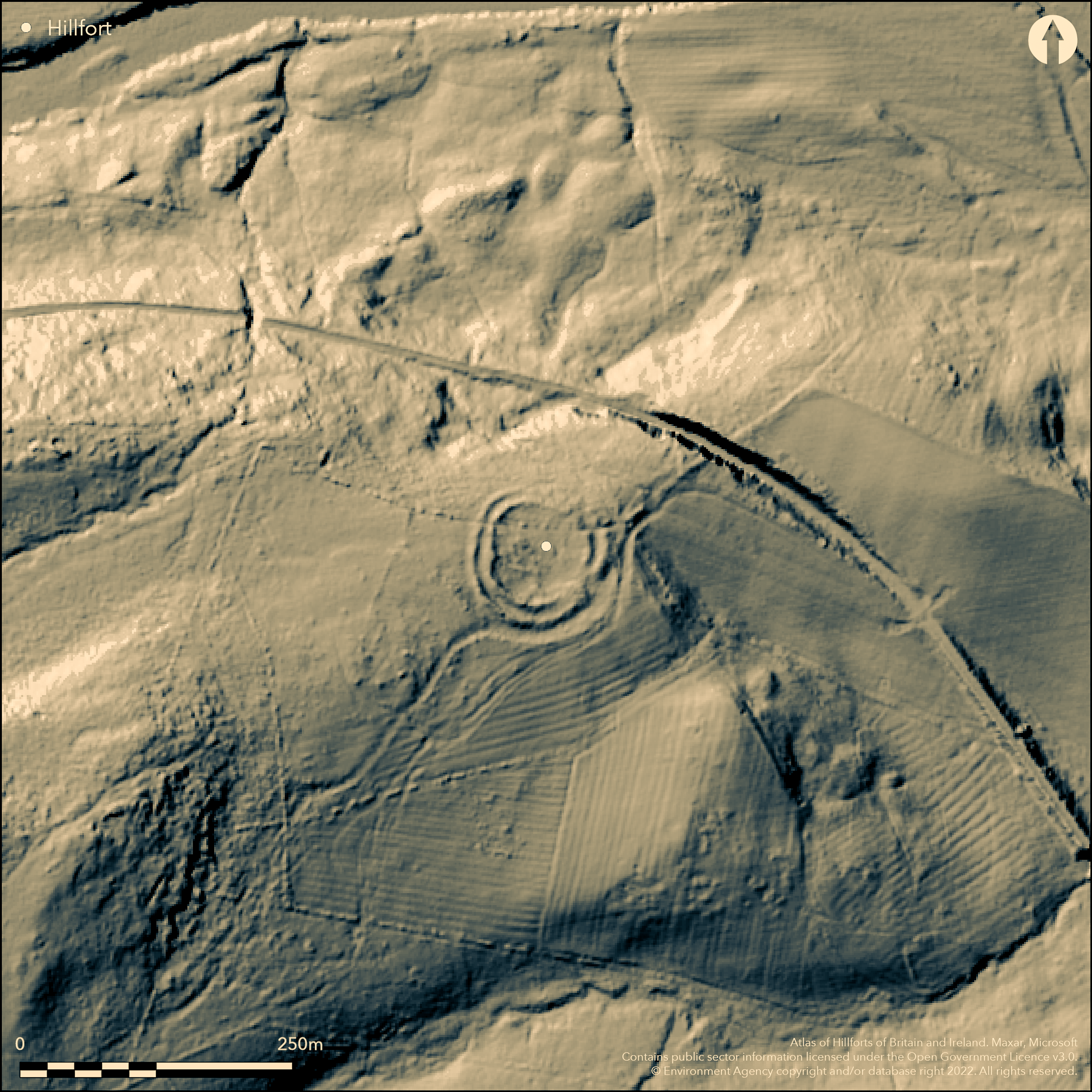
LiDAR 1m DTM Hillshade
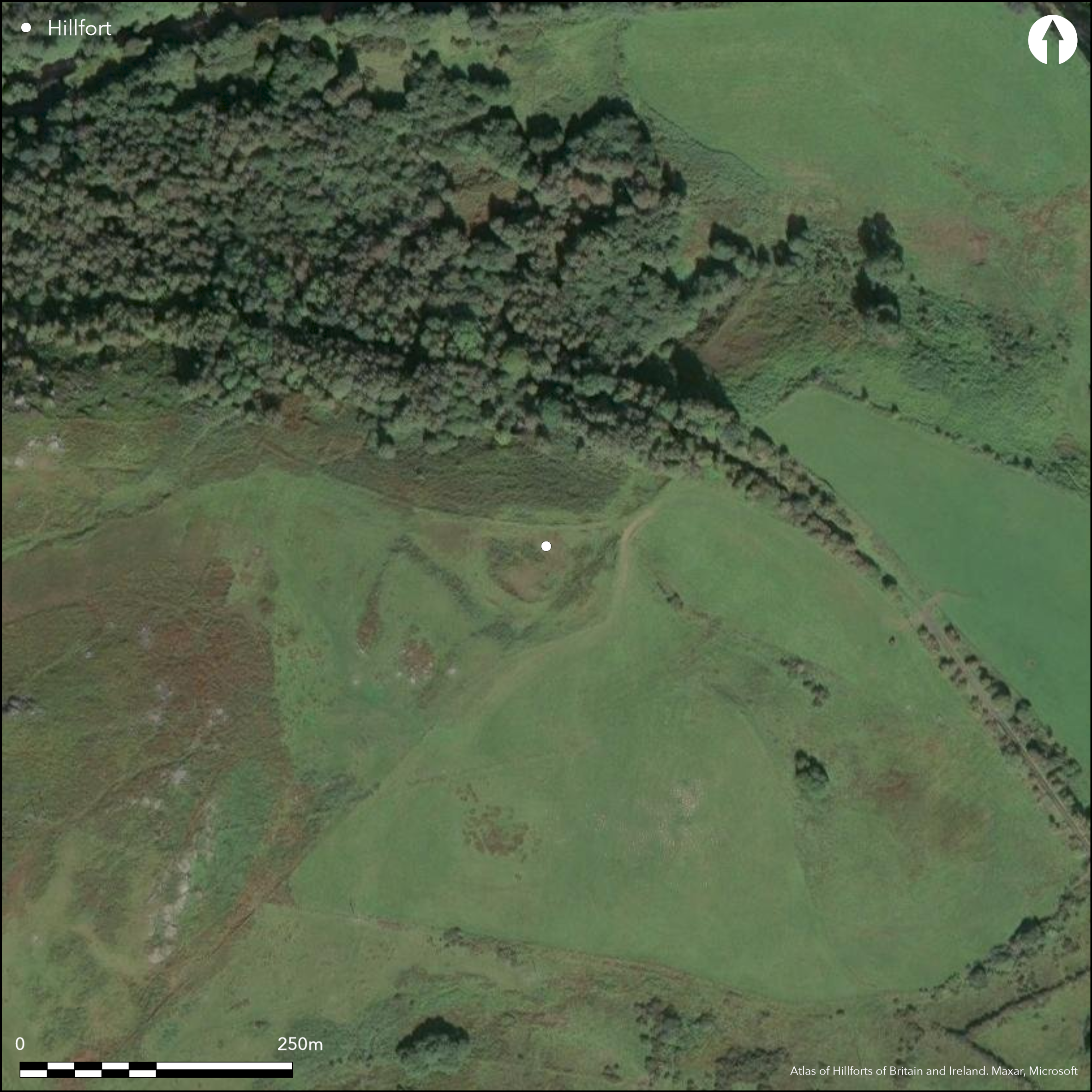
Satellite Imagery
LiDAR 1m DTM Hillshade
Satellite Imagery
Scroll left/right to view further images.
HER: Northumberland 2903 (None)
NMR: NU 00 SE 7 (4439)
SM: 1002909
NGR: NU 0801 0049
X: 408010 Y: 600490 (OSGB36)
To the SE of Wagtail Farm, a bivallate hillfort of 0.19ha lying at 122m OD on a NE-facing slope towards Craghead. The hillfort is oval measuring 53m N-S by 49m E-W internally. It has commanding views in the N and E with the ground sloping away steeply towards the River Cocquet, but is overlooked in the S and SW by gradually rising ground. Two earth and stone ramparts and unhewn boulders surround the hillfort with a ditch between in the E, S and W providing a whole site footprint of approximately 0.4ha. Where the ground is higher in the S a further outer ditch was created from soil dug out for the rampart. The interior of the hillfort has also been scooped out in the S. A bank, now much reduced, runs across the interior to enclose the scooped area. A simple break cuts through both ramparts in the SE with a causeway between from which a holloway extends south-eastwards towards former field systems in the S and W. Three stone-founded hut circles have been identified within the interior in the SE, W and N between 6m and 8m in diameter, probably representing Romano-British reuse of the site. Damage to the ramparts has occurred in the N through an old fieldbank running approximately E-W cutting through the ramparts. The site is shown on 1856-65 OS mapping. It is scheduled but remains undated.
Citizen Science: ✗
Reliability of Data: Confirmed
Reliability of Interpretation: Confirmed
X: -208767 Y: 7420012 (EPSG: 3857)
Longitude: -1.875385446989632 Latitude: 55.29848219392068 (EPSG:4326)
Country: England; None
Current County or Unitary Authority: Northumberland
Historic County: Northumberland
Current Parish/Community/Council/Townland: Cartington; Brinkburn
None
| Extant | ✓ |
| Cropmark | ✗ |
| Likely Destroyed | ✗ |
None
| Woodland | ✗ |
| Commercial Forestry Plantation | ✗ |
| Parkland | ✗ |
| Pasture (Grazing) | ✗ |
| Arable | ✗ |
| Scrub/Bracken | ✗ |
| Bare Outcrop | ✗ |
| Heather/Moorland | ✓ |
| Heath | ✗ |
| Built-up | ✗ |
| Coastal Grassland | ✗ |
| Other | ✗ |
A hillslope fort at 122m OD on land trending NE towards steep wooded crags lining the Cocquet Valley
| Contour Fort | ✗ |
| Partial Contour Fort | ✗ |
| Promontory Fort | ✗ |
| Hillslope Fort | ✓ |
| Level Terrain Fort | ✗ |
| Marsh Fort | ✗ |
| Multiple Enclosure Fort | ✗ |
| Hilltop | ✗ |
| Coastal Promontory | ✗ |
| Inland Promontory | ✗ |
| Valley Bottom | ✗ |
| Knoll/Hillock/Outcrop | ✗ |
| Ridge | ✗ |
| Cliff/Plateau-edge/Scarp | ✗ |
| Hillslope | ✓ |
| Lowland | ✗ |
| Spur | ✗ |
Dominant Topographic Feature: Hillslope to NE towards steep wooded crags
| North | ✗ |
| Northeast | ✓ |
| East | ✗ |
| Southeast | ✗ |
| South | ✗ |
| Southwest | ✗ |
| West | ✗ |
| Northwest | ✗ |
| Level | ✗ |
Altitude: 122.0m
The parish boundary between Cartington and Brinkburn lies 150m to the S and 100m to the W
Boundary Type: Parish/Townland
Undated presumed Iron Age, with later occupation
Reliability: D - None
| Pre 1200BC | ✗ |
| 1200BC - 800BC | ✗ |
| 800BC - 400BC | ✗ |
| 400BC - AD50 | ✗ |
| AD50 - AD400 | ✗ |
| AD400 - AD 800 | ✗ |
| Post AD800 | ✗ |
| Unknown | ✓ |
| Pre Hillfort: | None |
| Post Hillfort: | Stone-founded hut circles, probably Romano-British. Fieldbank. |
| Morphology/Earthwork/Typology: | None |
The site is shown on 1856-65 OS mapping; general reference in MacLauchlan (1867). Field investigations in 1957 and 1972. Scheduled.
| 1st Identified Written Reference (1867): | Maclauchlan |
| Other (1957): | Field investigation |
| Other (1972): | Field investigation |
| 1st Identified Map Depiction (None): | None |
| Other (None): | Scheduled |
Hut circle in SE on a raised platform 6m in diameter; larger hut circle 8m in diameter in the W with an entrance on the SE side. A further small hut circle lies below this on a raised platform.
Stream 230m to the S
| None | ✓ |
| Spring | ✗ |
| Stream | ✗ |
| Pool | ✗ |
| Flush | ✗ |
| Well | ✗ |
| Other | ✗ |
Bank enclosing scooped area
| No Known Features | ✗ |
| Round Stone Structures | ✓ |
| Rectangular Stone Structures | ✗ |
| Curvilinear Platforms | ✗ |
| Other Roundhouse Evidence | ✗ |
| Pits | ✗ |
| Quarry Hollows | ✗ |
| Other | ✓ |
None
| No Known Excavation | ✓ |
| Pits | ✗ |
| Postholes | ✗ |
| Roundhouses | ✗ |
| Rectangular Structures | ✗ |
| Roads/Tracks | ✗ |
| Quarry Hollows | ✗ |
| Other | ✗ |
| Nothing Found | ✗ |
None
| No Known Geophysics | ✓ |
| Pits | ✗ |
| Roundhouses | ✗ |
| Rectangular Structures | ✗ |
| Roads/Tracks | ✗ |
| Quarry Hollows | ✗ |
| Other | ✗ |
| Nothing Found | ✗ |
None
| No Known Finds | ✓ |
| Pottery | ✗ |
| Metal | ✗ |
| Metalworking | ✗ |
| Human Bones | ✗ |
| Animal Bones | ✗ |
| Lithics | ✗ |
| Environmental | ✗ |
| Other | ✗ |
None
| APs Not Checked | ✓ |
| None | ✗ |
| Roundhouses | ✗ |
| Rectangular Structures | ✗ |
| Pits | ✗ |
| Postholes | ✗ |
| Roads/Tracks | ✗ |
| Other | ✗ |
A simple break cuts through both ramparts in the SE, with a causeway between, from which a holloway extends southeastwards towards former field systems in the S and W.
| 2: | Break through each rampart |
| 2: | None |
Guard Chambers: ✗
Chevaux de Frise: ✗
| 1. Simple Gap (South east): | Inner rampart |
| 2. Simple Gap (South east): | Outer rampart |
Two earth and stone ramparts and unhewn boulders surround the hillfort with a ditch between in the E, S and W enclosing a total area of approximately 0.4ha. Where the ground is higher in the S a further outer ditch was created from soil dug out for the rampart.
| Area 1: | 0.19ha. |
| Total: | 0.19ha. |
Total Footprint Area: 0.4ha.
None
| ✗ | Areas estimated from satellite imagery |
| ✗ | None |
| NE Quadrant: | 2 |
| SE Quadrant: | 2 |
| SW Quadrant: | 2 |
| NW Quadrant: | 2 |
| Total: | 2 |
| Partial Univallate | ✗ |
| Univallate | ✗ |
| Partial Bivallate | ✗ |
| Bivallate | ✓ |
| Partial Multivallate | ✗ |
| Multivallate | ✗ |
| Unknown | ✗ |
| Partial Univallate | ✗ |
| Univallate | ✗ |
| Partial Bivallate | ✗ |
| Bivallate | ✗ |
| Partial Multivallate | ✗ |
| Multivallate | ✗ |
None
| None | ✗ |
| Earthen Bank | ✓ |
| Stone Wall | ✗ |
| Rubble | ✓ |
| Wall-walk | ✗ |
| Evidence of Timber | ✗ |
| Vitrification | ✗ |
| Other Burning | ✗ |
| Palisade | ✗ |
| Counter Scarp Bank | ✗ |
| Berm | ✗ |
| Unfinished | ✗ |
| Other | ✗ |
None
| None | ✗ |
| Earthen Bank | ✗ |
| Stone Wall | ✗ |
| Murus Duplex | ✗ |
| Timber-framed | ✗ |
| Timber-laced | ✗ |
| Vitrification | ✗ |
| Other Burning | ✗ |
| Palisade | ✗ |
| Counter Scarp Bank | ✗ |
| Berm | ✗ |
| Unfinished | ✗ |
| No Known Excavation | ✓ |
| Other | ✗ |
| ✗ | None |
| ✓ | Ditch in E, S and W, with further ditch in the S |
Number of Ditches: 2
| ✗ | None |
Hogg, A.H.A. 1947. A new list of the native sites of Northumberland. Proc Soc Antiq Newcastle (4th Series) 11, 167.
Jobey, G .1965. Hillforts and Settlements in Northumberland. Archaeol Aeliana (4th Series) 43, 63 No.104
MacLauchlan, H.1867. Notes not included in the memoirs already published on Roman roads in Northumberland (London), 83.
Atlas of Hillforts:
Wikidata:
This work is licensed under CC BY-SA 4.0

 and should be cited as:
Lock, Gary and Ralston, Ian. 2024. Atlas of Hillforts of Britain and Ireland. Available at: https://hillforts.arch.ox.ac.uk
Document Version 1.1