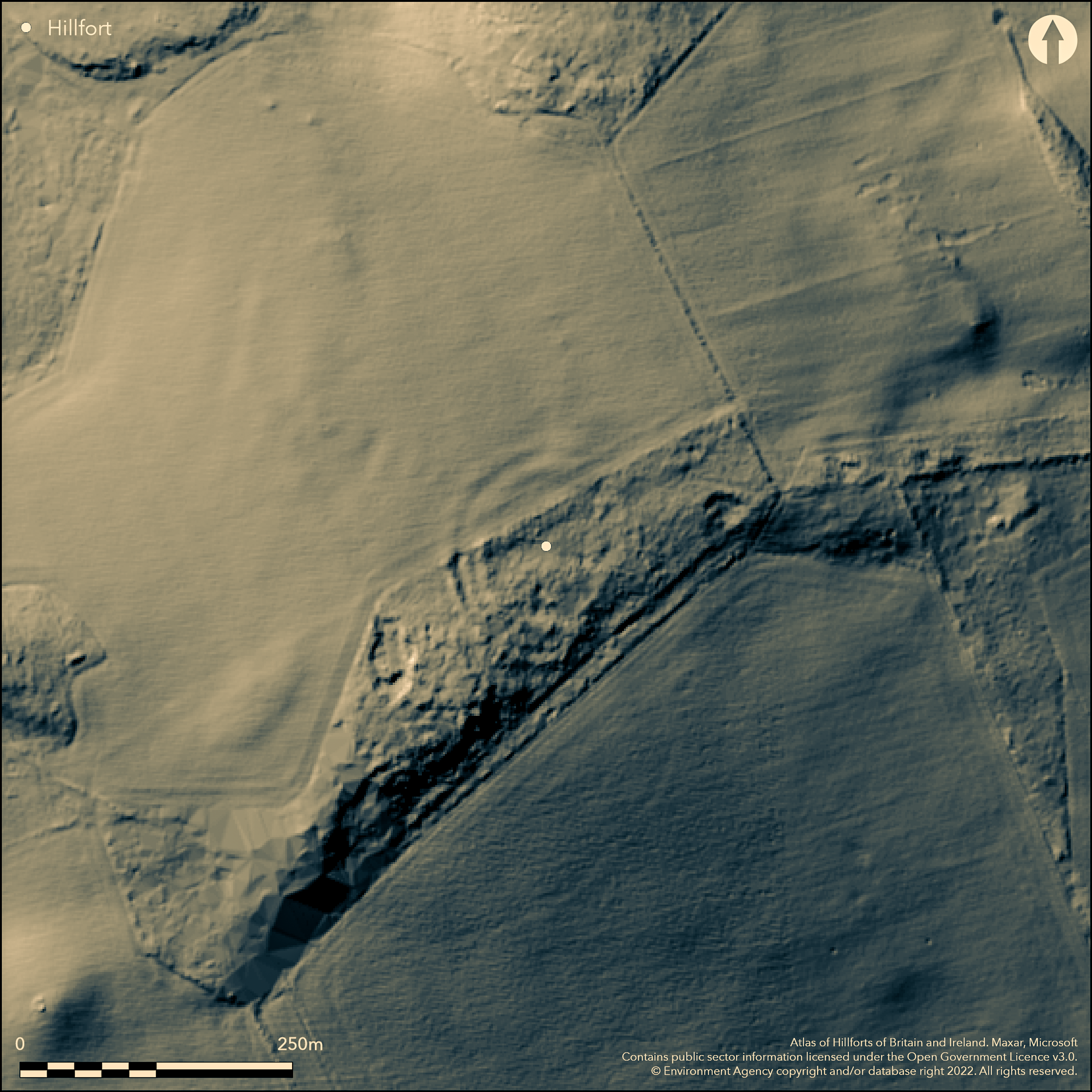
LiDAR 1m DTM Hillshade
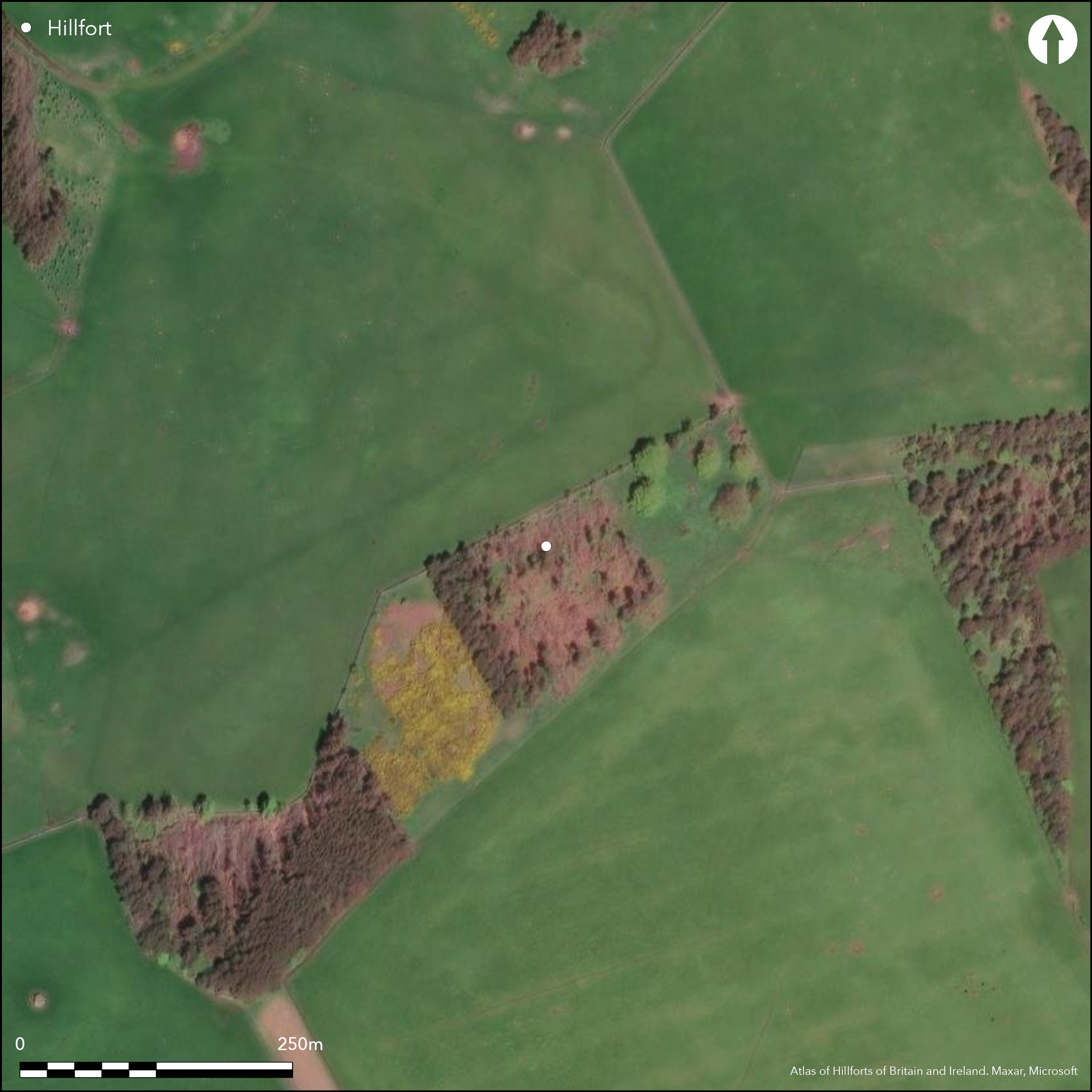
Satellite Imagery
LiDAR 1m DTM Hillshade
Satellite Imagery
Scroll left/right to view further images.
HER: Northumberland 3812 (None)
NMR: NU 03 SW 35 (6371)
SM: 1006531
NGR: NU 0186 3119
X: 401860 Y: 631190 (OSGB36)
Lying at 150m OD on a SE-facing slope, 1km to the NW of East Horton, a possible hillfort now mostly levelled. Almost circular in plan, comprising two banks with a medial and outer ditch in places, a third bank and ditch was recorded in the SW during a field investigation in 1955. it was estimated as having a diameter of 60m, enclosing 0.25ha. The enclosure was divided NE-SW by a dyke and now a wall. An OS inspection in 1955 reported that to the N of the dyke the ramparts survived as a low spread of earth and stone banks and scarps, the inner bank being 8m wide and 0.3m high, the outer 5-7m wide and 0.4m high and the ditch 5-8m wide and 0.1m deep. In the SW, the inner bank was recorded as 8-9m wide and 0.5m high, the middle bank 7m wide and 0.3m high and the outer bank 9m wide and 1m high. The ditches were 4m wide and shallow. Ploughing in the N and reafforestation in the S has resulted in further mutilation. There is no surviving evidence for an entrance or internal features. The site was depicted as 'Camp remains of'' on 1856-65 OS mapping showing damage had occurred by that time although the earthworks in the N were still fairly well defined on aerial photographs taken in the 1930's and can still be seen on satellite imagery. The site was scheduled in 1994 but it appears to continue to be ploughed in the N. There is no known excavation and the site is undated.
Citizen Science: ✗
Reliability of Data: Confirmed
Reliability of Interpretation: Confirmed
X: -219528 Y: 7474154 (EPSG: 3857)
Longitude: -1.972051742562097 Latitude: 55.5744033749516 (EPSG:4326)
Country: England
Current County or Unitary Authority: Northumberland
Historic County: Northumberland
Current Parish/Community/Council/Townland: Chatton
In the N the defences can still be seen as two arcs on satellite imagery
| Extant | ✓ |
| Cropmark | ✓ |
| Likely Destroyed | ✓ |
The site was under varied land use throughout the 20th century, both to the N and S of the dyke. It is currently under pasture in the N and reafforested in the S. Quarrying has also occurred in the S.
| Woodland | ✓ |
| Commercial Forestry Plantation | ✗ |
| Parkland | ✗ |
| Pasture (Grazing) | ✗ |
| Arable | ✓ |
| Scrub/Bracken | ✗ |
| Bare Outcrop | ✗ |
| Heather/Moorland | ✗ |
| Heath | ✗ |
| Built-up | ✗ |
| Coastal Grassland | ✗ |
| Other | ✓ |
A partial contour fort occupying a shoulder of a SE facing slope at approximately 150m OD
| Contour Fort | ✗ |
| Partial Contour Fort | ✓ |
| Promontory Fort | ✗ |
| Hillslope Fort | ✗ |
| Level Terrain Fort | ✗ |
| Marsh Fort | ✗ |
| Multiple Enclosure Fort | ✗ |
| Hilltop | ✓ |
| Coastal Promontory | ✗ |
| Inland Promontory | ✗ |
| Valley Bottom | ✗ |
| Knoll/Hillock/Outcrop | ✗ |
| Ridge | ✗ |
| Cliff/Plateau-edge/Scarp | ✗ |
| Hillslope | ✓ |
| Lowland | ✗ |
| Spur | ✗ |
Dominant Topographic Feature: Shoulder on a SE facing slope
| North | ✗ |
| Northeast | ✗ |
| East | ✗ |
| Southeast | ✓ |
| South | ✗ |
| Southwest | ✗ |
| West | ✗ |
| Northwest | ✗ |
| Level | ✗ |
Altitude: 150.0m
N/A
Undated
Reliability: D - None
| Pre 1200BC | ✗ |
| 1200BC - 800BC | ✗ |
| 800BC - 400BC | ✗ |
| 400BC - AD50 | ✗ |
| AD50 - AD400 | ✗ |
| AD400 - AD 800 | ✗ |
| Post AD800 | ✗ |
| Unknown | ✓ |
| Pre Hillfort: | None |
| Post Hillfort: | Cup and ring marked rocks lie in the vicinity |
Identified on 1856-65 OS mapping and recorded by MacLauchlan (1864). Field investigations in 1955, 1964 and 1969. Scheduled. This site has been mapped from the air as part of the Milfield Geoarchaeology Project
| 1st Identified Written Reference (1864): | None |
| Other (1955): | Field investigation |
| Other (1964): | Field investigation |
| Other (1969): | Field investigation |
| 1st Identified Map Depiction (None): | None |
| Other (None): | Scheduled |
No features recorded
None
| None | ✓ |
| Spring | ✗ |
| Stream | ✗ |
| Pool | ✗ |
| Flush | ✗ |
| Well | ✗ |
| Other | ✗ |
None
| No Known Features | ✓ |
| Round Stone Structures | ✗ |
| Rectangular Stone Structures | ✗ |
| Curvilinear Platforms | ✗ |
| Other Roundhouse Evidence | ✗ |
| Pits | ✗ |
| Quarry Hollows | ✗ |
| Other | ✗ |
None
| No Known Excavation | ✓ |
| Pits | ✗ |
| Postholes | ✗ |
| Roundhouses | ✗ |
| Rectangular Structures | ✗ |
| Roads/Tracks | ✗ |
| Quarry Hollows | ✗ |
| Other | ✗ |
| Nothing Found | ✗ |
None
| No Known Geophysics | ✓ |
| Pits | ✗ |
| Roundhouses | ✗ |
| Rectangular Structures | ✗ |
| Roads/Tracks | ✗ |
| Quarry Hollows | ✗ |
| Other | ✗ |
| Nothing Found | ✗ |
None
| No Known Finds | ✓ |
| Pottery | ✗ |
| Metal | ✗ |
| Metalworking | ✗ |
| Human Bones | ✗ |
| Animal Bones | ✗ |
| Lithics | ✗ |
| Environmental | ✗ |
| Other | ✗ |
None
| APs Not Checked | ✗ |
| None | ✓ |
| Roundhouses | ✗ |
| Rectangular Structures | ✗ |
| Pits | ✗ |
| Postholes | ✗ |
| Roads/Tracks | ✗ |
| Other | ✗ |
The location of the entrances is unknown
| 0: | None |
| 2: | Unknown |
Guard Chambers: ✗
Chevaux de Frise: ✗
Almost circular in plan, comprising two banks probably with a medial and outer ditch, it is estimated as having a diameter of 60m, enclosing 0.25ha
| Area 1: | 0.25ha. |
| Total: | 0.25ha. |
Total Footprint Area: Noneha.
None
| ✗ | None |
| ✓ | Probably two banks although these show poorly as cropmarks. A third bank was recorded during a field survey in 1955 but it unverified |
| NE Quadrant: | 2 |
| SE Quadrant: | 2 |
| SW Quadrant: | 2 |
| NW Quadrant: | 2 |
| Total: | 2 |
| Partial Univallate | ✗ |
| Univallate | ✗ |
| Partial Bivallate | ✗ |
| Bivallate | ✓ |
| Partial Multivallate | ✗ |
| Multivallate | ✗ |
| Unknown | ✗ |
| Partial Univallate | ✗ |
| Univallate | ✗ |
| Partial Bivallate | ✗ |
| Bivallate | ✗ |
| Partial Multivallate | ✗ |
| Multivallate | ✗ |
None
| None | ✗ |
| Earthen Bank | ✓ |
| Stone Wall | ✗ |
| Rubble | ✓ |
| Wall-walk | ✗ |
| Evidence of Timber | ✗ |
| Vitrification | ✗ |
| Other Burning | ✗ |
| Palisade | ✗ |
| Counter Scarp Bank | ✓ |
| Berm | ✗ |
| Unfinished | ✗ |
| Other | ✗ |
None
| None | ✗ |
| Earthen Bank | ✗ |
| Stone Wall | ✗ |
| Murus Duplex | ✗ |
| Timber-framed | ✗ |
| Timber-laced | ✗ |
| Vitrification | ✗ |
| Other Burning | ✗ |
| Palisade | ✗ |
| Counter Scarp Bank | ✗ |
| Berm | ✗ |
| Unfinished | ✗ |
| No Known Excavation | ✓ |
| Other | ✗ |
| ✗ | None |
| ✓ | The presence of a third ditch is unverified |
Number of Ditches: 2
| ✗ | None |
Hogg A.H.A. 1947. A new list of the native sites of Northumberland, Proc Soc Ant Newcastle (4th Series) Vol.11. 11, 140-179 and 157
Jobey G. 1965, Hillforts and settlements in Northumberland, Arch Aeliana (4th Series) vol. 43. No.37
MacLauchlan, H. 1864. Memoir written during a survey of the eastern branch of the Watling Street (London), 943
Atlas of Hillforts:
Wikidata:
This work is licensed under CC BY-SA 4.0

 and should be cited as:
Lock, Gary and Ralston, Ian. 2024. Atlas of Hillforts of Britain and Ireland. Available at: https://hillforts.arch.ox.ac.uk
Document Version 1.1